Quinnebaugh Meadows- Beartooth Mountains
Quinnebaugh Meadows- Beartooth Mountains
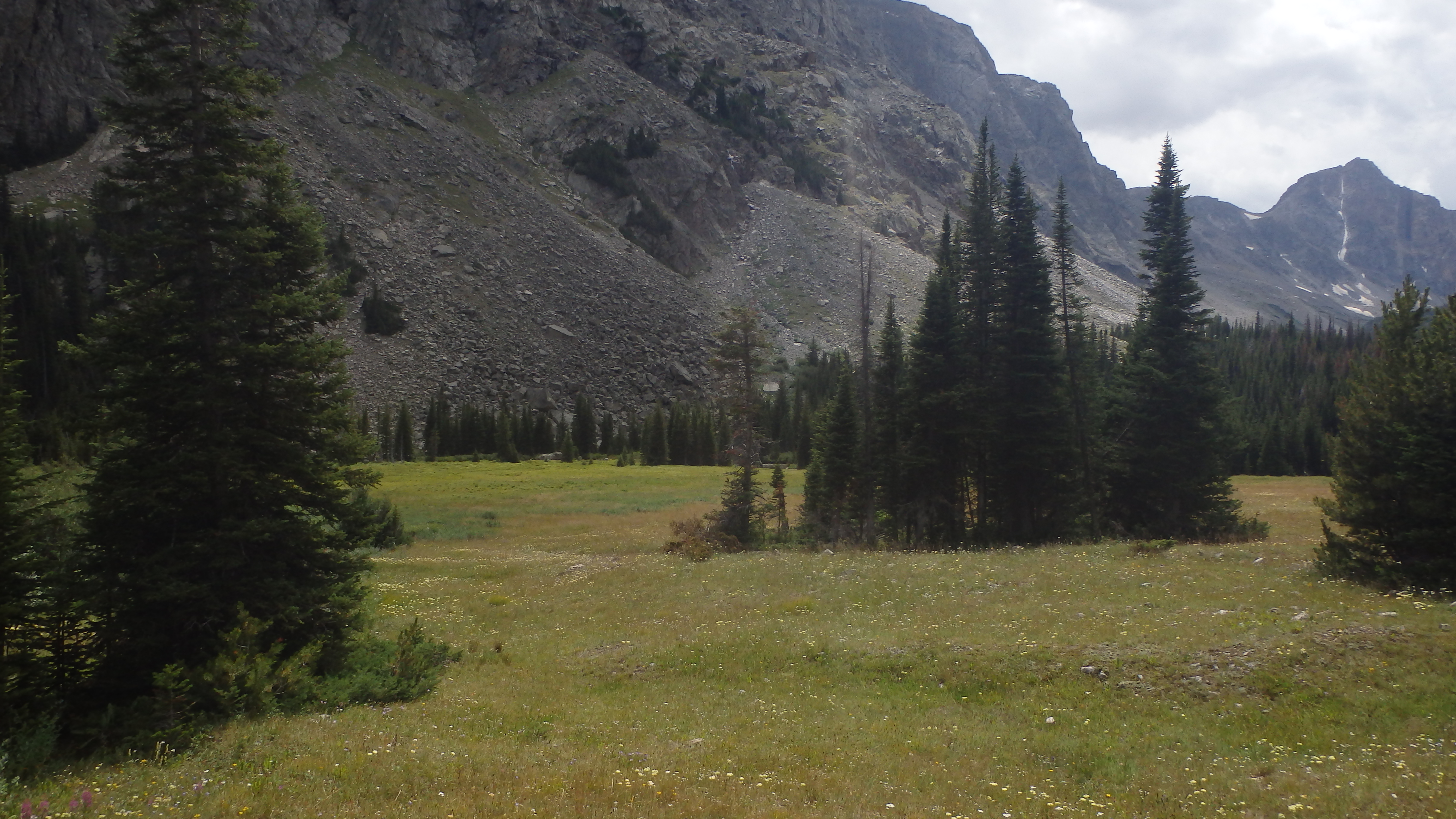
Quinnebaugh Meadows
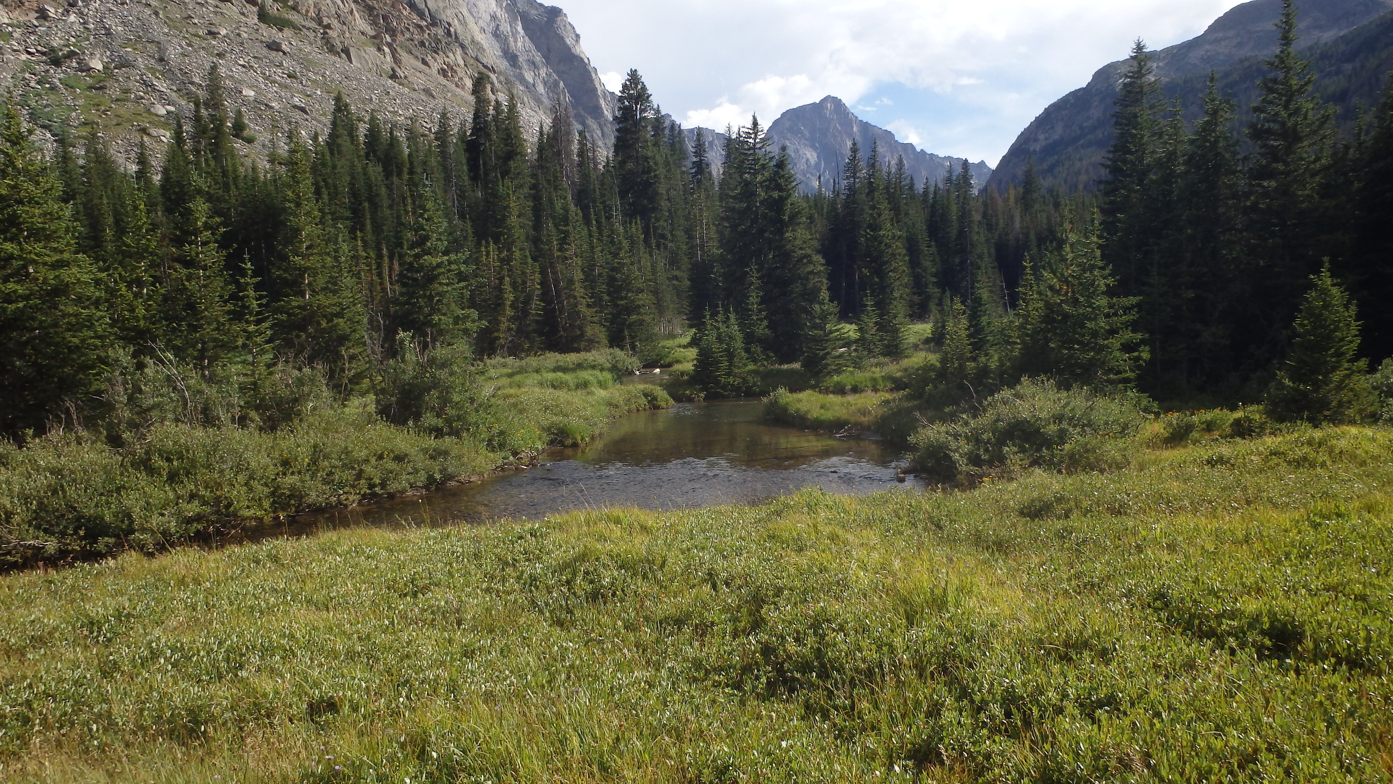
Quinnebaugh Meadows is a gorgeous mountain meadow that is surrounded by spectacular views of the Silver Run Plateau, and nearby Whitetail Peak. Wildflowers blanket the meadows, and line the trail all the way to Quinnebaugh Meadows. Nearby Rock Creek thunders down two waterfalls along the trail, with side trails leading to both falls. Once you reach the meadows, the number of people that you passed on the trail all seem to disappear- the meadows are so expansive that they easily swallow large and small parties alike.
Hiking to the meadows is rather straightforward, as the trail gains only 1,000 feet in 5 miles. The trail itself is well built, well maintained, and well traveled. You can expect to see company on this trail, but that won’t bother you much once you reach Quinnebaugh Meadows. There are also no turns on this trail, other than a left turn at the trailhead.
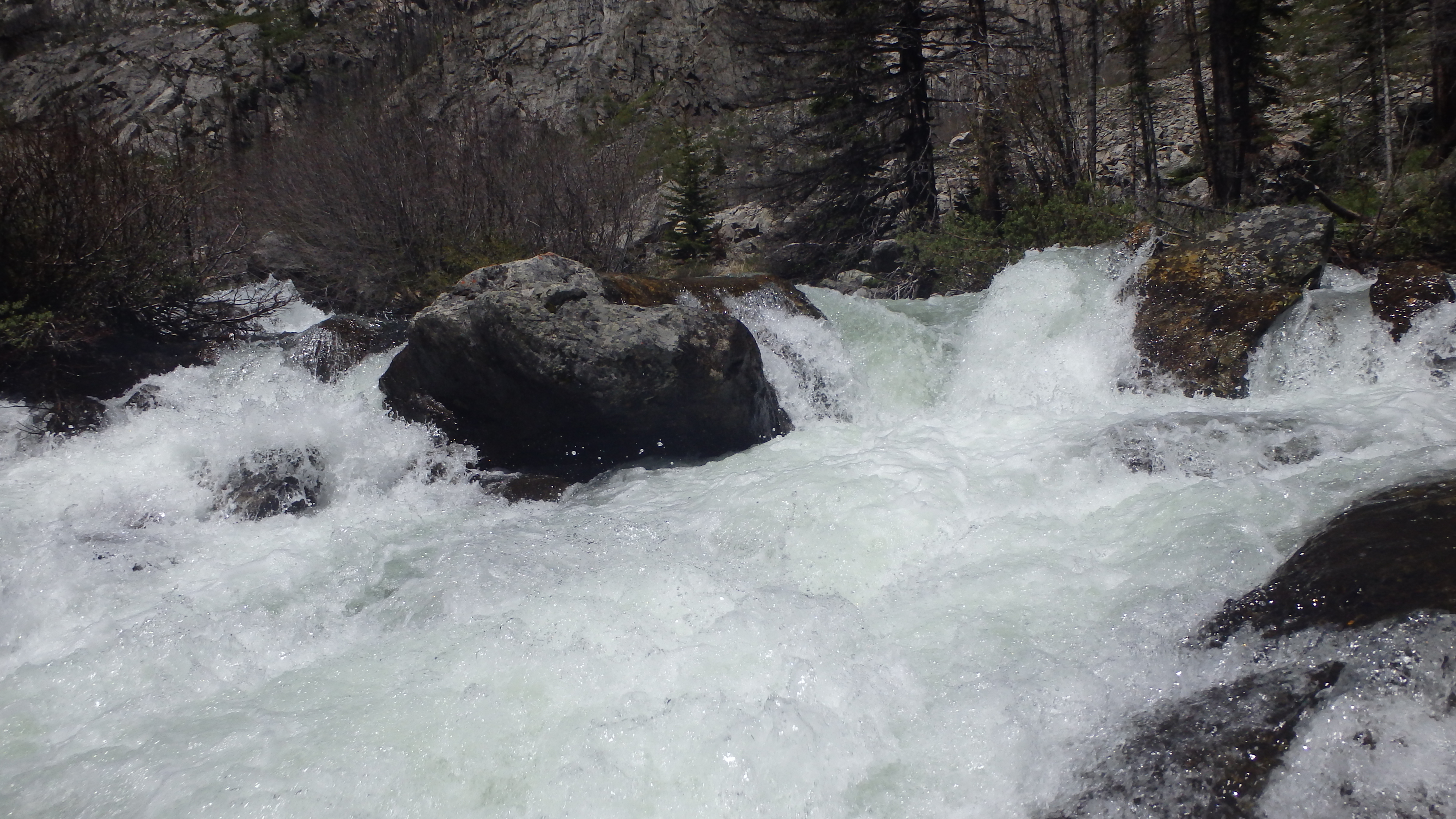
Calamity Falls
Starting from the trailhead, turn left to stay on West Fork Trail #1, which is well signed. The 2008 Cascade Fire burned this section of the trail, allowing the wildflowers to flourish without competition from trees. The trail here is dry, sunny, and lacks deadfall, or other obstacles. Kids do well on this section of the trail, and it’s easy to make good time here. At a little over a mile, you can hear Calamity Falls pouring down the narrow gorge.
Taking a short trail to the left, you can view Calamity Falls. It’s a great spot to stop and rest, or just take in the view. Hold onto any little ones on this spur trail however, as it does lead perilously close to the edge of the gorge. Once you have taken in the awesome view at Calamity Falls, continue up the West Fork trail.
Moving forward down the trail, another good resting spot appears (parents with little kids will love all the opportunities for breaks). A large pool appears next to the trail, a slow section in the West Fork of Rock Creek. I’m sure that this is a favorite place for dogs as well, judging from all of the wet dogs seen on this trail. Continuing down the trail, and at just under two miles, Sentinel Falls appears.
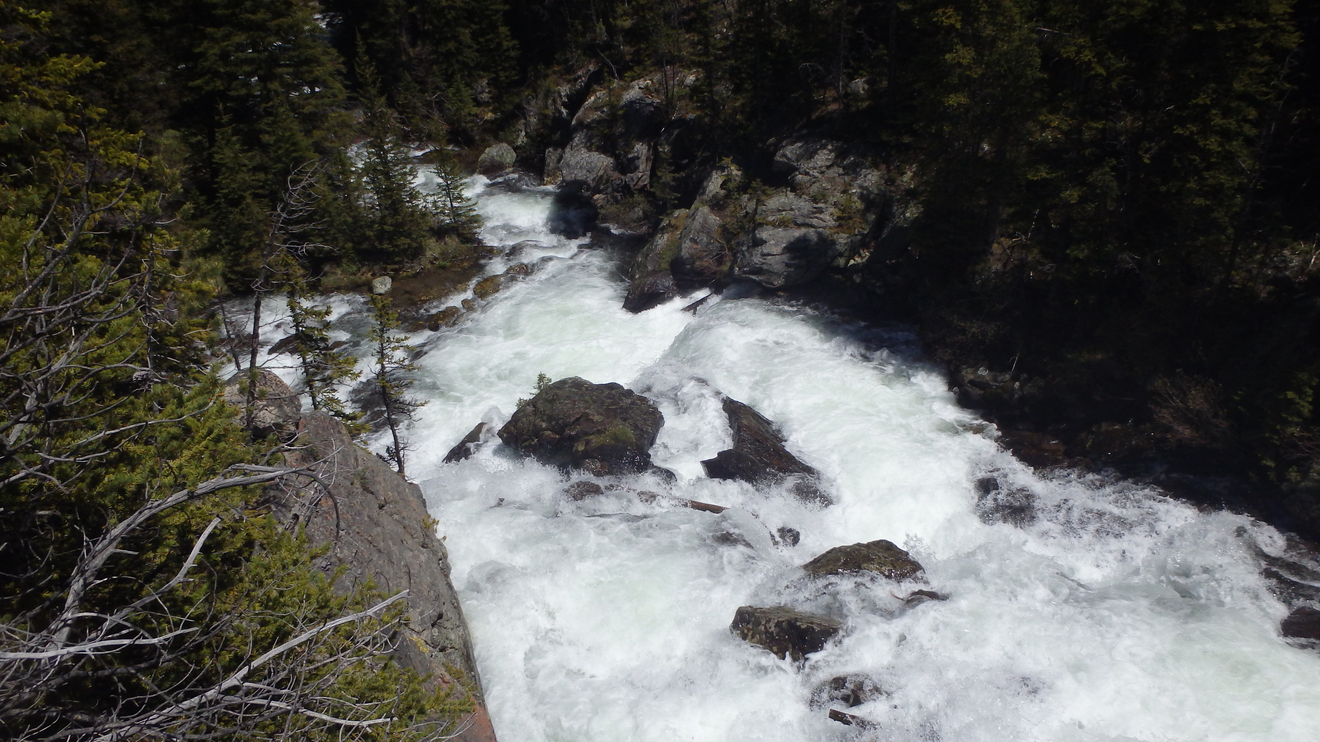
Sentinel Falls
Sentinel Falls is as equally impressive as Calamity Falls- it is a large cascade with several drops. The mist rises from the falls, and covers the large boulders near the trail- watch the little ones here. Sentinel Falls does offer several large boulders to stop and take a break on, making it yet another good spot for a break. Resisting the urge to stay all day, continue down the trail.
At this point, the forest re-appears, as you reach the furthest point that the Cascade Fire reached into the wilderness. Mature lodgepole trees here offer shade for sweaty hikers, and you can feel the temperature difference on this section of the trail. On a hot summer day, the difference is a much needed relief!
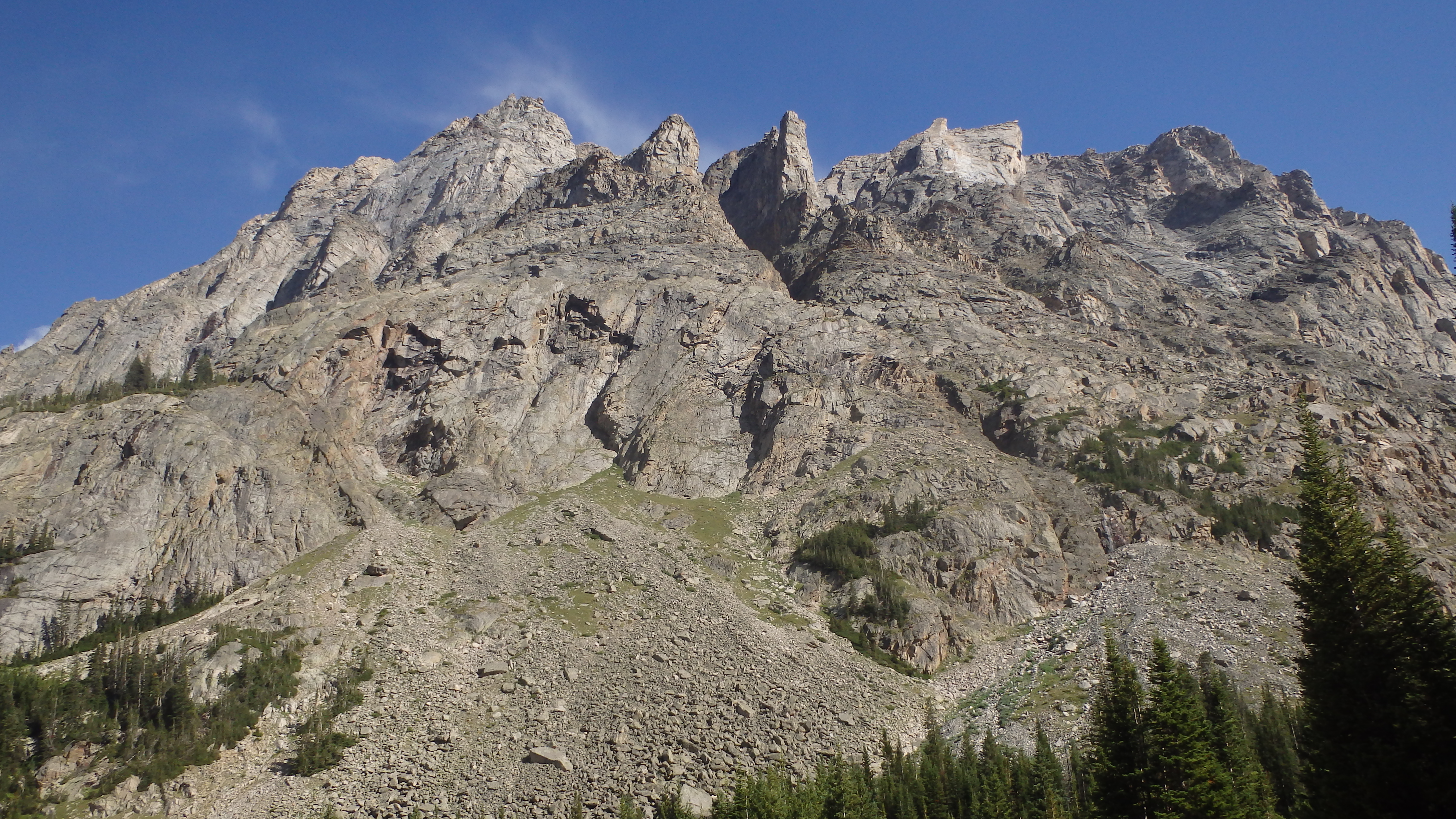
Silver Run Plateau
For the next three miles, the trail approaches several open meadows, which are tiny compared to Quinnebaugh Meadows. Resist the urge to stop at these sites, and instead push on- you won’t be disappointed. At 5 miles, the turn for Lake Mary appears, and you are now in the middle of Quinnebaugh Meadows. Hike just past this sign, crossing the small creek after the trail to Lake Mary (which is easier to cross 50 yards or so upstream, instead of at the trail). At this point, you are now greeted with the expansive Quinnebaugh Meadows- full of lush wildflowers, and shadowed by the Silver Run Plateau. From here, a multitude of destinations await.
Quinnebaugh Meadows is an excellent base camp, allowing exploration (without a heavy pack) to nearby destinations such as Lake Mary, Sundance Lake, Dude Lake, or any of the nearby peaks. It’s also a great destination in itself, although it doesn’t offer much for anglers. If you’re camping overnight at the meadows, the view from your tent is sure to leave a lasting impression.
Regardless of how long you plan on staying at Quinnebaugh Meadows, be sure that you leave no permanent signs of your stay. The meadows are in good shape, and not overused- please keep it that way. Camp back in the trees, as opposed to the main meadow, and be sure to keep a clean camp. This area is heavily traveled, and we all need to do our part to keep the wilderness beautiful for others.
Pictures of Quinnebaugh Meadows
 Quinnebaugh Meadows |
 Trail to Calamity Falls |
 Whitetail Peak from Quinnebaugh Meadows |
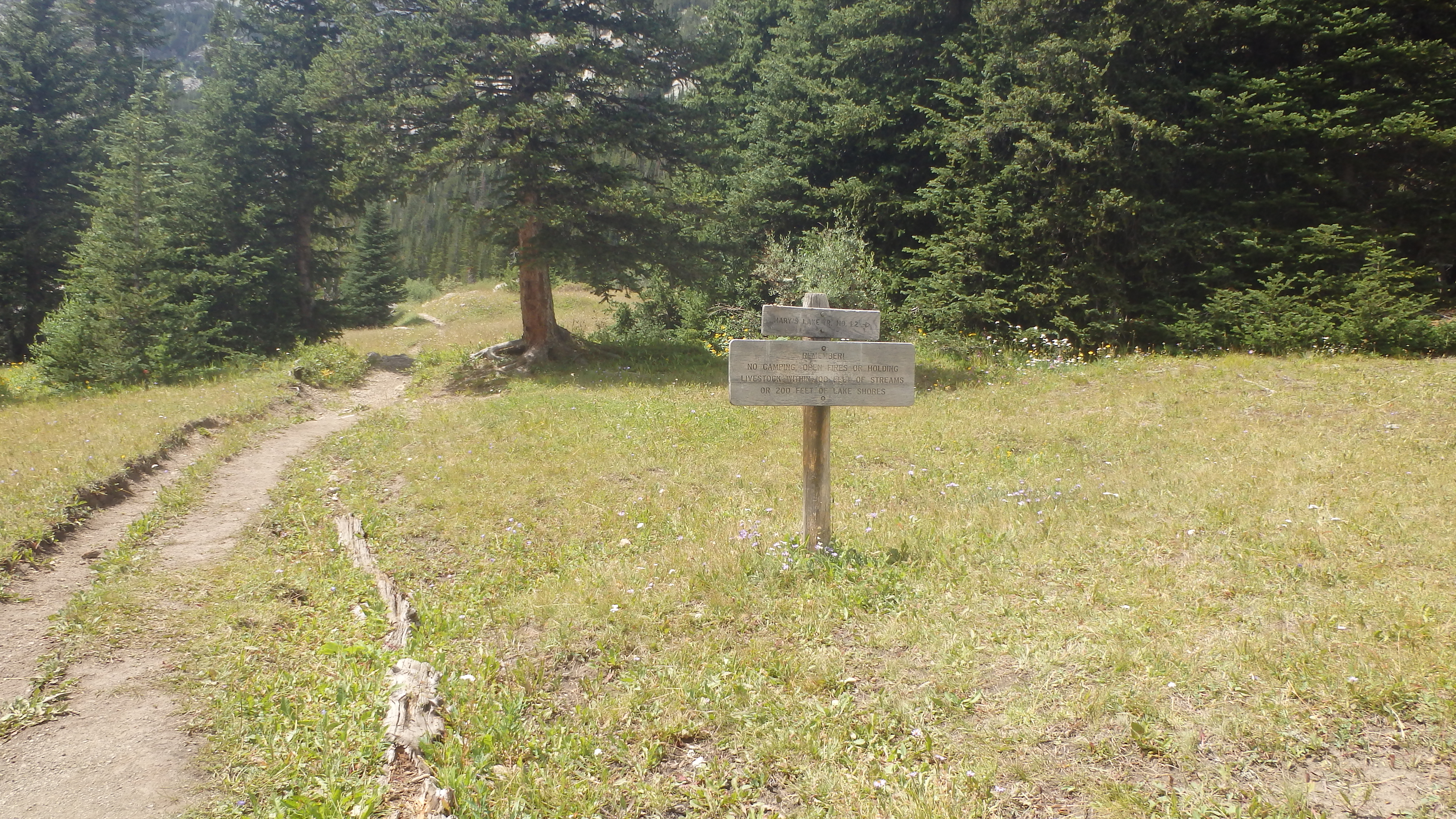 Forest Service Trail 1.2 to Lake Mary |
Directions to the Trailhead
Just outside Red Lodge, turn right onto West Fork Road (FR71). Follow this road for 12.8 miles, and arrive at the trailhead (and end of the road).
