Princess Lake- Beartooth Mountains
Princess Lake

Princess Lake
It’s a rare experience to hike on one of the busiest trails in the Beartooth Mountains, and hike in solitude for the last two miles of the trail. Princess Lake is a beautiful mountain lake located in the West Rosebud section of the Beartooth Mountains, and it’s just two miles from Mystic Lake– arguably one of the most popular day hike destinations in the Beartooth Mountains. The last two miles of the trail to Princess Lake are anything but busy, however. In the early or late season, you could easily have the lake to yourself. The trail to Princess Lake is what keeps most hikers away- the steep grade and faint track are not for inexperienced hikers.
This trail has a little something for everyone- rock fields, uphill switchbacks, flat runs, mature lodgepole pine forests, and good fishing. It also offers the opportunity to be lost in the woods, one of my favorite parts of this trail. The trail is well defined for the first six miles, but after that I’d recommend bringing along a GPS- just in case.
The hike starts on West Rosebud Trail 19, located at the West Rosebud Trailhead. Walk 200 yards from the parking lot, and you’ll see a sign marking the trail. One of the unique opportunities of this hike is the ability to learn about the Mystic Lake Dam, via the informational plaque at the beginning of the trail. Heading uphill, the trail enters forest while running along West Rosebud Creek. This is a great spot to sit and rest on the way back, but you’ll want to hurry down this section of the trail in the way in.
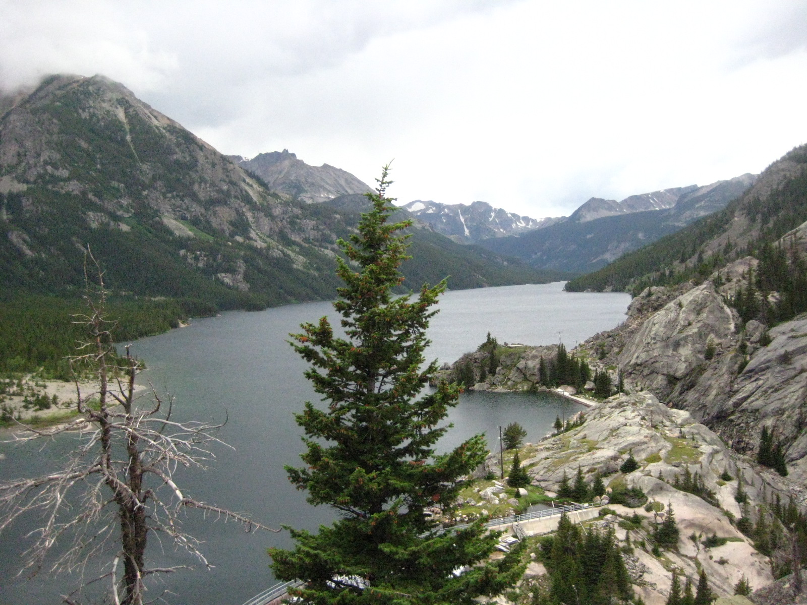
Crossing a well built bridge over the West Rosebud River, the trail continues to climb through the forest, gaining elevation steadily. After about two miles, the forest gives way to a rock field. This part of the trail is dry, hot, and downright miserable on a warm afternoon. Do yourself a favor, and hike this part of the trail in the morning or evening. This rock field does offer great views of both the West Rosebud Valley, as well as the Mystic Lake Dam pipeline. After three miles of hiking, Mystic Lake appears.
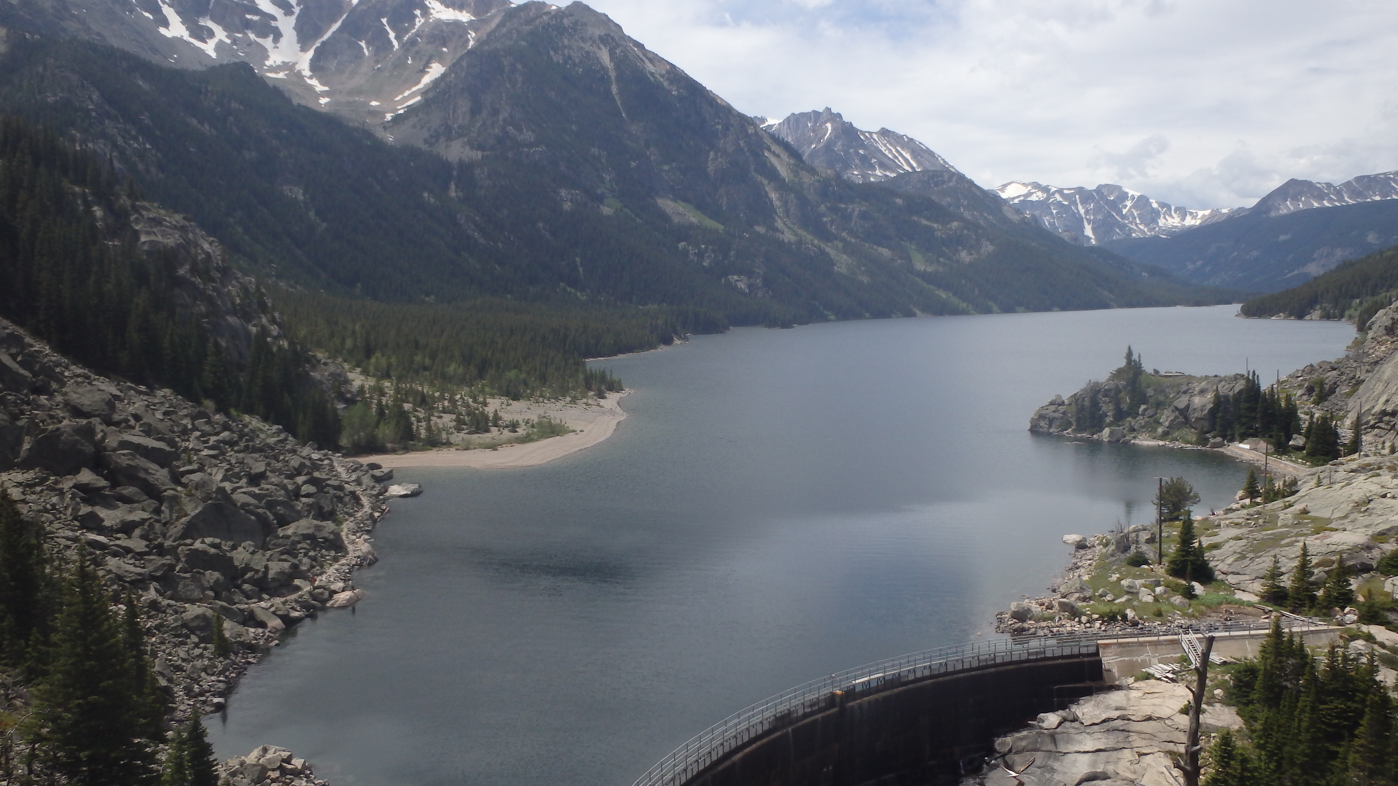
Mystic Lake
This section of the trail is one of my favorites- it offers a great view of nearby Froze to Death Mountain, and of course Mystic Lake itself. It’s hard to not stop and take a break here, and watch the wind create small waves on Mystic Lake’s surface. Mystic Lake is the largest lake in the Beartooths, which you’ll become well aware of over the next three miles.
The next three miles of this hike follow the shoreline of Mystic Lake. The first half mile of this section involves hiking past tents, and well used campgrounds. Resist the urge to camp here if you’re planning on camping, and instead camp further down the trail. This section of the trail (and it’s camp sites) receive heavy use.
There are several small stream crossings along this section of the trail, but you can easily cross on logs or rocks. Early in the season, these streams are larger, and are occasionally covered by snowbanks. This section does gain a little elevation, but the elevation is lost at the end of the three miles. At six miles from the trailhead, you cross the well built wooden bridge that crosses Huckleberry Creek. You’ll turn left, here.
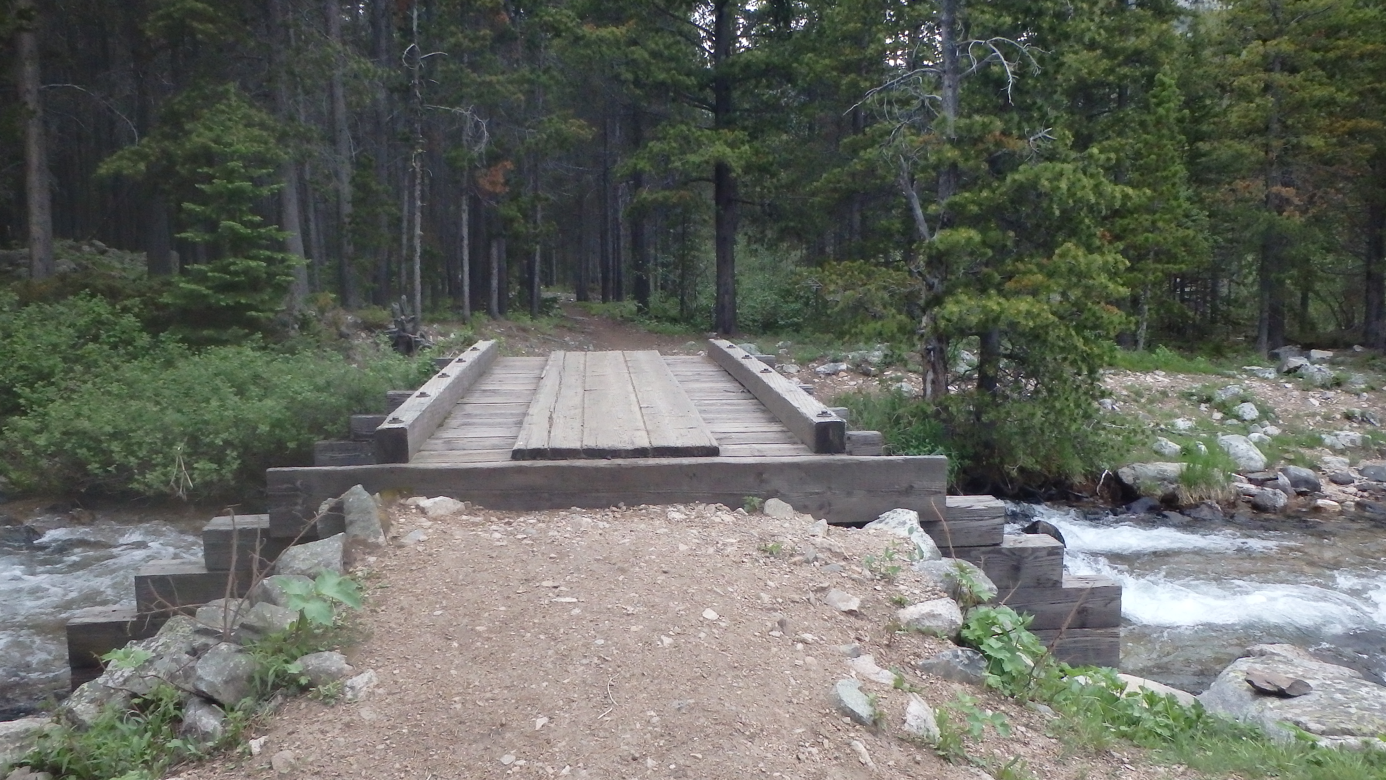
Bridge over Huckleberry Creek
The turn for the next trail is not well marked, but the path slightly forks just after the bridge over Huckleberry Creek. The trail then leads by some camp sites, before heading uphill. If you have trouble locating the trail at this point, try to hike uphill and parallel to Huckleberry Creek, and you’ll find it.
The next mile is uphill, and the trail is faint in areas. If you are alert, you should be able to follow the trail with little effort. If you do manage to lose the trail, just keep hiking uphill and parallel to Huckleberry Creek, and you’ll eventually locate the trail again. The trail runs close to the creek at several points, offering views of the cascades down below.

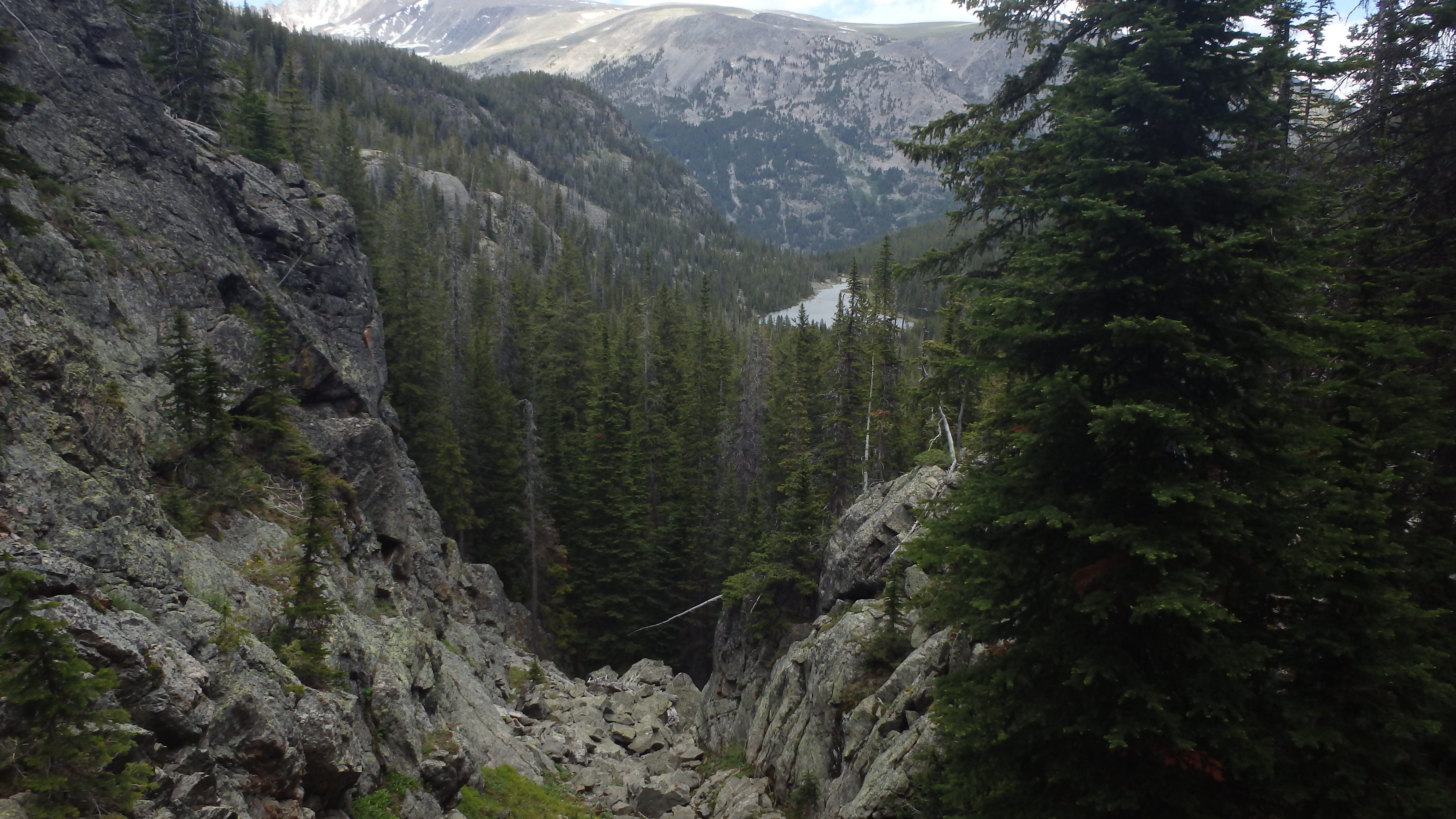
Huckleberry Lake Outlet
After a mile, Huckleberry Lake appears. This is a good spot to rest, fish, or eat a snack. The boulder field makes for good seating, and the Rainbow Trout are usually biting. The trail follows the shoreline of Huckleberry Lake, then sharply climbs. This last mile is the hardest- gaining 700 feet in a mile, and fading away completely in some spots.
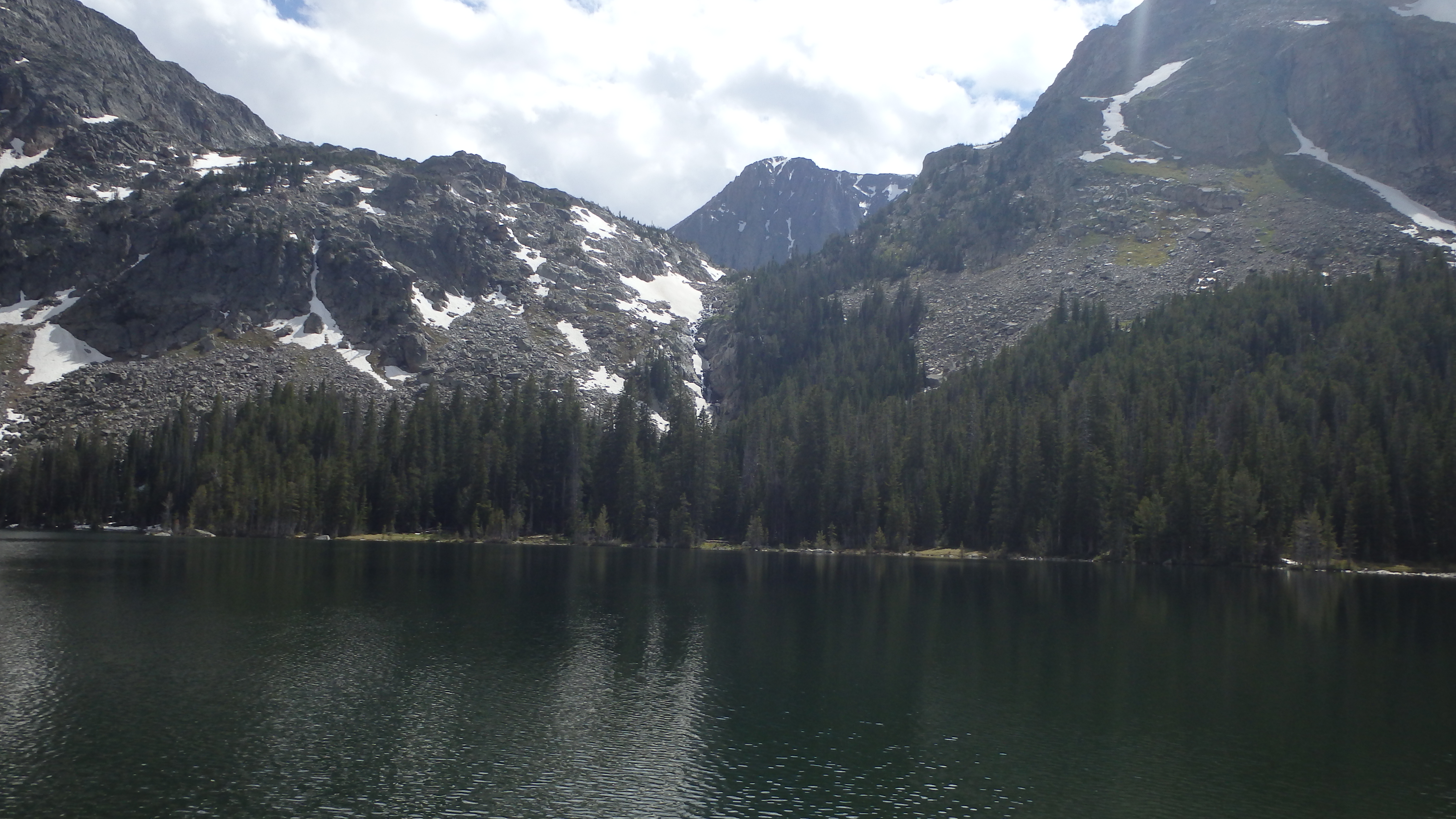
Fortunately, there are cairns along the way that others have left for you to follow. Do a good deed here, and help build up these cairns if they have toppled over. Heading uphill, this section of the trail takes about an hour. After 8 miles from the trailhead, Princess Lake appears.
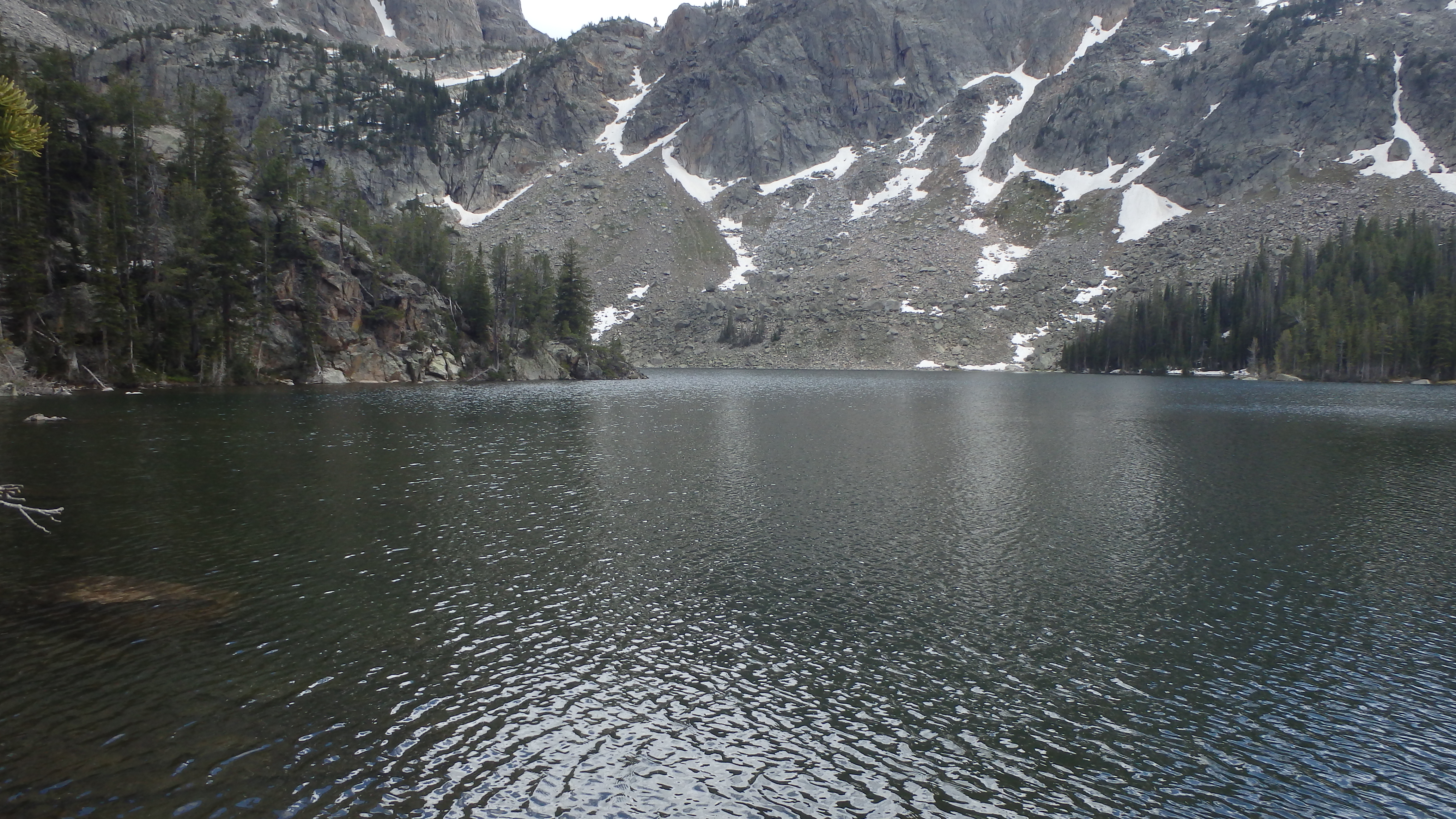
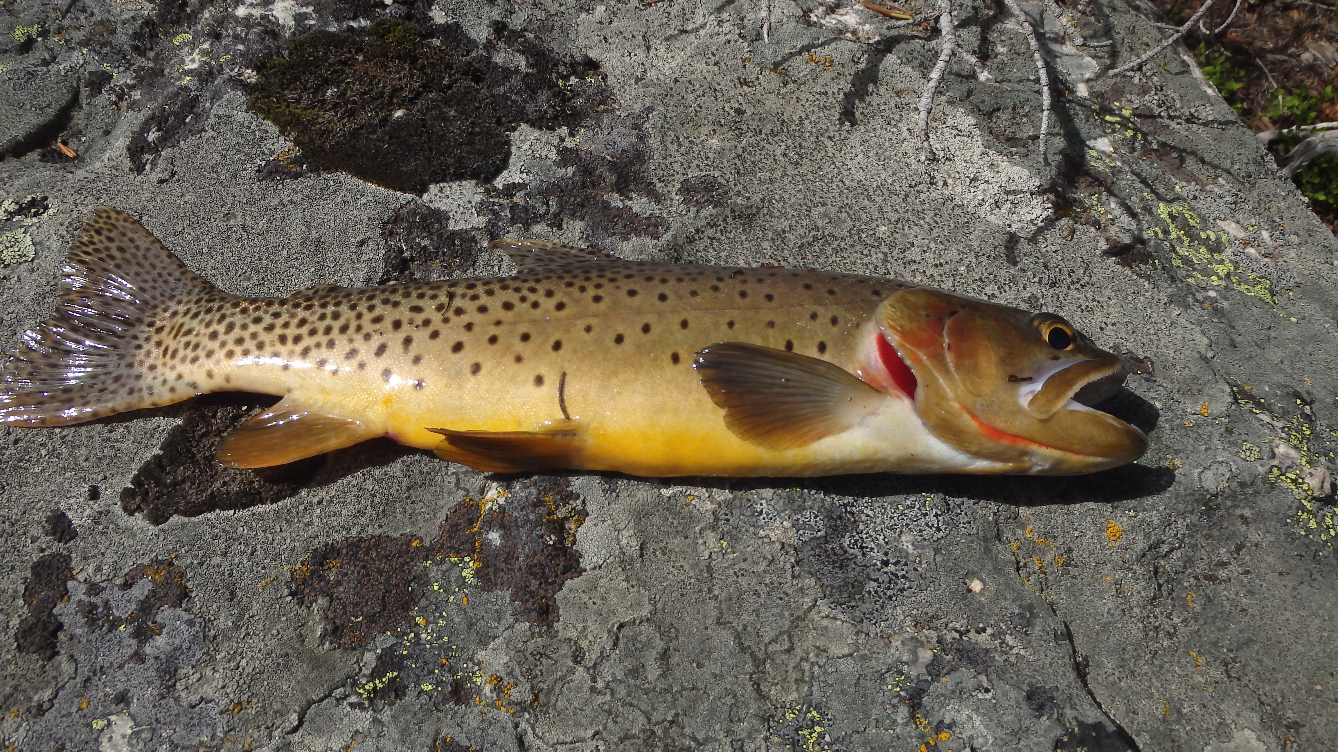
Princess Lake offers a great base camp potential. Although the camp sites are limited here, camping at Princess Lake allows a relatively quick day hike to Avalanche Lake, and Lower Storm Lake. However, the fishing at Princess Lake may leave you too distracted to pursue other destinations. Rainbow Trout dominate the fishery below Princess Lake, but Princess Lake offers Cutthroat Trout, which are usually more willing to bite than the rainbows.
When you’ve had your fill of exploring Princess Lake, turn around and head back on the same trail you arrived on. It’s 8 miles to the trailhead, but you can smile knowing that they’re mostly downhill. You’ve gained 2,500 feet of elevation on this trail, but if you’re still energetic after the hike down to the West Rosebud Trail, you should consider hiking over to nearby Island Lake, located a half mile past the trail to Huckleberry Lake.
Pictures of Princess Lake, and the Trail
 Princess Lake |
 Cairn on Trail to Princess Lake |
 Mystic Lake, at the overlook |
 Huckleberry Lake from Above |
 Cutthroat at Princess Lake |
 Granite Peak above Princess Lake |
Directions to the Trailhead
From Absarokee, head south of town on Highway 78. Turn right a couple of miles outside of Absarokee, onto Highway 419 (there will be a gas station at this turn). Drive down Highway 419 for 6 miles, passing through Fishtail. Once you drive through Fishtail, drive one more mile down Highway 419, and then turn left onto West Rosebud Road. Follow this road for seven miles, turning left at the sign to Mystic Lake. Travel down this gravel road for about 14 miles (passing Emerald Lake and West Rosebud Lake), and park at the trailhead. This is the end of the road (the rest of the road is closed to the public), and the trailhead is easy to find.