Whits Lakes: Gallatin Range
Whits Lakes: Gallatin Range

North Whits Lake
Whits Lakes, or Whits Lake, is a pair of small lakes located north of Hebgen Lake and just outside of Yellowstone National Park. Since the descriptions of these two bodies of water is somewhat confusing (some maps refer to them as Whits Lake, whereas others refer to the lakes as north or south Whits Lake) in this guide I’ll refer to them as separately as north or south Whits Lake. Now that we have that bit of confusion cleared up, let’s dive into the hike itself. Although the trail is only 2 miles round-trip, it allows you to escape the crowds of Yellowstone and explore the Gallatin National Forest. For big game hunters, Whits Lake is especially popular in the fall, which is also when I prefer to hike this trail.

Whits Lake Trail
Leaving the trailhead, you’ll see why I like to hike this trail late in the summer or in the early fall. The trail is muddy most of the year, with mosquitoes ever-present in the early summer. This trail is cool in the fall, since the lakes rest at above 7,000 feet. Nearby lakes such as Johnson Lake, or popular lakes closer to Bozeman such as Lava Lake are usually covered with snow in the late fall. Whits Lake, however, remains clear well into early winter. Winding through the forest, the trail starts at a level incline, and then climbs a total of 320 feet. If you take your time on the way up you might be rewarded with seeing some of the deer and elk along this trail, or possibly some limestone fossils.
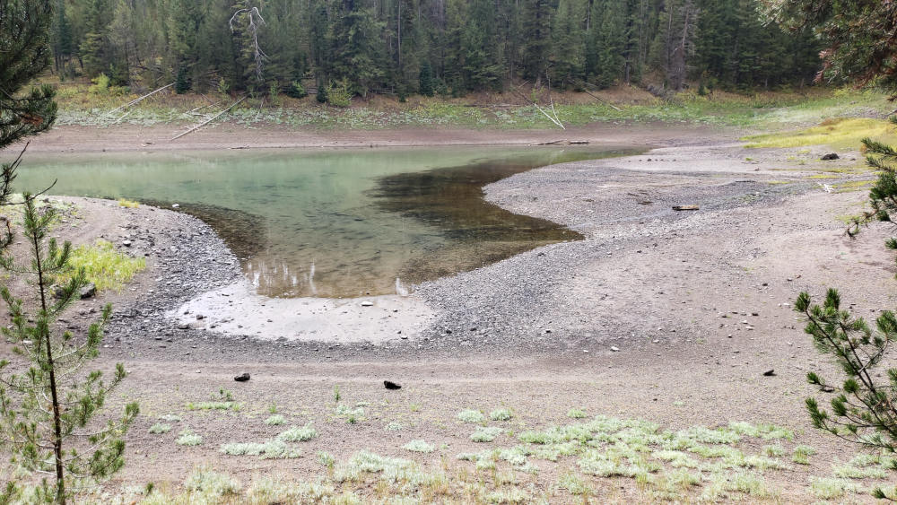
South Whits Lake
The first Whits Lake (south) appears after just a short jog up the trail. It’s easy to see in the spring why some would think this is the main Whits Lake, and why the USGS lists these at “Whits Lakes”. This pond is bigger in the spring, and you can see how much of the shoreline moves between the summer and fall. Water from the springs that feed these lakes makes them grow larger in the summer, while shrinking down to smaller pools of water during the late summer and fall. Hiking past the southern Whits Lake, the trail moves around a wet marsh and quickly ascends.
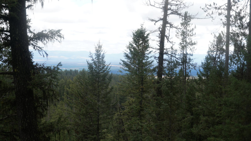
View from Whits Lake Trail
This hill is the steepest in the hike, but it’s still an easy hill. The trail climbs swiftly and leads to the northern Whits Lake. From the trail you can see Hebgen Lake as you ascend. At the top of this short hill, north Whits Lake appears through the trees. There’s no mistaking the northern Whits lake from its southern neighbor; even in the summer the northern lake is noticeably bigger. Although these lakes aren’t as scenic as some of the other nearby lakes that are highly trafficked, the possibility of hiking alone in a popular area has its own appeal. Given the amount of tourist traffic nearby, it amazes me that this trail is so clean. Let’s keep it that way by making sure to pick up any random garbage you may see along the trail and to not cut across the trail. Your help ensures that many can enjoy both of these lakes without the crowd of Yellowstone National Park.
Directions to the Whits Lakes Trailhead
From West Yellowstone, drive 8.2 miles north on Highway 191. Turn left (east) onto Highway 287 and head east for 2.5 miles, turning right at Forest Service Road 791. From here it’s an easy 2 miles to the trailhead at the end of the road.