Tepee Pass- Yellowstone National Park
Tepee Pass- Yellowstone National Park

Tepee Pass
Tepee Pass is a scenic day hike that is located just barely outside of Yellowstone National Park, and although the trail isn’t technically in the park, you can still see vistas of the park and the surrounding mountain ranges. Tepee Pass provides one of those rare moments when you can see two mountain ranges in all of their glory- the Gallatin Range to your left and right, and the Madison Range in front of you. While you’re on this hike, you also have the opportunity to see some of Yellowstone’s famous wildlife- bears, moose, and deer. If you’re not afraid of hiking up a large hill, the hike up to Tepee Pass is worth your time.
Tepee Creek Trail
From the trailhead, the trail starts out as a flat two track road- an unusual way to start a hike that is near a national park. The trail to Tepee Pass is just a half mile from the Yellowstone National Park boundary, which relaxes some of the rules on this hike. You don’t have to pay a park entrance fee, and you’re allowed to pick up any small rocks that may catch your eye. I’ll get back to the rockhounding potentials later- the first intersection of the trail is just ahead.

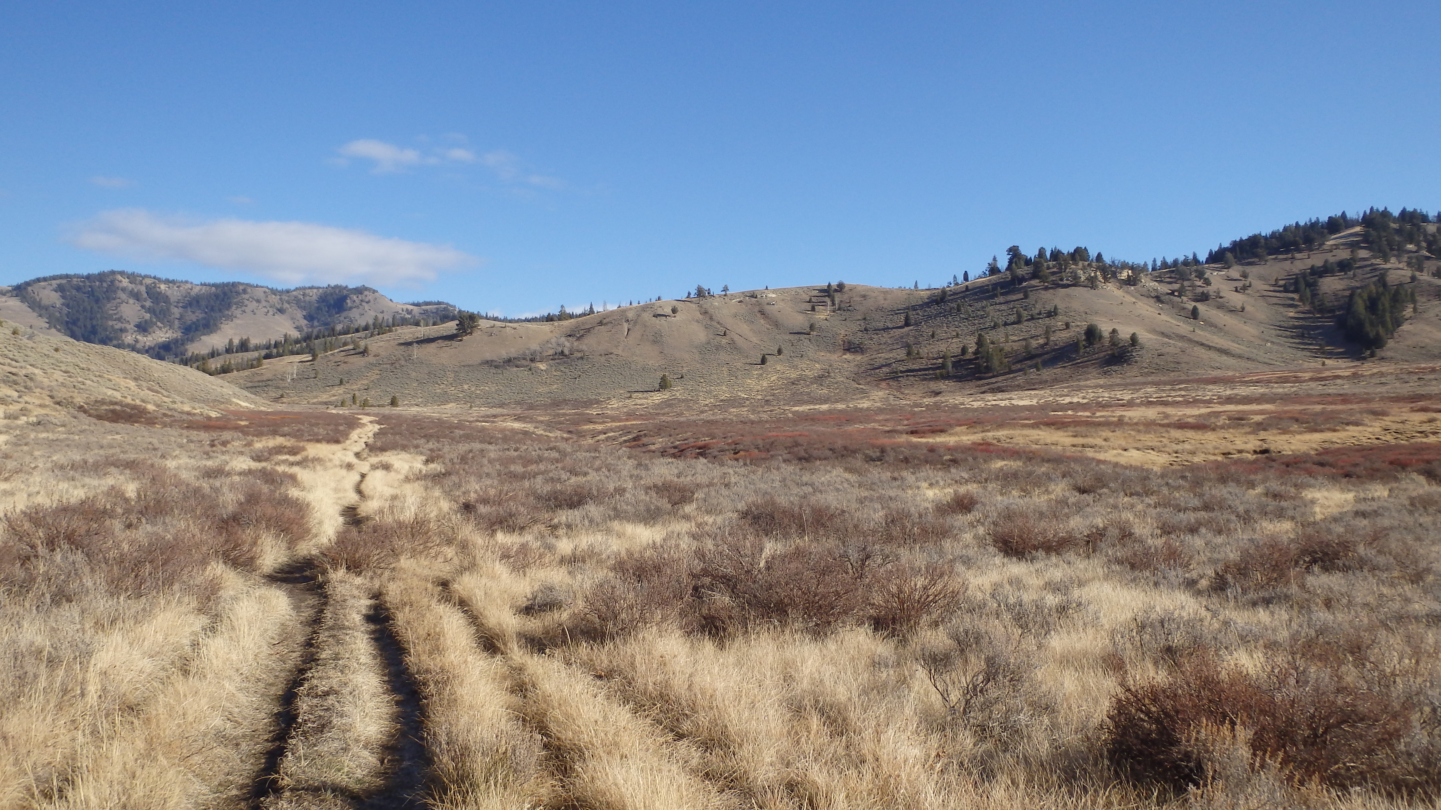
1st Fork on Tepee Creek Trail
At around a mile, a fork in the trail appears. Bear left at this fork, and immediately hike uphill. This is where the harder hiking begins, and where most hikers turn around. Over the next two miles, you’ll gain 670 feet- nothing terrible, but it’s still enough elevation to keep away most day hikers. For the first mile, the hike is relatively straightforward. There are no switchbacks on this trail- the trail either leads uphill or downhill- a relief for those who despise switchbacks. As you hike along this section of the trail, turn back from time to time, and enjoy the scenery around you. As you gain elevation, the scenery becomes more wonderful. Just don’t be too distracted by the scenery to look down at the trail itself- a small treasure may lay beside the trail.

Scoria and Petrified Wood
Millions of years ago, a violent volcanic eruption ravaged this landscape, turning the rivers to mud and ash, and the trees to stone. Today, as you hike along this section of the trail, you can see evidence of this violent past. Large pieces of petrified wood lay by the trail, caked in mud and debris, left to be forgotten by time. Scoria, a black igneous rock that was ejected from a volcanic eruption, also lies along the trail. Feel free to explore this stretch of the trail- numerous geological treasures await an eager rockhound. Once you’ve satisfied even the most curious rockhound in your group, continue to hike uphill.
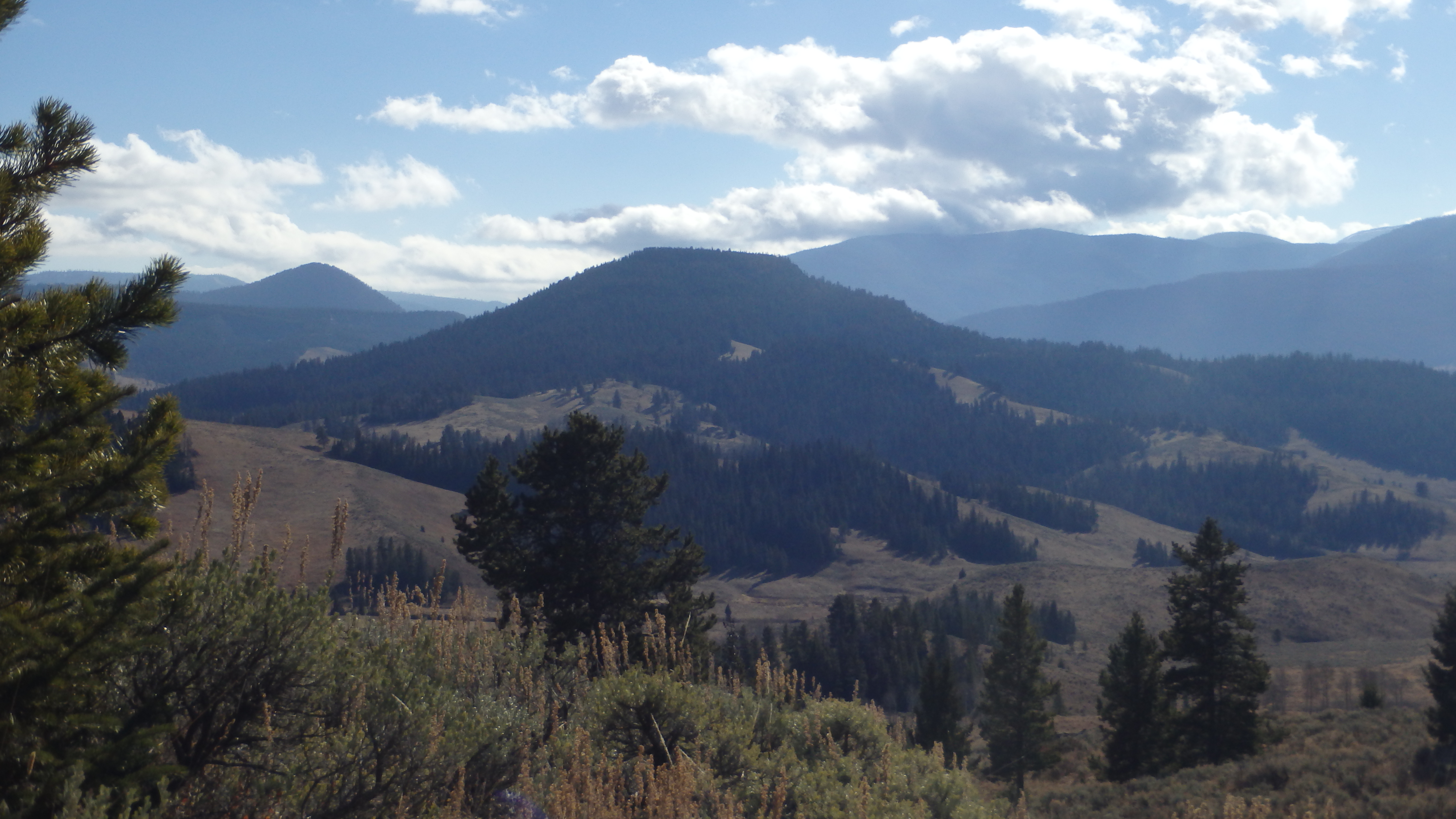
Crown Butte from Tepee Pass
After three miles, you arrive at Tepee Pass, a junction with trails that lead to the upper Gallatin River, and Yellowstone National Park. From here, you should turn to the right and hike about a hundred yards towards Yellowstone National Park (west), where you will be rewarded with a clear view of the Madison Range, including the Spanish Peaks section. Looking to your left, you’ll see the Yellowstone National Park boundary, and Crown Butte. Once you’ve taken your fill of the scenery, you can hike further down any of the intersecting trails, or hike back down to your vehicle at the trailhead.

View from Tepee Creek Trail
The hike back down to your vehicle is an easy one- it is mostly downhill, and you can see the trailhead for almost the entire trip back. It would be a good idea to have a pair of binoculars for this portion of the hike- you can view thousands of acres from this vantage point, and most of Yellowstone’s wildlife visits these valleys. This includes bears, so know how to safely hike in bear country. Although this trailhead is conveniently located off of Highway 191, it is every bit as wild as the Yellowstone Park interior. Remember the same rules for preserving this landscape for generations after us- keep the trail clean, and pick up any trash you may find along the trail. Your efforts today make a huge impact on the future condition of the trail.
Directions to the Trailhead
From Four Corners, take Highway 191 South for 50 miles. The trailhead will be on the left, just before the Yellowstone National Park boundary. It is signed, but easy to miss on the busy highway- if you drive past it, just turn around at the Yellowstone National Park boundary, and you will easily find the trailhead.
