Slate Trail to Go John Trail Loop – Cave Creek Regional Park
Slate Trail to Go John Trail Loop – Cave Creek Regional Park
Slate Trail to Go John Trail
Cave Creek Regional Park has plenty of trails that can combine into a myriad of options. One popular loop that isn’t as long as the nearby Go John Trail is the Slate Trail to Go John Trail Loop. This hike is only 3.8 miles long and offers beautiful views of northern Phoenix as well as the Superstition Mountains. A side benefit to hiking this trail is that if you’re not from Arizona and don’t have all of the cactus names memorized (other than the famous saguaro, of course) this trail has informative plaques near the major types of cacti in the park. Leaving the parking lot via the west trail marked Slate Trail, this quick loop begins.

Slate on Slate Trail
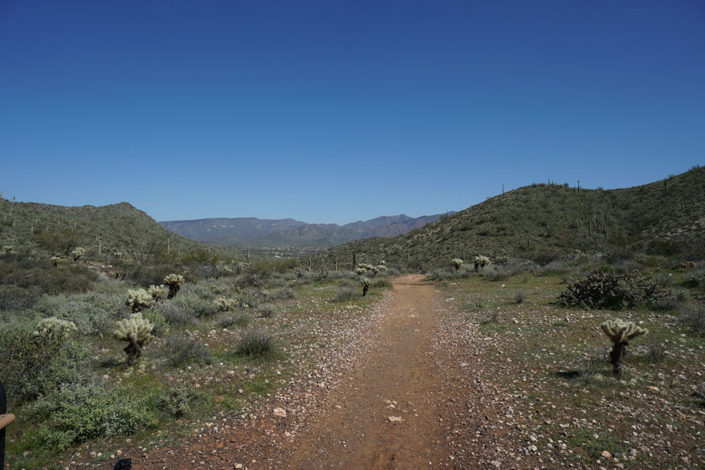
This trail has a few hills, but nothing more than a couple of hundred feet of elevation. You can easily see why this is named Slate Trail– large pieces of jagged slate stick out of the ground at random spots on the trail. Other than the geology, you’ll feel the difference hiking up closer to the top of the hills where you can feel the cool wind, and then roasting in the valleys below. The first turn on this loop is Quartz Trail, at .8 miles. Turn left (north) at the well-signed intersection.

Slate Trail to Go John Trail Intersection
Quartz Trail brings more hills to this hike. Slate Trail is pretty flat, but Quartz Trail makes the hike interesting. Look at the sides of the trail as you walk by to see fossils preserved in slate, shiny quartz, and the occasional piece of petrified wood. Don’t disturb these specimens, though; it is specifically forbidden to remove any rocks, plants, or historical artifacts from the park. Hiking up to the highest point on the Quartz Trail, you will see an intersection onto Go John Trail. Turn left (east) at this junction.
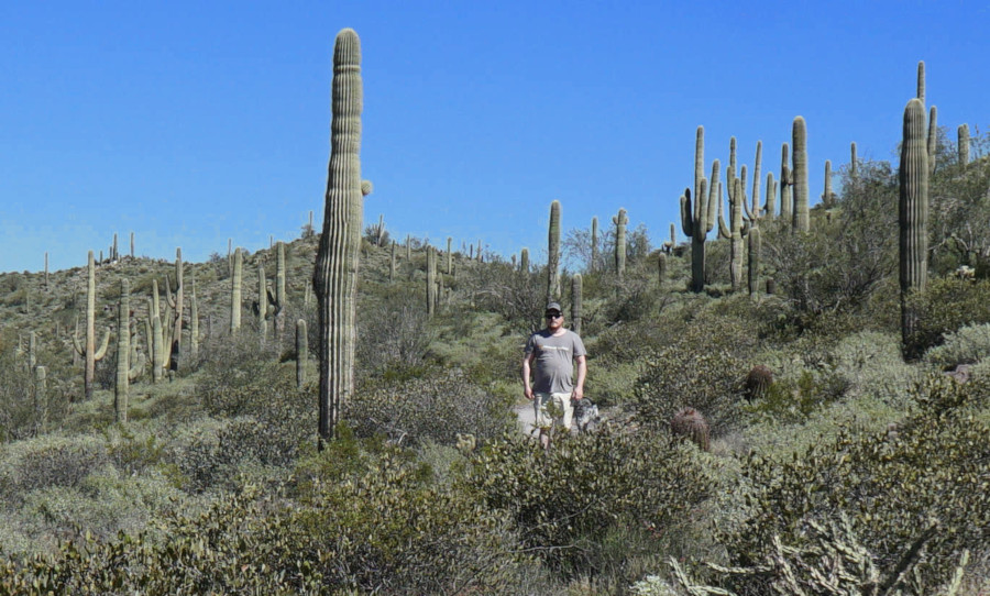
Saguaro Cacti are Tall!
Taking Go John Trail down this last leg will go by quicker than you’d think. Although the section is nearly a mile long, the downhill course of the trail speeds up your pace. Take the time to stop and enjoy the view at least a couple more times along this trail. After .9 miles from Quartz Trail, Jasper Trail appears on the left. Turn left (south) at this well-signed intersection.

The Dreaded Teddy Bear Cholla
Jasper Trail is the shortest trail in the park at a quarter-mile. I can’t help but wonder why this trail even has a name. In any event, Jasper Trail runs back to the Slate Trail, where you will turn right (west). After another short quarter of a mile, you will see the parking lot where you started. This is the second shortest hike that I’ve traveled on in the Cave Creek Regional Park, but it’s still neat. The scenery is amazing, and this section of the park isn’t nearly as busy as the Clay Mine or Go John trails.
Directions to the Slate Trail Trailhead
Enter Cave Creek Regional Park (37019 N Lava Ln, Cave Creek, AZ 85331), pay your $8 entrance fee, and drive past the horse stables to the well-signed Slate Trail Trailhead.
Map to the Slate Trail Trailhead