Go John Trail – Cave Creek Regional Park
Go John Trail – Cave Creek Regional Park – Phoenix, AZ

Go John Trail
The Go John Trail was my favorite trail in Cave Creek Regional Park. This trail is 6 miles long, giving you a decent bit of exercise (unlike the flatter Clay Mine and Slate/Quartz trails). My favorite part about this trail is the wildlife, though. This trail receives less traffic than the others in the park, so you’re more likely to see a rattlesnake or two. During my quick hike through Go John Trail, I was able to see deer as well, having otherwise eluded me over the previous three days. This hike starts at the north trailhead because the grade is easier; if you’re looking for a more strenuous workout, try hiking this trail in reverse.

One of the Many Saguaro Cacti Along Go John Trail
Once you leave the north trailhead at the parking lot, it’s easy to stay on the Go John Trail. Starting up the trail, bear right to follow the inside curve of the trail. It’s practically impossible to get lost since every intersection is well marked. Loop hikes tend to give me a little bit of anxiety since you can add 10+ miles to your hike if you miss a turn. This happened to me on The Beartooth Recreational Trail ended up being an extra ten miles when I missed a turn south of Sawtooth Lake. Thankfully, Go John Trail won’t get you lost. You should still hike this trail at a slower pace than normal. Not only is the scenery worth slowing down to appreciate, the wildlife isn’t as shy when you slow down.
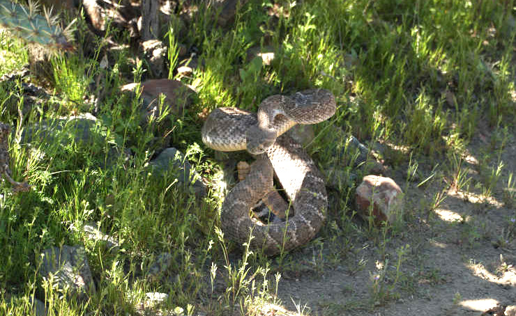
Rattlesnake on Go John Trail
Keeping conversations and trail noise to a minimum will pay off on this trail. I hiked this trail solo after noisier groups, and the wildlife noticeably hides at the warning of these hikers. Frankly, I think that everyone should hike a trail in this manner, but to each their own. The profile of this trail is straightforward if hiked clockwise– there is a small hill in the beginning and middle, with a larger hill at the end. Many guides have categorized this trail as a “moderate” trail, but I cannot agree with them. Although one hill turns into a set of stairs, all of the hills on this trail are less than 300 feet high. Compared to the other hikes I have written, Go John is definitely an easy trail and changes less elevation than most. Bring plenty of water on this hike (I hiked this in February and ran through a liter of water), and take your time. The best part of this trail is the chance to see wildlife. Speak softly, step lightly, and maybe you’ll see a critter or two.
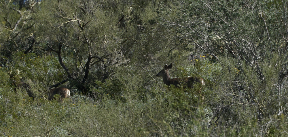
Deer on Go John Trail
Directions to the Go John Trailhead
Enter Cave Creek Regional Park (37019 N Lava Ln, Cave Creek, AZ 85331), pay your $8 entrance fee and drive to the end of a loop. You can’t miss the Go John Trailhead.
Map to the Go John Trailhead