Goldmine Trail to Dynamite Trail Loop – San Tan Regional Park
Goldmine Trail to Dynamite Trail Loop – San Tan Regional Park – Phoenix, AZ
View From Dynamite Trail
The San Tan Mountain Regional Park is located an hour from downtown Phoenix, AZ and offers a good calf-stretching trail that is stunning. On this trail, it seems as if you are walking on diamonds as tiny glimmers from mica and Pyrite glisten in the sun. You can hike this loop in reverse to save yourself some exercise, but I wouldn’t recommend it. It’s better to hike up the 500 ft tall hill in the beginning so that you can appreciate the scenery heading downhill. For either option, start at the Goldmine Trailhead located just outside of San Tan Mountain Regional Park.
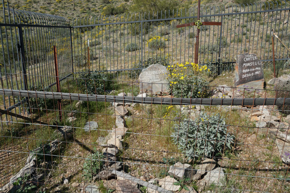
Graves on Goldmine Trail
Leaving the trailhead, you immediately have the choice to hike this loop counter-clockwise or clockwise. Clockwise is probably the easiest, but if you hike this trail counter-clockwise, you have only one big hill to hike up in the beginning. This makes the trail more interesting. As you take the counter-clockwise option, you will soon see the spur path to the graves of Marion E. Kennedy and Mansel L. Carter. These two men started in the Arizona desert in search of gold, finding a deep connection with the local flora and fauna. They are buried here in this quaint cemetery, to remind us to tread lightly and respect the unique animals and plants along the trail.

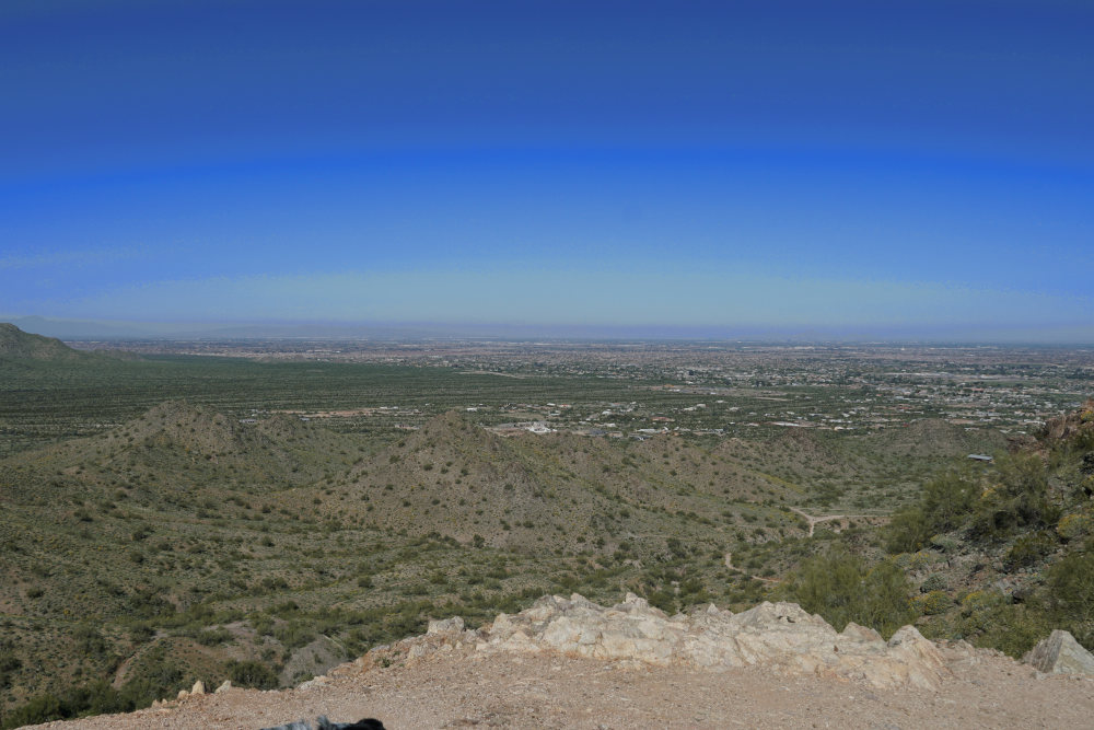
View From the Top of Goldmine Trail
Leaving this spur trail, you will re-connect to the main trail, which dips down into a coulee before starting the climb to the east shoulder of Goldmine Mountain. The trail climbs swiftly here, but I am still categorizing this hike as an easy hike. Yes, the next mile gains a little over 500 feet and is quite steep. However, I saw two small children and several older men and women hike this portion of the trail, so the trail can’t be that difficult. Take your time on this one big hill, and the rest of the trail is more or less downhill. Reaching the top of the hill, the view is fantastic. If you look to the north (behind you), you can see Phoenix and the Superstition Mountains. Looking south (forward), a scenic spread of hills and valleys await.
San Tan to Dynamite Trail
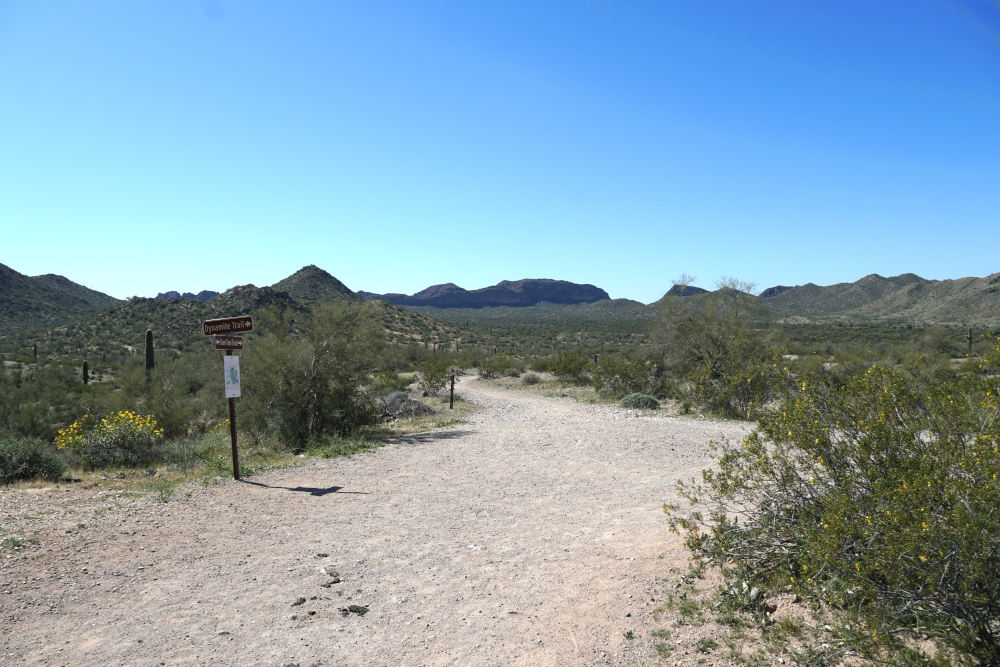
Once you’ve carefully descended into the valley below (this portion of the trail is marked as difficult, but it honestly is an easy section of the trail), you reach the valley floor. The next 2.8 miles are a walk in the park so to speak. The trail leads mostly downhill to the San Tan junction on your left, and following this junction quickly reaches the Dynamite Trail, where you will bear right. This portion is the easiest but the longest section of the loop. 2 ½ miles lie between you and the trailhead, but it honestly doesn’t seem that far.
As you slowly glide up and down ravines, the time passes by quickly. Take your time and look down at the trail. You will see beautiful reflections from Pyrite and mica specks that reflect the ever-present sunlight. These specks will decorate the trail for the rest of the hike. As you wind your way towards the trailhead, one last hill appears.
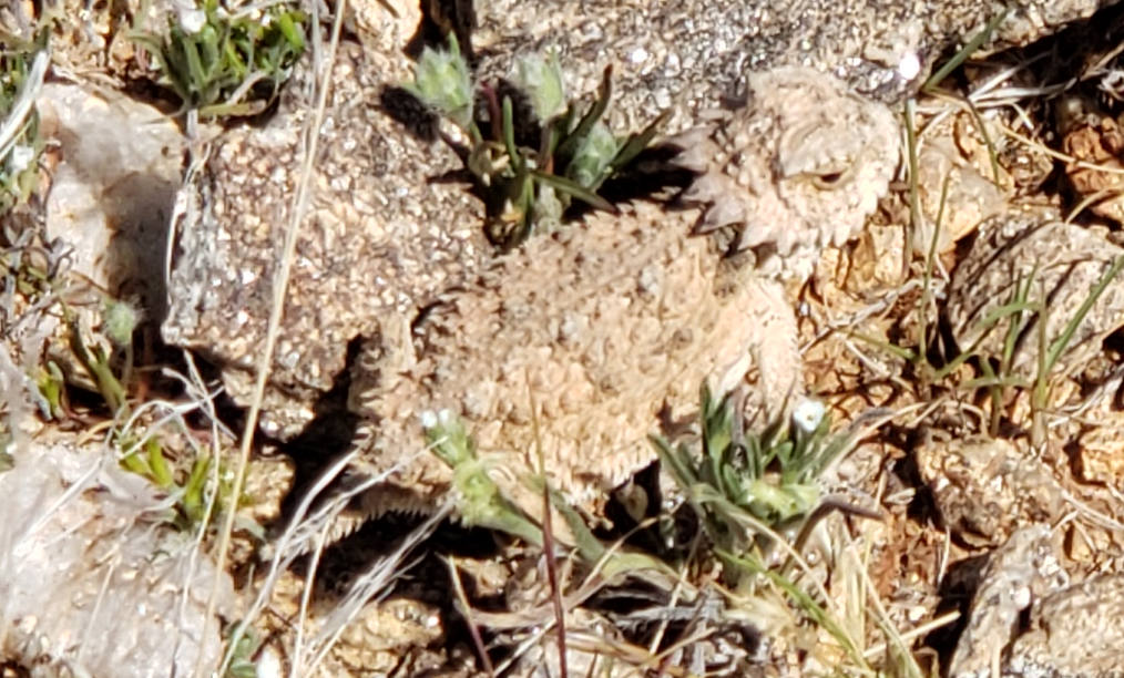
Horned Lizard on San Tan Trail
This hill is so much easier than the first, and if you hike this in the late morning, you will be thankful for the nice breeze at the top. After a couple of switchbacks, the trail leads downhill slowly towards the trailhead. Look out for all of the lizards darting back and forth on this section of the trail. Remembering Kennedy and Carter’s lifestyle, take the time to appreciate this unique habitat and the creatures that make this desert their home. After 2.4 miles from the San Tan junction, you will arrive back at the trailhead. Hopefully, you will have gained an appreciation for the land and animals that Kennedy and Carter fell in love with decades ago.
Directions to the Goldmine Trailhead
Take exit 167 off of I-10 to East Riggs Road. Follow East Riggs Road for 11.7 miles, turning right onto S Higley Road. Continue onto Hunt Hwy, turning right onto North Wagon Wheel Road. Follow this road as it turns into West Skyline Trail. The Goldmine Trailhead is at the end of West Skyline Trail. Pay your $8 park fee at the trailhead box.
Map to the Goldmine Trailhead