Rainbow Lake- Beartooth Mountains
Rainbow Lake
Rainbow Lake
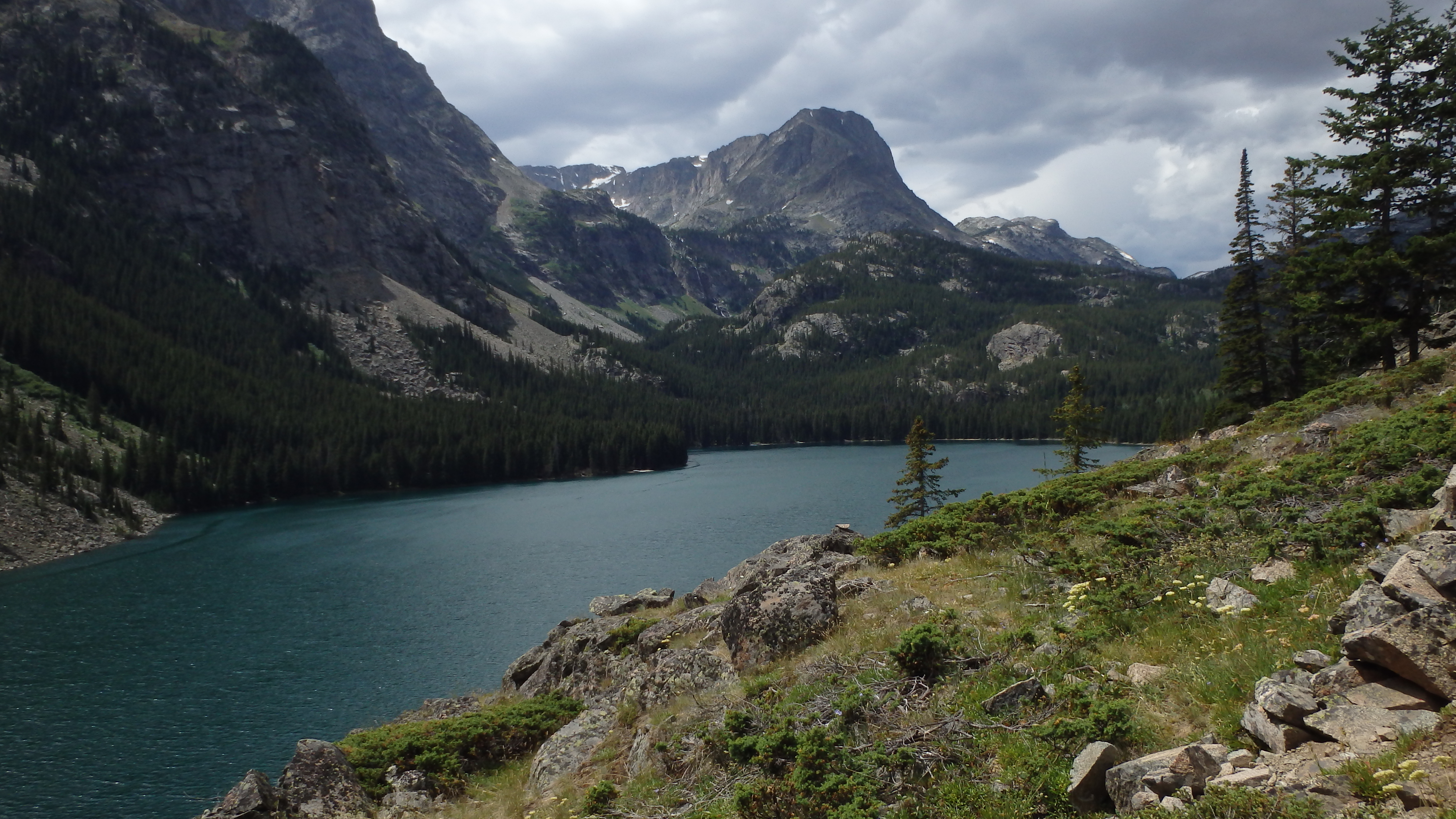
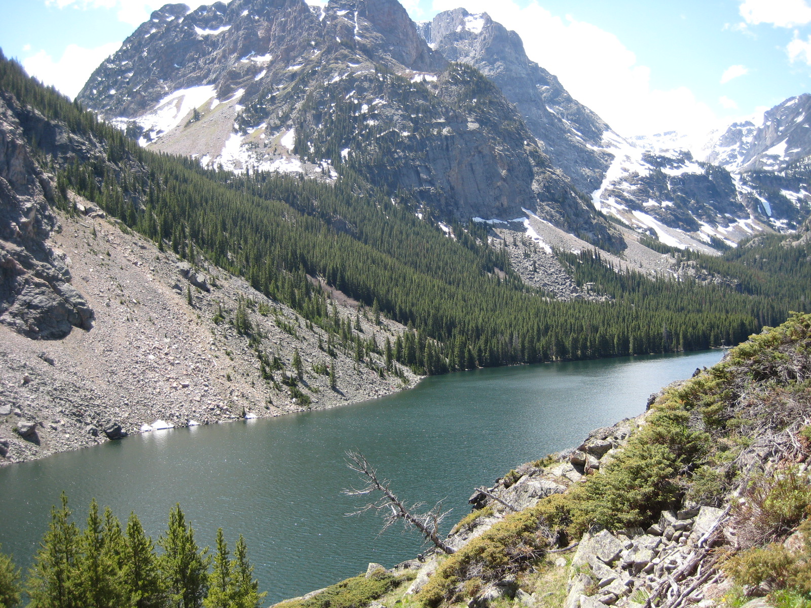
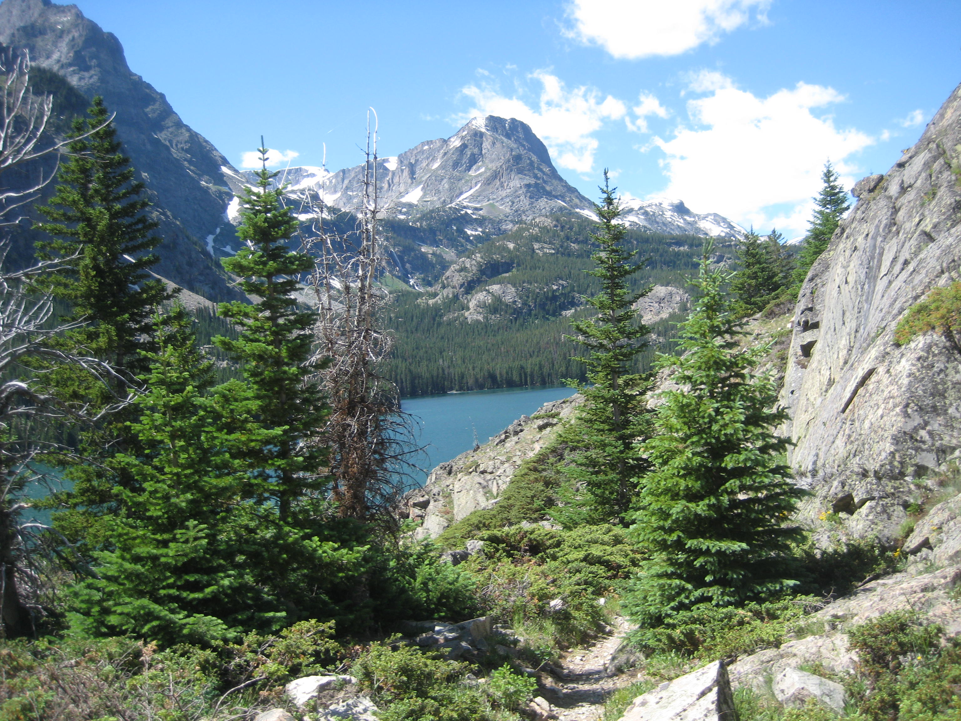
Rainbow Lake is the third lake along The Beaten Path, a 26 mile hike through the heart of the Absaroka-Beartooth Wilderness. At seven miles from the trailhead (technically about eight miles), the lake is a good day hike for strong hikers, or a good day trip for moderate hikers camped at Elk Lake. The lake is absolutely stunning- a jewel nestled in the mountains, fed by a gorgeous waterfall. The fishing here is also excellent, with an abundant amount of Cutthroat and Rainbow Trout.
From the trailhead, the hike starts at East Rosebud Lake, and a nicely sized parking lot. After about a half mile, you cross the wilderness boundary, and the end of the East Rosebud Lake. From that point, it’s another three miles of hiking until you arrive at Elk Lake. The hike is relatively flat at this point, and it goes by quickly.
From Elk Lake, the trail stays close to East Rosebud Creek for about a mile, and then climbs up a rock field. Although this rock field can be blocked by snow in the early or late season, it’s usually clear and dry in the Summer season. Watch out for horses on this part of the trail, as the trail can be narrow at times, and it can be hard to navigate around equestrian parties. While you are ascending the rock field, take the time to look over the trail edge, and into East Rosebud Creek. There’s a pool down below the trail, about 1.5 miles past Elk Lake that is impressive. Although the pool looks like a great spot to fish, I’ve never caught anything there, or seen any fish there.
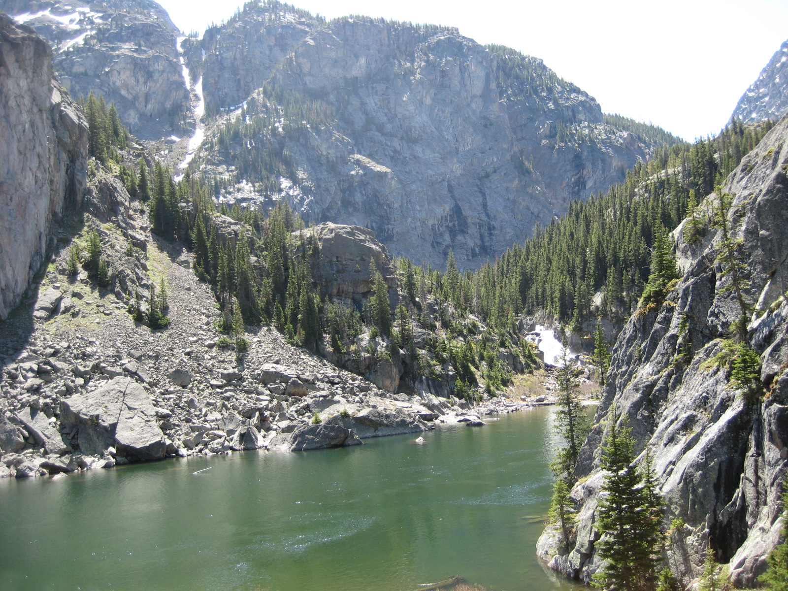
After the rock field, the trail leads to a small spot that is great for pictures. From this spot, you have a great view of Rimrock Lake, and the surrounding cliffs. Rimrock Lake was formed by a landslide that blocked the outlet, which you can easily see from this vantage point. From here, it’s down hill to Rimrock Lake, and to the bridge at the outlet. Moving past the bridge, the trail closely follows the lake. In fact, it must have been some feat to blast this trail, as the nearby cliffs become part of the trail in places.
From Rimrock Lake, the trail quickly switchbacks up, and offers a great view of a waterfall in the early season. The trail climbs steeply here, climbing about 250 feet in half a mile. This part of the trail alternates between meadows and lodgepole here, and is quite wet in the early season. After a mile, the trail brings you to the outlet of Rainbow Lake. Technically, you’ve arrived at your destination. However, you’re still about 200 feet above the lake at this point, and on a cliff overlooking the lake.
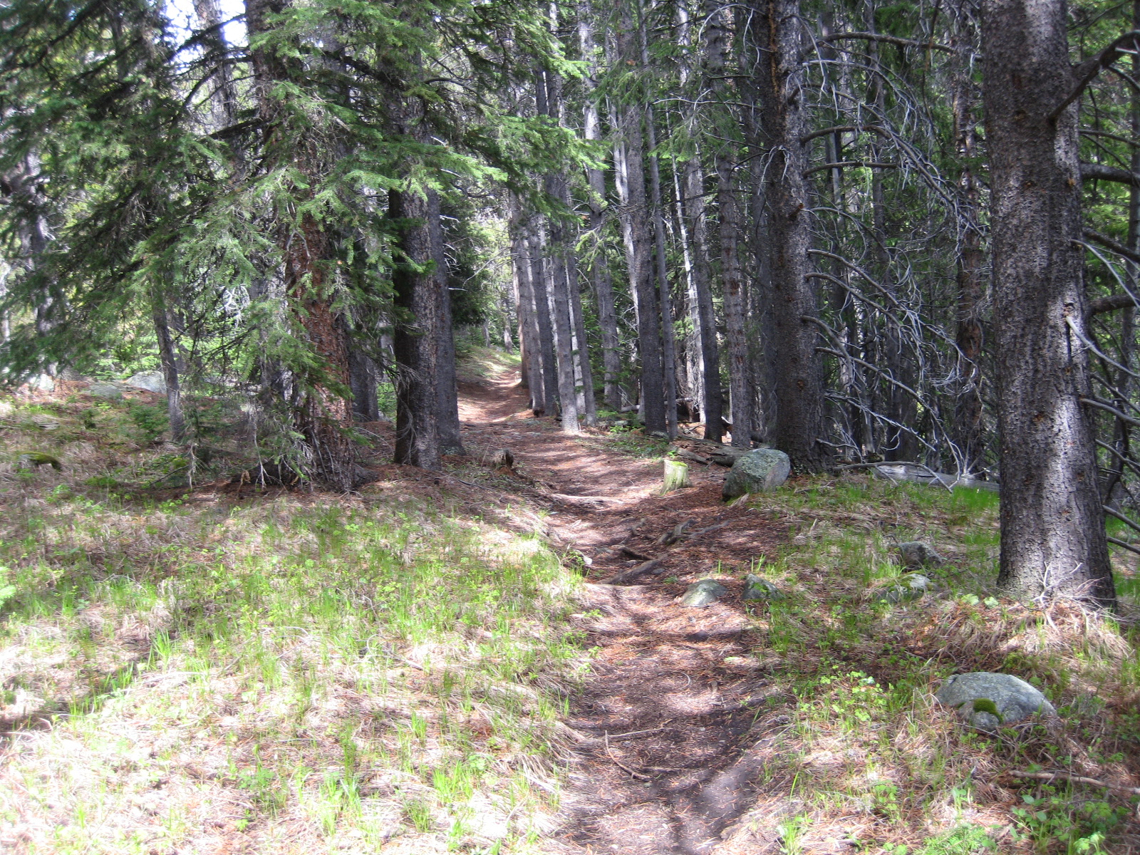
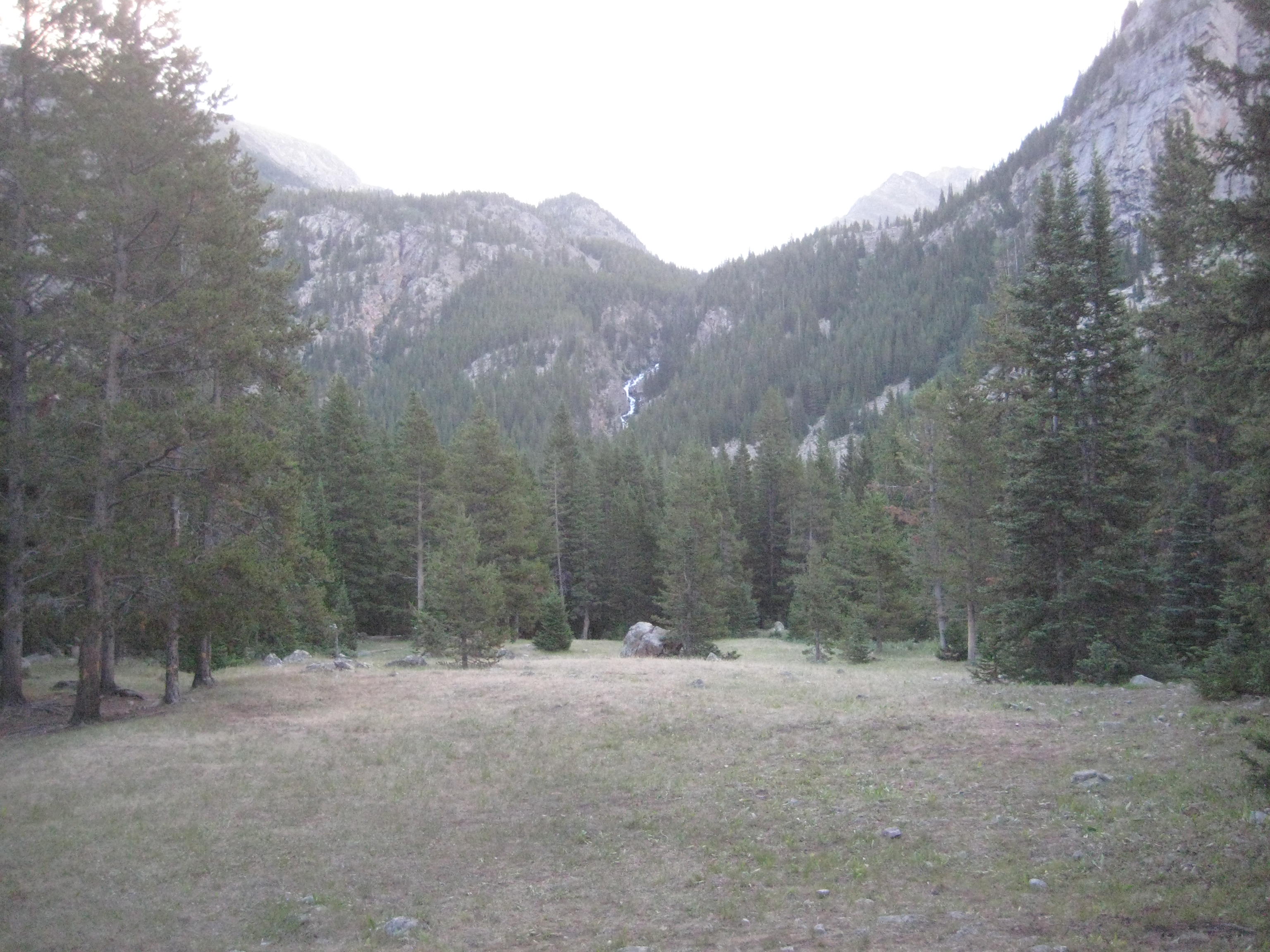
Continuing for another mile, the trail climbs and falls, losing a total of about 200 feet, over the course of a mile. The trail starts with a rock field for about a quarter mile, and then the rest of the trail is through a mature lodgepole forest. All the while, the trail follows the lake shore. After about a mile, you are at lake level, and several large meadows are in view. These meadows make excellent campsites, and the forest service has setup several of such campsites. This part of the lake can be quite busy in July and August, so make sure to plan for some company if you are thinking of camping during those months. The trail at this point can become quite wet in early June. The trail leaves Rainbow Lake at possibly one of my favorite fishing spots in this lake. Early in the season, the Cutthroat Trout can be quite aggressive. Later in the season, this lake receives a lot of fishing pressure, and the trout can start to become pickier. Day hike potentials from Rainbow Lake include Martin Lake, and Dugan Lake, both up the trail from Rainbow Lake.
Pictures from Rainbow Lake, and the Trail
 Trail at Rainbow Lake |
 Inlet of Rimrock Lake |
 Rainbow Lake |
 Rainbow Lake- Beartooth Mountains |
 Trout at Rainbow Lake |
 Campsite at Rainbow Lake |
Directions to the Trailhead
From Absarokee, take Highway 78 south of town. About 13 miles down the highway, turn right at Roscoe (East Rosebud Road). Follow this road all the way (about 5 miles), until the road sharply turns to the right (if you drive straight, you will hit Luther Roscoe Rd). There is a bridge just before the turn, and a large forest service sign at this turn, so it’s easy to spot. From here, it’s another 10 miles to the trailhead. The road is usually in fair condition, and is mostly gravel. At the parking lot, the trailhead is easy to spot.
Map to the Rainbow Lake Trailhead