The Beaten Path- Beartooth Mountains
The Beaten Path- Beartooth Mountains
Scenery Along The Beaten Path
The Beaten Path is the name given to a route that runs 26 miles through some of the most beautiful scenery in the Beartooth Mountains. The Beaten Path leads by cascading waterfalls, alpine lakes, towering peaks, and lush forests. The fishing is also excellent on this trip, with many of the lakes stocked with hungry rainbow and cutthroat trout. The first obstacle with this hike is figuring out the logistics- you can hike this trail in two different ways, and both ways require special transportation considerations.
This hike is a shuttle hike, requiring you to leave your vehicle at one trailhead and have another ready at the other trailhead. The two trailheads are three hours apart, so on your last day, you will need to make this long drive to retrieve your vehicle. With this in mind, logistics play a large part in determining which trailhead to start at- the East Rosebud Trailhead is located on a bumpy gravel road, whereas the Clarks Fork Trailhead is easy to find, and just off of the paved Highway 212. There is another good reason to start at the Clarks Fork Trailhead- there is less elevation to fight.
East Rosebud Trailhead
The East Rosebud Trailhead is at 6,280 feet, and the Clarks Fork Trailhead is at 8,000 feet, which makes starting from the Clarks Fork Trailhead the easier option- it’s 1,700 feet less that you have to fight to complete this hike. That being said, the scenery is more beautiful coming from the East Rosebud Trailhead, and hiking this trail “the hard way” will give you a better sense of accomplishment than hiking the easier route. This guide will assume that you’ll start at the East Rosebud Trailhead, but if you start at the Clarks Fork Trailhead, just read the guide in reverse. Finding the East Rosebud Trailhead is easy (the East Rosebud Road dead-ends at it), and that is where your adventure begins.
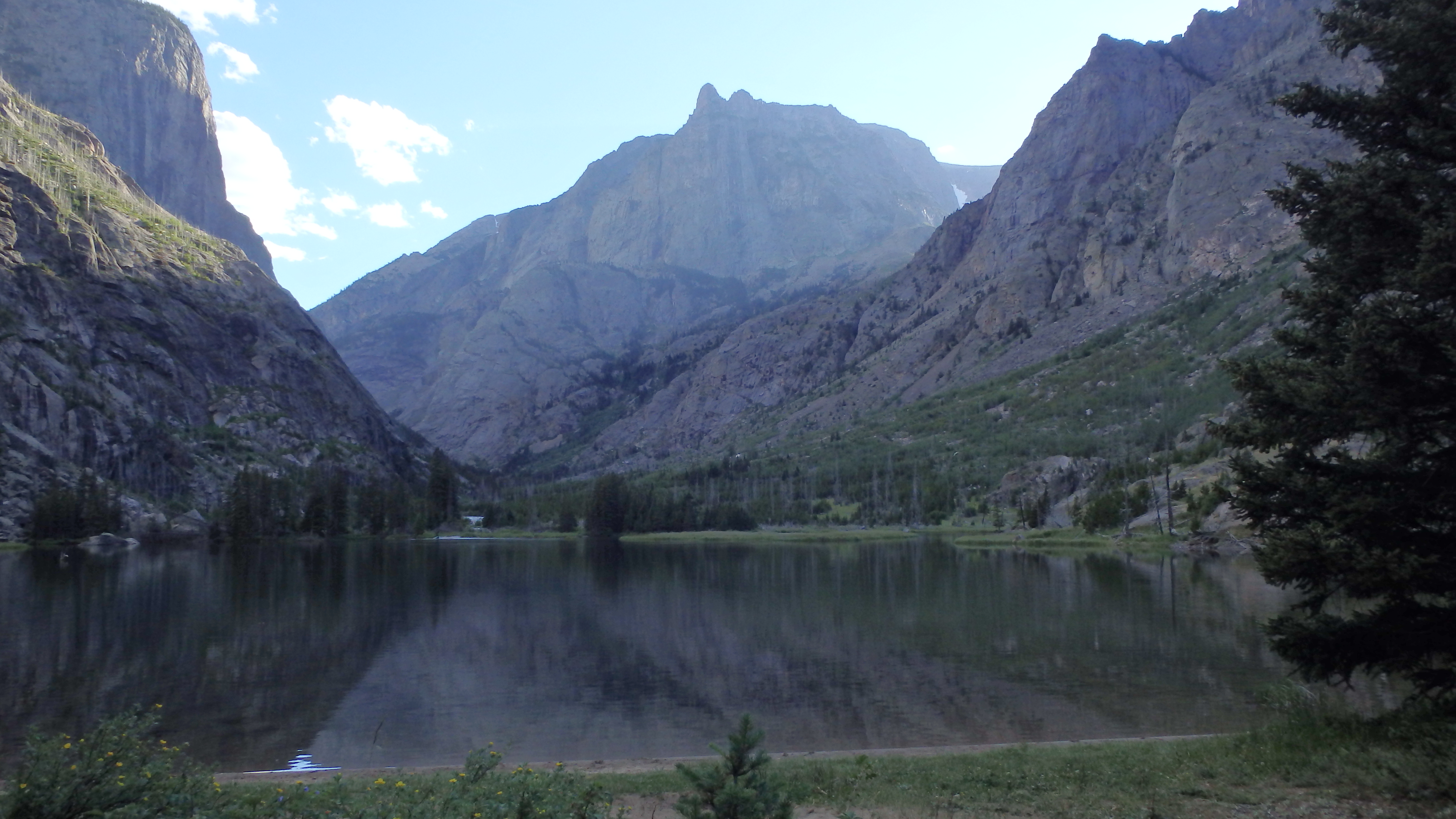
Elk Lake
Hiking from the spacious parking lot, the first three miles lead through burned forest, and young lodgepole pine trees. This area was burned in the 1996 Shepard Mountain Fire, and the forest is slowly regrowing. The recovering forest allows open views of East Rosebud Creek, as it rushes down to East Rosebud Lake. After a short three miles, the first lake appears- Elk Lake. Camping spots are plentiful at Elk Lake, which makes it a great spot to camp the first night out, if you started late on the trail. Otherwise, it will be another 5 miles until a good camping spot is available. Leaving Elk Lake, the trail begins to increase in grade.

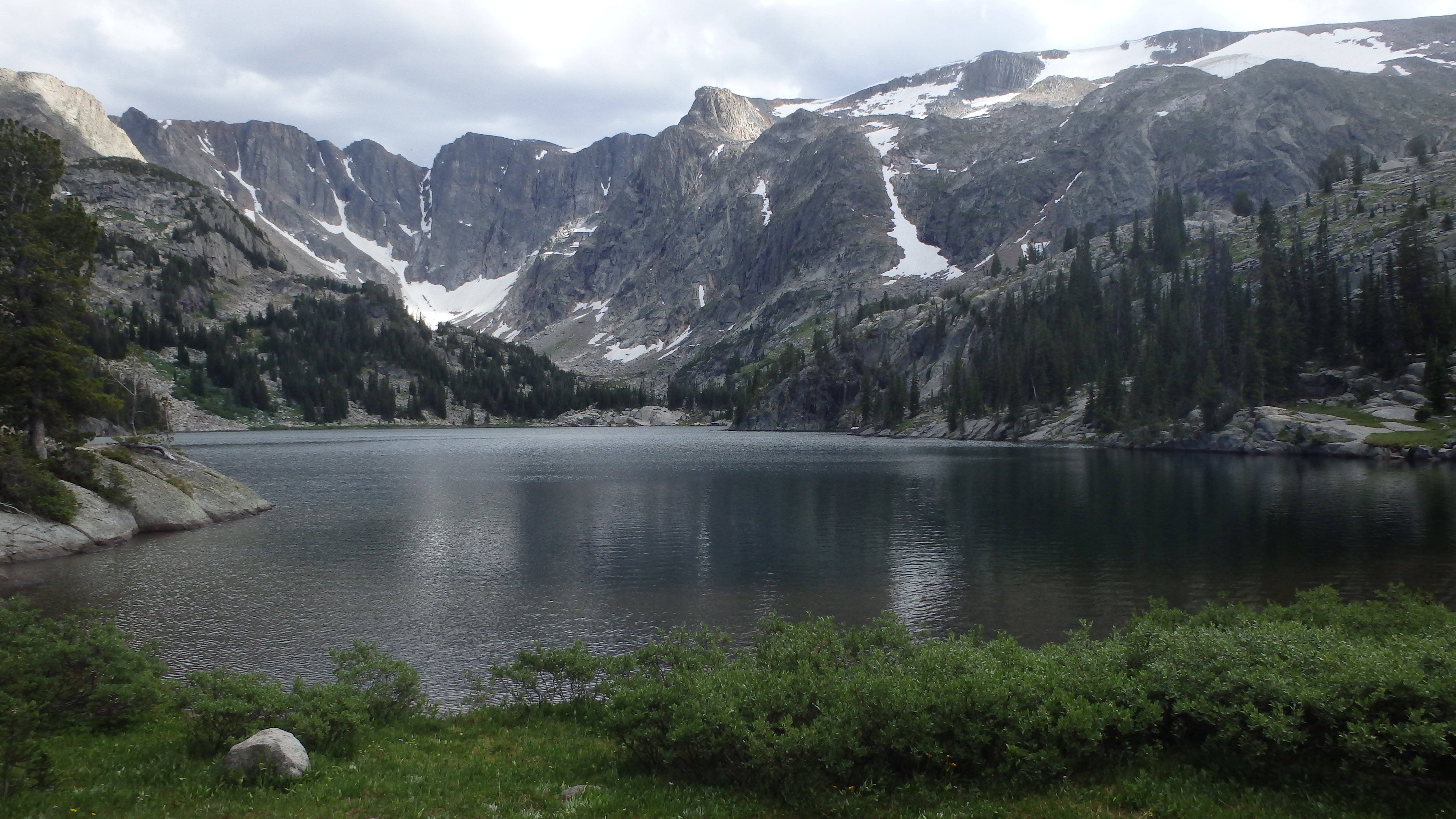
Rimrock Lake
The next three miles climb 900 feet, starting with sections of mature, unburned forest, and eventually leading to a large rock field, where the remaining 560 feet of elevation are gained. This rock field is stifling hot in the afternoon or early evening when the sun heats up the narrow canyon. Hiking through this rock field, the trail leads to an overlook that offers a beautiful view of Rimrock Lake. Sadly, campsites at Rimrock Lake are extremely limited due to the steep canyon walls. Instead, hiking another 2 miles offers many more camping options.
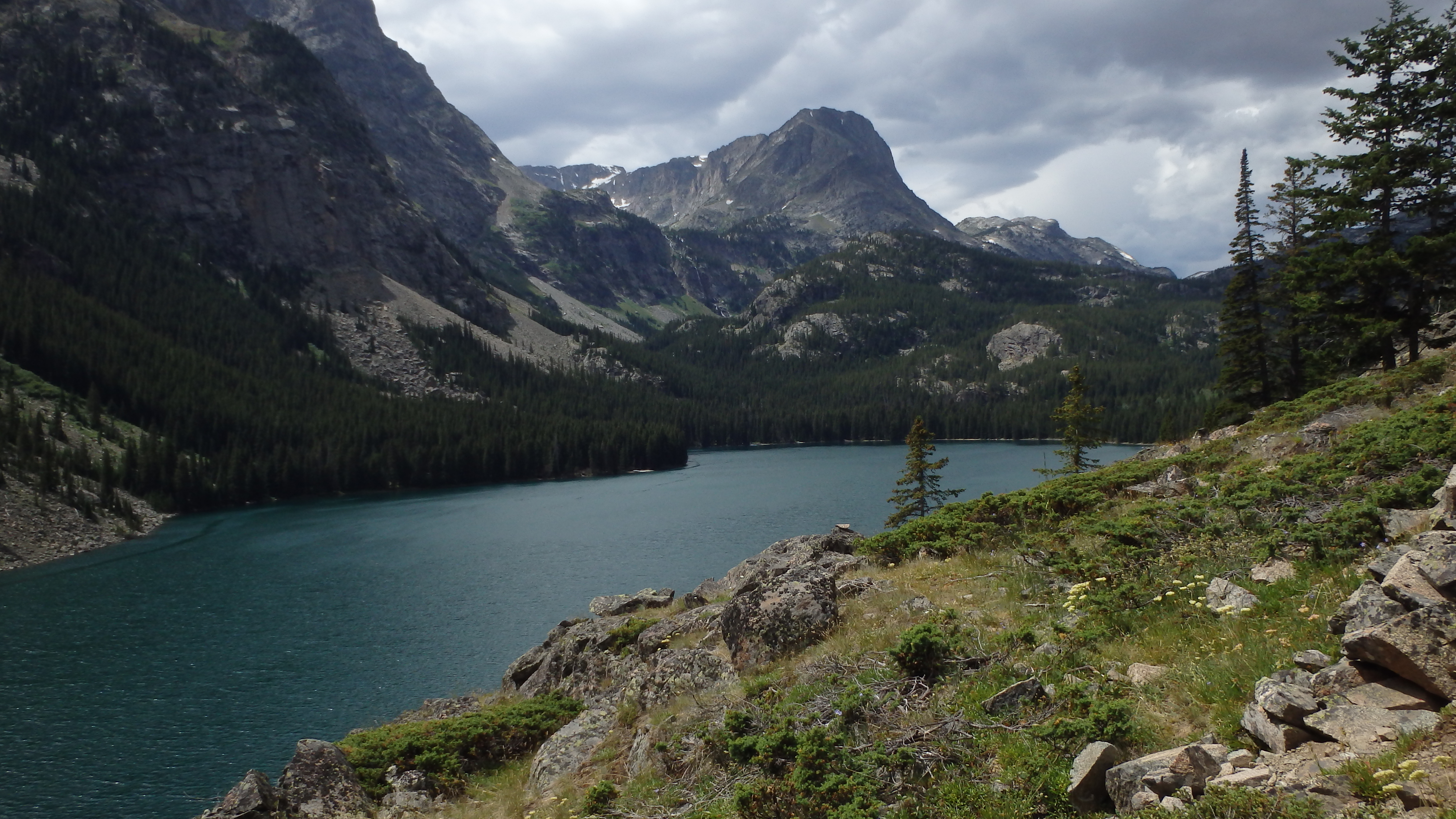
Rainbow Lake
Continuing past Rimrock Lake, the trail leads through the forest, a welcome change for those that were sunburned or baked alive on the earlier rock field. The trail runs for a mile here, with a couple of small hills, before offering a fantastic view of Rainbow Lake. Although the forest service and most guide books list Rainbow Lake at 7 miles from the East Rosebud Trailhead, it is closer to 8 miles before you can camp, or enjoy the lake. For the next mile, the trail runs downhill, losing 130 feet to finally bring you to the inlet of Rainbow Lake, and to the many campsites that await. Rainbow Lake is the first lake along this route that offers excellent fishing and campsites, making it a busy lake. You shouldn’t expect privacy here, but if you continue down the trail some more, you just might find solitude.

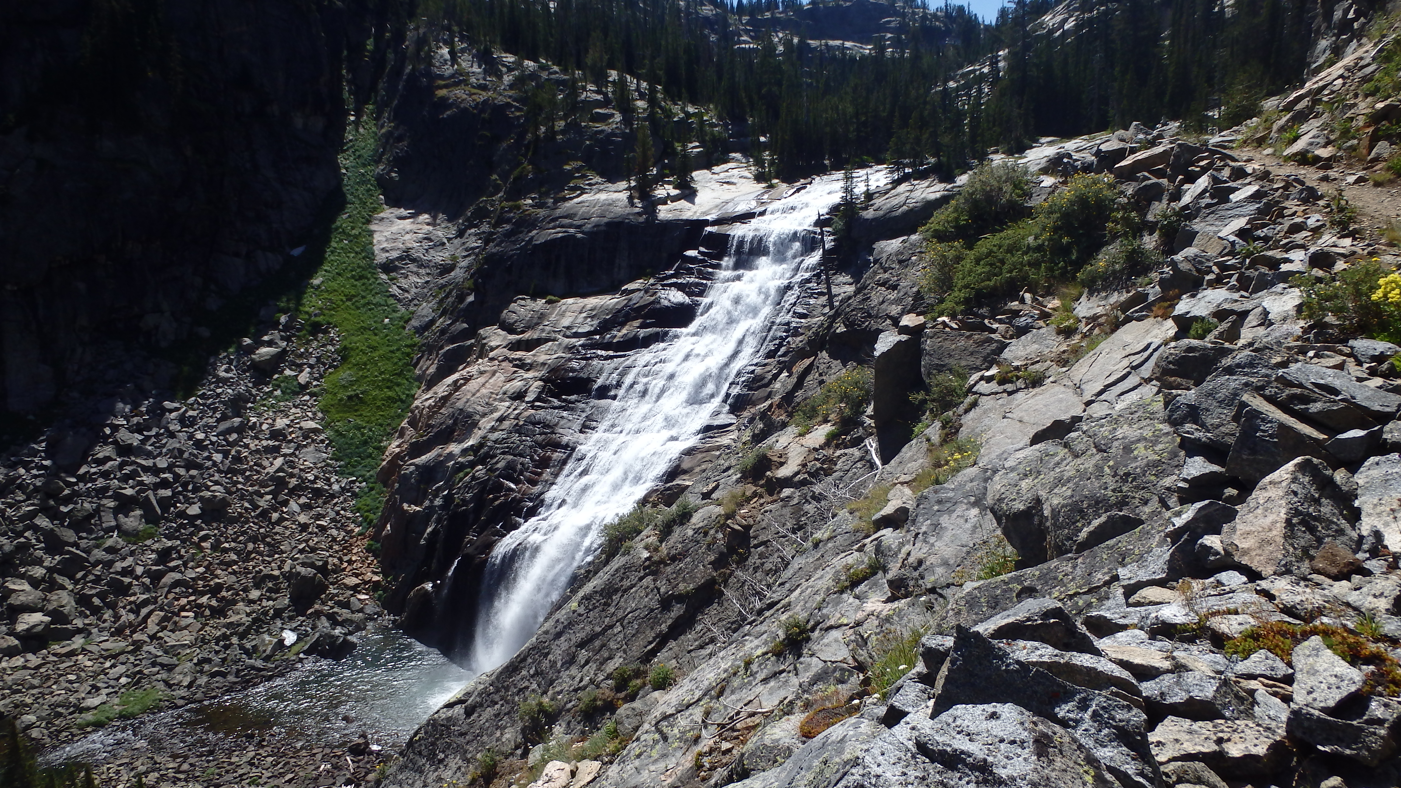
Lake at Falls
Hiking past Rainbow Lake, the trail continues through the forest and starts climbing uphill. Gaining 500 feet in the next mile, the trail offers fantastic views of Rainbow Lake from above, just before Lake at Falls. This lake is well named- two large waterfalls plunge hundreds of feet down into the lake. The falls are visible from the trail for the next third of a mile, allowing you to view the falls from different angles. The campsites here are limited- there is a only one large campsite at the inlet, but there are better sites just a mile down the trail.

Big Park Lake
Continuing through the forest, Big Park Lake appears. This lake looks like perfect grizzly bear habitat– be sure to keep food scents around your camp to a minimum if you plan on camping here. A nearby quick side trip from Big Park Lake is to Echo Lake, and the trail is easy to follow. To make this side trip, hike on the faint trail to the right (west), just before the bridge over Granite Creek. Hiking past the turn for Echo Lake, and continuing down The Beaten Path, Duggan Lake appears after another 2 miles.
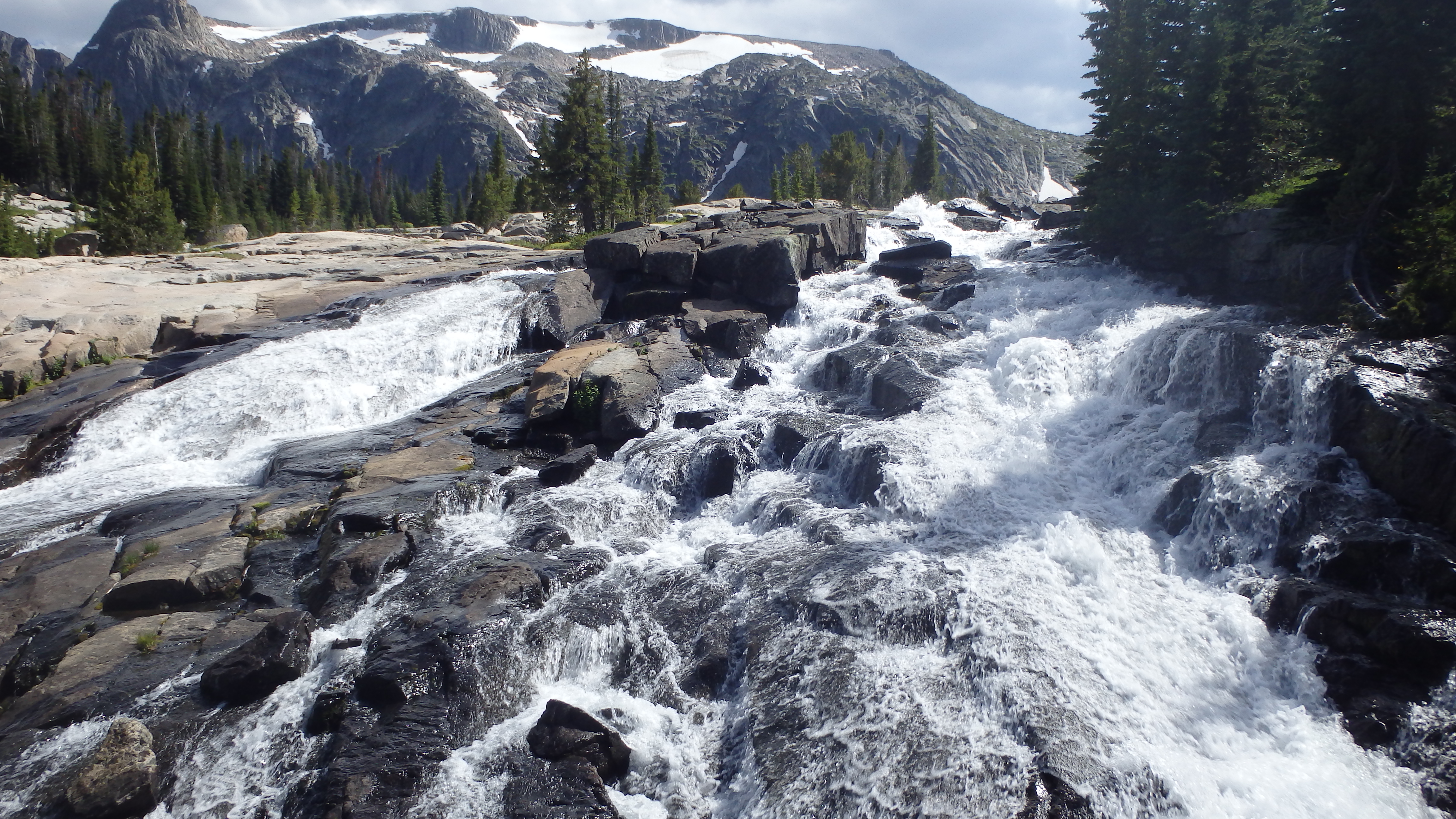
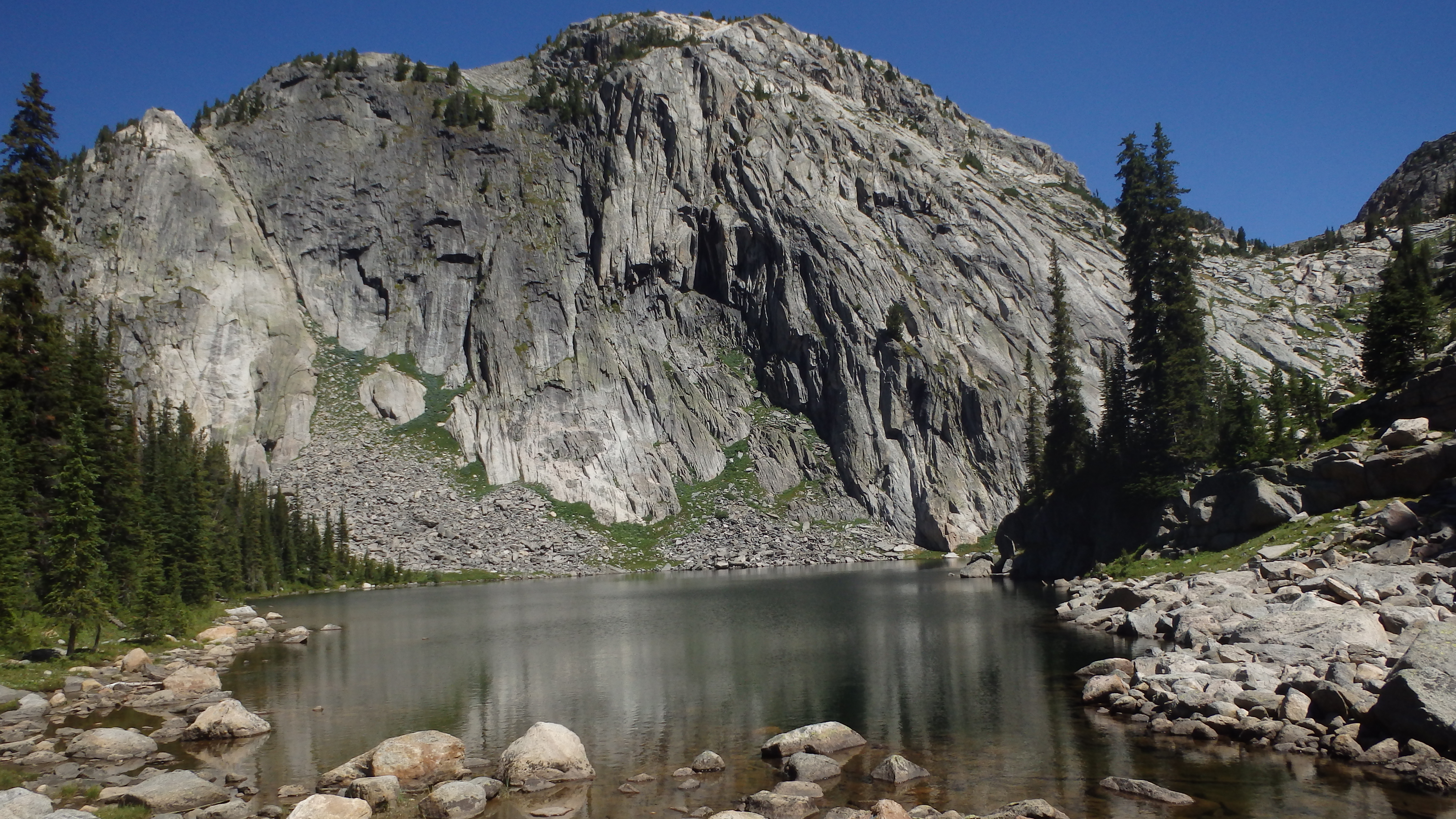
Impasse Falls
At Duggan Lake, you will see the most spectacular waterfall on this hike. Impasse Falls plunges into the lake, and the trail runs right alongside this picturesque waterfall. It’s nearly impossible to hike this section of the trail without pausing for a moment, and watching the cascading water. As the trail leads up to the top of the falls, it offers several points to step off of the otherwise narrow trail and take in the view. Once you can pull yourself from this geological spectacle, continue down the trail.
Dewey Lake
The next two miles lead past Twin Outlets Lake, and Dewey Lake. A sign just before Twin Outlets Lake states that campfires are banned from Twin Outlets Lake to Fossil Lake. You’ll need to bring a frying pan if you want to eat trout for dinner. Dewey Lake is a gorgeous lake with many hungry trout, but it’s best visited passing through, as it offers virtually no campsites, and hardly any level ground for a zero impact campsite. Most backpackers continue down the trail a little further for a combination of excellent fishing, and virtually limitless campsites.
Hiking from Dewey to Fossil Lake is one of my favorite sections of the trail. The next two miles lead through alpine paradise. The forest gradually gives way to wide-open views of mountain peaks, snowfields, wildflowers, and flowing streams. The trail gains more elevation in this section, but the scenery makes it hardly noticeable. The best part is that the view only gets better from here. After a total of 16 miles from the East Rosebud Trailhead, Fossil Lake appears.
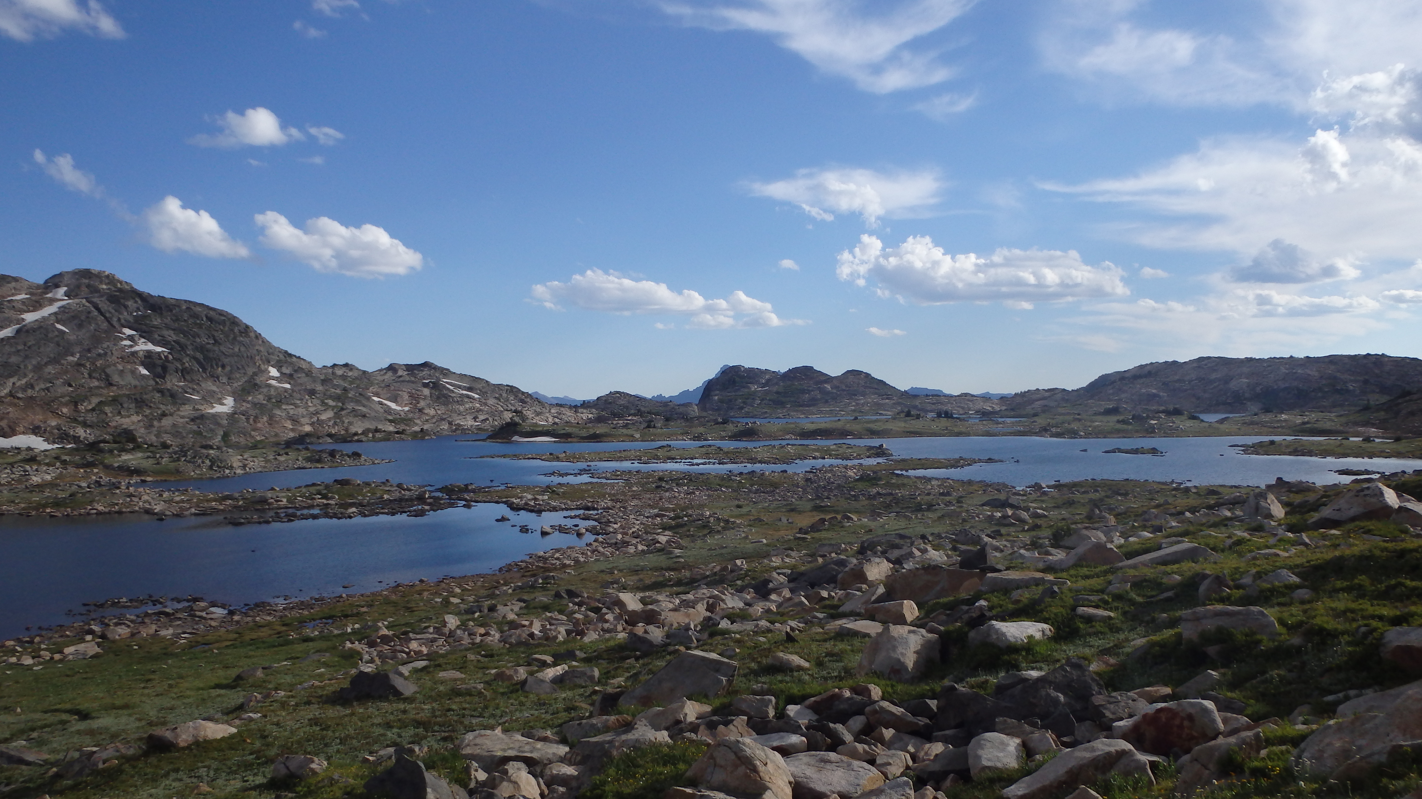
Fossil Lake
Fossil Lake is a unique lake, and it’s well named. The lake sprawls out and looks as if the skeleton of some long-extinct creature buried here. This shoreline would easily take a day to hike around, yet the lake itself is only average in size. Fossil Lake is the last lake on this hike where campfires are banned, and it’s easy to see why– the delicate alpine scenery would be spoiled by the many backpackers starting campfires. Instead, find a level spot, and make a zero-impact camping site, and make sure that the site looks as if no one had camped there when you leave Fossil Lake.
The next four miles go by quickly and offer many good campsites. Leaving Fossil Lake, you hike past a large cairn. This cairn marks the border between Gallatin and Custer national forests, where the trail changes from East Rosebud Trail #15 to Russel Creek Trail #3. Off to the right is Windy Lake, which is the first lake that allows campfires outside of Fossil Lake. There are plenty of other campsites further down the trail, all of which have an ample supply of firewood.
Ouzel Lake
Continuing down The Beaten Path, the next lake that appears is Skull Lake, followed by Bald Knob Lake, and Ouzel Lake. The scenery here is remarkable- high alpine lakes are surrounded by sheer cliffs and snowfields that persist even until August. Bald Knob Lake and Ouzel Lake offer the best camping in this short stretch, with many campsites large enough to accommodate larger groups. These four miles seem to flash by in an instant, with so much to see and do, and it helps that you’re hiking downhill all the way. After 20 miles from the trailhead, Russell Lake appears.

Russell Lake
Russell Lake is also another good spot for camping, although it has been clearly abused in the past. If you do camp here, try to make it a zero impact site, leaving it in a better condition than you found it. Russell Lake has a large population of brook trout, which is their downfall- there is only so much food available for these trout, and their size is stunted. One of the best features of Russell Lake is its warmer water- it’s a great feeling to wash off the last few days of sweat and dirt! Leaving Russell Lake behind, the last six miles continue downhill.
From Russell Lake, the trail leads through an open rock field, and then down into the forest. Be thankful that you’re hiking down this portion of the trail, instead of up it. The trail loses elevation rapidly at first, and then levels out to a straight trail that only slightly runs downhill. As you hike these final 6 miles, you pass by the trails to Fox Lake and Rock Island Lake, which are extremely short side trips. The trail leads by Kersey Lake, and finally passes by the junction for Vernon Lake. After 26 miles, the trail meets the Clarks Fork Trailhead, ending your hike down The Beaten Path.
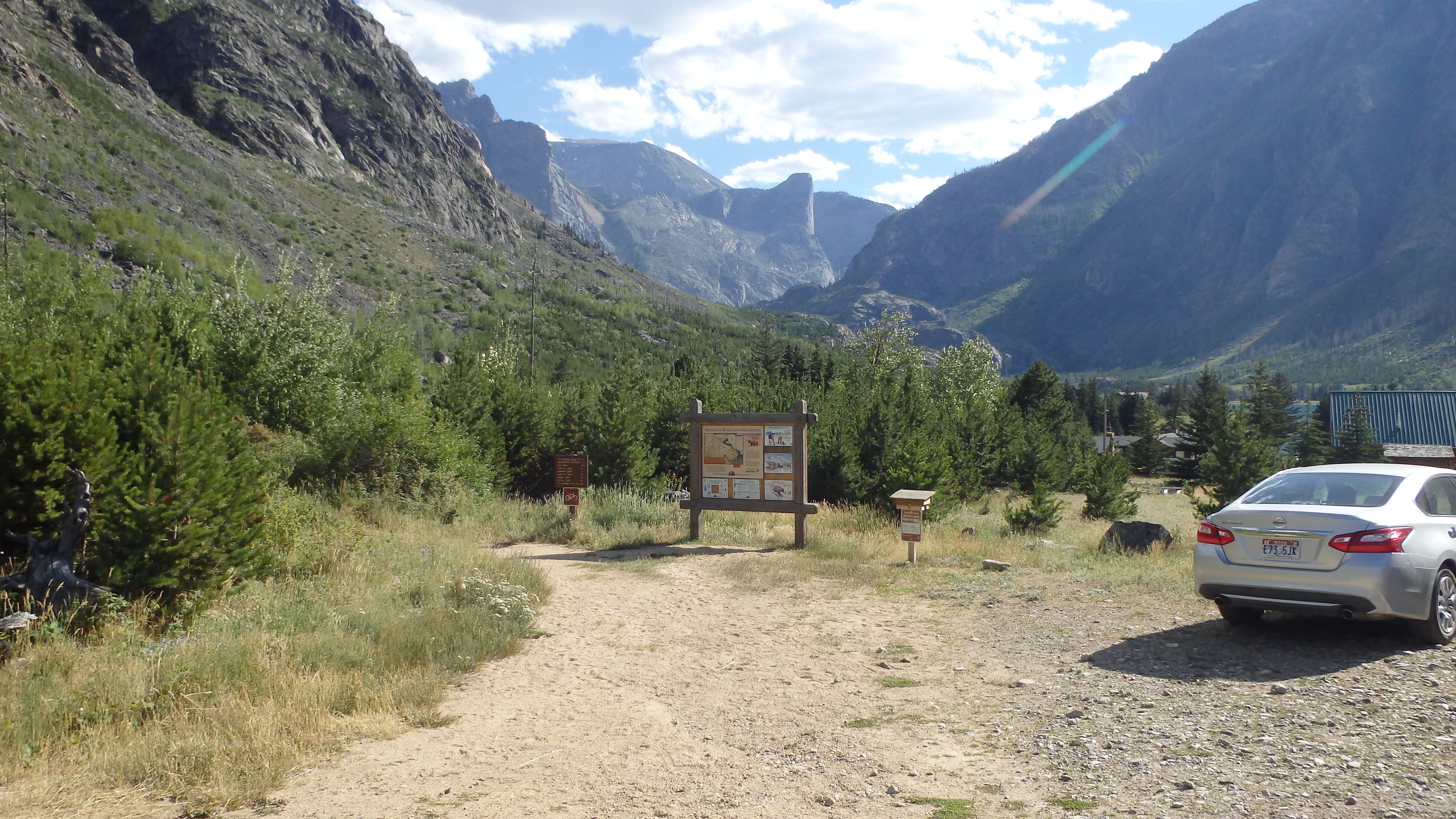
Directions to the East Rosebud Trailhead
From Absarokee, take Highway 78 south of town. About 13 miles down the highway, turn right at Roscoe (East Rosebud Road). Follow this road all the way (about 5 miles), until the road sharply turns to the right (if you drive straight, you will hit Luther Roscoe Rd). There is a bridge just before the turn, and a large forest service sign at this turn, so it’s easy to spot. From here, it’s another 10 miles to the trailhead. The road is usually in fair condition and is mostly gravel. At the parking lot, the trailhead is easy to spot.
Directions to the Clarks Fork Trailhead
From Red Lodge, drive on Highway 212 for 58.1 miles, or from Cooke City drive 3.4 miles to the well-signed Clarks Fork Trailhead.
