West Boulder Meadows- Absaroka Range
West Boulder Meadows- Absaroka Range
Boulder Meadows
Located south of Big Timber, the north end of the Absaroka Range is best described as a typical western mountain range. Instead of the numerous lakes, and tall, jagged peaks of the Beartooth Mountains; the northern end of the Absaroka Range’s peaks are much lower in elevation, and few lakes are present. The lakes that have formed in this part of the Absaroka Range are usually high elevation lakes, and usually involve quite the hike to reach. For these reasons, most anglers and hikers in the Absaroka Range tend to hike and fish near streams and rivers. A popular destination in all seasons, the West Boulder Meadows is an excellent choice for hiking, snowshoeing, wildlife photography, climbing, or fishing- whatever suits your fancy.
Once you’ve located the trailhead (see the directions below), park your vehicle at the parking lot on the left, and continue on foot for almost 300 yards down the gravel road. The land you are crossing at this point is private land- please be courteous and respect their property. This trail crosses public and private property on several occasions, and this is the first crossing. If you’re planning on hunting this area, be sure which part of the trail you’re on (and that you’re on public land).

Park here, and hike the remaining 300 yards on foot.
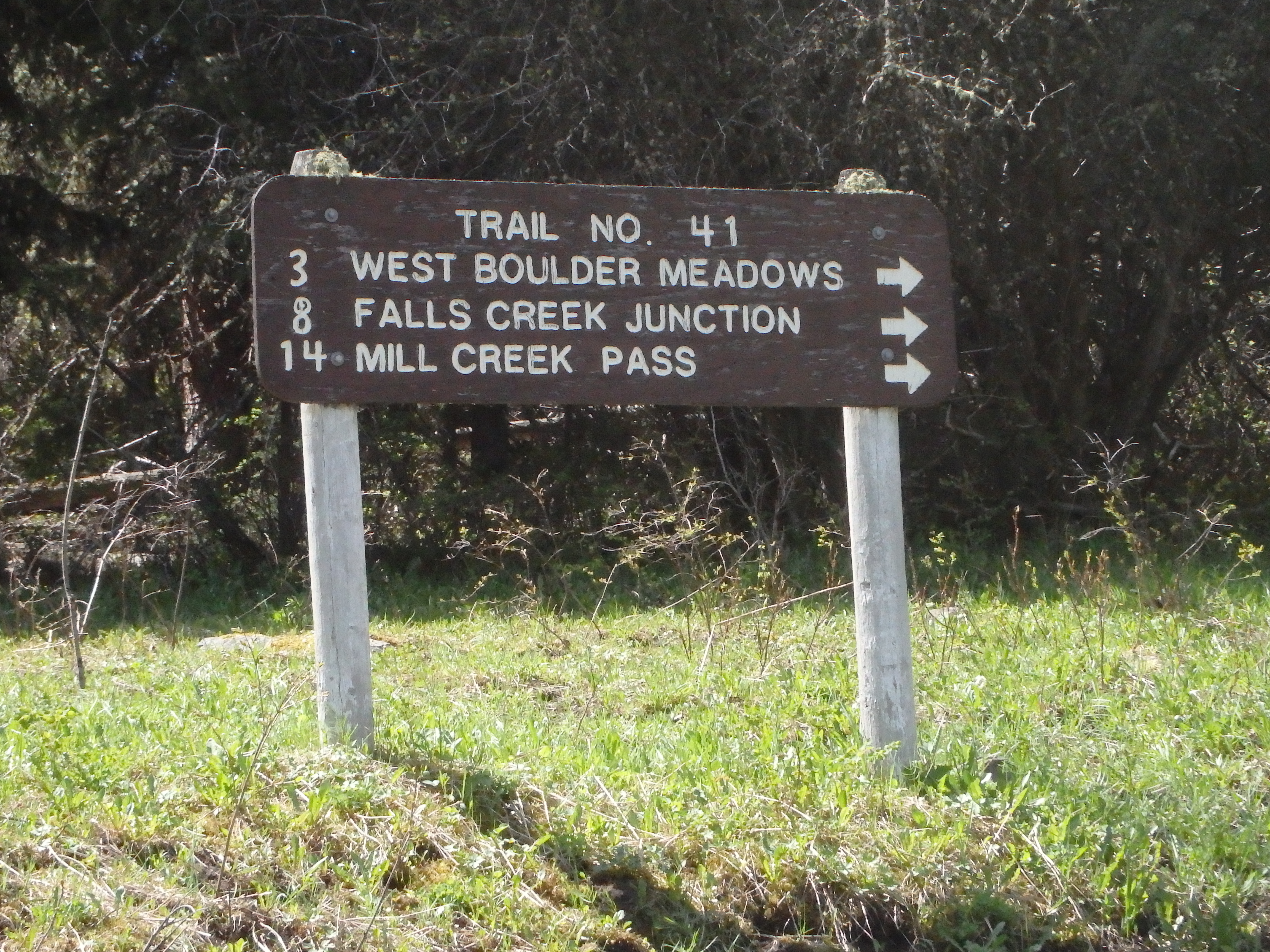
West Boulder Meadows Trailhead Sign
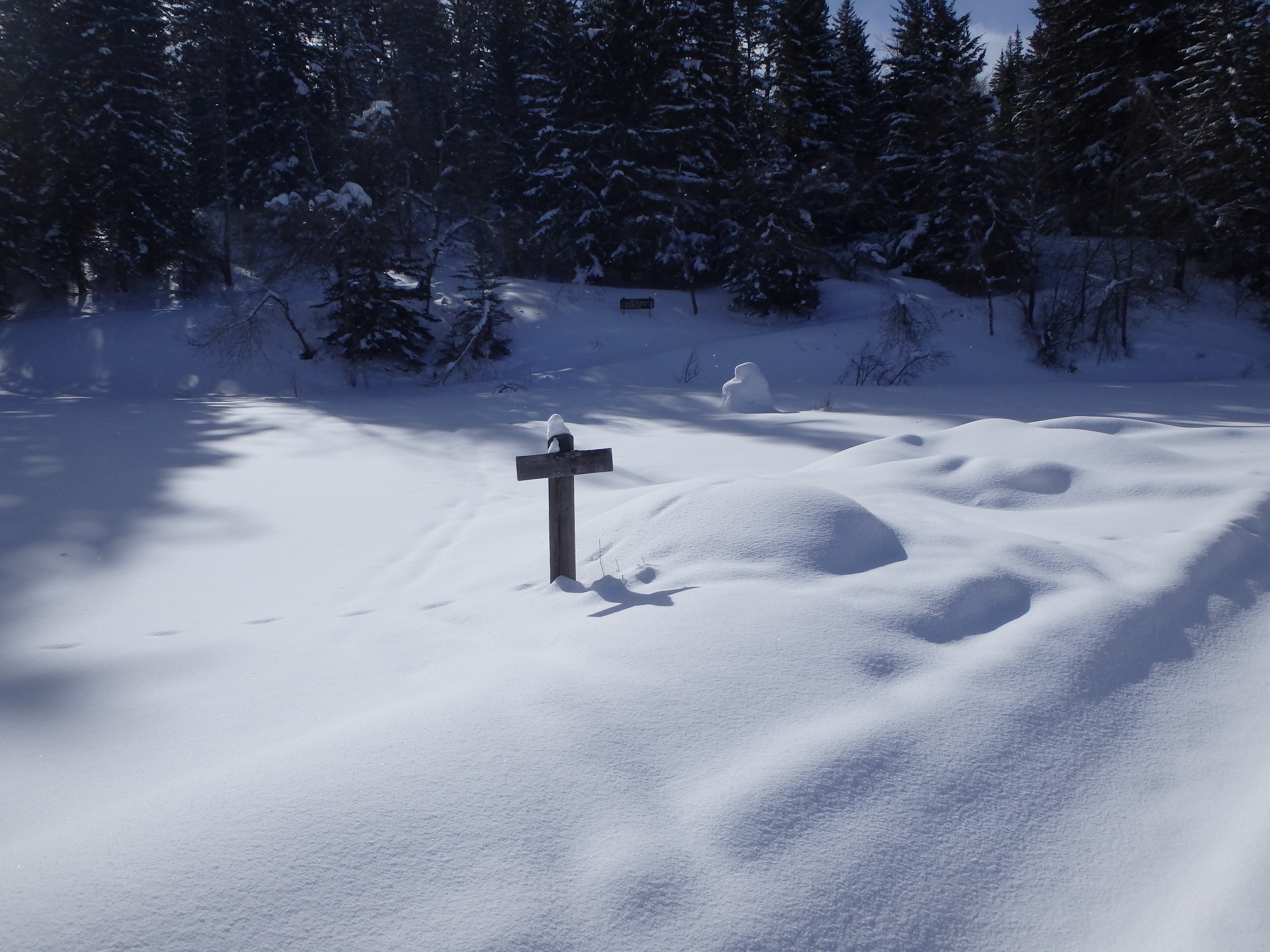
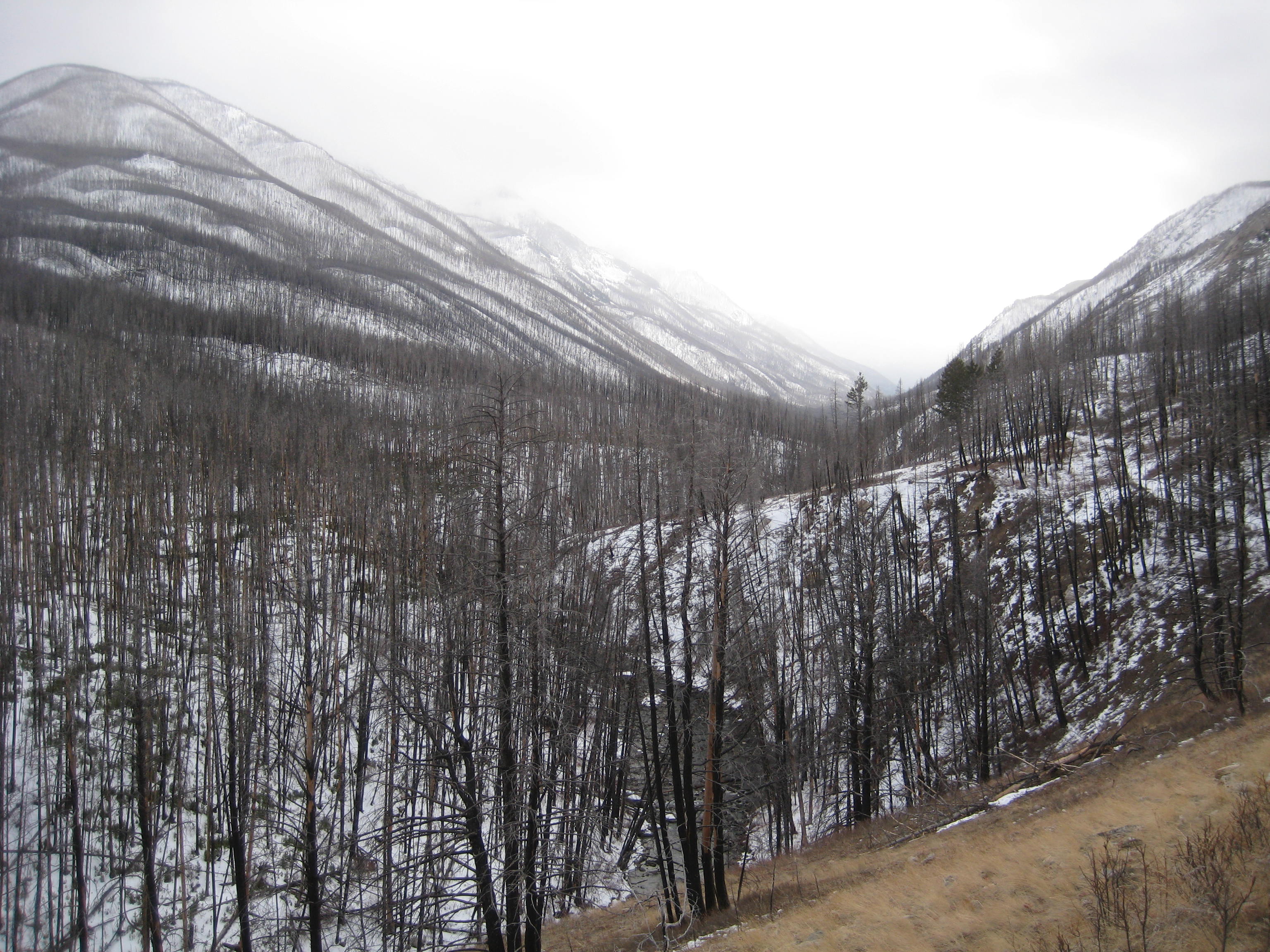
Snow on West Boulder Meadows Trail (February)
Starting down the trail, there are quite a bit of “ups and downs” in the trail, but the trail itself is in excellent shape. This trail receives a lot of equine traffic in both the summer, and the fall. The Forest Service kept this in mind during the construction of this trail, and it shows. The first two miles of the trail are bordered with logs, elevated, and well drained. The first section of this trail starts as a mature green forest, but that quickly changes. This area was burned in the 2006 Jungle Fire, which burned more than 30,000 acres of forest. After a short distance, you cross the second boundary, a gate. Be respectful, and close the gate behind you.
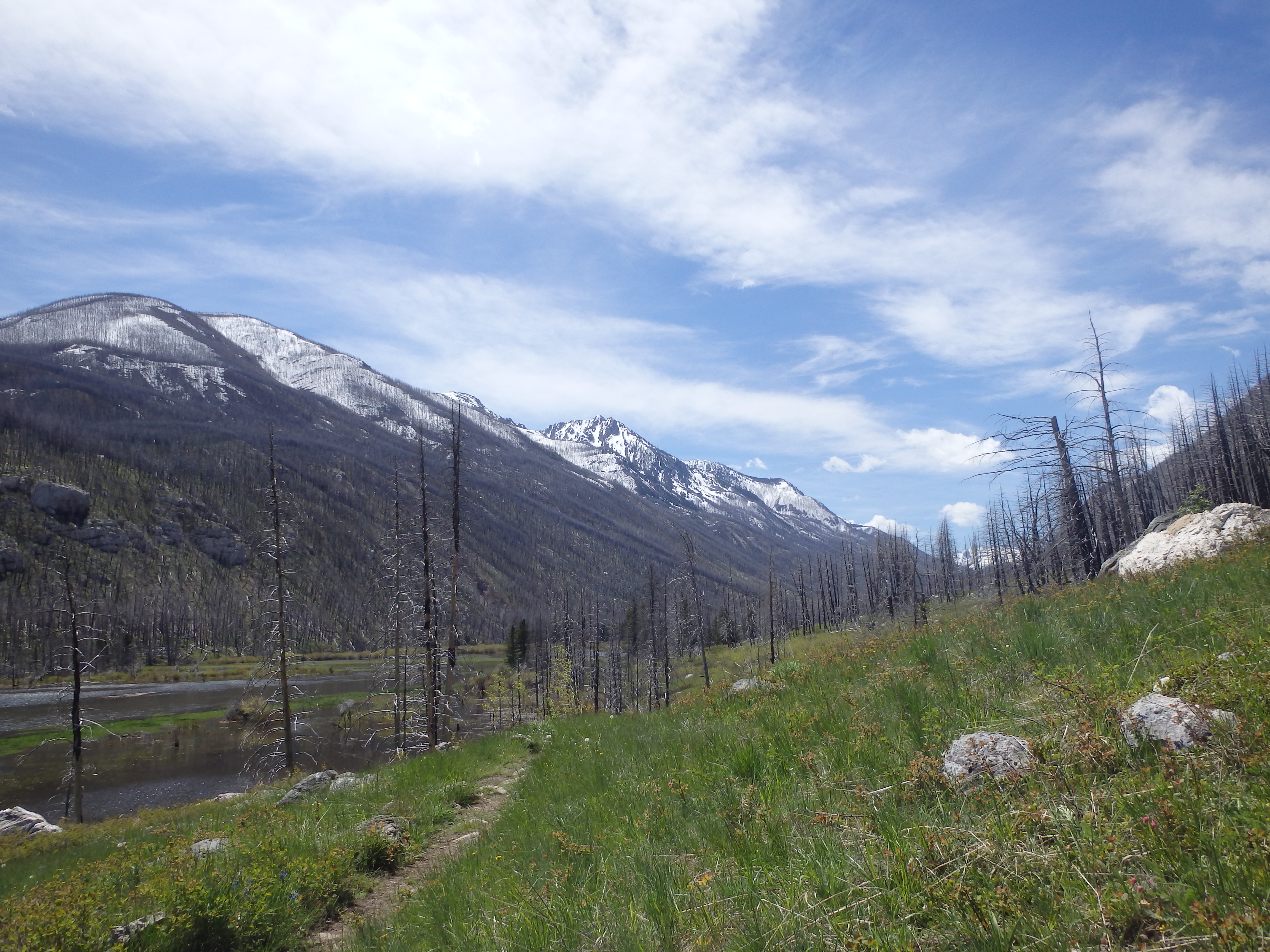
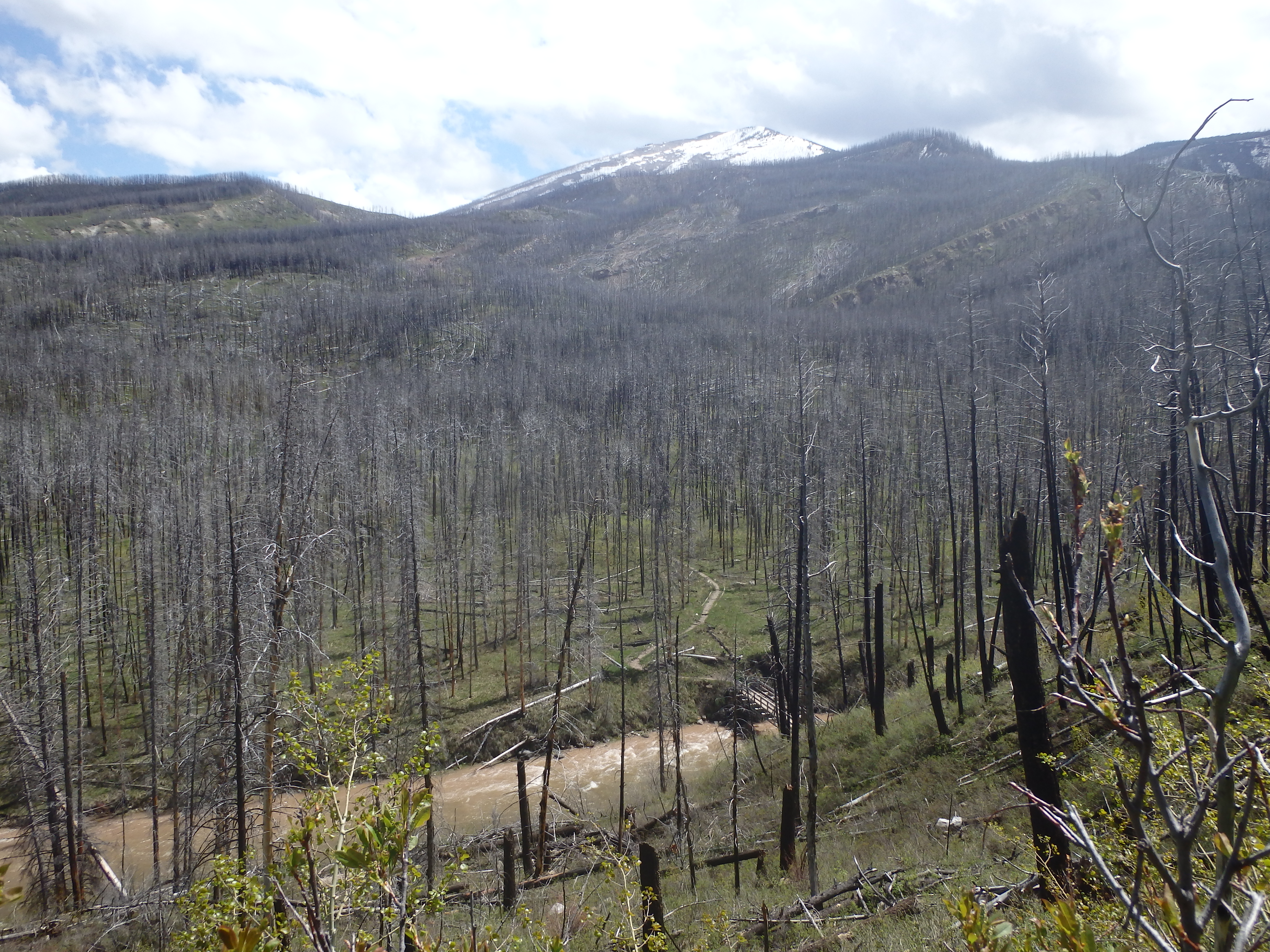
At the halfway point in this hike, you reach a sturdy bridge that spans over the West Boulder River. This bridge needs to be sturdy, since it needs to withstand the thousands of pounds worth of snow in the winter, as well as equine traffic in the warmer months. Crossing this bridge, you can wave goodbye to the last bit of privately owned land on this trail, and the busy sounds of the ranch below. The trail immediately climbs to the highest point on this part of the trail, topping out at 5,818 feet, roughly 325 feet above the trailhead. After another mile, the trail begins to dip down to the meadows. After a total of 3 miles, the meadows appear.
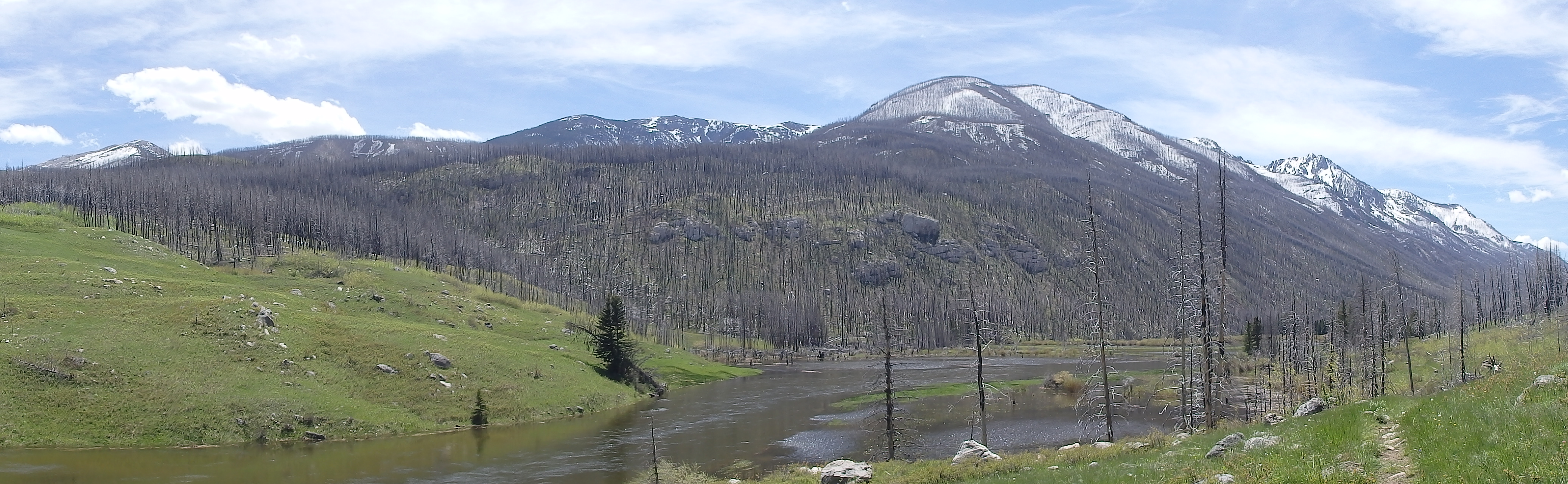
West Boulder Meadows
There’s a little something for everyone, in the meadows. Anglers will appreciate the trout in the river, climbers will love all the caves and rock climbing opportunities in the area, campers will love the abundant firewood, and hunters/photographers will love the wildlife in the area. There’s even something for the rock hounds- check out the fossils located near the trail, as you leave the meadows. Hikers with more energy can hike further up the trail to the Falls Creek junction (another 5 miles up the trail), or can try the off-trail trek to Lost Lakes, above the meadows.
Campers will want to camp on the south west corner of the meadows. Although there are several trees located by the meadows, please resist the urge to camp here. Camping near a river is not only against Forest Service regulations, it also leaves an eye sore for everyone else. Instead, please camp at least 100 feet from the river. Although there is limited shade at the meadows, it’s better to help protect the beauty of the area.
If you’re planning on fishing, concentrate your efforts on the pools located in the outlet portion of the meadows. Rising trout can easily be seen, and the water is easily deep enough to use lures in. Pay attention to the runoff though, as you don’t want to fish this area during Spring runoff.
Pictures from West Boulder Meadows, and the Trail
 West Boulder Trail in Winter |
 Spring Runoff |
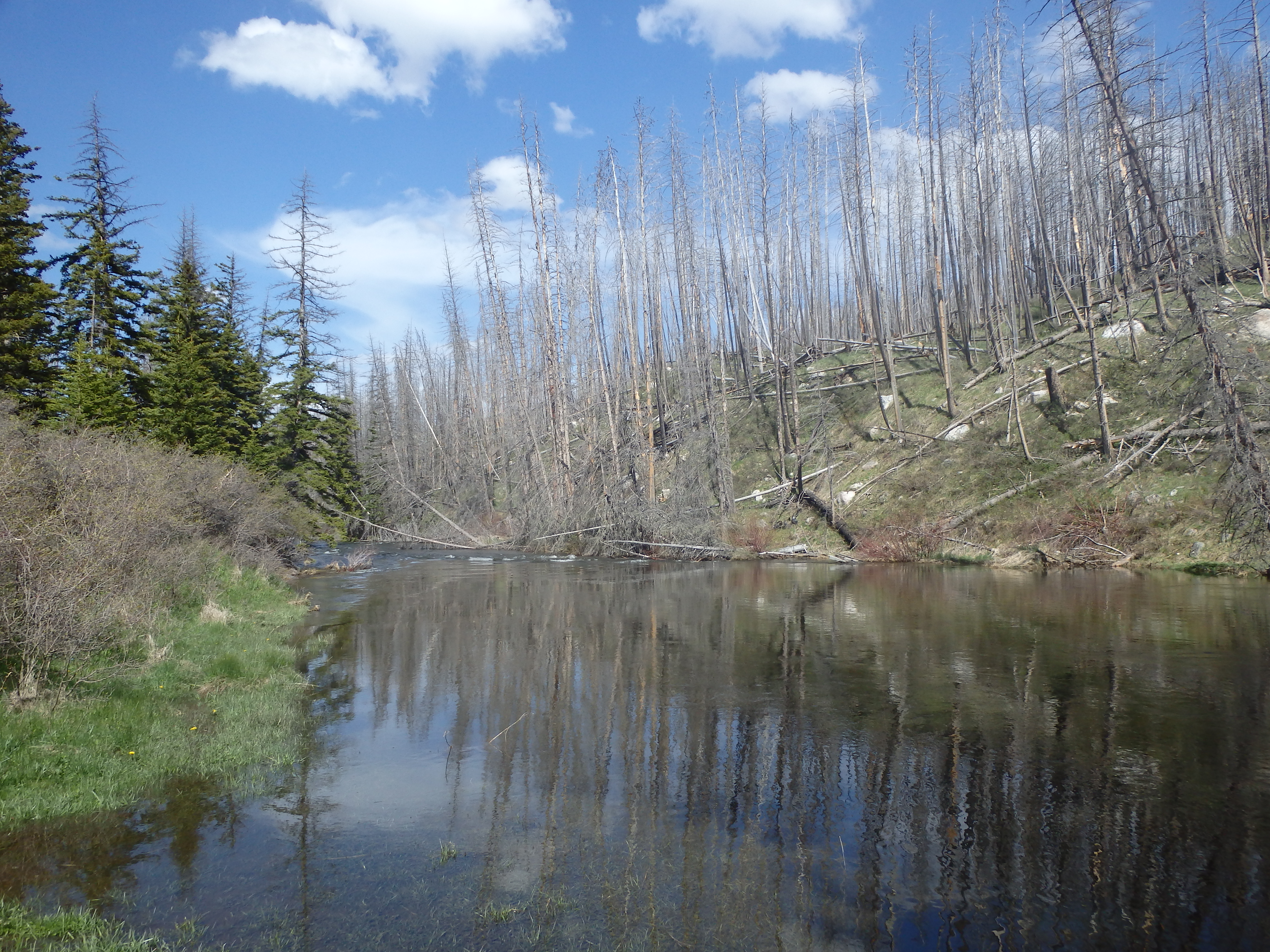 West Boulder Meadows Outlet |
 West Boulder Trail in Winter |
 Caves in Lion Mountain |
 Goose at the Meadows |
Directions to the Trailhead
Follow highway 298 south from Big Timber for approximately 17 miles. Then, turn right onto West Boulder Road. Follow this gravel road for 7 miles, bear left to stay on the West Boulder road. After another 7 miles, arrive at the parking area/camping ground at the end of the road. You can camp at the trailhead, park at the trailhead, or even stay at a Forest Service cabin that is nearby.
Map to the West Boulder Meadows Trailhead