Waterfall and Black Rock Loop – White Tank Mountain Regional Park
Waterfall and Black Rock Loop – White Tank Mountain Regional Park
Waterfall at White Tank Mountain Regional Park
The trail through Waterfall Canyon in White Tank Mountain Regional Park is a short yet interesting hike. I felt that I needed a little more exercise for this hike, so I added the Black Rock Loop onto this hike. Feel free to keep the hike at the original 2 miles if you wish, but you will miss some awesome scenery and wildlife. The terrain for both trails is flat and easy to hike along. Starting at the trailhead for the Waterfall Canyon hike, head east along the well-paved trail.
Petroglyphs along Waterfall Trail
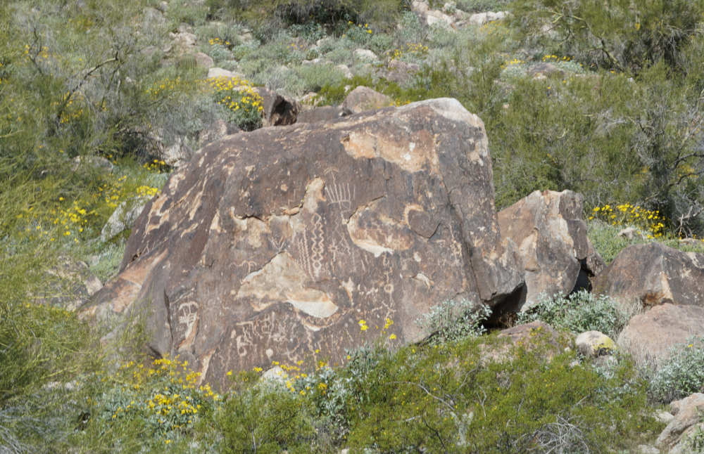
This section almost turned me completely away from this hike, and I’m glad that I didn’t turn around and hike another trail in the White Tank Mountain Regional Park. The first half mile is paved, which is a big turn-off, but at least there are petroglyphs along the northern side of the trail. Passing by the turn for Black Rock Loop (we’ll get to that later), continue hiking along until the pavement ends at half a mile before the waterfall.
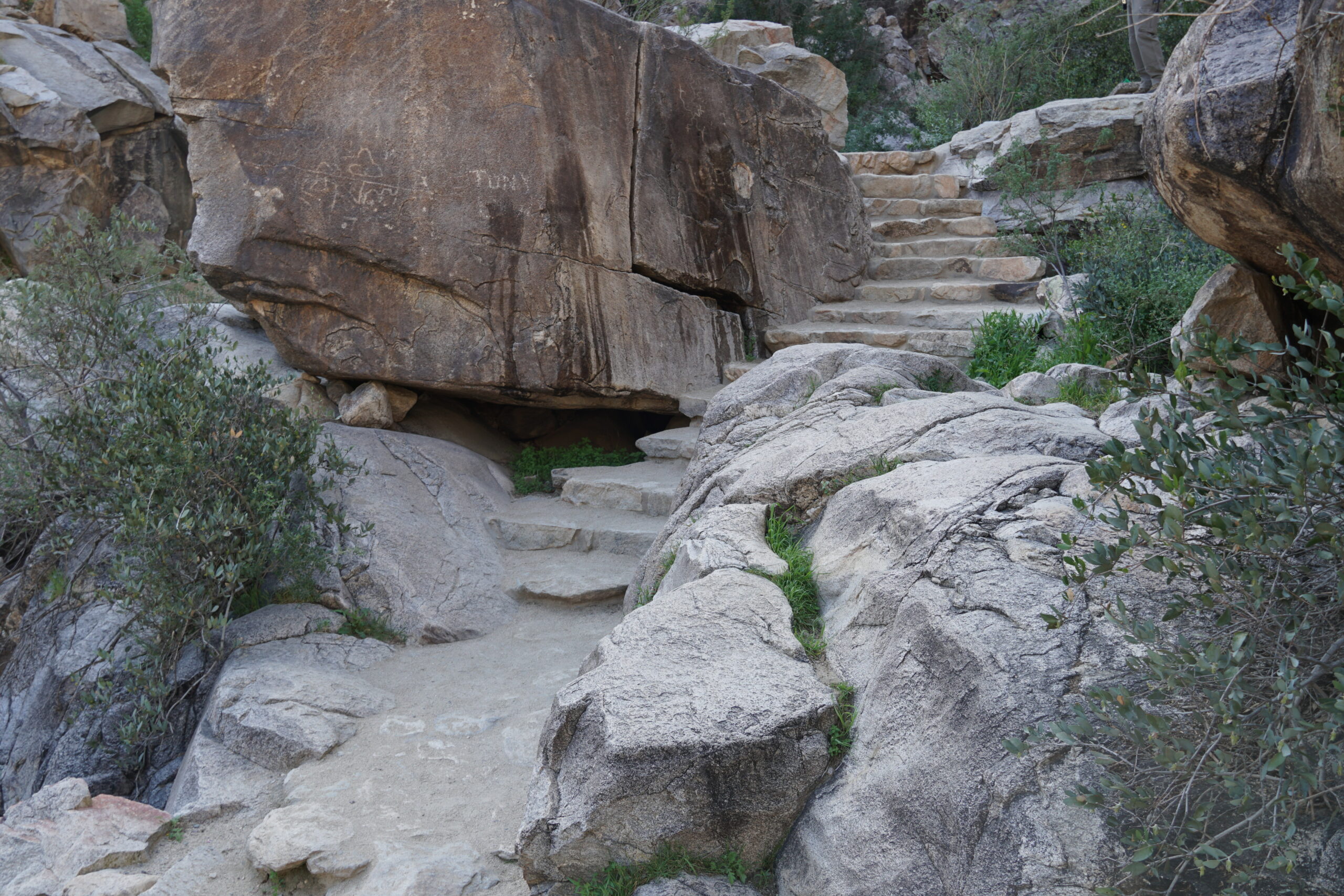
Stairs Leading to Waterfall in White Tank Mountain Regional Park
This section of trail is fun, with lots of bends in the trail and wildlife all around you. My favorite critters are the ornate tree lizards, which scamper across the trail when you approach them. Waterfall Trail is the most popular trail in the park, so there may be a line of people waiting to see the waterfall. Patiently wait your time out and then scamper along a couple of boulders to the waterfall.
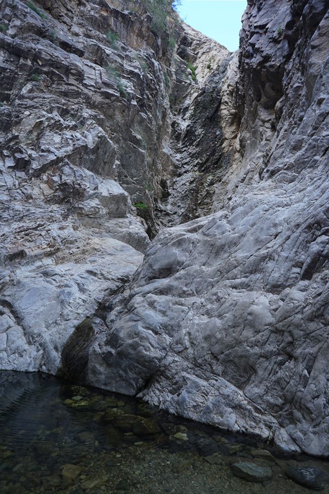
Pool Beneath Waterfall
First of all, I’m going to crush your expectations of a cascading waterfall. You are hiking in the desert after all, and frankly, I was surprised to see the waterfall at all once I saw the dry creek bed below. Although rain rarely occurs in the Phoenix area, when it does, it carves these interesting coulees throughout the desert due to flash flooding. This waterfall is one of those features that is formed by flash flooding, although the water does slightly trickle down when there hasn’t been heavy rain. Once you have taken in the beautiful view of the waterfall, turn around and retrace your steps toward the Black Rock Loop.
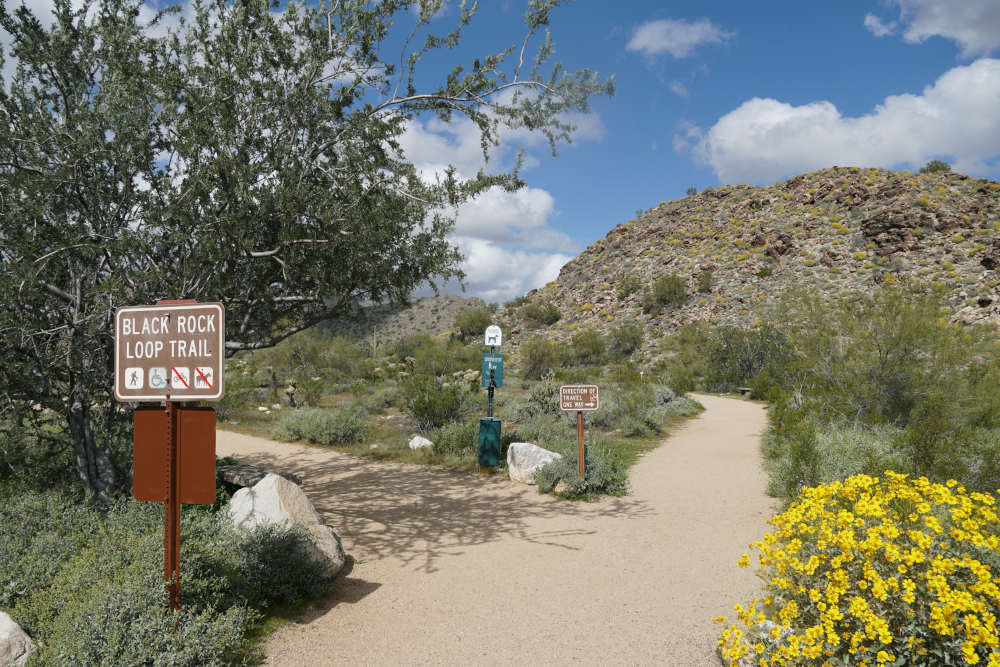
Black Rock Loop
After ½ mile, you have a choice: do you continue to the trailhead, or do you take the Black Rock Loop? The “long” Black Rock Loop only adds 1 ½ mile to your hike, making this extra side trip an obvious one. With that extra 1 ½ mile, you can view far more wildlife than just hiking to the waterfall. Turn right at the well-signed Black Rock Trail sign and then bear right at the intersection of the Black Rock Loop in a couple of hundred yards. Note that this short loop is a one-way trail, please hike in the indicated direction to avoid annoying your fellow hikers.
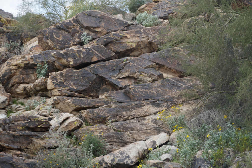
Petroglyph Along Black Rock Loop
Continue along this route until you reach the Black Rock trailhead, and then keep following the loop to bring you back to the junction to the Waterfall Canyon trail. Keep your eyes peeled for critters along the way; most people walk right past them without noticing them. Regardless of whether or not you are looking for wildlife, take your time and see what most people don’t as they quickly walk these short trails. You may discover more along these few miles than some hikers discover all day, as they briskly hike through the many trails that make up White Tank Mountain Regional Park.
Directions to the Waterfall Trailhead
Enter White Tank Mountain Regional Park (located at 20304 W White Tank Mountain Rd, Waddell, AZ 85355), pay your $6 entrance fee, and bear to the right to arrive at the well-signed trailhead to the waterfall.
Map to the Waterfall Trailhead