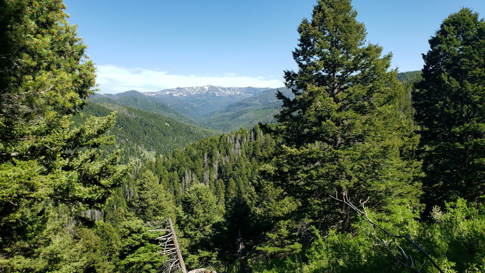
Leverich Canyon – Gallatin Range
Leverich Canyon – Gallatin Range

Leverich Canyon
Just outside of Bozeman, MT, Leverich Canyon Trail is a moderate 5 ½ mile hike. Bikes are allowed and recommended on this trail, and you will see many. 90% of the traffic on this trail is dominated by bikes, and the trail offers generous curves and slopes that mountain bikers will love riding down. For hikers, the gradual ascent, followed by generous curves, make this trail perfect for a moderate hike. You can also explore a bit of history on this trail, the loop leads by a long-forgotten mining camp. If you do decide to hike this trail instead of riding it on a bike, be prepared for a good workout.
Turn Right Here
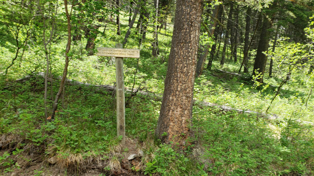
Leaving the trailhead, you immediately head uphill. Get used to this grade. The Leverich Canyon Trail is full of ups and downs, and you are given your option for difficulty as soon as you start down the trail. You can hike this trail clockwise or counter-clockwise. My advice is that you hike it counter-clockwise, despite the signs recommending clockwise. The trail elevation profile makes this route clear, but most importantly if you hike the trail counter-clockwise, you are able to see bicyclists as they tumble down the trail towards you, giving you precious seconds to get out of the way. Either way, reaching the top of the hill is no easy task.
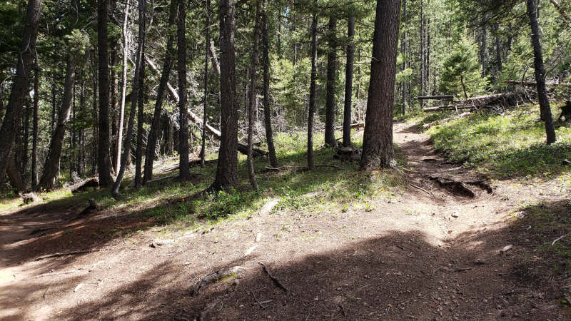
Turn Left on Cut-Across Trail
You will gain over 1,000 feet in elevation within the first two miles. It sounds like an easy grade, but this hike is full of hills. Big hills, little hills, and everything in-between. Bikes perform better on this trail than hikers, as the bikes can coast up and down these hills better than you can. Along every bend of the trail, you will need to look out for bicyclists. Most of them can’t stop in time to avoid you, so forget the “traditional” hiking right-of-way rules and be prepared to get out of their way. This is not a trail to question ethics or physics on; you will see the mountain bikers long before they see you, enabling you to safely get out of their way. Thankfully, after a couple of miles, you are near the high point in the trail, and the bikes aren’t traveling nearly as fast. Remember to still respect them by still giving them the right-of-way, though. On a busy day, you will probably pass 15-20 bicyclists. Dodging the bicyclists and steadily moving towards the top, the highest point on the Leverich Canyon Trail appears. This small clearing has a nice log for resting tired knees. This is a great opportunity to sit down and take a quick break, only one other part of the trail is so accommodating.
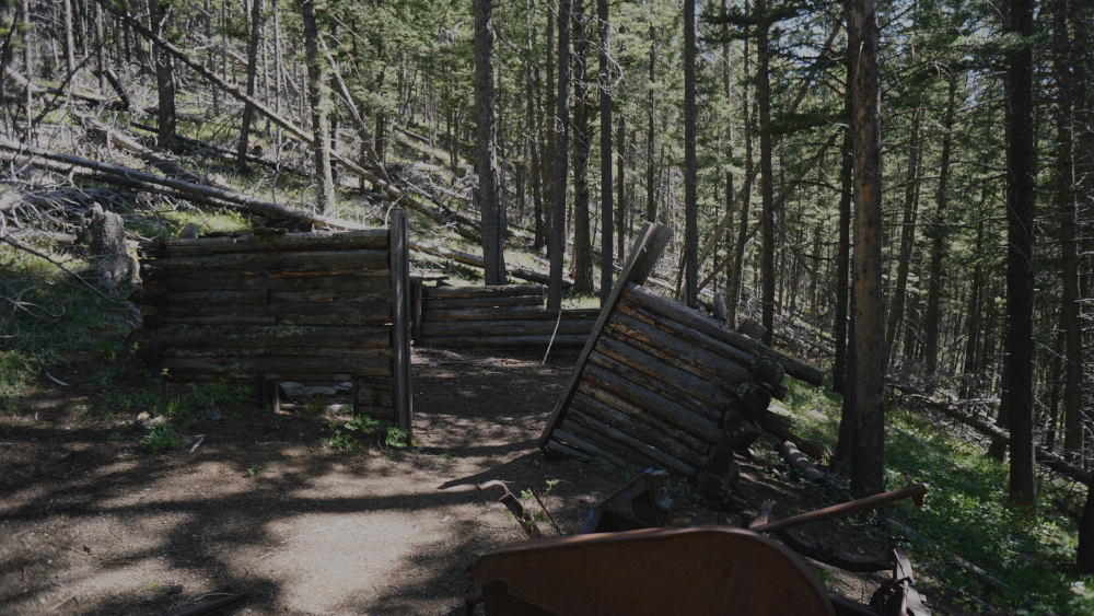
Cabin on Leverich Canyon Trail

Mine Along Leverich Canyon Trail
Continuing up and down the trail, a cut-across trail appears on the left. Turn left here, and avoid an extra .7 miles of hiking to the road junction that is mentioned in other hiking guides. Continue along this nice downhill run, traveling a half-mile before reaching the other side of the Leverich Canyon loop. Turn left here, continuing uphill and downhill.
This part of the trail is windy, which is a great relief after climbing the western side of the trail. After another ¾ of a mile down the path, you can visit the cabin I mentioned earlier. Directly next to the trail is a run-down cabin and a 20-foot crater from the abandoned mine shaft. This shaft ran deep underground, and the iron tracks leading into the mine are still visible. Like many mines in the area, this mine was likely not productive. Resist the urge to explore this dangerous pit and continue along the trail.
M Trail from Leverich Canyon Trail
The next hill is one of the last hills you will fight on this hike. This hill gains just a couple hundred feet in the next half-mile, but the hilly nature of this trail makes it annoying. Push past this last challenge, and the trail quickly leads downhill. You can see why bicyclists should take the clockwise route– a series of long switchbacks run down the remainder of the trail which is easier for bikes to climb.
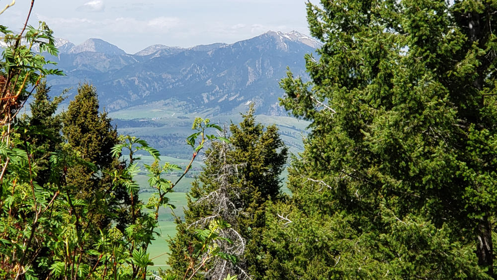
Sourdough Canyon from Leverich Canyon Trail
The last 1 ¾ mile goes by quickly, guiding you back to the loop junction and the trailhead. You’ve gained and lost 4,400 feet of elevation along this 5 ½ mile trail, making this trail a moderate-level trail. I don’t score a trail as moderate lightly, and this trail is the shortest trail I’ve rated as moderate. The everlasting hills add up and exhaust you, perfect for someone wanting to train themselves for more strenuous hikes.
Directions to the Trailhead
From Bozeman, drive on S 19th Ave for approximately 5 miles. Turn left onto Nash Road, and follow this road for another half-mile. Lastly, turn right onto S 3rd Rd. The trailhead is at the end of this road, which includes a mile of dirt and gravel road. This road is a little rough at the end, but most cars should be able to drive to the trailhead.
