Gallatin Petrified Forest Interpretive Trail- Gallatin Range
Gallatin Petrified Forest Interpretive Trail- Gallatin Range

Petrified Wood on the Gallatin Petrified Forest Interpretive Trail
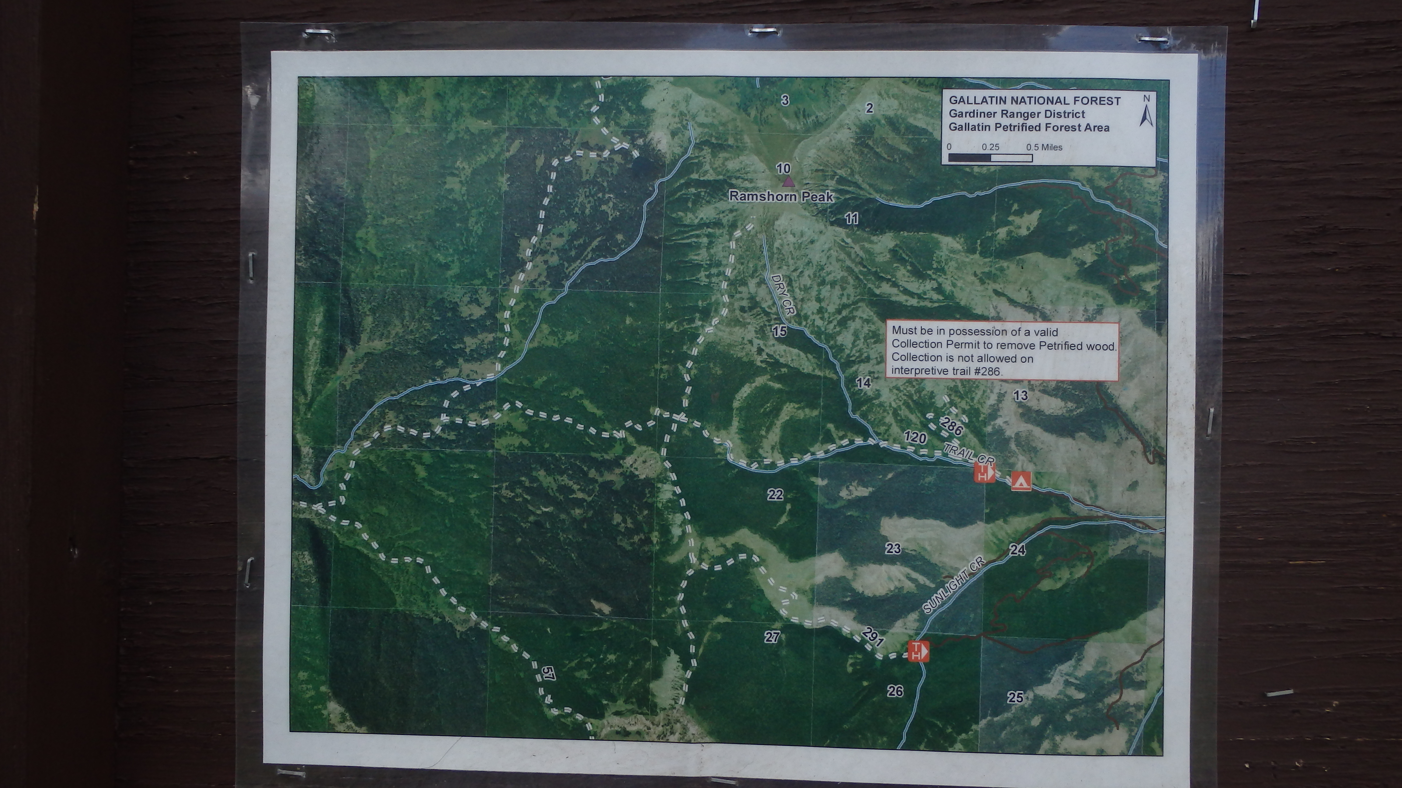
If you’re interested in the geological forces that shaped the mountains outside of Yellowstone National Park, or simply enjoy viewing petrified wood and semi-precious gems, the Gallatin Petrified Forest Interpretive Trail is an amazing trail. Although this trail is short, it gains 625 feet of elevation along the way (most of it during the last half mile). This gives a great calf stretch on the way to Yellowstone National Park, and is an excellent introduction to Yellowstone’s unique geology. Once you’re ready to hike this beautiful interpretive trail, drive down Tom Miner Rd for a dusty 11 miles, and begin your quick geologic adventure.
Petrified Forest Interpretive Trail
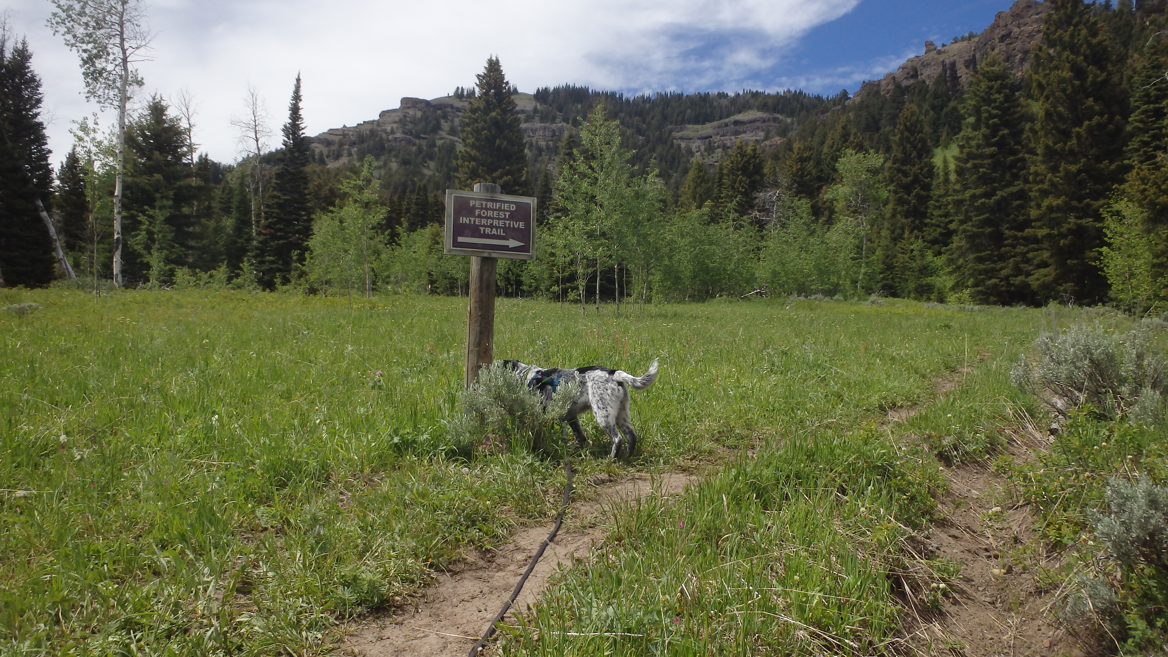
Leaving the large trailhead parking lot, you first pass through a gate (close it behind you). Walking through a beautiful meadow, you can tell that this is no boring rock hike. Deer, elk, and even grizzly bears can be seen along this trail if you’re lucky, so be sure to bring protection against bears. After a short third of a mile, Trail #286 appears, which is clearly marked as the Petrified Forest Interpretive Trail. Turn right here, and continue into the forest.
The First Plaque on the Trail
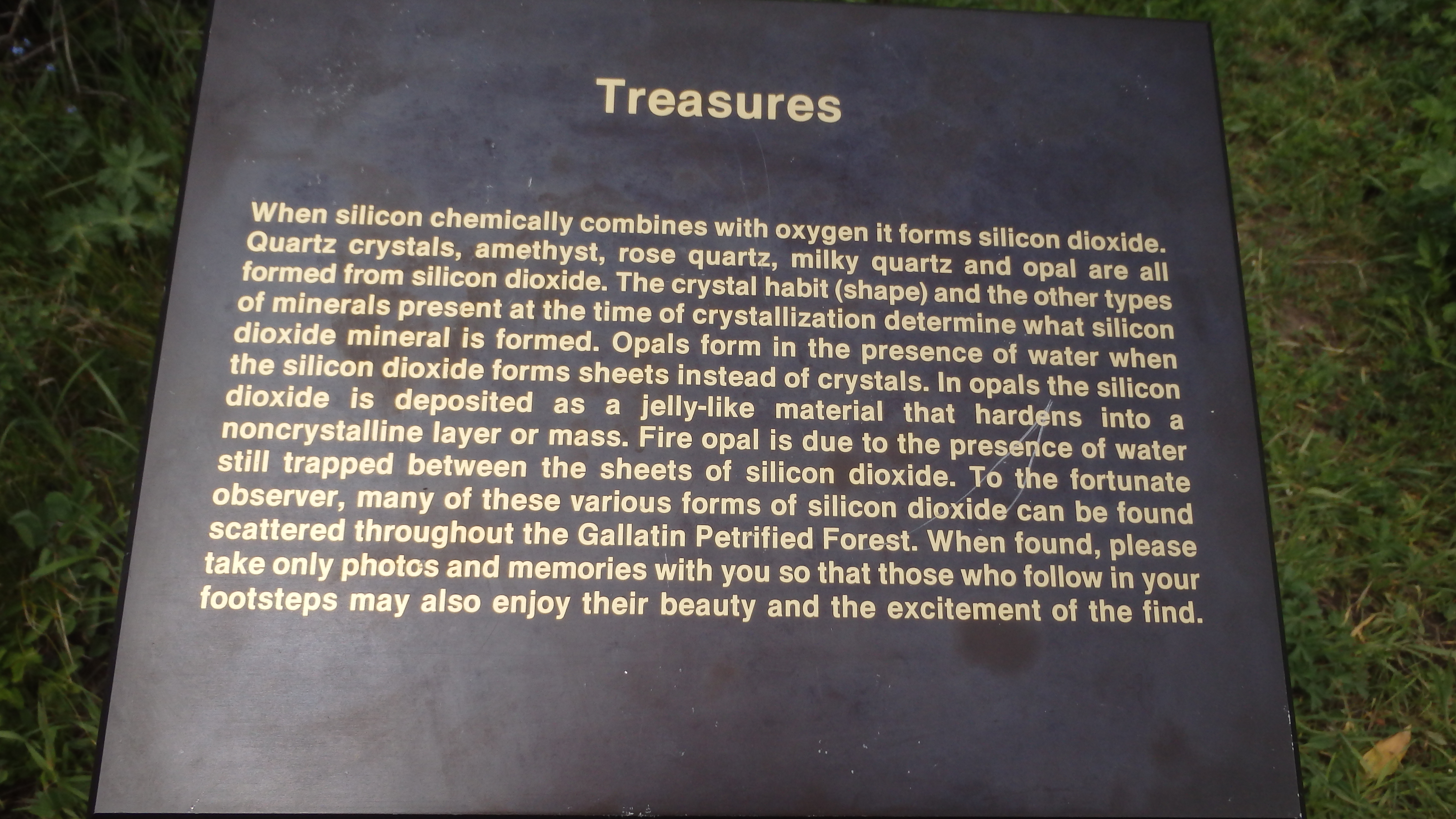
Not long after you’ve entered a mature fir and aspen forest, the first informational plaque appears. This plaque discusses the silicon dioxide-based treasures that await along the trail, such as amethyst, opal, and rose quartz. It also reminds you of a very important rule for this trail- do not remove any rocks, gems, or petrified wood along this trail. This is a protected area that has been set aside to ensure the enjoyment of many generations to come- erosion is already hard at work to destroy this natural beauty, don’t accelerate the process by removing any of these natural treasures from the trail. It should also be noted that while you can obtain a permit from the Custer Gallatin National Forest to remove small samples of petrified wood from the Gallatin Petrified Forest, this permit is not valid along the Gallatin Petrified Forest Interpretive Trail. Simply put, these geological treasures along the trail are protected by law, and should be left as you found them. Moving past the warnings of removing these natural wonders, the trail leads to the next plaque.
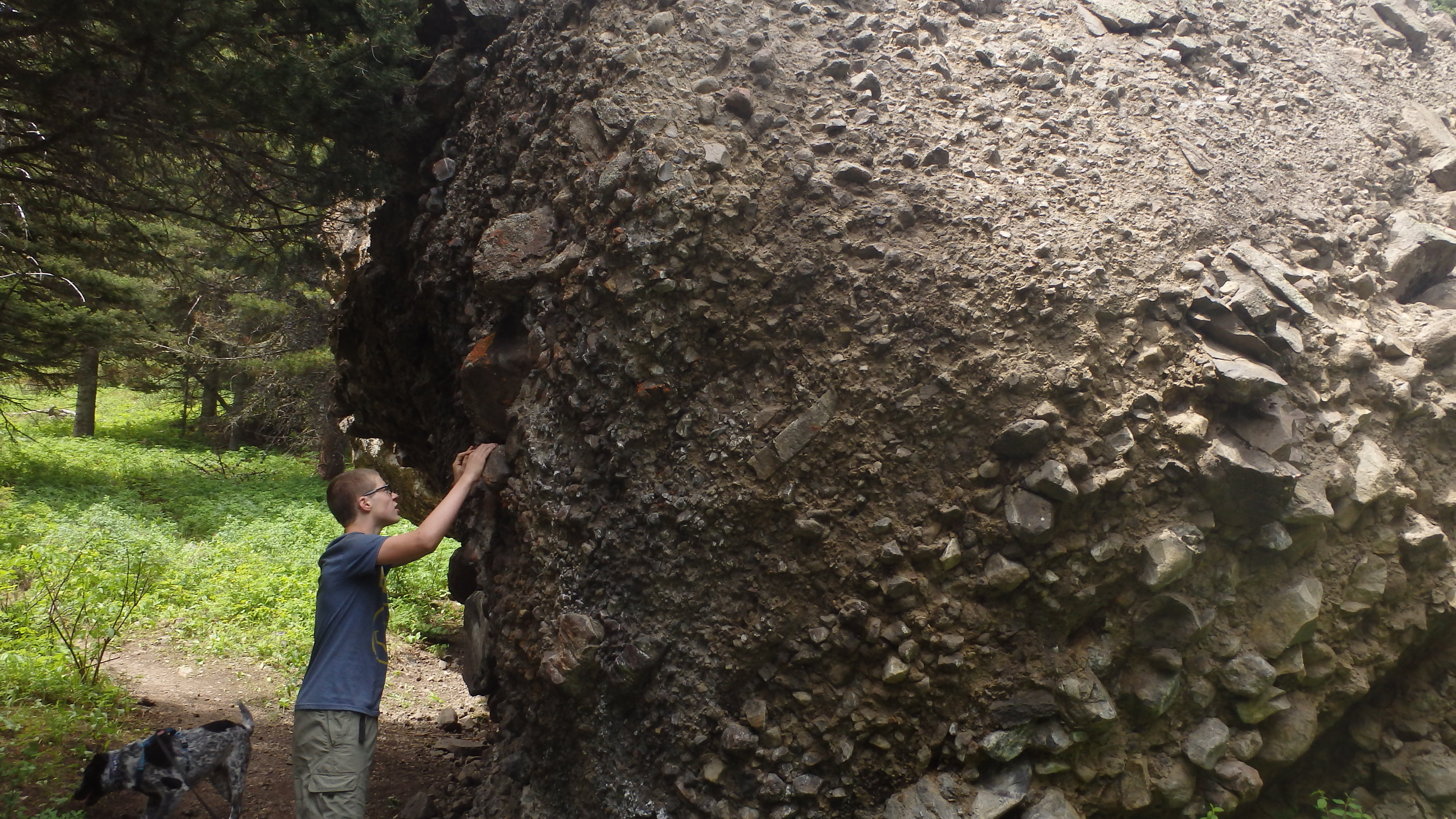
A large conglomerate along the trail. Don’t worry- he’s not pulling on the rock, but instead running his hands across the top of a stone in the conglomerate.
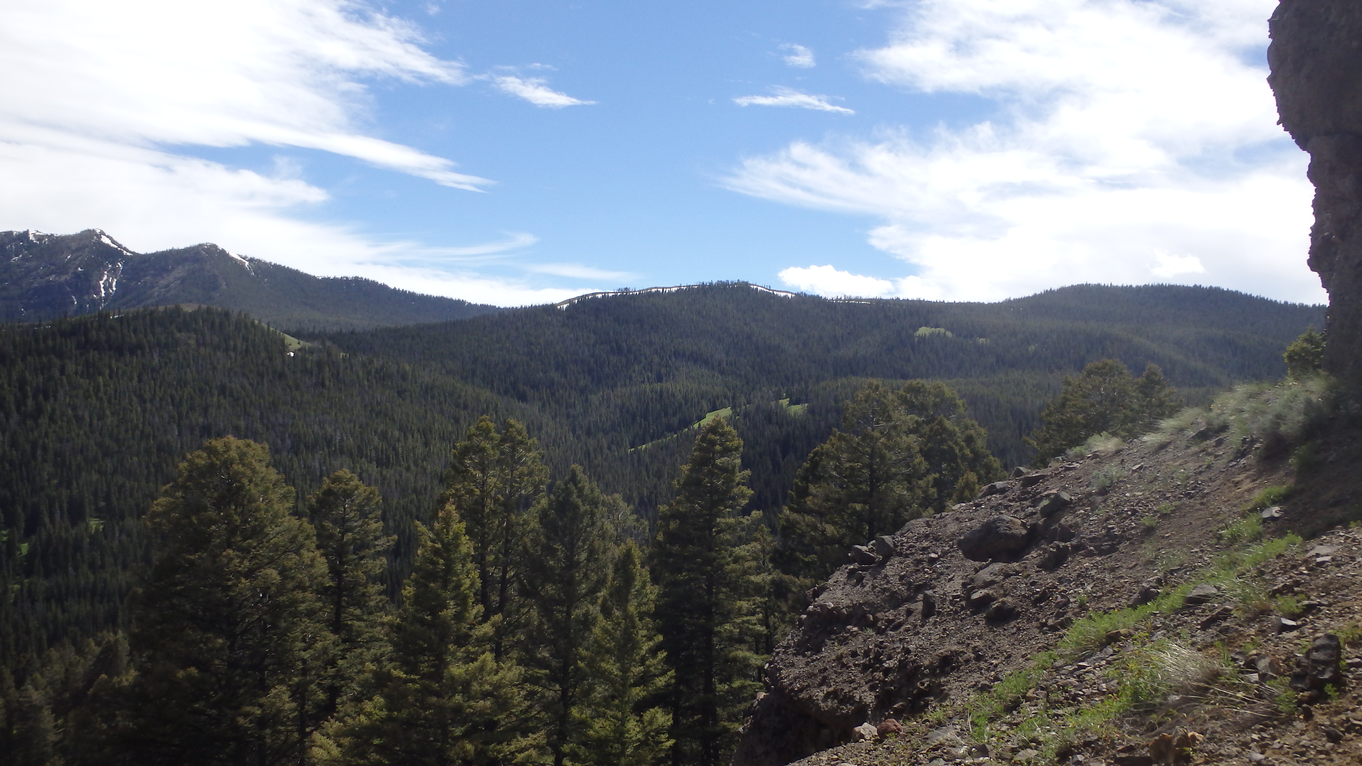
The trail continues, leading to the first large conglomerate. Many more lie along this trail, and some hikers pass right by these conglomerates while looking for petrified wood. Don’t make this mistake- take the time to examine these huge conglomerate masses, and see the rocks and debris that were buried and cemented in volcanic ash 50 millions of years ago. Try to imagine the inferno that engulfed this valley eons ago, and the processes of erosion that have worked over time to expose these stony conglomerates. If you pay attention, you may see some of the petrified wood or precious gems that this trail is famous for, buried in these large boulders. Continuing down the trail, the grade increases.
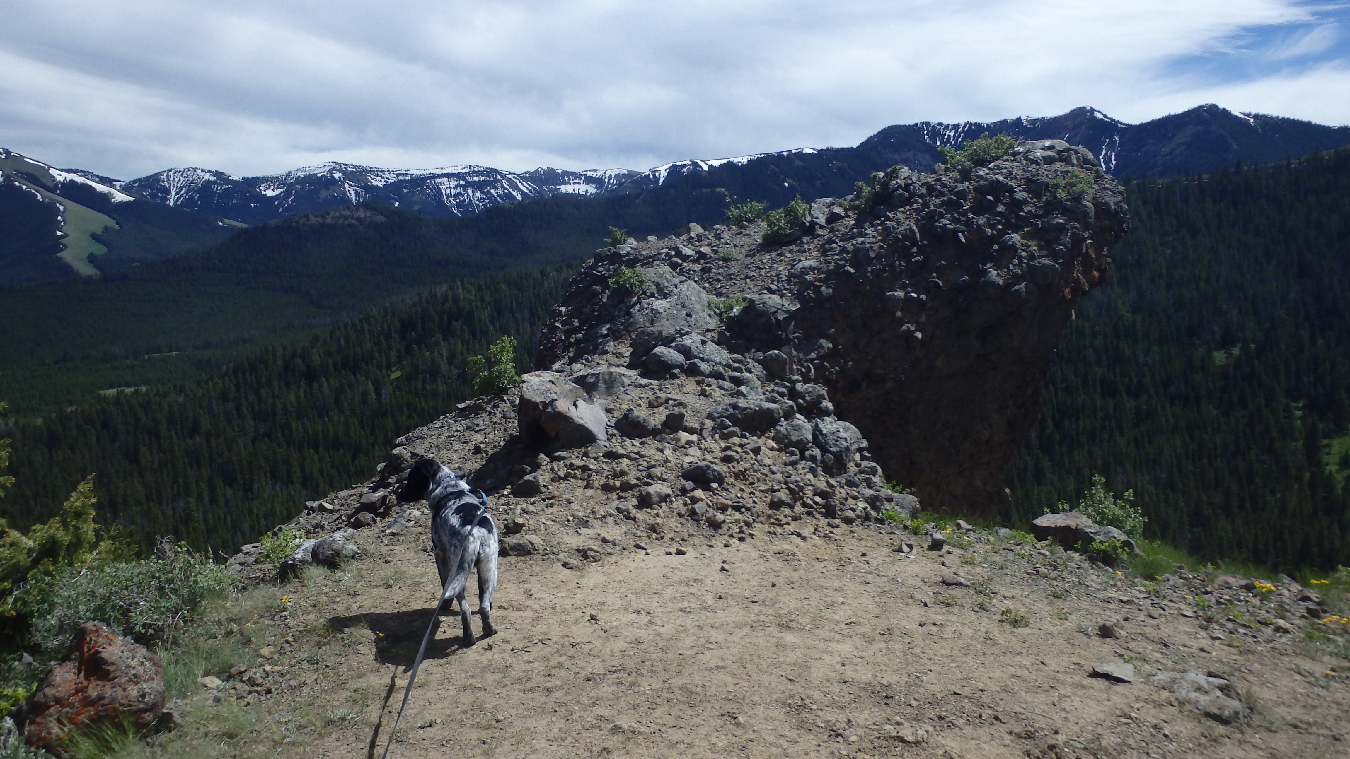
View of Tom Miner Basin
Although not especially difficult, this section of the trail switchbacks to bring you to the main attraction of the trail. After a short hike uphill in the forest, you arrive at a massive conglomerate containing quartz and amethyst crystals, as well as some petrified wood fragments. Do yourself a favor here, and hike up the steep social path that leads uphill, and on top of the large conglomerate cliff. Tom Miner Basin appears many hundreds of feet below you, offering a splendid view of the valley floor, and of Sheep Mountain to the east. This is a breathtaking view to be sure, but don’t be tempted to step onto the fragile ledge- these rocks are glued together with hardened ash, which erodes quickly and at times suddenly, so stay away from the edge of the overlook. When you’ve thoroughly enjoyed this vista, head back down to the main trail, and continue hiking.
As you hike along this next section of the trail, the footing becomes more unstable. If you brought kids or dogs on this trail with you, keep a close eye on them, since the loose scree along the trail can create miniature rock slides at any moment. This minor peril is more than worth it though: the main attraction to this trail lies just yards ahead.
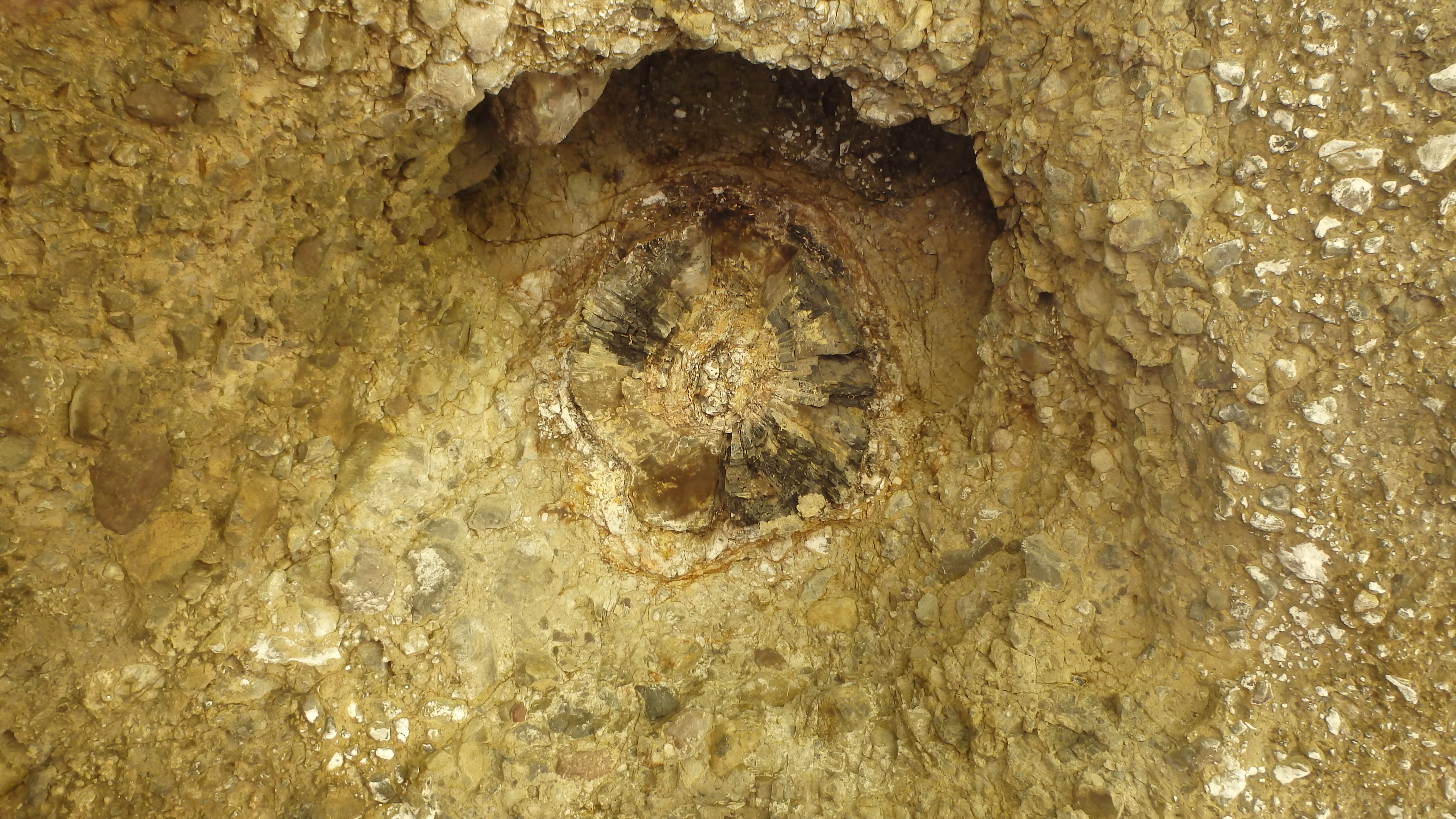
Petrified Wood in Ceiling
At the next two cliffs, the awesome power of the ash flow that covered this basin millions of years ago becomes apparent. As you walk up to the first conglomerate, you’ll see petrified wood, in an unusual location. The informational plaque titled, “Preservation of an Original” stands here, and explains this unique structure. Instead of looking for petrified wood fragments on the ground, or on the sides of the cliffs, look towards the ceiling of the exposed cliff. Suspended from the ceiling is a beautifully preserved tree trunk. However, the tree trunk is not horizontal, like most petrified wood. Instead, this tree was preserved as it was standing, millions of years ago. A violent lahar, or hot ash mudflow, that covered the Tom Miner Basin did so at such a quick pace that mature trees were completely buried before they had a chance to fall down. If you’ve never seen a petrified tree from this perspective, it’s far more interesting than your typical fallen log. All along the next few cliffs you can see these trees, suspended in time. Once you pry yourself from this scene (don’t worry, you can always stop by them again on the way back), continue to the end of the trail, less than a hundred feet away.
End of the Interpretive Trail
After hiking just over a mile total, the trail becomes significantly narrower, marking the end of the interpretive trail. If you still have plenty of energy at this point, keep hiking- the open landscape is very conducive to off trail hiking, and there are many other discoveries to be made. Use caution here, though: the loose scree in this area is easily disturbed, breaking and covering the precious natural treasures lying scattered on the ground. Once you’ve reached your limit (or slipped and cut yourself too many times), turn around and back to the trail. When you pick up the main trail again, take the time to revisit the conglomerate boulders and cliffs that you hiked past earlier- you may discover something that you missed before.
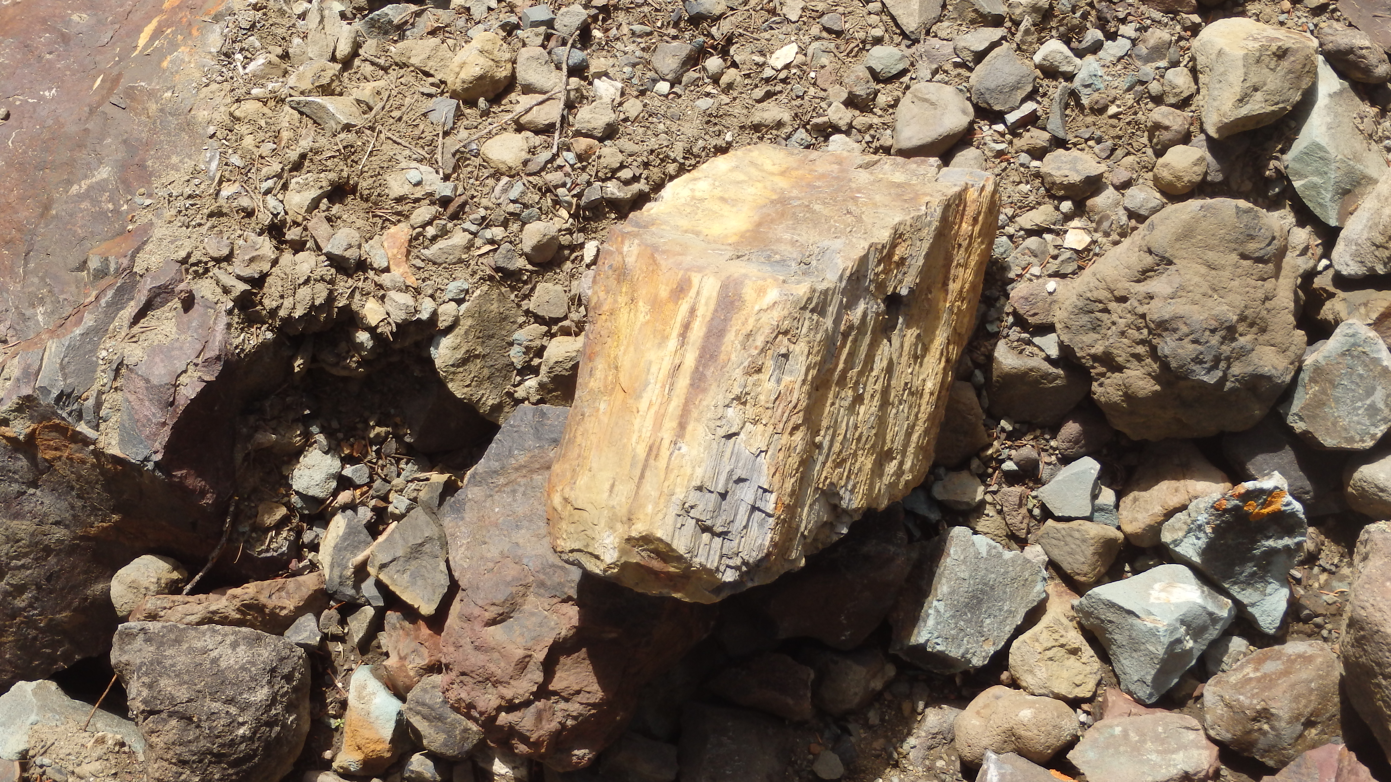
Resist the temptation to take smaller pieces of petrified wood home, please.
On this site I write a lot about conservation, and leaving no trace behind you while you are in the mountains. These are special places that have been set aside for everyone to enjoy, and for our future generations to cherish. These mountain trails allow us to connect with nature, and to temporarily escape civilized society. Preservation of these areas is absolutely vital- and no trail deserves more respect than the Gallatin Petrified Forest Interpretive Trail. Even though you may be tempted to kick or pull a rock loose from a conglomerate, or take a tiny treasure home, please don’t. Harming these natural wonders in any way only robs future hikers of the ability to experience them, and to appreciate the Gallatin Petrified Forest. Without the support of respectful hikers, interesting places like this would not exist. So please, leave no trace behind you along this educational trail, and make sure everyone in your group respects these natural wonders.
Directions to the Trailhead
Drive north for 16 miles on Highway 89 from Gardiner, or south for 37 miles on Highway 89 from Livingston, and then turn west onto Tom Miner Road. Follow this road for 11 miles to the Tom Miner Campground. Drive through the campground, and park on the west end of the campground, in the large parking lot.