Avalanche Lake- Beartooth Mountains
Avalanche Lake- Beartooth Mountains
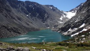
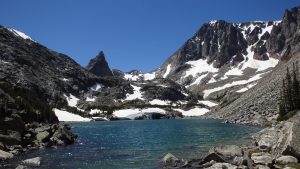
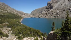
Avalanche Lake lies beneath Montana’s highest mountain, Granite Peak, and is fed by melting snow and ice from Granite Glacier, giving the lake a beautiful teal color. What sets Avalanche Lake apart from the many lakes in the area isn’t its beauty, or its population of cutthroat trout, but the towering mass of rock above it- Granite Peak. Each year, hundreds of climbers tackle Granite Peak, usually with success. Although most climbers prefer to use the Froze to Death Plateau route, the Avalanche Lake route offers the best scenery and fishing. If you’re looking for a challenging route to Granite Peak, or for excellent fishing, Avalanche Lake will not disappoint.
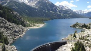
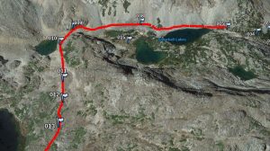
Starting at the West Rosebud trailhead, the first 6 miles of this hike are like a highway; day hikers and backpackers hurry along the double track trail, which offers no challenges. Hiking past Mystic Lake, and the turn for the Froze to Death Plateau, you can’t help but appreciate the size of Mystic Lake; the trail runs along its shore for 3 miles, presenting incredible views of the lake itself, surrounding cliffs, and nearby mountains. After 6 miles, you cross Huckleberry Creek, where the hiking gets tougher.
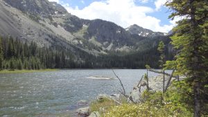
Turning left after the bridge over Huckleberry Creek, the trail immediately leads uphill. Although this trail can be hard to find at first, if you continue to hike uphill, you’ll find it soon enough. The trail runs approximately 1 mile, before Huckleberry Lake appears. From here, the trail is harder to follow, and rock hopping is necessary to get to the end of Huckleberry Lake, if you lose the trail. Once at the inlet, the trail is easily found, and continues uphill.
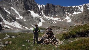
This part of the trail can be tricky in some areas- since this is not an official trail, hikers have worn this trail themselves. This means that if hikers are commonly lost in an area, the trail might seem to lead off in multiple directions. If all else fails, cairns have been placed along the trail to help guide hikers through the often confusing sections of the trail. After 8 miles of hiking, Princess Lake appears, as well as the next obstacle.
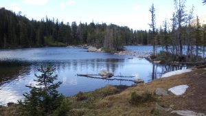
Once at Princess Lake, a couple of obstacles appear. To continue along the trail, you need to reach the south end of the lake, which appears intimidating at first. Along the west end of the lake is a wall of willow branches and thorns, which will tear at you, and mock your attempt to push past this tangled mess. However, a straight line of rocks leads to the other end of the lake. Although this is a popular route (and it requires getting your feet wet), a better option exists. Instead of pushing through a wall of cuts and bruises, or plunging your feet into ice cold water, if you hike uphill of the creek, you will reach an unnamed lake after about 70 yards. From there, you can easily cross on a logjam, or cross the creek on some of the rocks in the creek. Then, you can head back downhill, and walk along the western shore of Princess Lake. No cuts on your legs, no frigid feet, and no frustration.
When you reach the southern shore of Princess Lake, the trail continues near the first campsite. The trail leads uphill, weaving in and out of the forest, and crossing the occasional rock field. Fortunately, cairns are well placed on this route, making it easy to stay on the trail. In fact, the cairns are so well placed that the trail has two different branches which all converge on one main trail- such is the beauty of improvised trails. After a mile of hiking uphill, the first Snowball Lake appears.
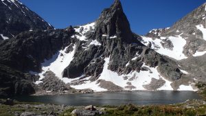
The next four lakes are all part of the Snowball Lakes chain. These lakes are fishless, but beautiful. However, the route around them is anything but beautiful, and this is where the hike becomes difficult. The trail leads around the western side of the first Snowball Lake, all but disappearing at this point. Boulder hopping along the western shore, you’ll pass the second and third Snowball Lake, where you’ll immediately hike up the hill, and bear left (crossing the outlet stream of the fourth Snowball Lake, buried under the boulders). Although another popular route is to climb the mass of rock south of the second Snowball Lake, but this route involves more risk. After Snowball Lakes, the hiking gets easier.
Leaving the eastern shore of the fourth Snowball Lake, you continue to hike uphill. As the boulders fade away to alpine grass, the hiking becomes easier- or so you think. Once the impressive Lower Storm Lake appears, a maze of krummholz, or stunted and deformed trees block the trail. Life up here is hard for plants, and these trees are defying the tree line. Impressive as this may be, the krummholz maze presents a formidable barrier. Fortunately, there is an easy way around this obstacle.
Heading downhill at this point, towards Lower Storm Lake, you can bypass most of the thorns, branches, and twigs that block the trail above. At the outlet of Lower Storm Lake, you’ll see a large cairn. Cross the outlet stream here, and head downhill through the marsh, around the willows on the north side of the creek. After a couple hundred yards, you’ll finally reach your destination- Avalanche Lake.
After traveling approximately 10 miles, you have arrived at the scenic and inspiring Avalanche Lake. The southern face of Granite Peak towers above you, and Granite Glacier appears directly in front of you- lying under the many climbers who chose the Froze to Death Plateau route. Climbers wishing to attempt Granite Peak should head along the eastern shore of Avalanche Lake, as the western shore is blocked by cliffs, and anglers should concentrate on the inlet stream, or better yet Lower Storm Lake just up the trail. Regardless of your intentions at Avalanche Lake, leave absolutely no trace of your presence behind. This fragile alpine environment suffers from even the slightest abuse, help preserve this incredible place for others.
Directions to the West Rosebud Trailhead
From Absarokee, head south of town on Highway 78. Turn right a couple of miles outside of Absarokee, onto Highway 419 (there will be a gas station at this turn). Drive down Highway 419 for 6 miles, passing through Fishtail. Once you drive through Fishtail, drive one more mile down Highway 419, and then turn left onto West Rosebud Road. Follow this road for seven miles, turning left at the sign to Mystic Lake. Travel down this gravel road for about 14 miles (passing Emerald Lake and West Rosebud Lake), and park at the trailhead. This is the end of the road (the rest of the road is closed to vehicles), hike up the road to the trailhead.
