Author Archives: chris
Author: chris | Category: Easy Day Hikes, Hiking Trails in the Beartooth Mountains, Montana Hiking Trails | Tags: Absaroka-Beartooth Wilderness, Beartooth Mountains, Easy Day Hikes
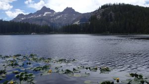
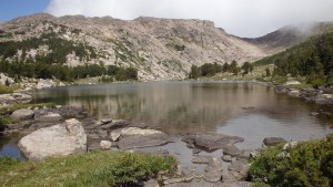
Margaret Lake
If you’re seeking a lake less than 3 miles from a popular trailhead, while at the same time looking for isolation from others, look no further than Margaret Lake. Although the trail isn’t as easy to follow as others (the last quarter mile is hard to follow at times), the fishing and solitude more than make up for the quarter mile of stumbling though brush. Located just a few minutes from Cooke City, you’ll pass many hikers on the way into Margaret Lake, but you’ll be almost guaranteed solitude once you arrive at the lake. This trail does lead through an area that is notorious for its bear population, so be sure that you know how to safely hike in bear country, before you leave the trailhead. This hike starts from the busy Clarks Fork Trailhead, easily accessible from Highway 212.
(more…)
19 Jul 2016
Author: chris | Category: Easy Day Hikes, Hiking Trails in the Beartooth Mountains | Tags: Absaroka-Beartooth Wilderness, Beartooth Mountains, Easy Day Hikes
Vernon Lake
Located just 2 ½ miles from the Clarks Fork trailhead, Vernon Lake is a perfect day hike for travelers on their way to Cooke City, or Yellowstone National Park. The trail gains very little elevation, and offers the opportunity to see wildlife such as deer, moose, and yes- bears. Finding the trailhead is incredibly easy, since it is both well signed, and next to Highway 212. Although you’ll pass many hikers on the first mile of this hike, once you turn onto the Vernon Lake trail, the traffic diminishes greatly. Another feature of this trail is a side trip to the Flume Trail at the beginning of the hike, which offers an educational opportunity about the now-defunct hydroelectric dam that was built in 1916. This “trail” is wheelchair accessible, while of course the hike to Vernon Lake is not.
(more…)
11 Jul 2016
Author: chris | Category: Difficult Hikes, Hiking Trails in the Beartooth Mountains, Montana Hiking Trails | Tags: Absaroka-Beartooth Wilderness, Beartooth Mountains, Difficult Hikes
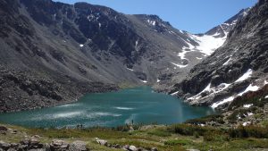
Avalanche Lake
Avalanche Lake lies beneath Montana’s highest mountain, Granite Peak, and is fed by melting snow and ice from Granite Glacier, giving the lake a beautiful teal color. What sets Avalanche Lake apart from the many lakes in the area isn’t its beauty, or its population of cutthroat trout, but the towering mass of rock above it- Granite Peak. Each year, hundreds of climbers tackle Granite Peak, usually with success. Although most climbers prefer to use the Froze to Death Plateau route, the Avalanche Lake route offers the best scenery and fishing. If you’re looking for a challenging route to Granite Peak, or for excellent fishing, Avalanche Lake will not disappoint.
(more…)
30 Jun 2016
Author: chris | Category: Hiking Articles, Hiking Safety | Tags: backpacking in bear country, hiking in bear country, prevent bear attacks
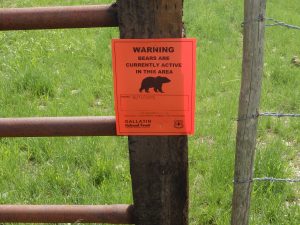
Hiking in Bear Country
For some, hiking or backpacking in bear country is a truly terrifying experience. Hiking down a trail in the wilderness has its hazards, and bears can certainly be one of those hazards. Camping in bear country is even more dangerous- extra precautions need to be taken to prevent an attack at night, and to keep food scents out of your tent. Knowing how to safely hike or backpack in bear country can prevent a bear attack, and save your life.
(more…)
08 Jun 2016
Author: chris | Category: Easy Day Hikes, Hiking Trails in the Beartooth Mountains, Montana Hiking Trails | Tags: Beartooth Mountains, Easy Day Hikes
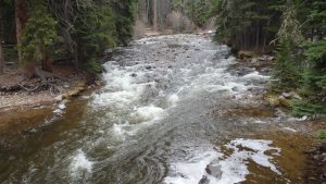
Meyers Creek Trail
Meyers Creek Trail #27 offers a chance to enjoy the outdoors on a well established trail, without the crowds. This trail is great for any hiker’s skill level, or physical condition. Rockhounds will be satisfied with the fossils and metamorphic rocks that are easily found on the trail, and hunters will find no shortage of wild game. For some, the trailhead is scenic enough, but to fully appreciate the trail, you’ll want to stretch your legs.
(more…)
01 Jun 2016
Author: chris | Category: Easy Day Hikes, Hiking Trails in the Absaroka Range, Montana Hiking Trails | Tags: Absaroka Range, Absaroka-Beartooth Wilderness, Easy Day Hikes
East Fork Boulder River
South of McLeod, MT, lies the East Fork Boulder River, a popular trail that leads to less than popular destinations. The trail runs 3.5 miles to the bridge over the East Fork Boulder River, where many hikers choose to fish, camp, or hike onward to the Lake Plateau. The camping at the East Fork Boulder River is excellent, with both firewood and trout in large supply. For a novice backpacker, the low elevation gained on this hike make it a good choice. In fact, the hardest part of this hike might be driving to the trailhead itself.
(more…)
08 May 2016
Author: chris | Category: Easy Day Hikes, Hiking Trails in the Madison Range, Montana Hiking Trails | Tags: Easy Day Hikes, Madison Range
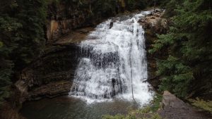
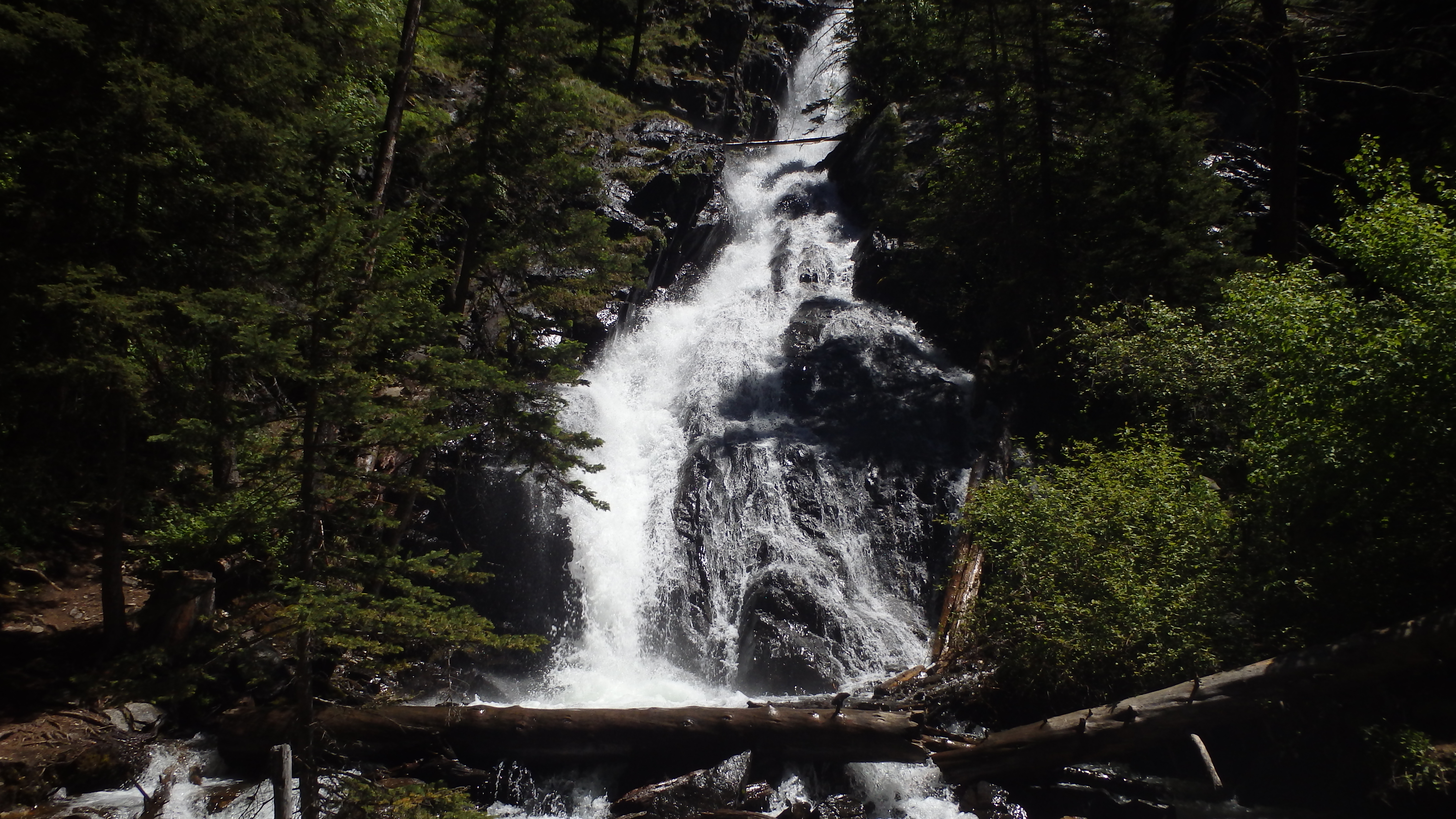
Ouzel Falls
Ouzel Falls, located in Big Sky, Montana, offers the opportunity for a quick hike to a scenic waterfall. The South Fork of the West Fork of the Gallatin River (which is a mouthful, to say the least) plunges over the falls, on its way to the Gallatin River. Ouzel Falls is located just .75 miles from the trailhead, making it a short hike after a long day of skiing, or an attractive detour on the way to Yellowstone. The low grade of the trail is easy for most hikers, although there are many side trips along the way if you want to stretch your calves. In winter, the trail to the falls, and the falls themselves, are the most scenic.
(more…)
01 May 2016
Author: chris | Category: Hiking Articles, Hiking Gear, Hiking Safety, Hiking Skills
Planning a Backpacking Trip
Planning a backpacking trip takes time, but the rewards are worth it.
Planning a backpacking trip is the least exciting part of backpacking. Figuring out where to go, what gear to carry, what to eat, and transportation is the backpacking equivalent to working in an accounting office. However, as an accountant is invaluable to the company that he or she works for, proper planning of a backpacking trip is equally important. Not to sound over-dramatic, but planning a backpacking trip properly can literally mean the difference between life and death. You can survive without food for weeks or drink contaminated water for days, but if you plan a trip poorly, you can die within hours.
(more…)
10 Apr 2016
Author: chris | Category: Easy Day Hikes, Hiking Trails in the Pryor Mountains, Montana Hiking Trails | Tags: Easy Day Hikes, Pryor Mountains
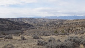
Cottonwood Road BLM
Most people think of a beautiful lake or a scenic alpine view, when they think of hiking. They imagine a beautiful drive to the trailhead, where they might see a cascade of water rushing down the valley, or evergreen forests that surround the road. Most people overlook the Cottonwood Road area, which is equally beautiful in its own right. Covered only with sagebrush and a few juniper trees, Cottonwood Road’s beauty is something you have to hike away from the road to appreciate.
(more…)
01 Apr 2016
Author: chris | Category: Easy Day Hikes, Hiking Trails in the Pryor Mountains, Montana Hiking Trails | Tags: Easy Day Hikes, Pryor Mountains
Weatherman Draw
Eighteen miles south of Bridger, MT lies an unusual hiking destination, called Weatherman Draw. At first, Weatherman Draw (also referred to as Valley of the Chiefs by many Native American tribes) seems lifeless and barren. Here there isn’t any flowing water, and only the occasional juniper tree provides shade. What does make Weatherman Draw an amazing hike has to do with the history of the Valley of the Chiefs, and the geological wonders of the area.
(more…)
18 Mar 2016
Author: chris | Category: Easy Day Hikes, Hiking Trails in the Beartooth Mountains, Montana Hiking Trails | Tags: Absaroka-Beartooth Wilderness, Beartooth Mountains, Easy Day Hikes
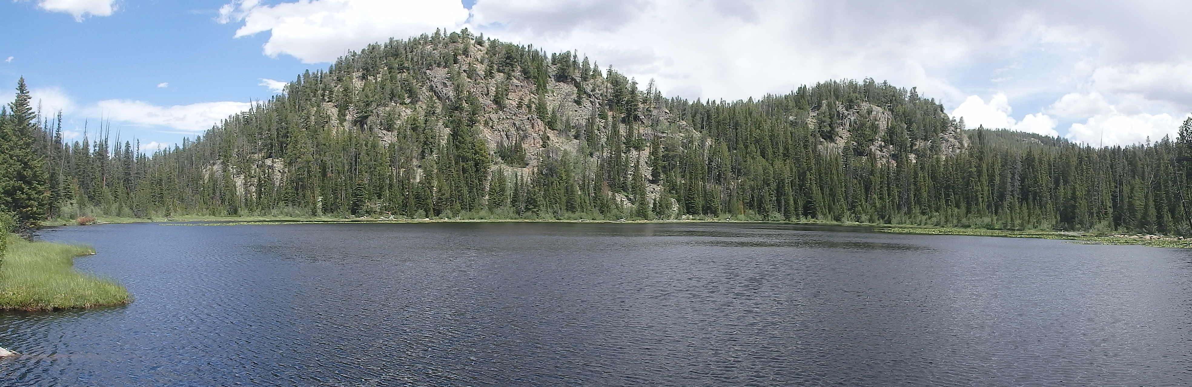
Slough Lake
Underneath Froze to Death Plateau, Phantom Creek slows to a standstill, creating a scenic marsh. Inside that marsh lies Slough Lake, a shallow 6 foot deep lake filled with brook trout, and an excellent destination for a day hike. Located just 2.5 miles from the trailhead, it’s a short hike to Slough Lake, albeit mostly uphill.
(more…)
23 Dec 2015
Author: chris | Category: Hiking Trails in the Beartooth Mountains, Moderate Day Hikes, Montana Hiking Trails | Tags: Absaroka-Beartooth Wilderness, Beartooth Mountains, Moderate Day Hikes
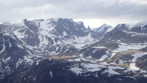
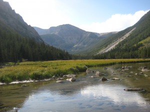
Froze to Death Plateau
There are few places on this planet that are truly named well. Covered with ice and snow 11 months out of the year, Froze to Death Plateau more than lives up so its name. At this plateau, snow is possible any time of the year, and the air conditioning is always on. If you hike up to this plateau, you’ll be rewarded by the scenery- the West Rosebud and Phantom Creek valleys are breathtaking, to say the least.
On the topic of breathtaking, the high altitude and steep trail make this hike a moderate hike. Weather at this altitude can also rapidly change, so be sure you are both in good shape, and prepared for the weather. With a name like Froze to Death Plateau, it goes without saying that you’ll want to carry a warm jacket, at least.
(more…)
14 Dec 2015
Author: chris | Category: Hiking Articles, Hiking Skills
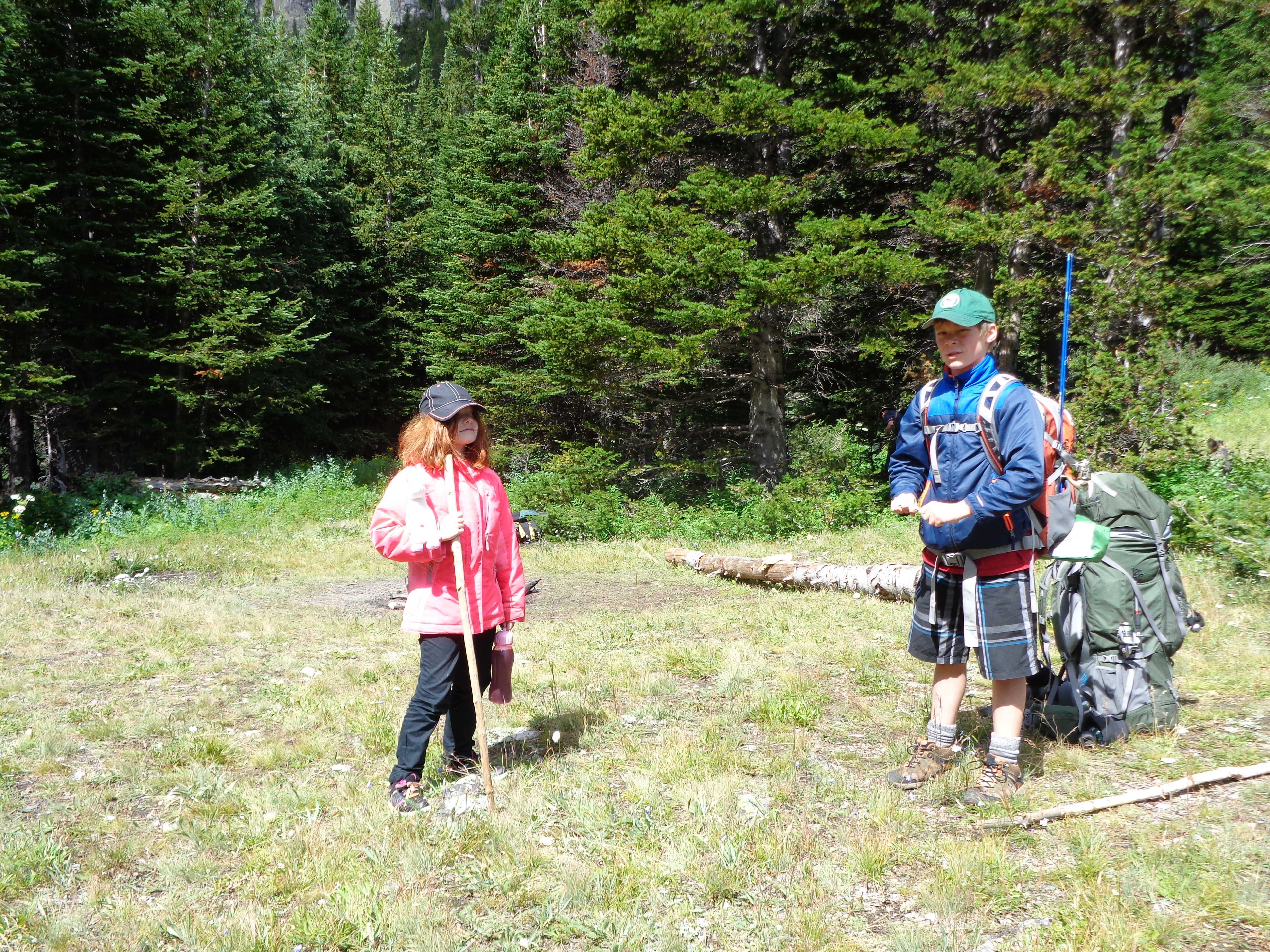
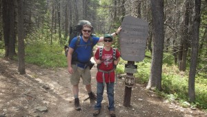
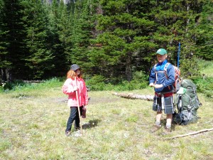
Hiking with Kids- Tips 6-10
<–Click here to read Hiking with Kids- Tips 1-5, if you haven’t already.
Young kids can carry a few pounds- and every pound helps!
6.) As a kid becomes more familiar with hiking, share the weight.
Kids like to help adults, let your child start helping out with carrying gear, when they are ready. That’s a tough decision- how do you know when your child is ready to start carrying a pack? For starters, the child shouldn’t have any weight the first couple of trips. If they’re young enough (younger than 9), you should be carrying all of their gear, with the exception of their water bottle. As the child grows older (and is more experienced with hiking), you’ll know the right time to start adding weight to their pack- they’ll ask for it. Kids love to help out, and as they grow older they’ll want to be increasingly more independent. They’ll thank you for the added responsibility, and your back will be thankful as well!
(more…)
10 Nov 2015
Author: chris | Category: Hiking Articles, Hiking Skills
Hiking with Kids- Tips 1-5
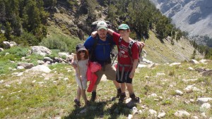
Hiking with your kids forms memories that last a lifetime.
There’s no greater joy than sharing the outdoors with your family. Hiking with kids adds a whole new perspective to a day hike or overnight hike, allowing you to see the mountains through their excited eyes. Hiking with children is no easy task- it will test your patience, and theirs as well. Special considerations will have to be made, adding extra weight to your pack. The extra weight and hassle is definitely worth it-you will build memories that last a lifetime, provided a few extra precautions are made, and a few extra provisions carried.
(more…)
10 Nov 2015
Author: chris | Category: Hiking Trails in the Absaroka Range, Moderate Day Hikes, Montana Hiking Trails | Tags: Absaroka Range, Absaroka-Beartooth Wilderness, Moderate Day Hikes
Thompson Lake
Thompson Lake, located in the Absaroka Range, offers something for everyone; cutthroat trout swim beneath the lake’s surface, deer and bears are commonly seen, the mature forest makes for great camping, and the trail to Thompson Lake is a relatively easy hike. The trail is a short 5 miles, and only gains 1,200 feet in elevation. This barely qualifies it as a “Moderate” hike, and the only reason it should be a “Moderate” hike is due to the number of hills and obstacles on the trail.
(more…)
20 Oct 2015
Author: chris | Category: Easy Day Hikes, Hiking Trails in the Beartooth Mountains, Montana Hiking Trails | Tags: Beartooth Mountains, Easy Day Hikes
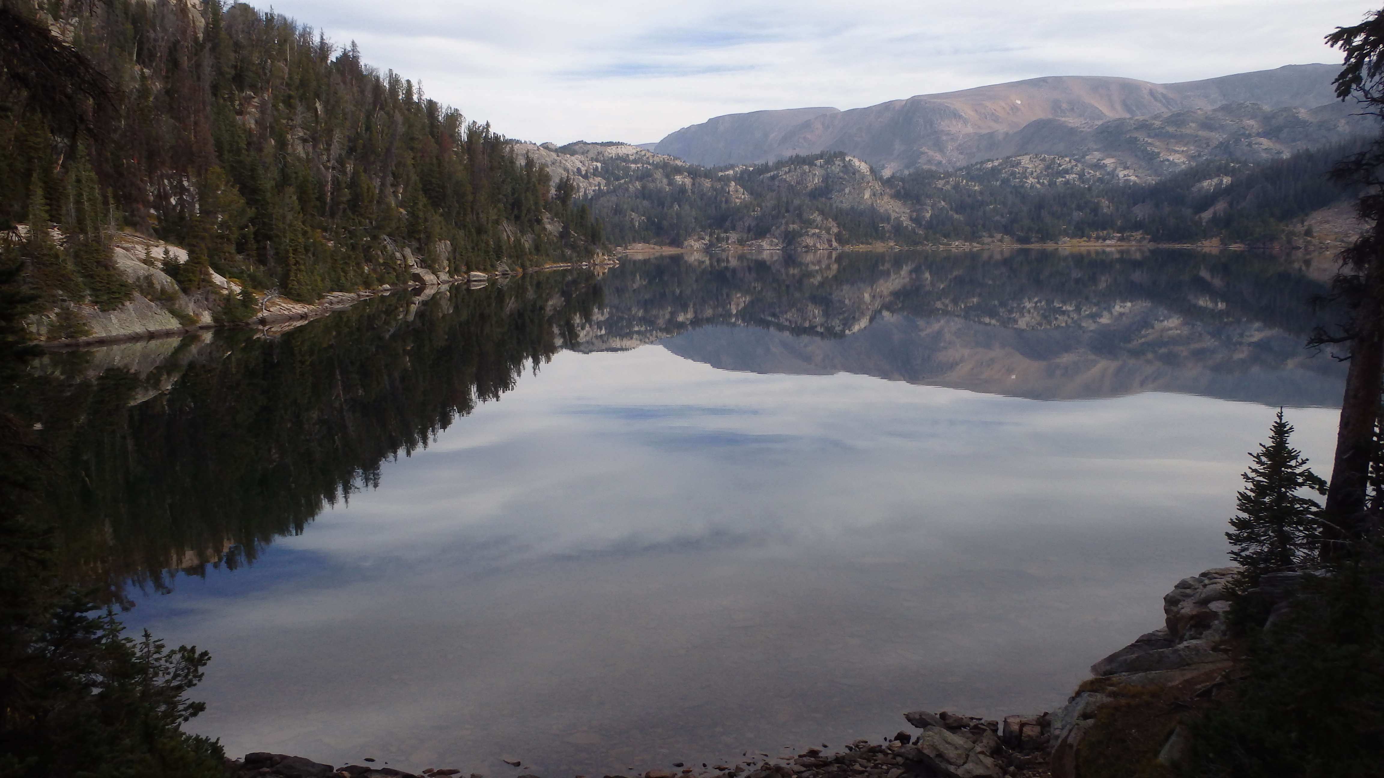
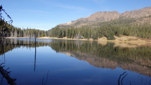
Beauty Lake, WY
Located in Wyoming, Beauty Lake is a popular summer day hike, for many good reasons. Beauty Lake is well named, the gorgeous scenery from the surrounding hills is reflected on its surface; leaving you to wonder if you are looking at a lake, or a mirror. The lake is below timberline, but only just barely- leaving you with shade in the afternoon, while offering alpine vistas as well. Nearby Crane Lake offers similar views, with perhaps less visitor traffic. Both lakes are easily accessible from the Beartooth Lake Trailhead, with the total elevation gain little more than 500 feet in the short 2.4 miles to Beauty Lake.
You’ll want to have your camera handy along this trail, given the many scenic opportunities that lie along it. Immediately starting from the trail you’ll pass Beartooth Butte, an outcrop that rises more than 1,500 feet above Beartooth Lake. Further down the trail, you’ll pass Crane Lake, a beautiful lake in itself. Finally, you will arrive at Beauty Lake. You’ll appreciate the appropriate name of the lake, as you hike along its shore.
(more…)
18 Sep 2015
Author: chris | Category: Easy Day Hikes, Hiking Trails in the Beartooth Mountains, Montana Hiking Trails | Tags: Absaroka-Beartooth Wilderness, Beartooth Mountains, Easy Day Hikes
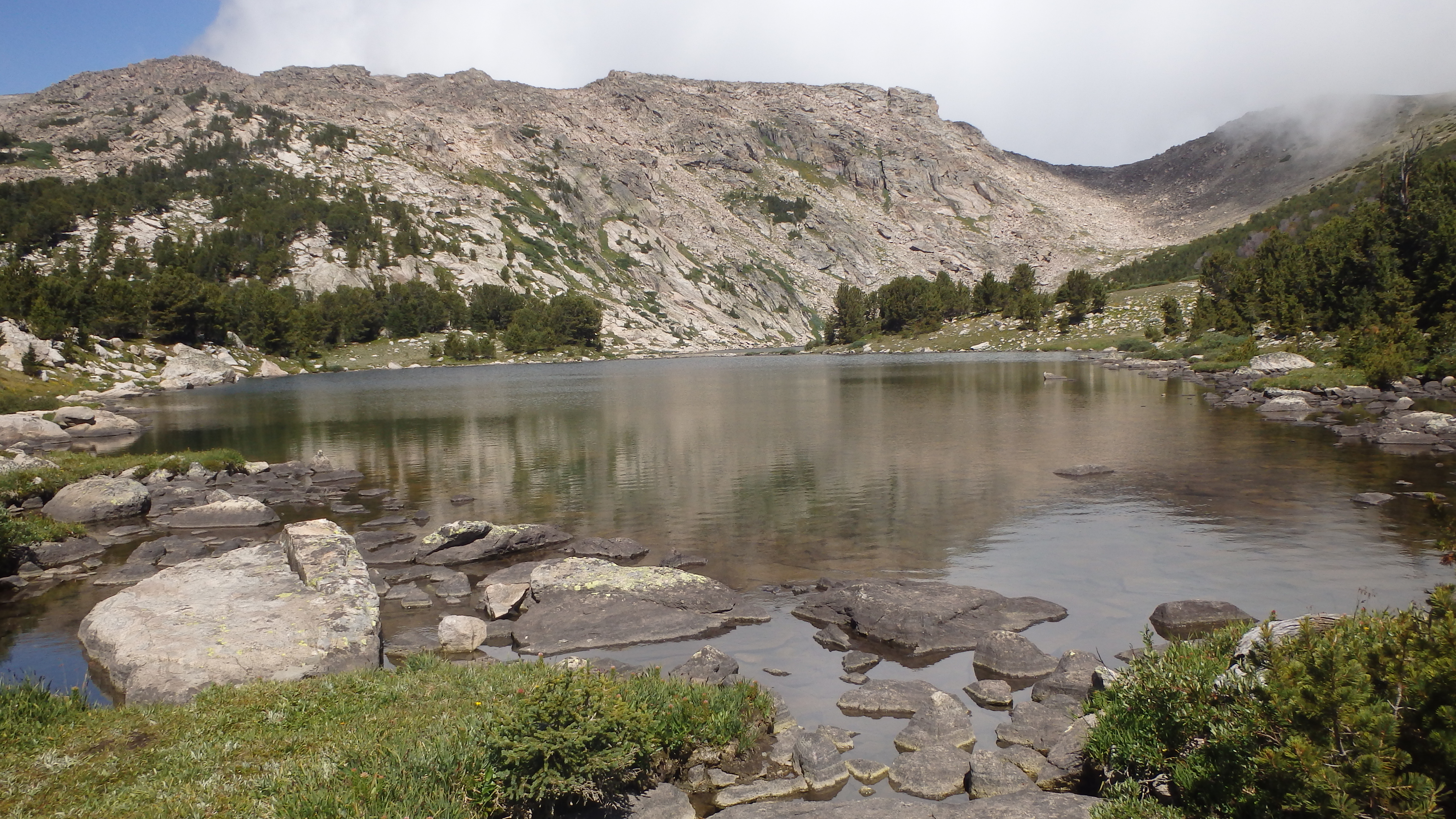
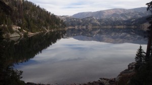
Timberline Lake
Timberline Lake is an alpine lake nestled beneath the Silver Run Plateau, located within minutes of Red Lodge. Scenic vistas surround the lake, leading you to wonder which is more beautiful- the surrounding rock and snow, or the lake itself. The lake has a beautiful turquoise hue, resulting from glacial melt above Timberline Lake. Snowfields, the remains of these glaciers, feed the lake today via Timberline Creek.
Timberline Creek is crossed a couple of times on this hike, although the first two miles of the trail are dry. The trail to Timberline Lake climbs about 2,000 feet in 4.5 miles, making it a relatively steep trail. Thankfully, the grade is only noticeably steep for the first couple miles.
(more…)
23 Aug 2015
Author: chris | Category: Hiking Trails in the Beartooth Mountains, Moderate Day Hikes, Montana Hiking Trails | Tags: Absaroka-Beartooth Wilderness, Beartooth Mountains, Moderate Day Hikes
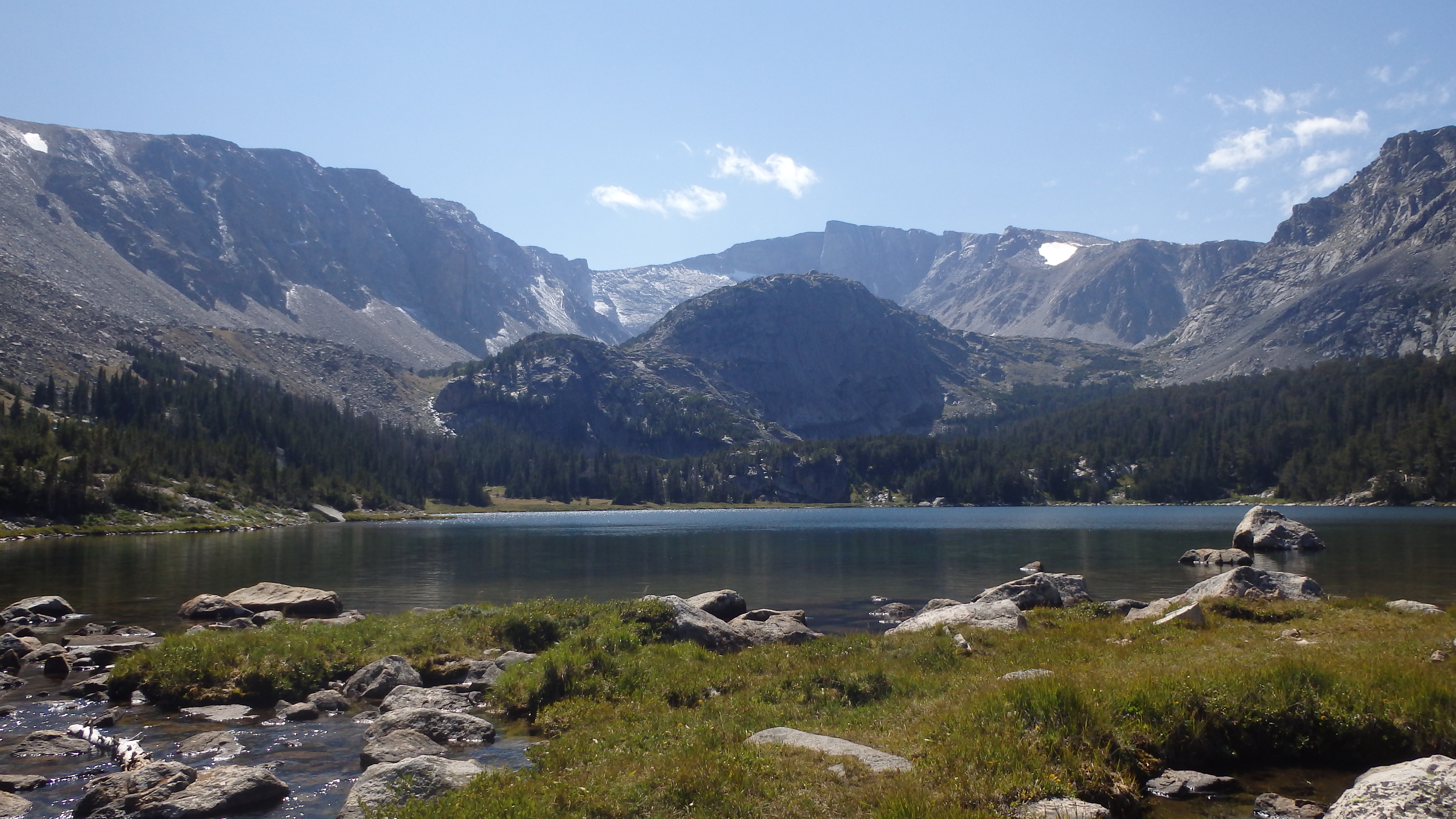
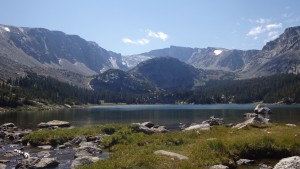
Lake Mary
Lake Mary is an alpine lake bordered by two high mountain plateaus- The East Rosebud Plateau rising from the west, and the Red Lodge Creek Plateau rising from the east. These two plateaus give Lake Mary a “top of the world” appearance, which is aided by the scenic trail to Lake Mary. At 9,960 feet, Lake Mary certainly isn’t the top of the world, but it will feel like it on this hike. Fortunately, most of the hike won’t make you feel like you’re climbing to the top of the world.
This hike covers 6 miles, gaining a little over 2,000 feet in elevation. Hikers can expect to spend half their hike on the first 5 miles, and half their hike on the last mile to Lake Mary. From Quinnebaugh Meadows to Lake Mary, you will climb 1,200 feet in just 1 mile. A light pack is recommended, unless you enjoy fighting gravity.
(more…)
10 Aug 2015