Sylvan Lake- Beartooth Mountains
Sylvan Lake
Sylvan Lake
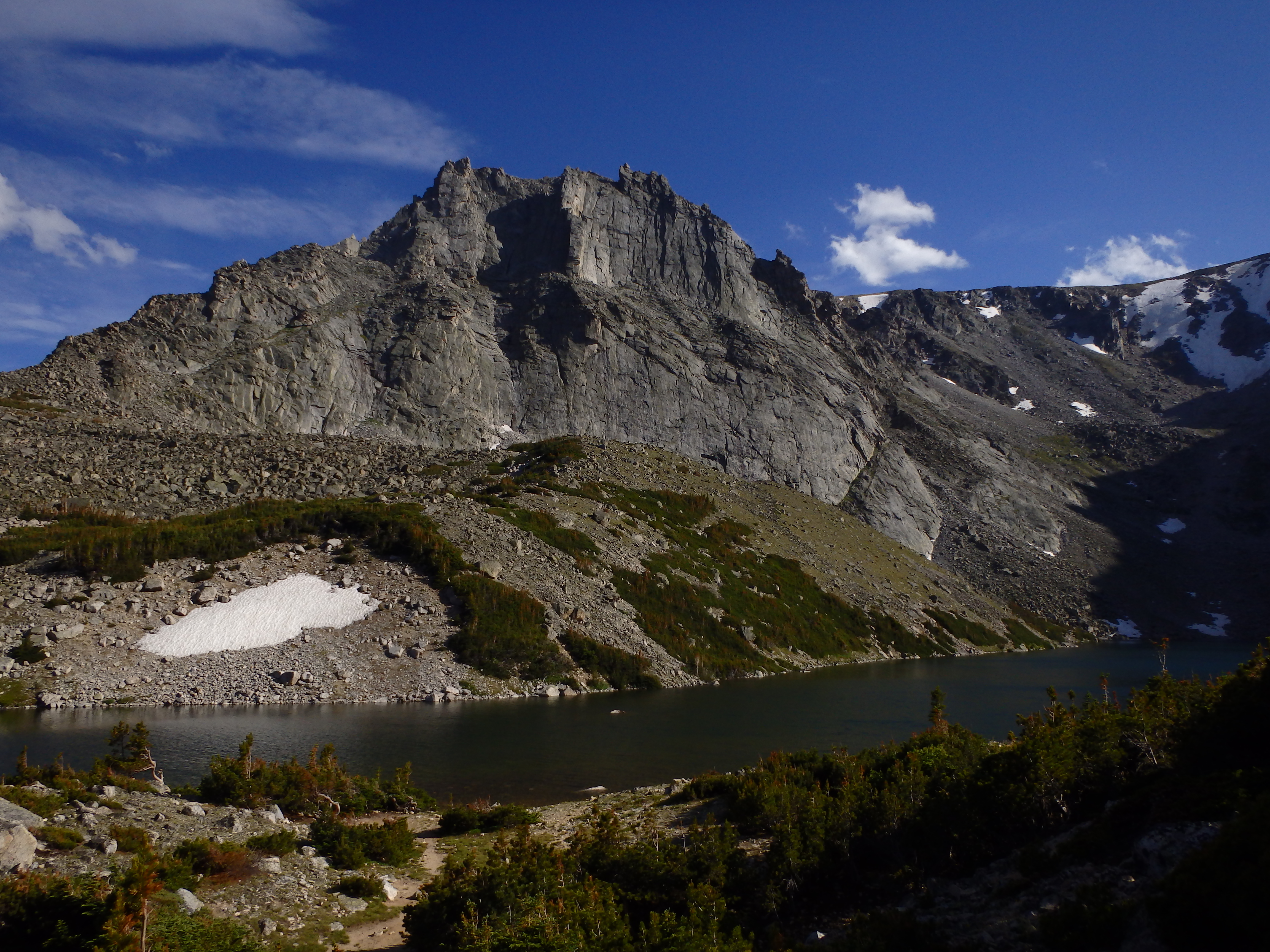
Shimmering beneath Sylvan Lake lies the prize most anglers and hikers seek- the California Golden Trout. First stocked in 1938, the golden trout at Sylvan Lake are well known in Montana for their genetic purity. Sylvan Lake’s golden population is so pure that the Montana Department of Fish, Wildlife, and Parks regularly uses the eggs laid by goldens at Sylvan Lake for stocking other lakes in Montana. If you seek the purest golden trout in the Beartooths, you should look no further than Sylvan Lake.
Although this trail presents a few difficulties, finding the trailhead is not one of them. Start off by entering the East Rosebud campground, and drive all the way to the northwestern corner (far back) of the campground, parking in the well marked trailhead parking lot. You can easily tell that this trail is going to be steep at this point- even the trailhead itself is on a hill!
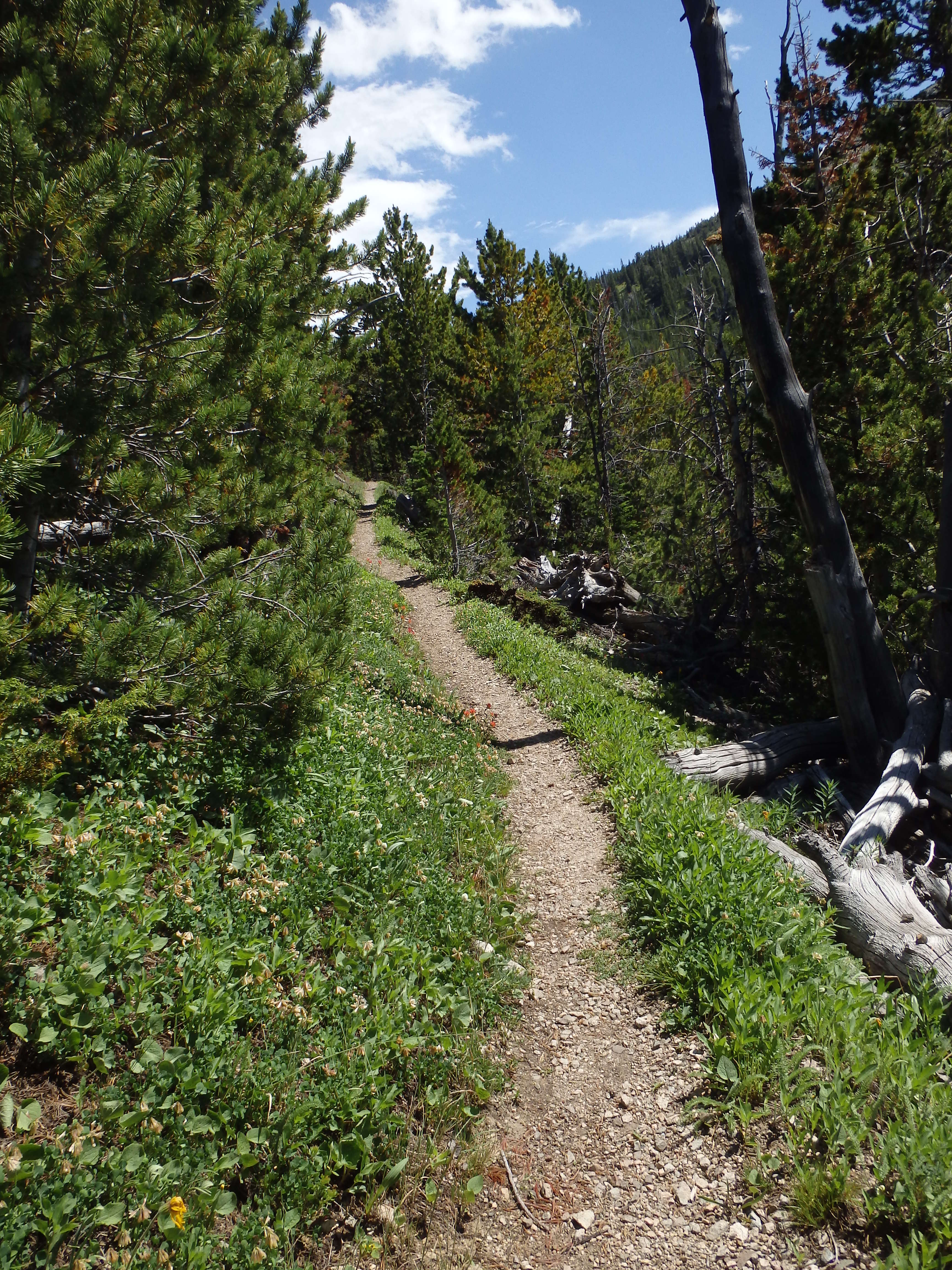
Hiking up the trail, the elevation gain on this trail becomes noticeable. Proper planning for this trail is important- keep your pack light! I hiked this trail once with a 55 lb. pack, and I despised my pack size every step of the way. Extra water should also be carried, if you plan on hiking this trail in the late summer. Although there are two good places to stop for water (1 mile in, and about 2 miles in), my personal preference is to not stop for water if I don’t have to. The trail is otherwise a dusty, winding trail that climbs the canyon wall rather swiftly.
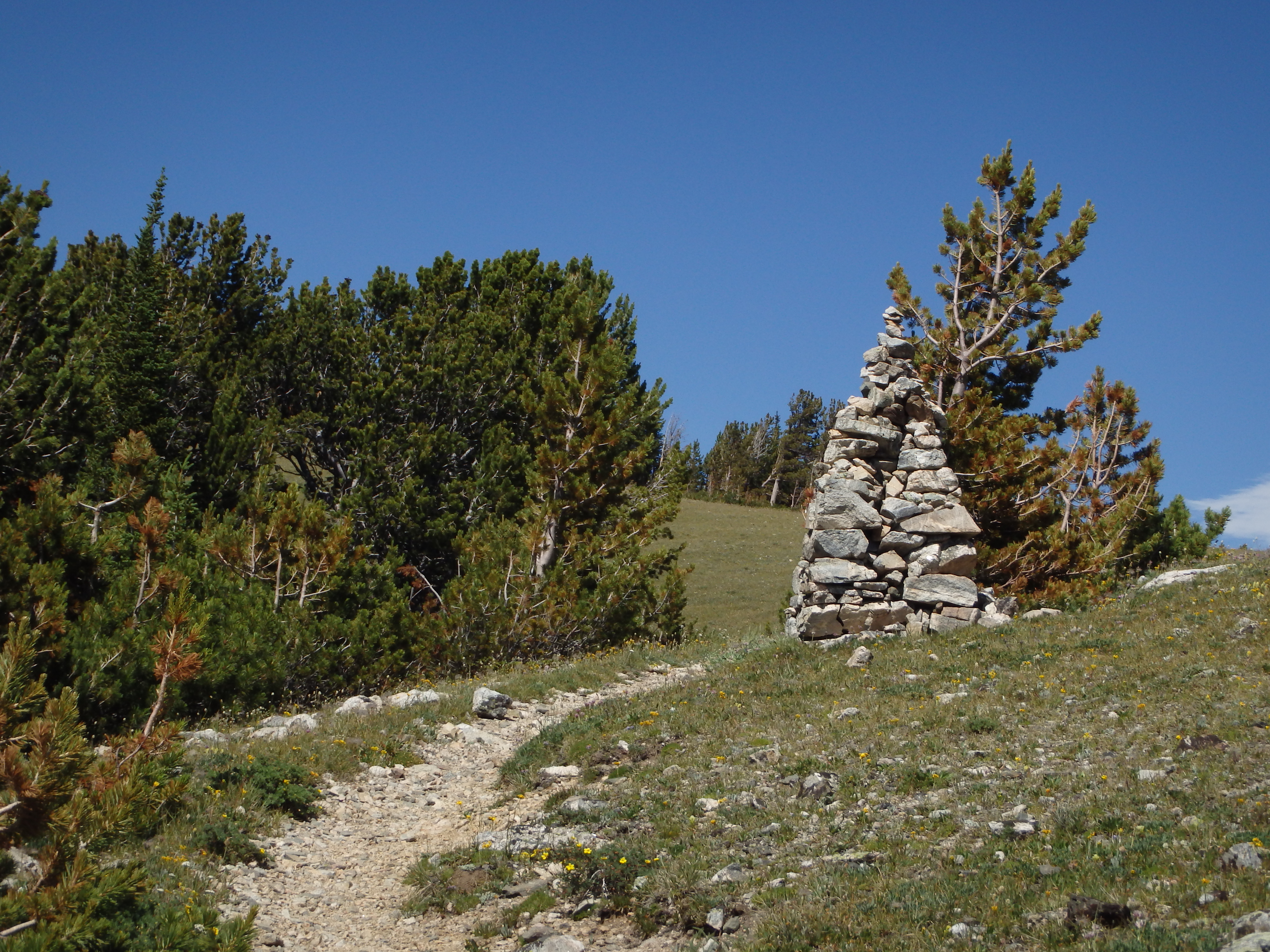
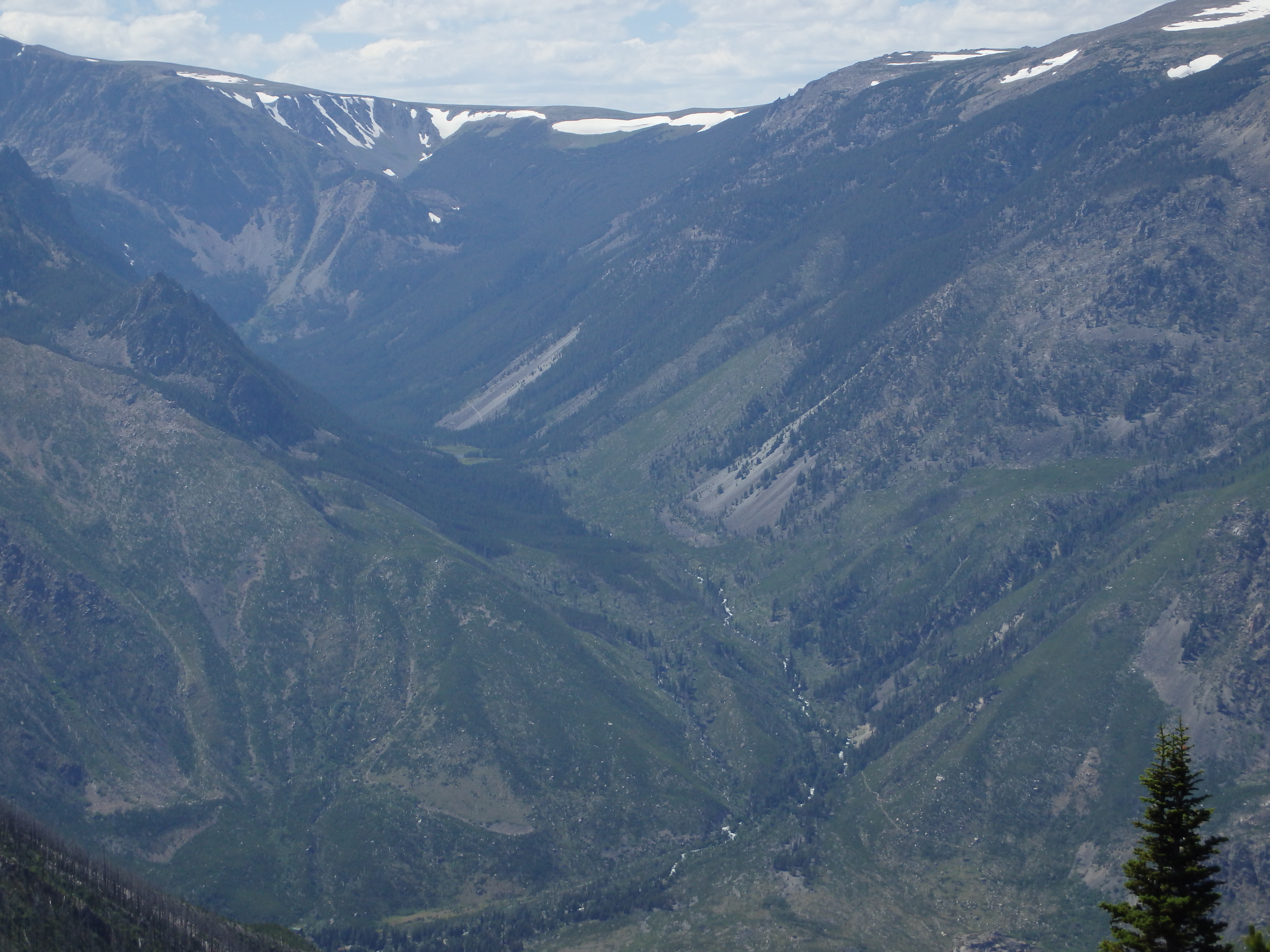
At about 3.5 miles the trail leads to the top of a ridge, an excellent spot for a break. The hardest part of the trail is behind you, and you’re now at the best spot to stop and take a break on the trail. Looking down into the East Rosebud valley, you can easily see East Rosebud Lake 2,500 feet below you. If you look to the right of East Rosebud Lake, you can see the Phantom Creek drainage, including Froze to Death Plateau. Make sure to bring your camera- the view is awesome!
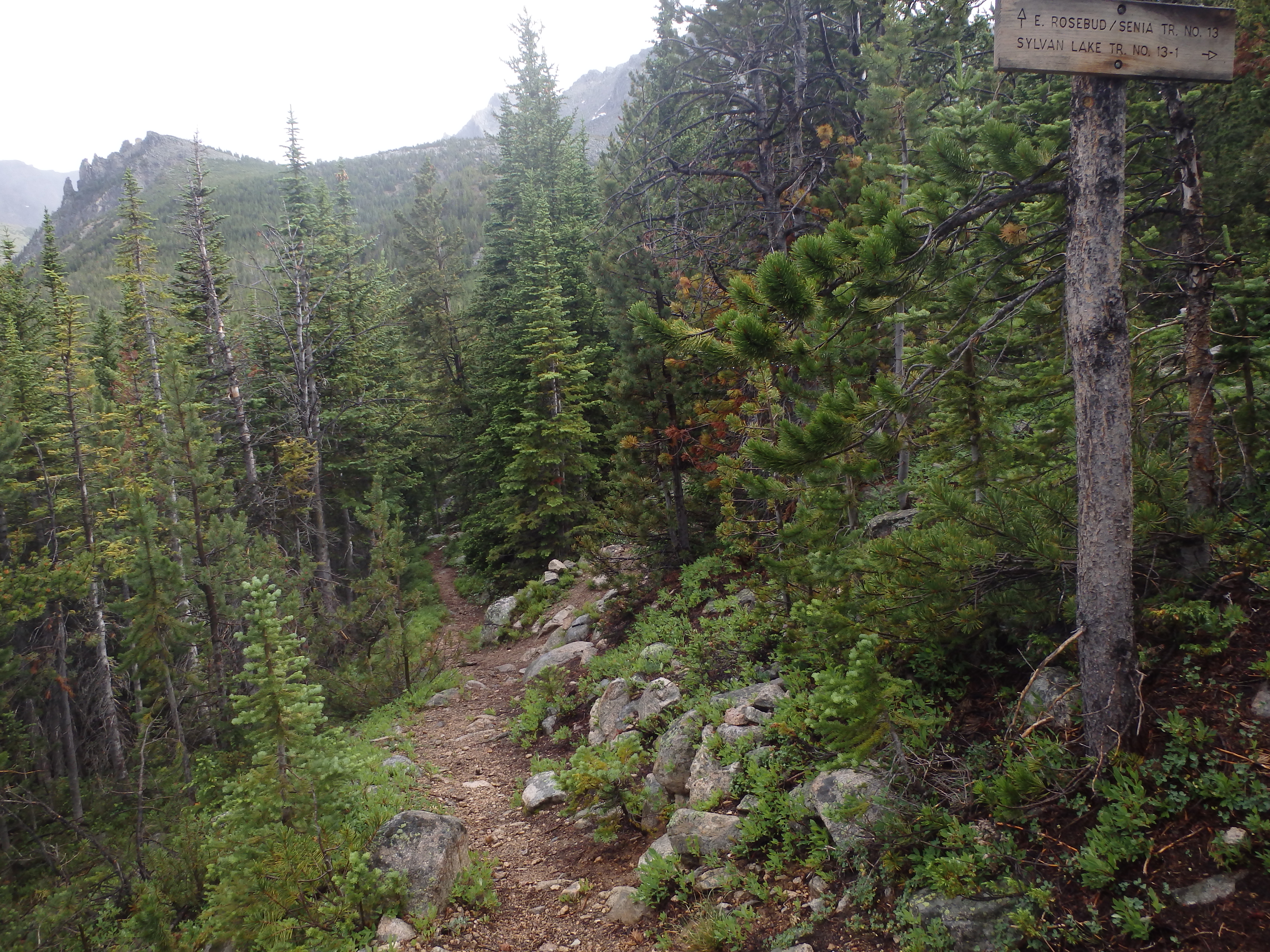
Moving down the trail from the ridge, the trail begins to disappear. Cairns mark the next several hundred yards of trail, and are easy to spot if you are cautious. Following the cairns, the trail leads into timberline. From here, it’s another 1.5 miles to Sylvan Lake. The trail runs downhill at first, but soon the spur trail to Sylvan Lake appears on the right. After this junction, it’s uphill again to the lake. Although this trail is well signed, hikers who are not paying attention may very well walk right past the sign. If you find yourself on a marshy trail, you may be on your way to Crow Lake, instead.
Once you take the turn onto the Sylvan Lake trail, it’s an uphill ¾ of a mile until you are greeted by the shimmering golden trout and alpine majesty of Sylvan Lake. Camp sites are non-existent at the lake itself, but there are several spots just before the lake that work well. If you plan on camping or fishing, you should expect to share the area- Sylvan Lake is no secret in the Beartooths. The best days of the week to visit are typically Tuesday through Thursday. You could very well have the lake to yourself on those days, as opposed to the busy weekend days.
The earliest you can expect to enjoy this trail would be mid-July, because of the massive amounts of snow and ice that accumulates in the winter. This lake is at relatively high elevation (9180 ft), so bring plenty of warm sleepwear. The nights in alpine country can be quite cold and windy. Regardless of when you enjoy this trail, consider hiking over to nearby Crow Lake– although the fishing isn’t nearly as good, the views will not disappoint!
Pictures from Sylvan Lake, and the Trail
 Cairn on Ridge marking Senia Creek Trail |
 View of the Phantom Creek Drainage |
 Senia Creek Trail |
 Junction with Crow Lake |
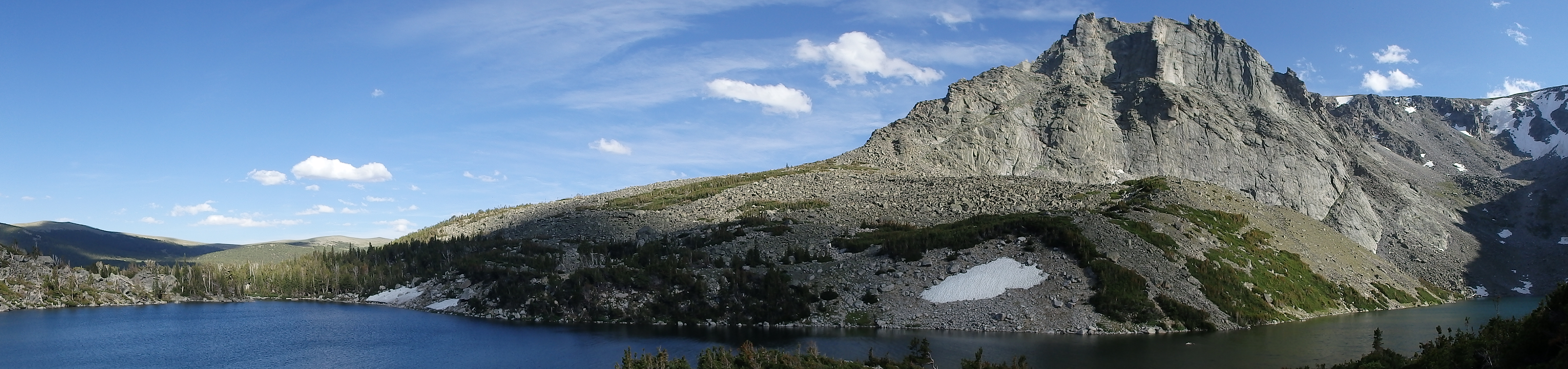 Sylvan Lake Panographic |
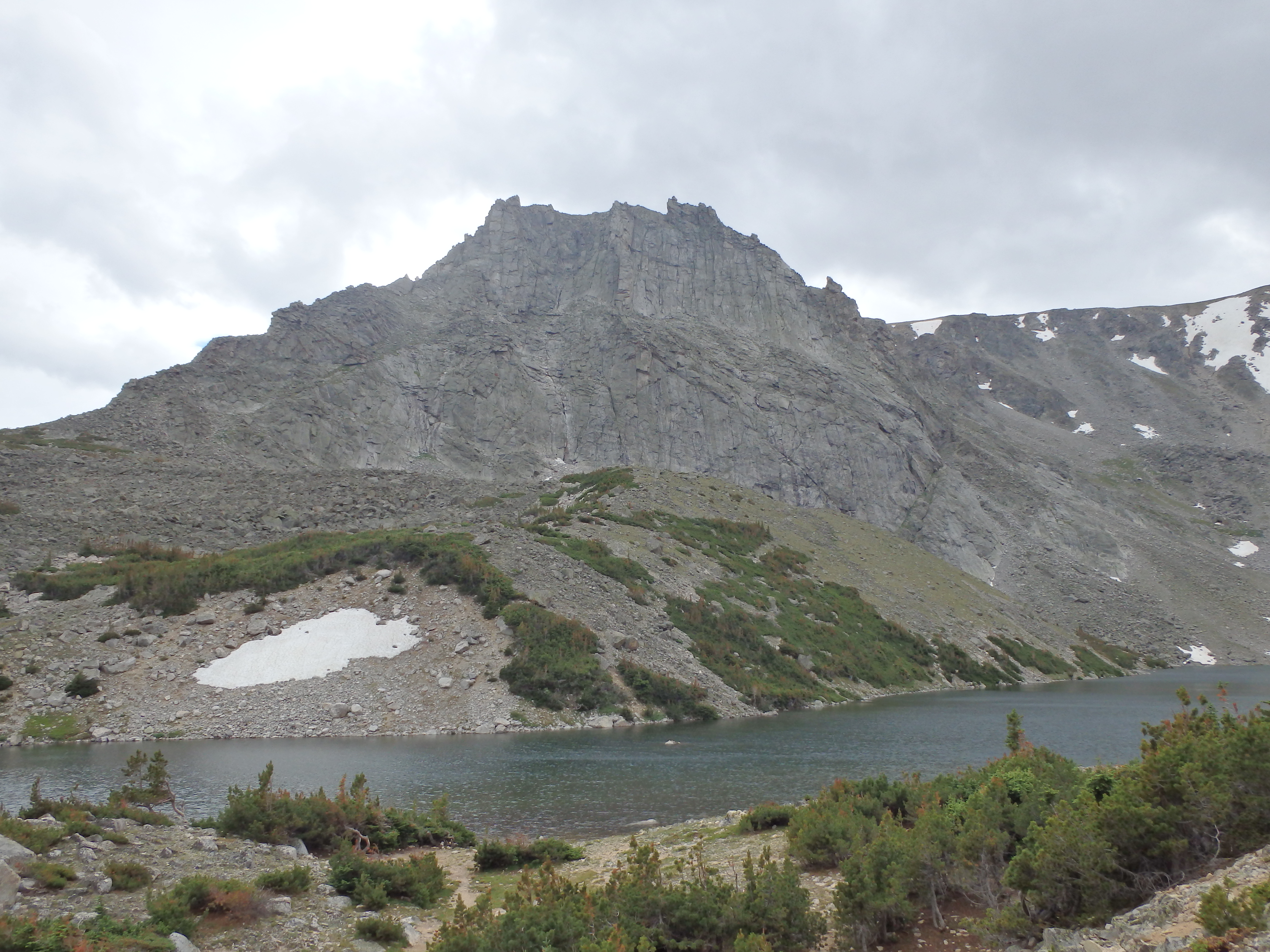 Sylvan Lake |
Directions to the Trailhead
From Absarokee, take Highway 78 south of town. About 13 miles down the highway, turn right at Roscoe (East Rosebud Road). Follow this road all the way (about 5 miles), until the road sharply turns to the right (if you drive straight, you will hit Luther Roscoe Rd). There is a bridge just before the turn, and a large forest service sign at this turn, so it’s easy to spot. From here, it’s another 10 miles to the campground, where the trailhead is located. The road is usually in fair condition, and is mostly gravel. Pull into the East Rosebud Campground on your left, just before the East Rosebud trailhead. Drive all the way to the back of the campground, and park at the Senia Creek Trailhead. The parking lot is fairly small, but is rarely near full.