Mystic Lake- Beartooth Mountains
Mystic Lake

Mystic Lake- Beartooth Mountains
Nowhere else in the Beartooths offers the unique opportunity to see a hydroelectric dam in action, while at the same time enjoying the surrounding wilderness. Although the lake itself is not within the Absaroka-Beartooth Wilderness, most of the trail and surrounding area is. That won’t stop you from enjoying Mystic Lake, the power company that controls the dam has had minimal impact on the lake itself. Other than the dam, and a small house by the dam, the lake is in the same condition that Mother Nature left it (albeit a little bigger).
From the trailhead, the hike starts at the hydroelectric plant. Going uphill from there, the trail continues to climb through mature Lodgepole Pine forests with the occasional Aspen. This is the toughest part of the trail, with the steepest grade. The trail continues over a sturdy bridge (crossing the West Rosebud Creek), and weaves in and out of Lodgepole Pine stands, and Aspen stands. Along the way, you can appreciate the need for preservation of this forest, as there have been numerous travelers that have carved their initials into the Aspen trees. This is forbidden by wilderness area rules, as well as Custer National Forest regulations. Yet, there is always a select group of individuals that seem to enjoy ruining such a pristine forest. Once you leave this scarred part of the trail behind, you enter a rock field.
This rock field is a bear to cross, during mid-day on a hot day. Do yourself a favor and plan your hike so that you pass this field either in the early morning or in the late afternoon. Otherwise, if you drink as much water as I do when it’s hot, you’ll need to pack an additional water bottle. This rock field is approximately a mile long and contains a good number of switchbacks. As you climb, be sure to take plenty of pictures, though. One of the most scenic parts of this hike is the view of the West Rosebud valley. You can also easily see the pipeline that is used for the hydroelectric plant, from this point on the trail.
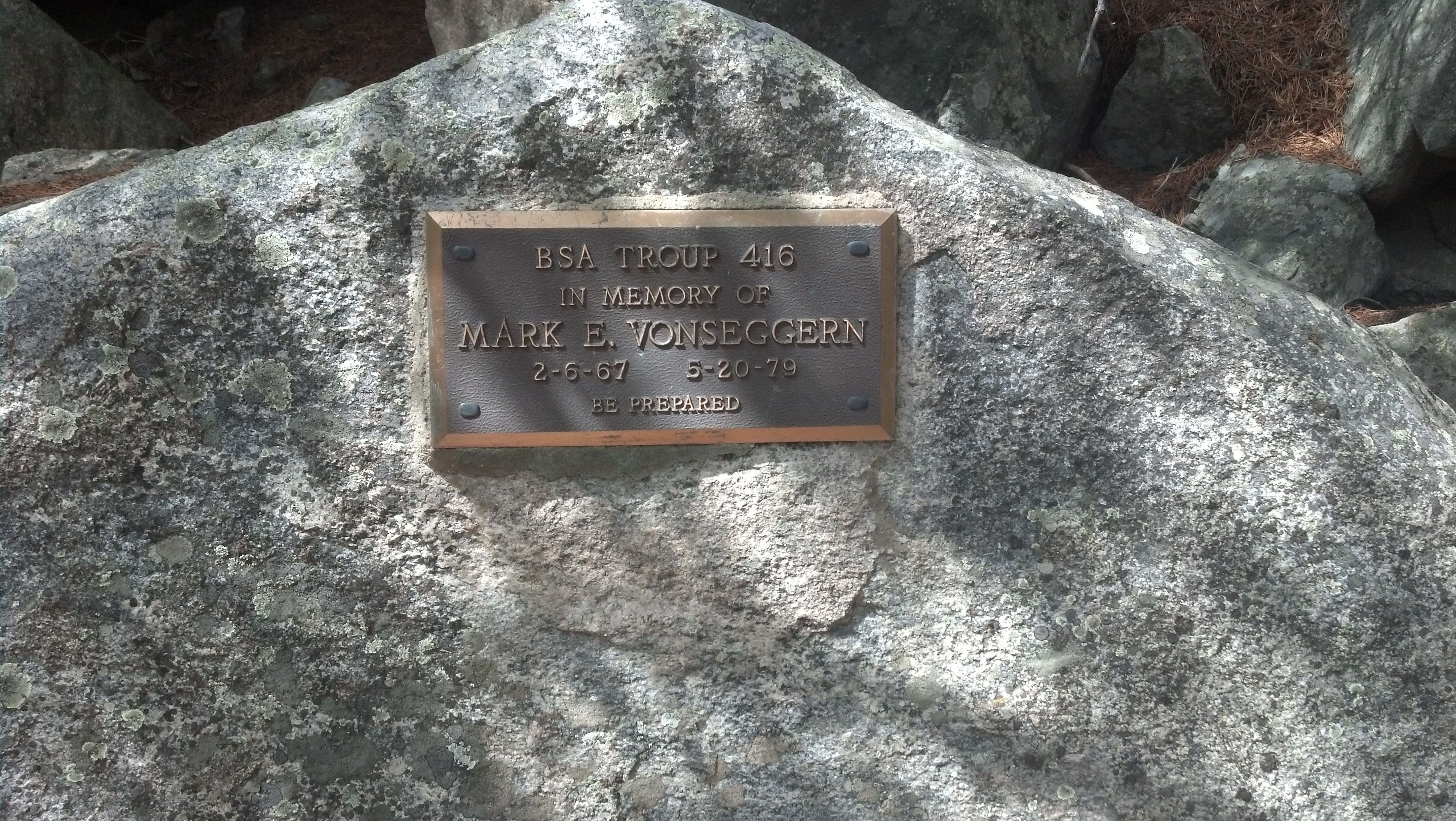
Mark E. Vonseggern’s plaque
When you are crossing this rock field, pay particular attention to where you place your footing. In 1979, a Boy Scout trooper named Mark E. Vonseggern fell from a spot on the rock field and perished. There is a plaque on the trail, near the trailhead, that remains today. This is a reminder that although the wilderness is a fun place to recreate in, it is still a deadly environment. The rock field into Mystic Lake is especially treacherous in the early season. Large snowbanks can block the trail in the early season, leading to accidents. For inexperienced hikers, I recommend hiking this trail from June-August only.
After the rock field, you hike into a small stand of Lodgepole Pine. There are a couple of nice places to rest at this spot if you’re hiking this trail in the early afternoon. Pushing on, you are greeted with one last reminder from the forest service- please do not camp closer than 300 feet (100 yards) from Mystic Lake. This rule is essential in this area since this trail is one of the busiest trails in the Beartooths. Once you move past this last reminder, you are greeted with one of the most beautiful overlooks in the Beartooths- Mystic Lake. Rest at this overlook and take in the beauty of the nearby Tempest, Mystic, and Granite Peak mountains.
Mystic Lake is the deepest lake in the Beartooths, at more than 300 feet. Also, it is the largest lake in the Beartooths, at over 2 miles long (the way the crow flies). The trail wraps around the lake for an additional three miles once you are down at the lake level. I highly recommend walking this trail, as it is a gorgeous trail that is in excellent condition. It has a fair share of hills as well, so it isn’t a boring three-mile hike.
Fishing at Mystic Lake is excellent, and although the Rainbow Trout are small (6-8 inches), they are tons of fun. The Montana Fish Wildlife & Parks keeps Mystic Lake stocked with Rainbow Trout, which are usually easy to catch. I have a few personal favorite fishing spots at Mystic Lake, one of which being close to one of the several small islands that are just tens of feet from the shore. Another excellent fishing spot is at the inlet of the lake, which although it adds more distance to your hike (about 3 miles), it’s worth it.
Mystic Lake is a fabulous spot for camping. Although the lake receives high use in the summer months, the large size of the lake helps to thin out some of the crowding. Do yourself a favor, and pitch your tent after about a half-mile from the lake outlet. Few people hike past the first half-mile of the trail, and the campsites there are plentiful. Make sure that if you do camp at Mystic Lake, you practice zero-impact camping.
Once you’re at Mystic Lake, you’re surrounded with possible day hike trips. If you’re a climber, you can join the legions of climbers that tackle Granite Peak. If you’re a fisherman, you can fish nearby Silver Lake, Island Lake, and Huckleberry Lake. If you’re a hiker who appreciates a challenge, you can hike to Froze to Death Plateau, and spend an hour taking in the scenic vistas (yes, the scenery is worth the tough hike). Regardless of your final destination, or activities at the lake, be sure to enjoy the scenery at Mystic Lake. Most importantly, be sure to help preserve the view by picking up any trash that you see.
Pictures from Mystic Lake, and the Trail
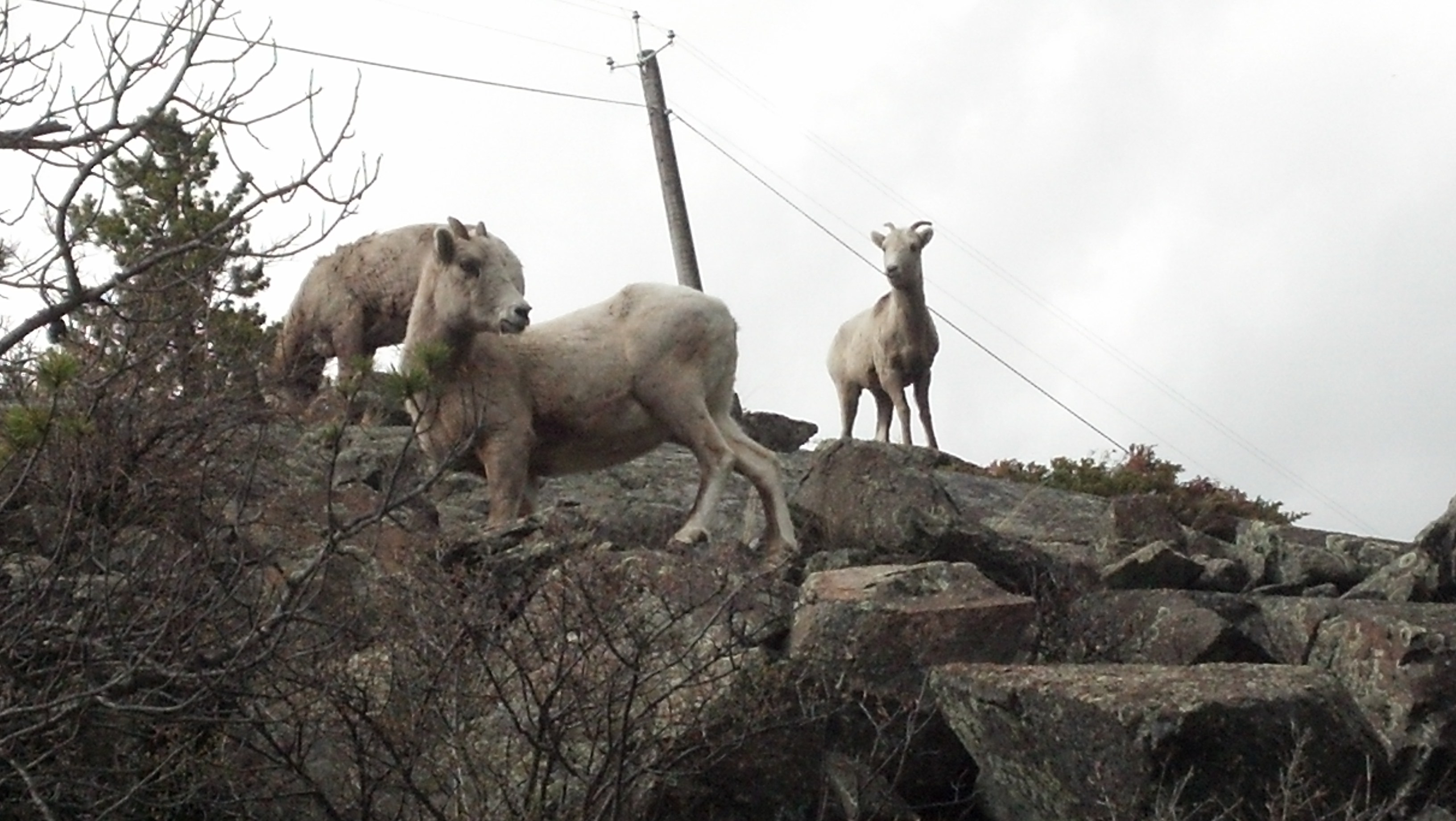 Bighorn Sheep on Trail to Mystic Lake |
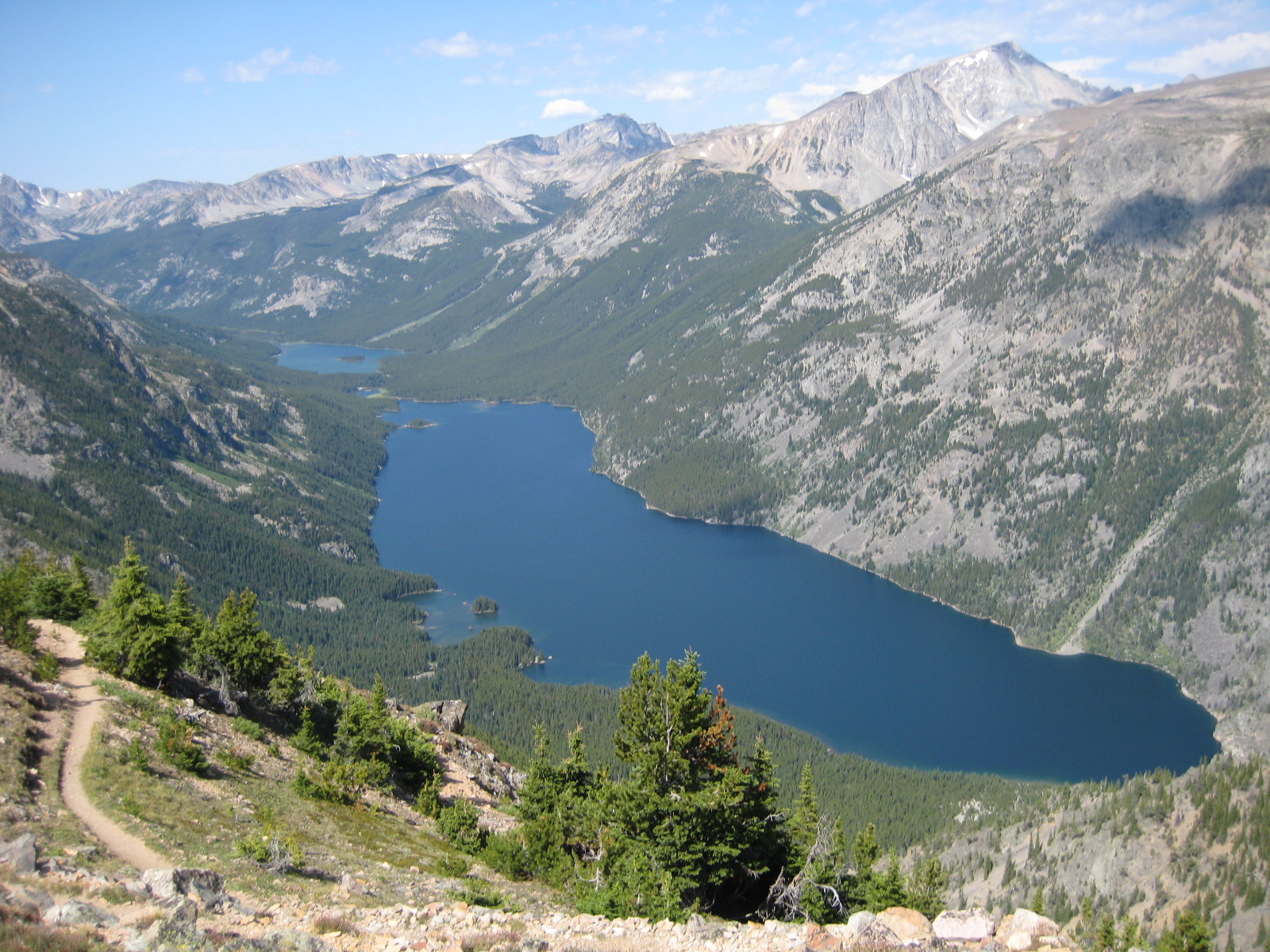 Mystic Lake, and Island Lakes, from the Froze to Death Plateau |
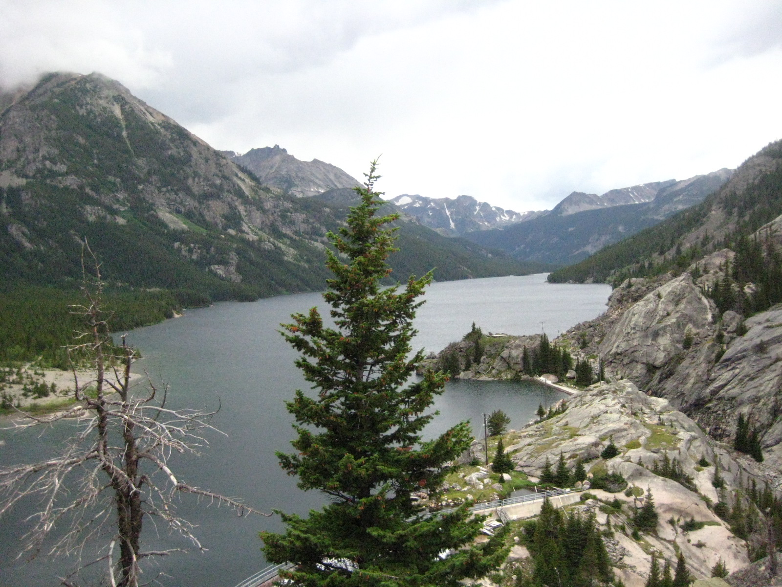 Mystic Lake, at the overlook |
 My Son’s First Fish- at Mystic Lake |
 Trail to Froze to Death Plateau |
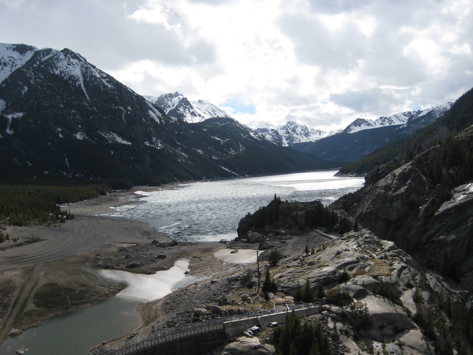 Mystic Lake in Late May |
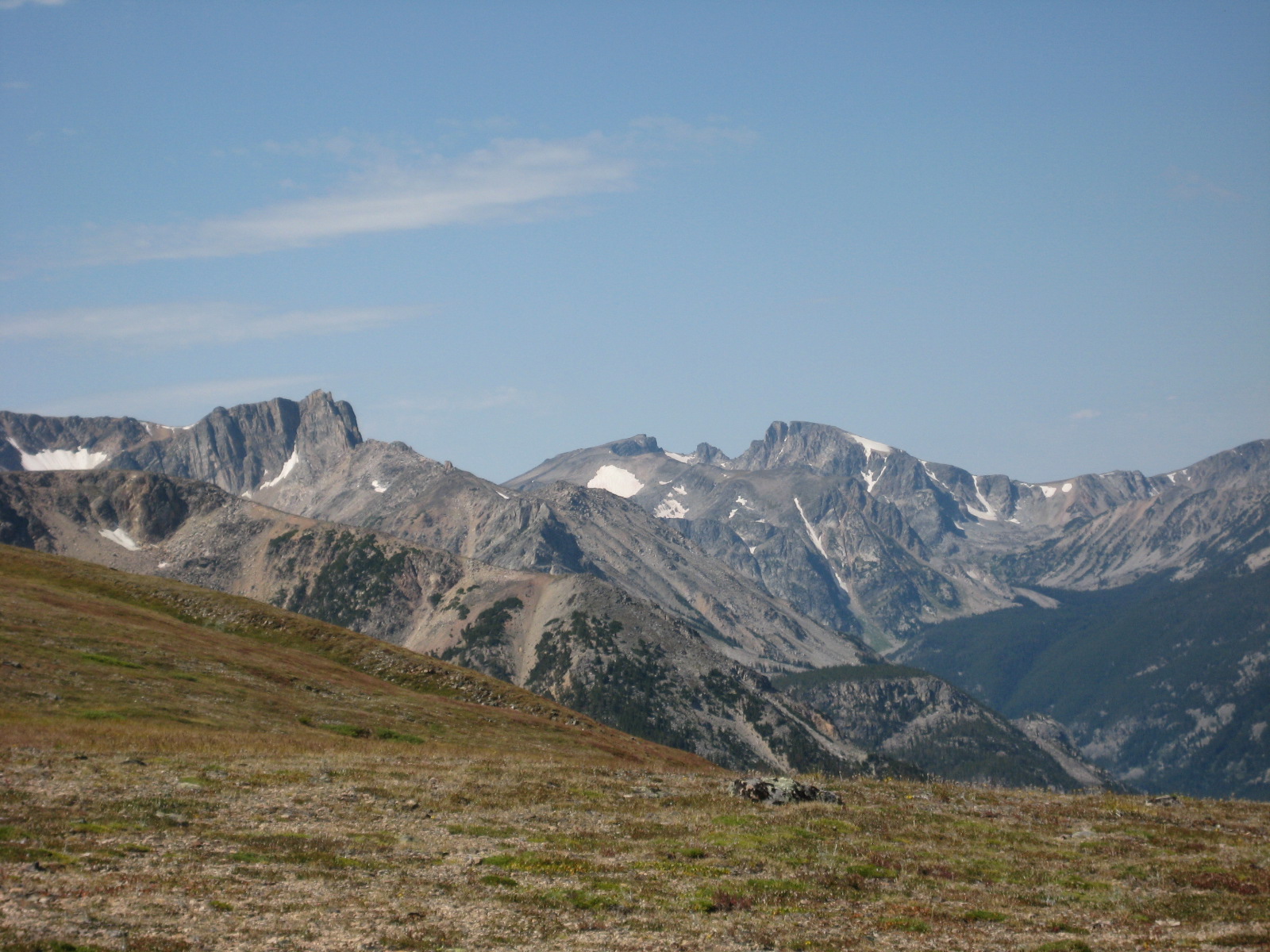 Mystic Mountain, from Froze to Death Plateau |
 Rock Field on Trail to Mystic Lake |
Directions to the Trailhead
From Absarokee, head south of town on Highway 78. Turn right a couple of miles outside of Absarokee, onto Highway 419 (there will be a gas station at this turn). Drive down Highway 419 for 6 miles, passing through Fishtail. Once you drive through Fishtail, drive one more mile down Highway 419, and then turn left onto West Rosebud Road. Follow this road for seven miles, turning left at the sign to Mystic Lake. Travel down this gravel road for about 14 miles (passing Emerald Lake and West Rosebud Lake), and park at the trailhead. This is the end of the road (the rest of the road is closed to the public), and the trailhead is easy to find.

These posts are great! Been very helpful in planning. Thank you!
Glad to hear that you’re enjoying my site!
Hiked to the lake on 6/30/20 with my 6yo. GREAT hike, no snow and beautiful sights. Did this one 36 years ago as a 10yo and this was my first time back…nothing’s changed!!!!
Where might we get a map of the trail? Online?
Hello. Hoping to hike this on the weekend of September 25th. Is it feasible to do so?
The map to the trail is the USGS map link on the right of your screen, or if you are on a mobile browser, the bottom of the screen.
Early September is usually fine. In the Beartooths, 8,000 feet becomes locked out with snow as long as early October.