Kersey Lake- Beartooth Mountains
Kersey Lake
Kersey Lake
You will rarely find a lake that offers fishing, good wildlife viewing opportunities, and is close to a major highway. Kersey Lake, located near Cooke City, Montana, is a relaxed day hike with the all of these features. The hike is an easy hike (3 miles round trip), and gains less than 200 feet of elevation. This makes the hike a perfect first hike for small children, or a quick hike for travellers passing through the area. The road to the trailhead is paved, so any motor vehicle can make the drive- something that is rare for a lake next to the Beartooth Absaroka Wilderness.
Driving to the trailhead can be considered an adventure itself. Whether if you are headed from Red Lodge, Yellowstone National Park, or Cody, you will pass trout filled lakes along the way, scenic alpine vistas, and glacier fed streams. Access to the trailhead is possible most of the time from late May to early October, but it is always best to check the Montana Road Conditions Map before you head out. The well signed Clarks Fork Trailhead is located 58.1 miles from Red Lodge, or 3.4 miles from Cooke City, on US 212.
This is a popular trailhead, and traffic is heaviest during the middle of summer, and lightest in the early summer and late fall. Although these times of the year may be the best for traffic, they can also be the most unpredictable. Make sure you plan well for your hike- afternoon thunderstorms are common in this part of the Beartooths. This article on day hiking gear can help you prepare for the hike, if you are unsure of what to bring.

Bridge over the Clarks Fork Yellowstone River.
Starting from the Clarks Fork trailhead (trail 3), the trail leads you over the impressive Clarks Fork Yellowstone River as it gushes into a narrow canyon. There is an opportunity to fish the waters just before they tumble into the rapids, after approximately a half mile down the trail. At this point, the water is so calm and wide that you will almost think it is a lake. This portion of the trail gets heavy use, especially in mid to late summer. The first 2/3 of a mile to Kersey Lake is the first 2/3 of a mile on the 26 miles of trail known as the The Beaten Path. Every year, thousands of hikers hike this trail, or branch off onto one of the many side trails. Speaking of side trails, at 2/3 of a mile down the Clarks Fork Trail, turn left onto trail 564.
This portion of the trail becomes rougher, but is not anything that the average person could not hike. Early in the year, the outlet stream from Kersey Lake floods a portion of the trail. This obstacle can be cleared easily enough by crossing on the many logs that are near the trail. Later in the year, this stream is easier to cross. Other than this obstacle, the trail from this point on is easy to follow.

This portion of the trail can be muddy in the early season.
Continuing along trail 564, the grade slighly increases, as you hike up the side of a small hill. This portion of the trail and beyond was burned in 1988, although the forest is rapidly recovering. Continuing along the trail, you are given the option of turning left, towards Curl and Broadwater lakes, or continuing straight. Continue straight for about 400 yards, and arrive at Kersey Lake.
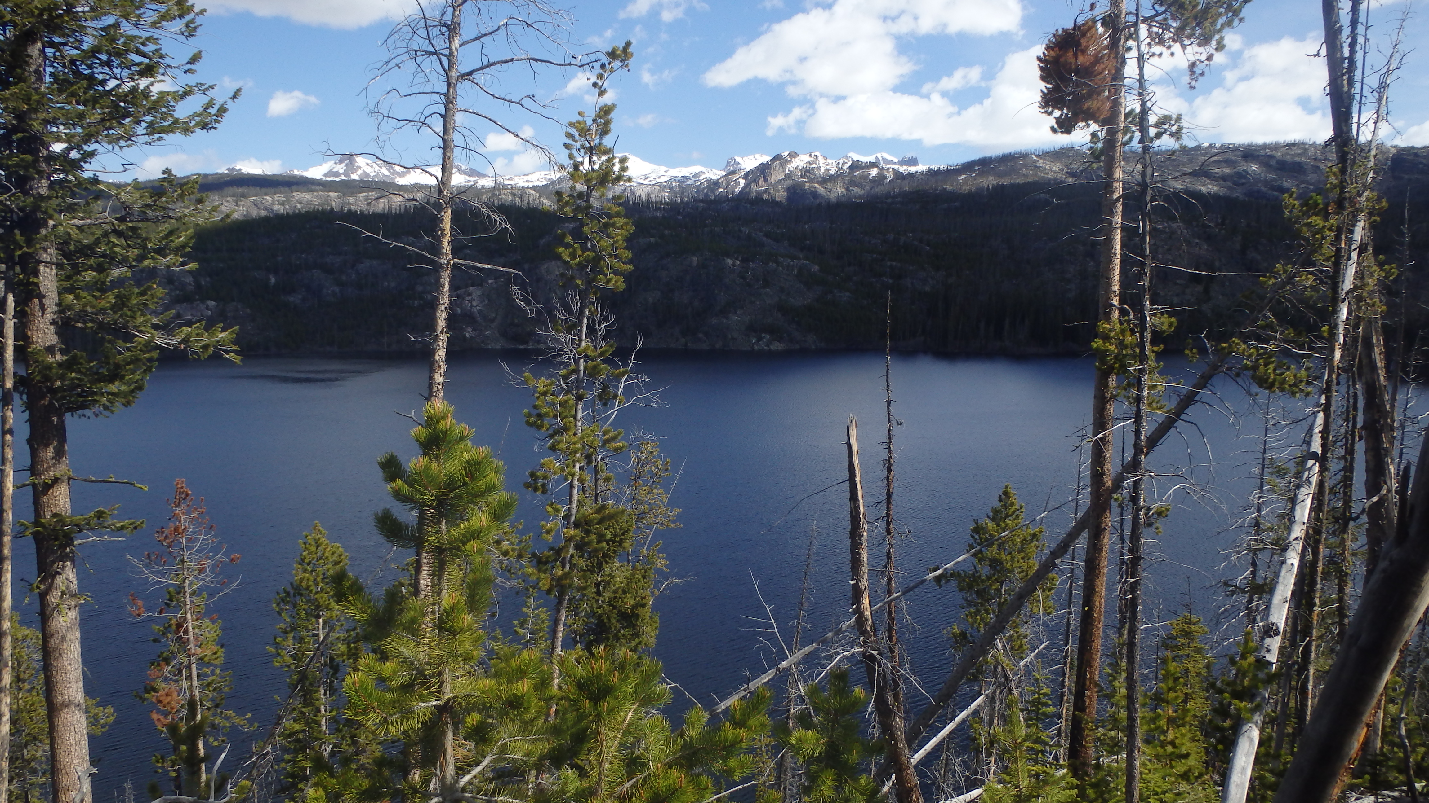
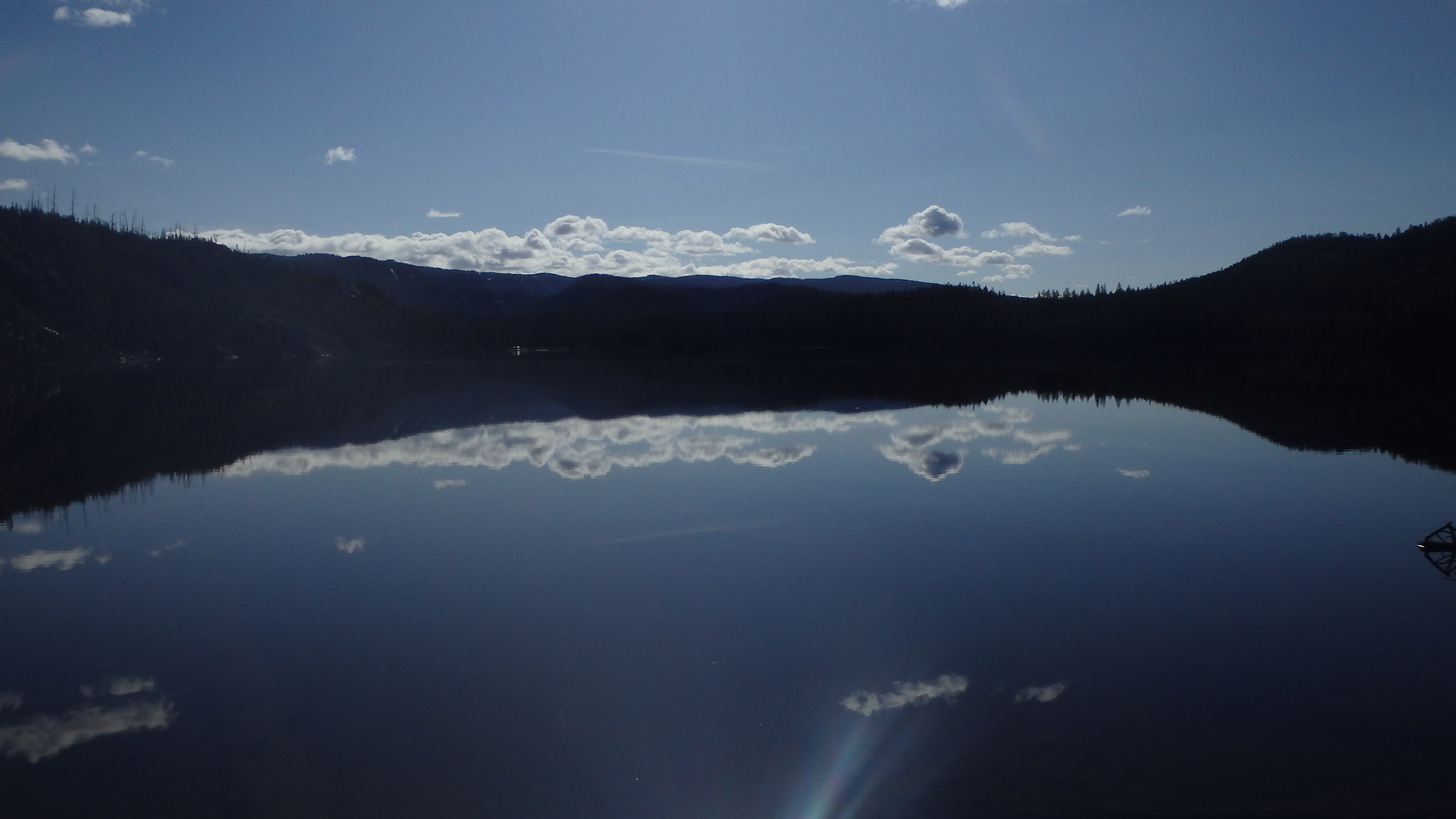
Kersey Lake is a muddy lake, but it does offer some fishing opportunities. Rising trout can easily be seen on this lake, and you should adjust your fishing accordingly. Trout aren’t the only resident animals in the area- bears, moose, deer, and eagles are all common along this trail, and at Kersey Lake. For this reason, you should be certain to take the proper precautions against bear or moose attacks. Always keep your distance from wildlife, and remember that a wild animal can attack at any time. Moose attacks are extremely common, and the surrounding area is notorious for bear attacks. Proper protection against bears is essential on this hike.
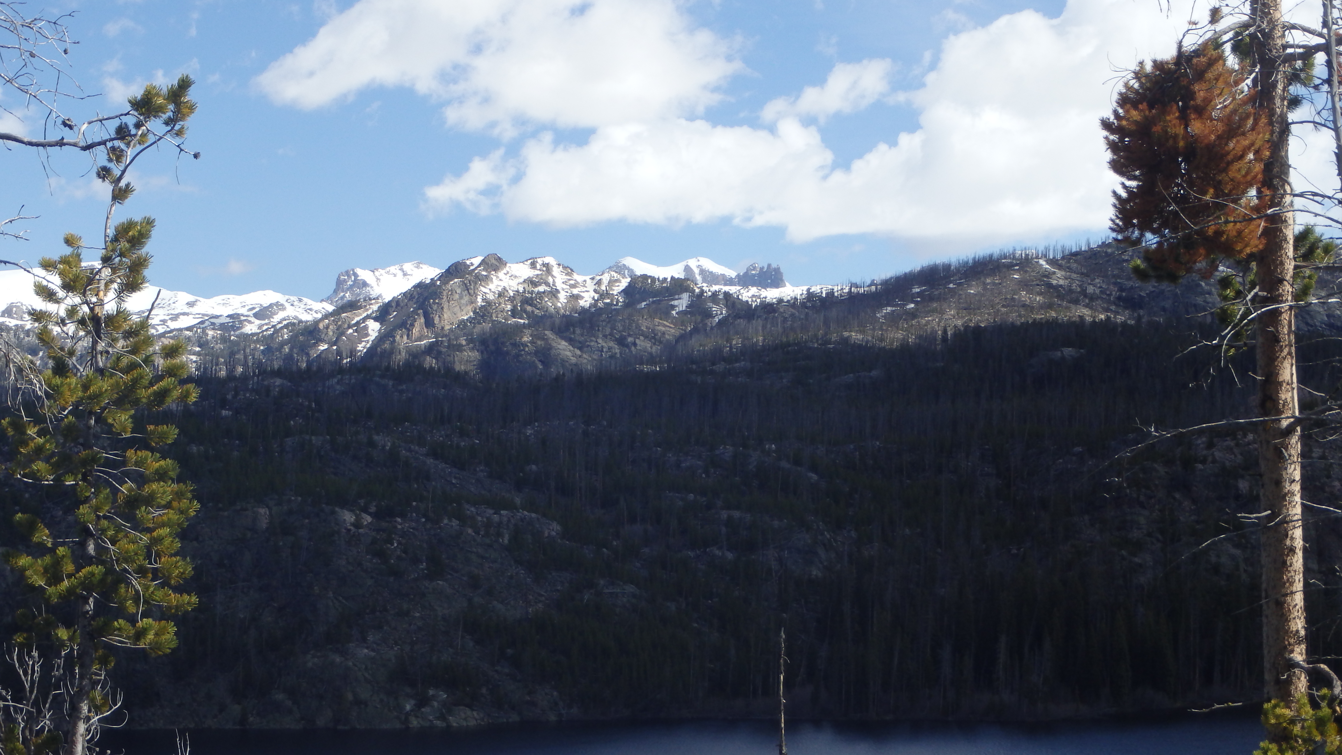
View Along Clark Fork Trail
Another option to this trail would be to hike straight along the Clarks Fork Trail, instead of turning left. This takes you to a less desirable side of Kersey Lake, but the trail is easily enough traversed in the early season, if you find yourself unable to cross the outlet stream on trail 564. The distance is similar, and if you miss the turn off to Kersey Lake, you will know it- the Clarks Fork Trail leads you above Kersey Lake for a wonderful view of the surrounding area. This trail can lead you to the inlet of Kersey Lake, or allow you to visit nearby Fox Lake, or Rock Island Lake.
Regardless of which trail you take to Kersey Lake, be sure to leave no trace behind of your presence, and carry proper protection against bears. One is critical to your health, and the other is critical to the forest’s health. Thousands of hikers use a section of this trail every year, and their impact is easily seen. Thanks to the efforts of the Custer and Gallatin National Forest rangers and trail crews, this trail is regularly maintained and cleaned. Please remember the efforts of these men and women when you hike this trail.
Pictures of Kersey Lake, and the Trail
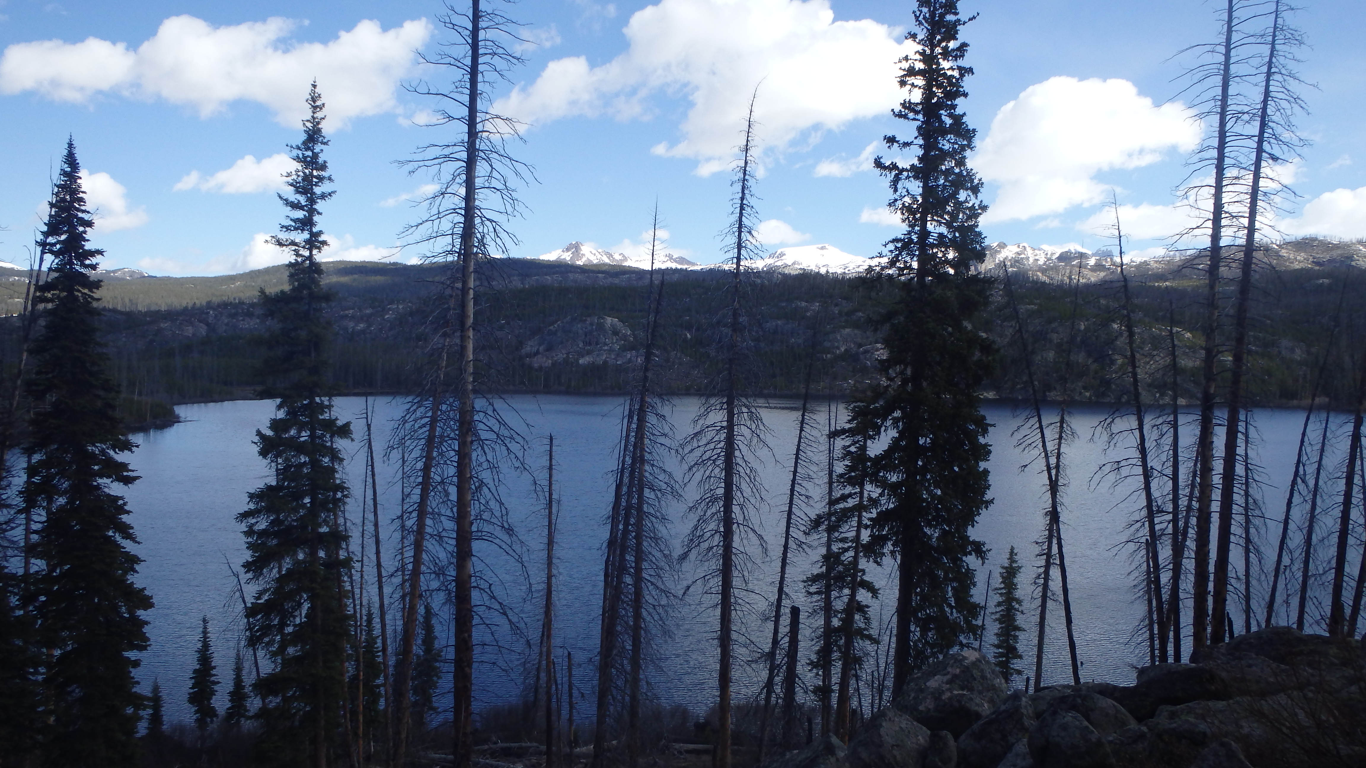 Kersey Lake from Clark Fork Trail |
 Kersey Lake from Kersey Lake Trail |
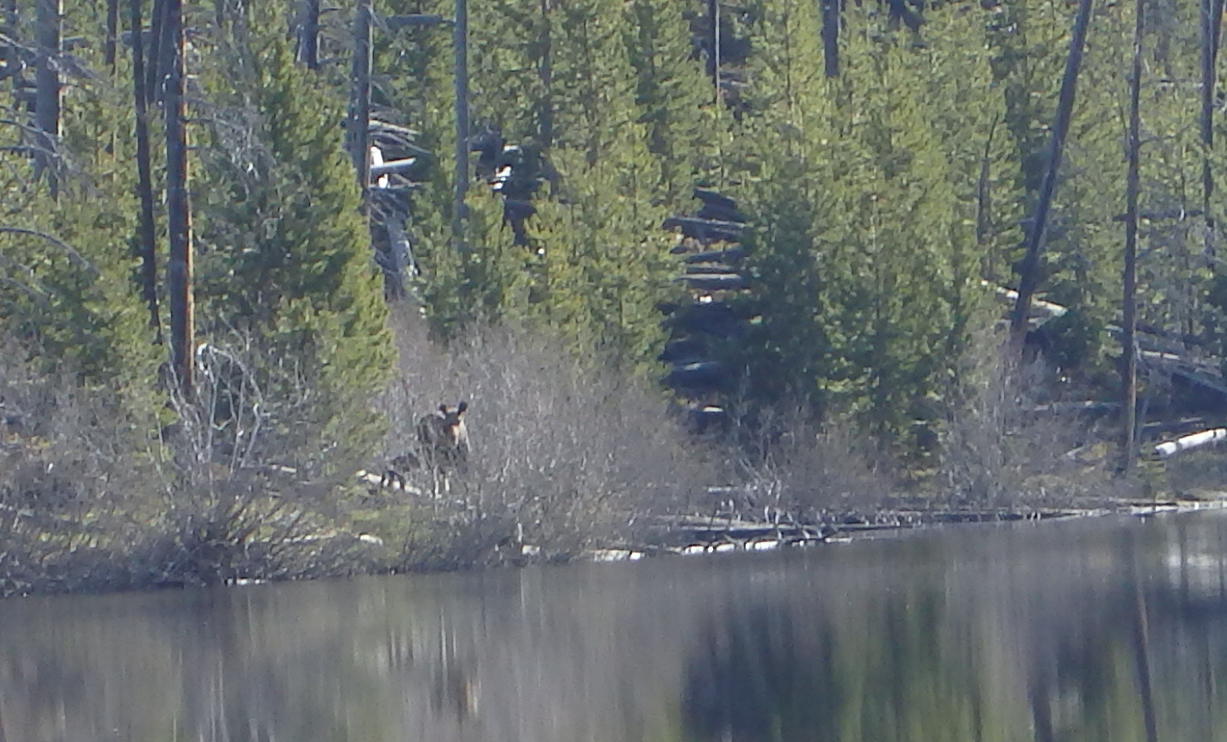 Moose at Kersey Lake |
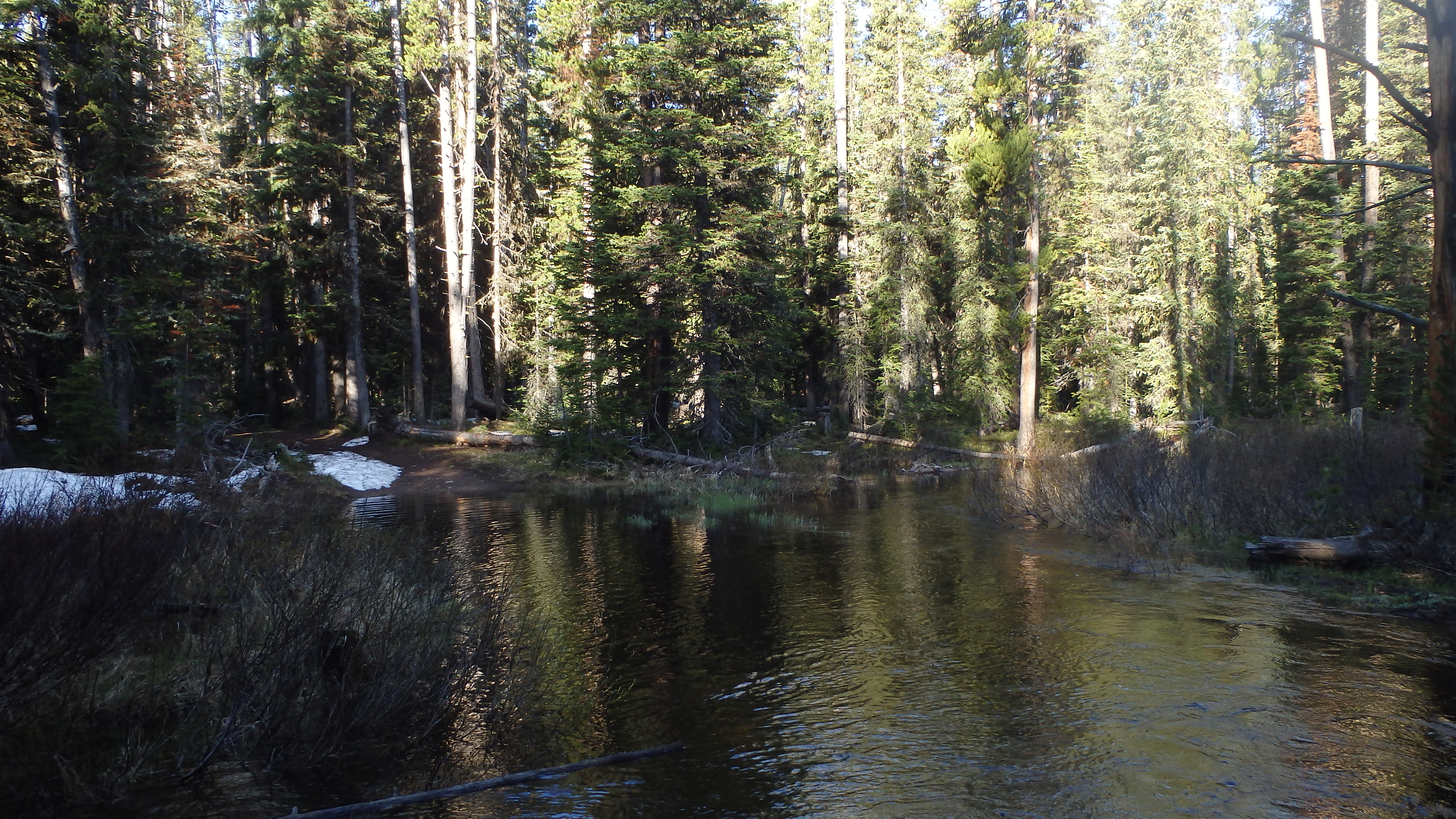 Kersey Outlet Crossing |
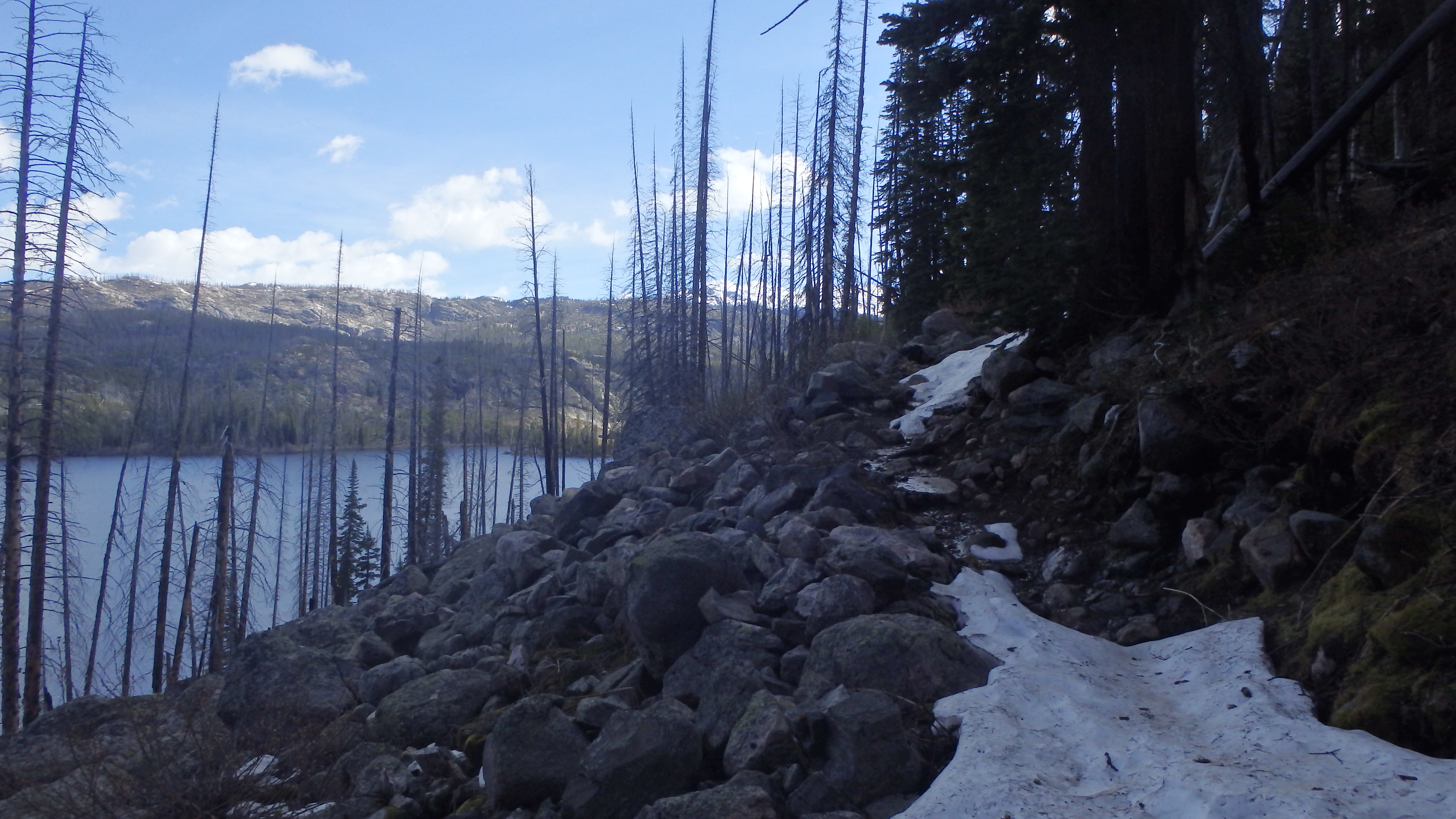 Snow on Clarks Fork Trail |
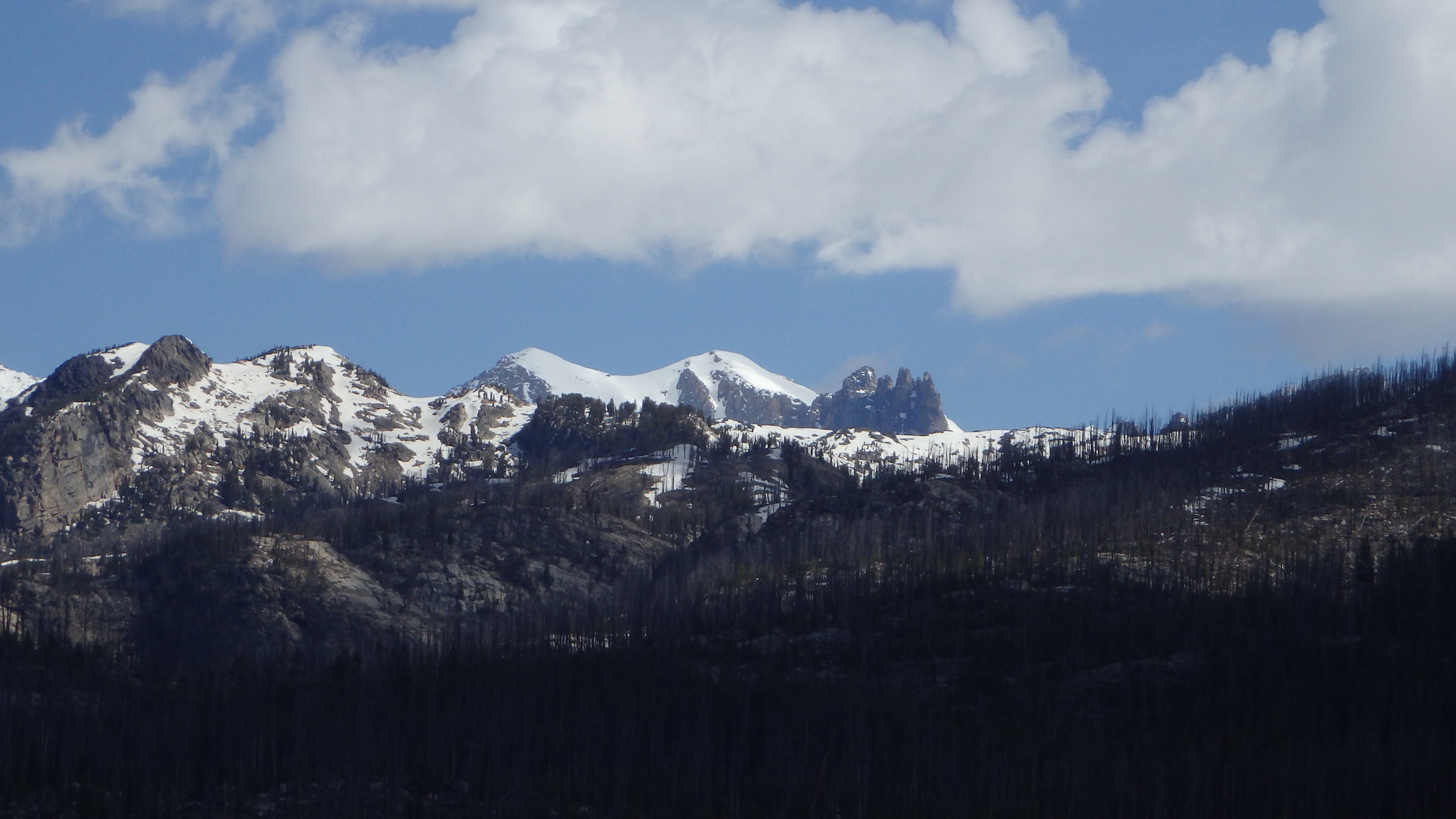 View from Trail |
Directions to the Trailhead
From Red Lodge, drive on Highway 212 for 58.1 miles, or from Cooke City drive 3.4 miles to the well signed Clarks Fork Trailhead.
