Crow Lake- Beartooth Mountains
Crow Lake

Crow Lake
There are few places that truly take your breath away; few places that absolutely leave you unable to describe their awesome beauty. Crow Lake, located at the mouth of a glacier carved cirque, is certainly one of those places. If the blue-green waters, dense lodgepole forests, and jagged granite spires of the East Rosebud Plateau don’t take your breath away, the hike there certainly will. The 6 miles of trail to Crow Lake climb more than 2,700 feet, most of which is in the first few miles.
Although this trail presents a few difficulties, finding the trailhead is not one of them. Start off by entering the East Rosebud campground, and drive all the way to the northwestern corner (far back) of the campground, parking in the well marked trailhead parking lot. You can easily tell that this trail is going to be steep at this point- even the trailhead itself is on a hill!
Hiking up the trail, the elevation gain on this trail becomes noticeable immediately. Keep your backpack light on this trail, and you won’t regret it. I hiked this trail once with a 55 lb. pack, and hated my heavy pack every step of the way. Make sure to also bring plenty of water on this trail. Although there are two good places to stop for water (1 mile in, and about 2 miles in), my personal preference is to not stop for water if I don’t have to. The trail is otherwise a dusty, winding trail that climbs the canyon wall swiftly.
At about 3.5 miles the trail leads to the top of a ridge, an excellent spot for a break. The hardest part of the trail is behind you, and you’re now at the best spot to stop and take a break on the trail. Looking down into the East Rosebud valley, you can easily see East Rosebud Lake 2,500 feet below you. If you look to the right of East Rosebud Lake, you can see the Phantom Creek drainage, including Slough Lake. Make sure to bring your camera- the view is breathtaking!
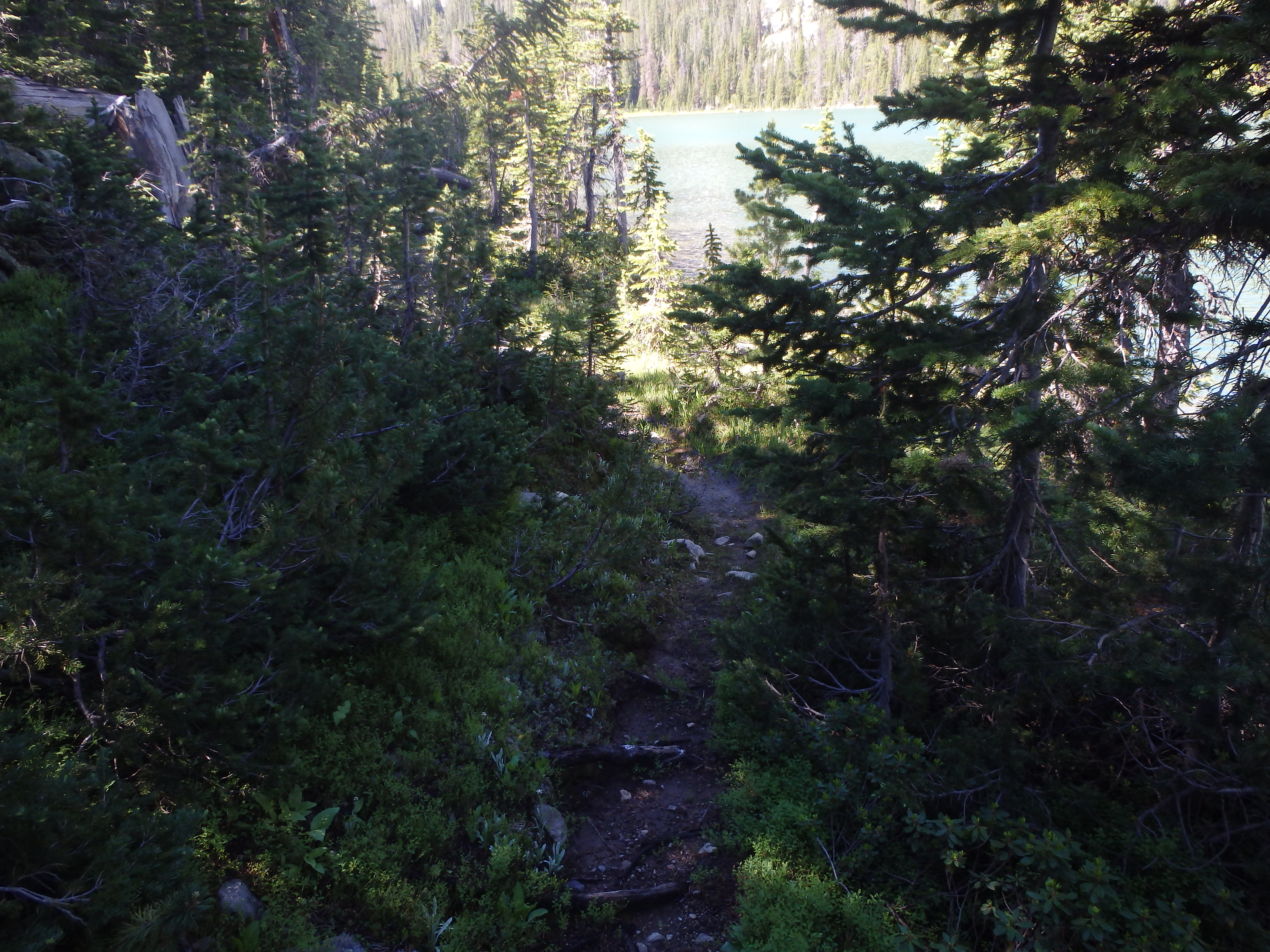
Moving down the trail from the ridge, cairns mark the next several hundred yards of the trail. Following the cairns, the trail leads into the forest, where the downhill slope of the trail is maintained. From here, it’s another 1.5 miles to the Sylvan Lake junction, where you will want to stay on the main trail (go straight).
The trail between Sylvan Lake and Crow Lake is muddy at times, and brushy. The dense forest on both sides of the trail adds to the creepy atmosphere on this section of the trail. You can’t see much past 25 yards- remember all the grizzly bear warnings at the trailhead? A grizzly bear could easily be within 10 yards of the trail, and remain invisible. Try not to think about this as you hike the remaining mile to Crow Lake.

Trail to Crow Lake
About a half mile from the lake, you arrive at an open clearing. This clearing is sometimes wet, but if you’re careful you’ll be able to keep your feet dry. The trail forks at this point, heading off to the right, and traveling straight as well. You’ll want to turn right (south), which is the trail to Crow Lake. From here, the trail runs next to several marshes, and ends at Crow Lake.
At this point, you might just be on your own. The anglers and hikers that you passed earlier on the trail were probably all headed to nearby Sylvan Lake. Sylvan Lake’s golden trout population catches most of the anglers and hikers on this trail. Crow Lake doesn’t support any golden trout (it does, however, have brook trout), but it makes up for this with an alpine beauty that is absolutely stunning. Even if you’re on a day hike, you have to take time to stop and admire it’s beauty.
Camping spots here are limited, but there are a few on the western shore of the lake. To access this section of the lake, you’ll need to cross the outlet stream. Fortunately, there are a large amount of boulders that divide the stream into smaller 3-4ft channels. Hop from boulder to boulder here, and you’ll arrive on the western shore. There is a nice trail that runs the entire length of the western shore, and it passes several campsites.
If you’re feeling adventurous enough, you can follow this trail to the end of the lake, and from there travel off trail to the ridge between Lake Mary and Crow Lake. This is a very difficult side trip, and it should not be attempted unless you are very skilled with a map and compass/GPS. The trail ends at the inlet of Crow Lake, so you will need to navigate the rest of the way by yourself, should you attempt this.
Whatever your intentions are at Crow Lake, please remember what makes this place unique. Pick up any trash that you see on the trail or by the lake, and please follow wilderness guidelines. Don’t camp closer than 200 feet from the lake, and pack out all garbage from your campsite. This is alpine country, and your cooperation helps to keep this lake beautiful.
Pictures from Crow Lake, and the Trail
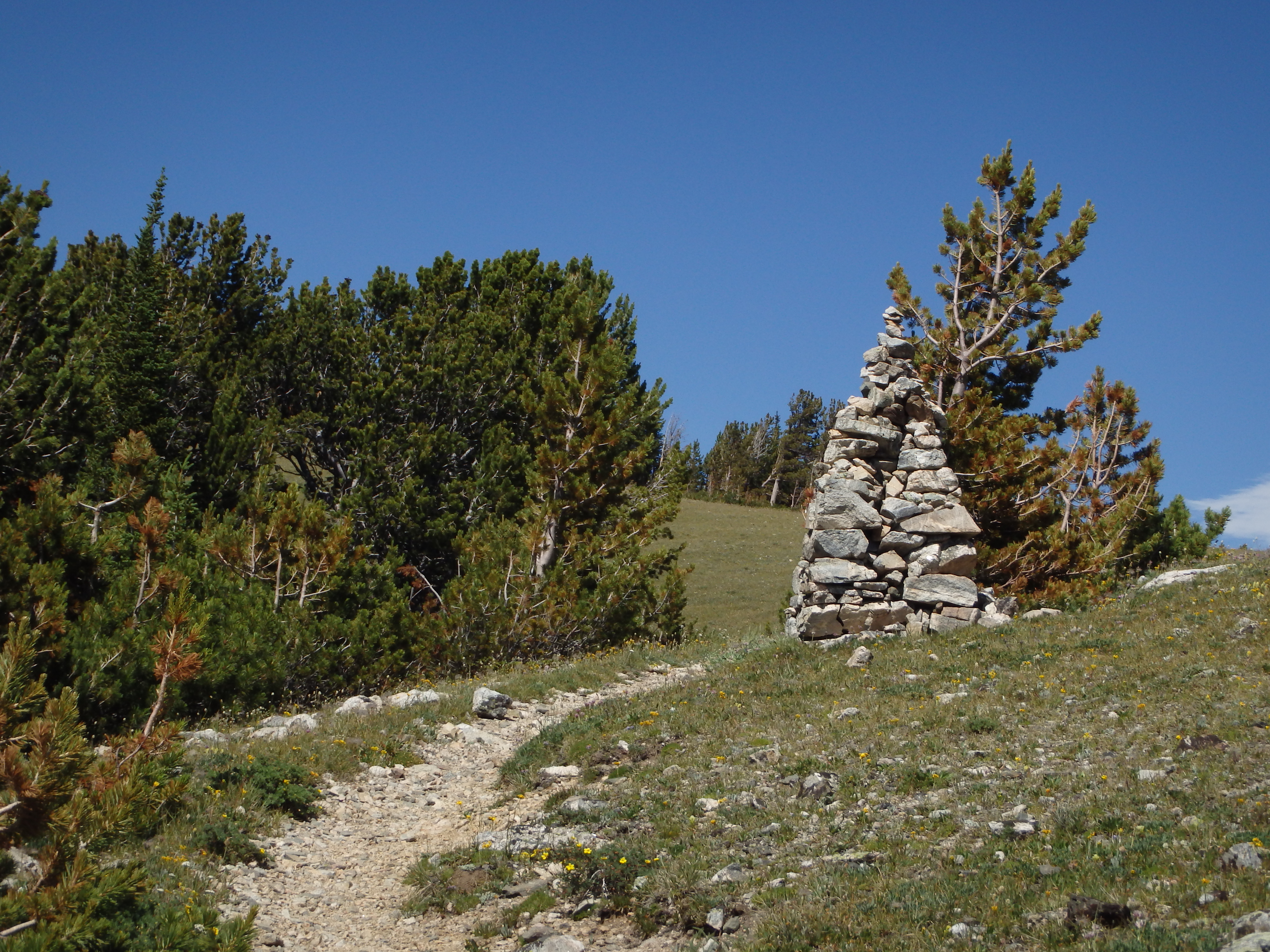 Cairn on Ridge marking Senia Creek Trail |
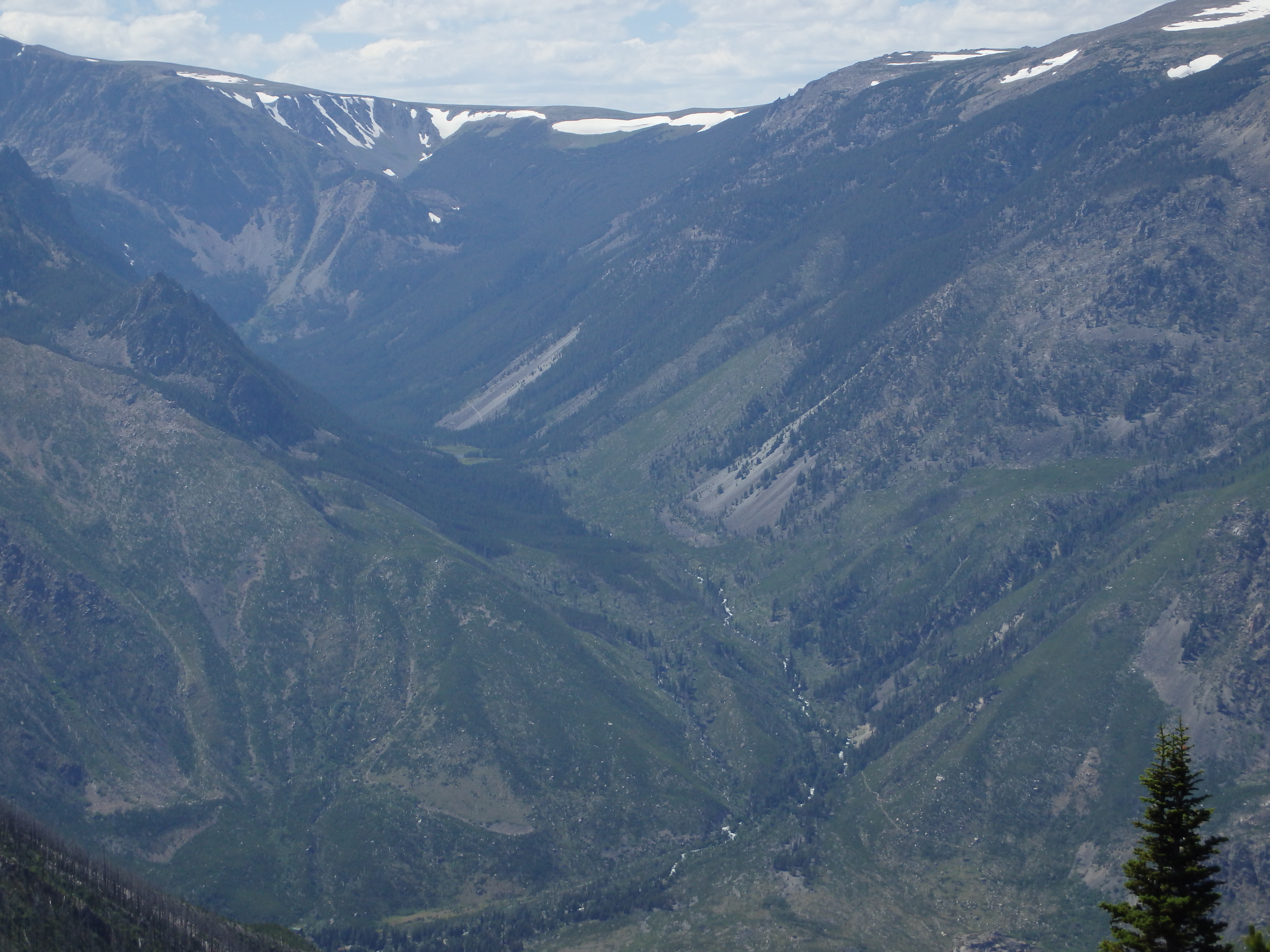 View of the Phantom Creek Drainage |
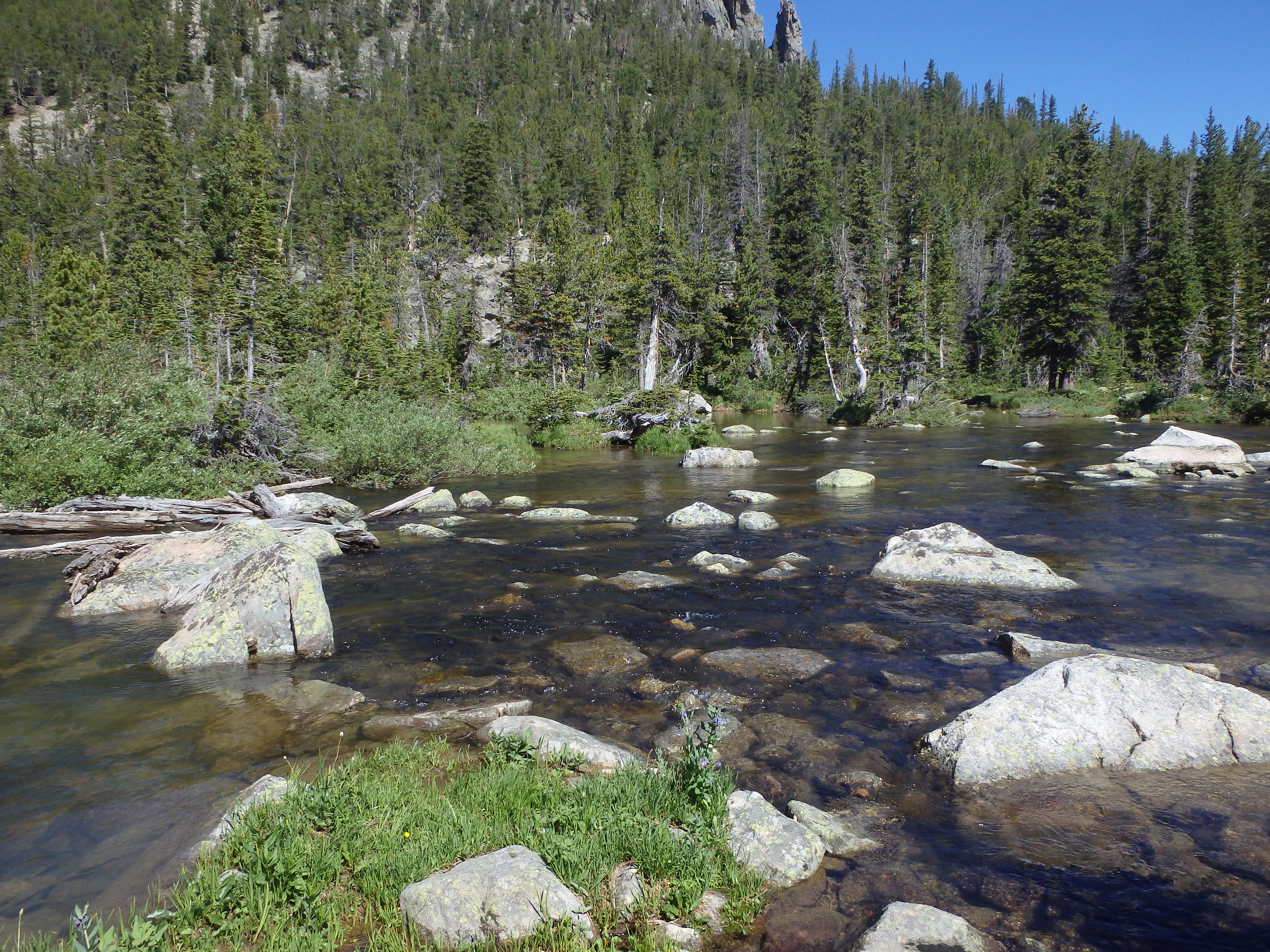 Crow Lake Outlet |
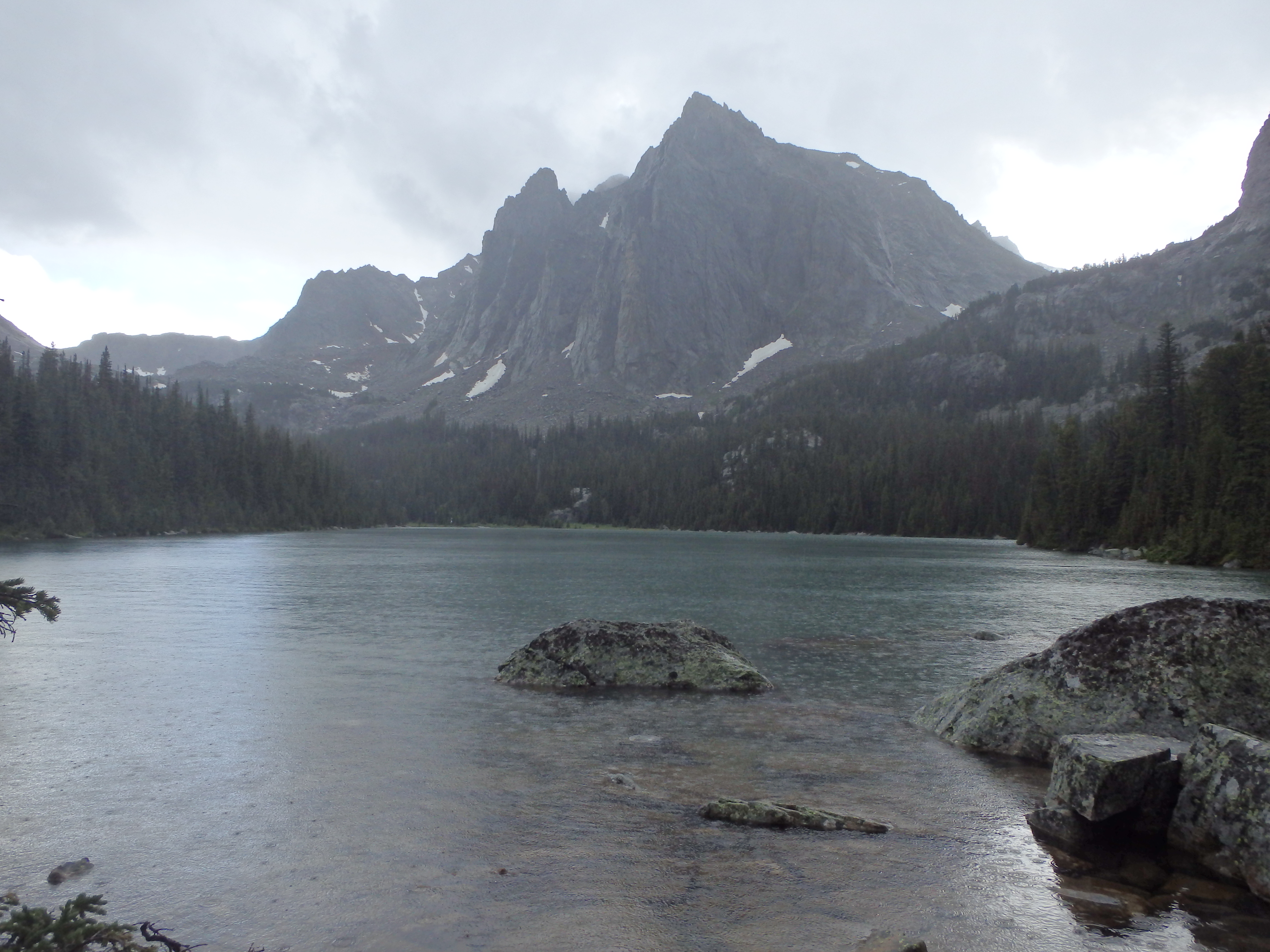 Storm over Crow Lake |
 Trail along lake shore |
 Trail between Sylvan and Crow lakes |
Directions to the Trailhead
From Absarokee, take Highway 78 south of town. About 13 miles down the highway, turn right at Roscoe (East Rosebud Road). Follow this road all the way (about 5 miles), until the road sharply turns to the right (if you drive straight, you will hit Luther Roscoe Rd). There is a bridge just before the turn, and a large forest service sign at this turn, so it’s easy to spot. From here, it’s another 10 miles to the campground, where the trailhead is located. The road is usually in fair condition, and is mostly gravel. Pull into the East Rosebud Campground on your left, just before the East Rosebud trailhead. Drive all the way to the back of the campground, and park at the Senia Creek Trailhead. The parking lot is fairly small, but is rarely near full.