Rattlesnake Gulch Trail- Front Range
Rattlesnake Gulch Trail- Front Range

Rattlesnake Gulch Trail
The Rattlesnake Gulch Trail is a quick 3 ½ mile hike through some of the most scenic views in Eldorado Canyon. This trail is full of natural beauty, with sheer quartzite and granite cliffs surrounding the hike, and vistas of distant mountain peaks. The trailhead is also close to Denver International Airport, making it a convenient detour for travelers in the area. Finding the trailhead is easy, although it does involve a fee; the Eldorado Canyon Park requires an $8 charge for those wishing to hike or climb in the canyon. That shouldn’t stop you from enjoying the Rattlesnake Gulch Trail, however.
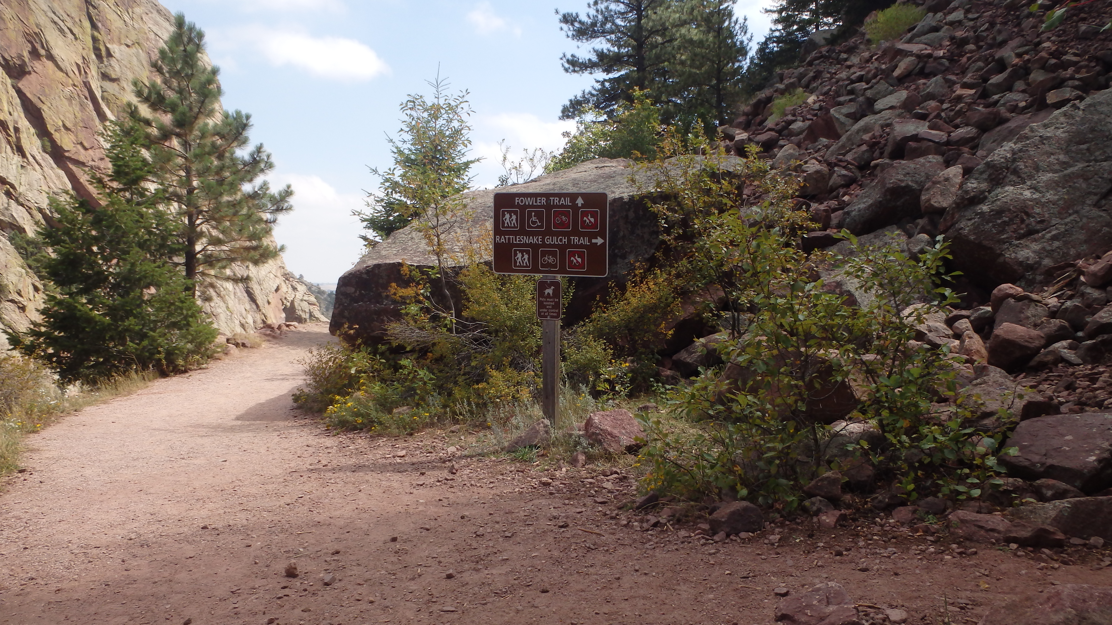
The well-signed turn to Rattlesnake Gulch Trail
Although the trailhead is easy to find, parking might be more of a challenge. Thankfully, there are several smaller parking lots within a few hundred yards of the trailhead, should the trailhead parking lot be full. Leaving the trailhead, the first few hundred yards are shared with Fowler Trail. After these few hundred yards, the first turn appears on the trail to Rattlesnake Gulch. Turn right here, as the trail leads uphill.

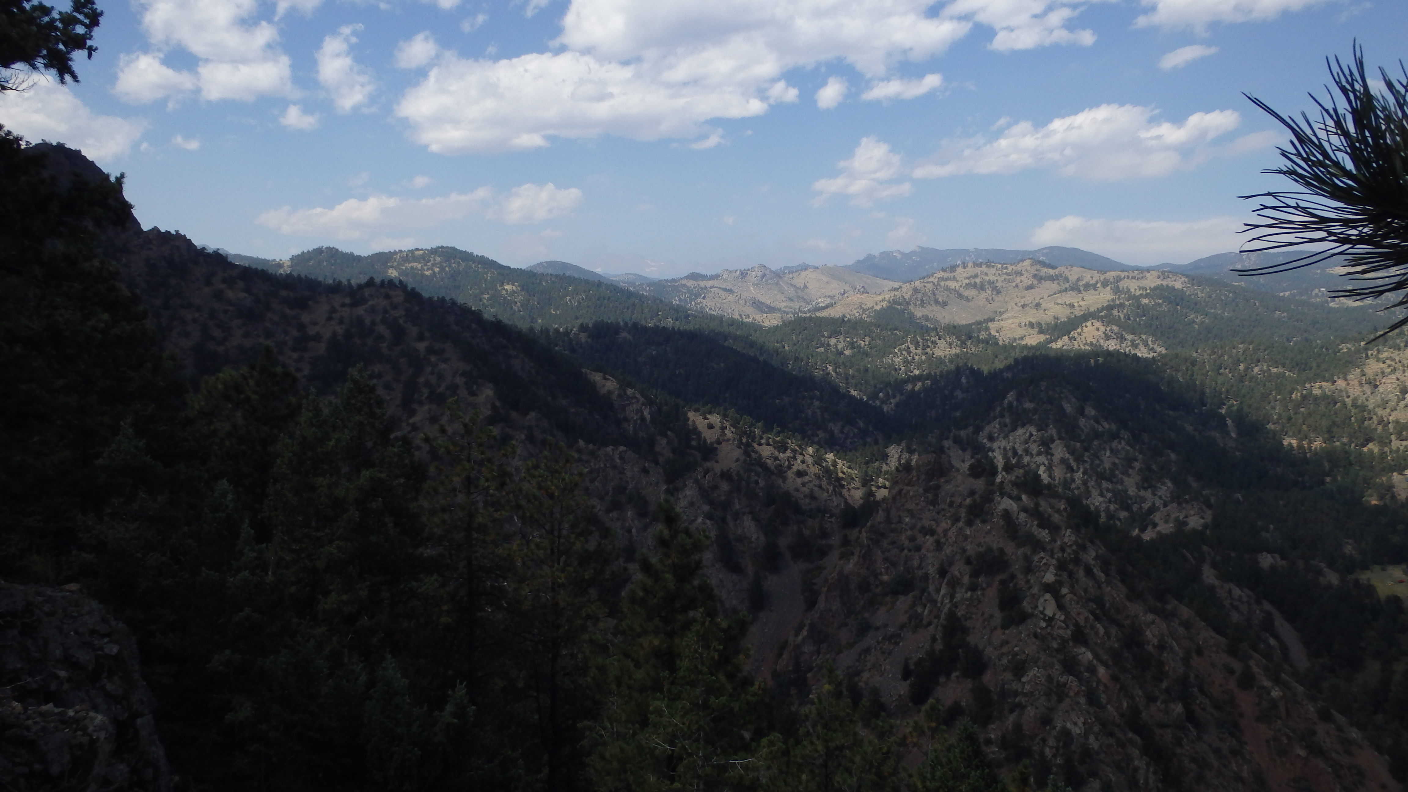
Denver in the distance, from the trail
This first section of the trail is the hardest- it gains 650 feet in just one mile. As you hike along this stretch, you’re rewarded with awesome views of the Eldorado Canyon, and of Denver in the distance. Hiking upward, you’ll reach the first main attraction of this trail at 1.4 miles from the trailhead.
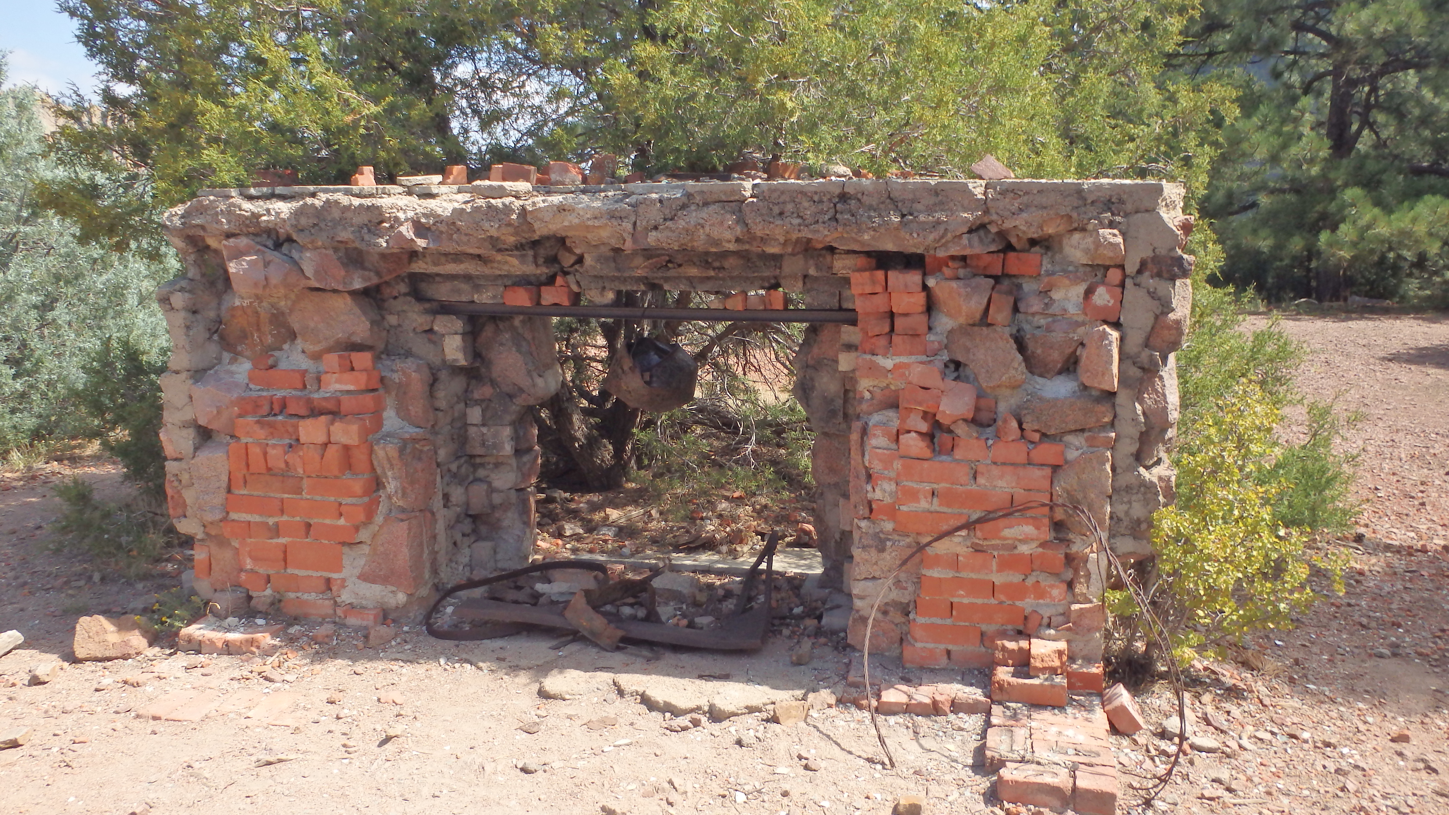
Crags Hotel Ruin
In 1912, the Crags Hotel burned down, leaving only these few ruins remaining. The trail forks to the right here and many social trails allow you to walk easily around the site and see the ruins. There is also a convenient bench at the trail junction, offering a chance to rest for tired hikers. Heading away from the ruins, there are two forks. One leads to the left, which is the east arm of the Rattlesnake Gulch loop, and the other leads straight ahead, towards the west arm of the loop. Hiking straight past the fork allows you to see another attraction to this hike, which is only a quarter of a mile away.
Continental Divide Overlook
Hiking this short quarter mile brings you to the Continental Divide Overlook, where you can view the distant high peaks of the Front Range, and see the expanse of Eldorado Canyon. The scenery here is spectacular, and there are several large benches to accommodate hikers that want to pause and take in the views. Once you’re ready to head down the trail, continue along the Rattlesnake Gulch Trail.
Hiking this short loop allows you to view more of the scenery that Eldorado Canyon has to offer. A mix of ponderosa and fir trees harbor the many black squirrels in the area, while raptors such as eagles and falcons try to make dinner out of the squirrels. After a short .8 miles, the loop joins the main trail again, and you can begin your descent towards the trailhead.
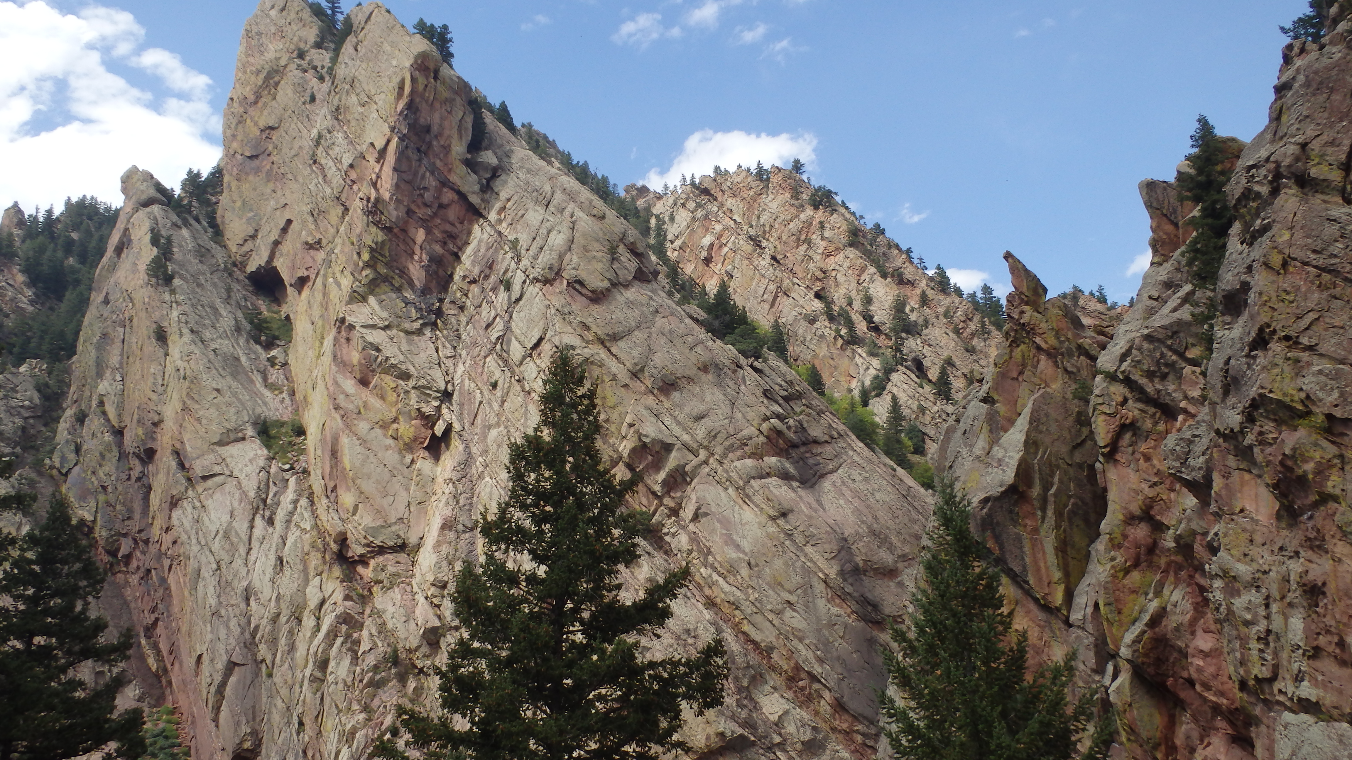
Scenery Along Fowler Trail
Once you reach the end of the Rattlesnake Gulch Trail, do yourself a favor and hike another short mile along the Fowler trail. Turning right at the end of the Rattlesnake Gulch Trail, the Fowler Trail runs parallel to Highway 170, offering splendid views of Eldorado Canyon. Often, you can see climbers scaling the many faces of the cliffs at Eldorado Canyon, and the flat trail offers relief from hiking the steeper Rattlesnake Gulch Trail. After this short mile, the Fowler Trail joins the Goshawk Ridge Trail, which is a good point to turn around and head back to the trailhead. If you take this extra trail option, you’ll have hiked 5 ½ miles, and seen some of the fantastic scenery that Eldorado Canyon has to offer.
Directions to the Trailhead
Drive on Highway 170 west towards Eldorado Springs, passing through the small town, and continuing straight until you reach a ranger station. Pay the $8 fee here, and then bear left down the gravel road until arriving at the well-signed trailhead.
