Lost Lake- Beartooth Mountains
Lost Lake- Beartooth Mountains
The Lake Fork of Rock Creek offers beautiful waterfalls, gorgeous scenery, abundant wildlife, and pristine mountain lakes. Lost Lake is no exception to this, and is the first lake along the Lake Fork of Rock Creek that I recommend exploring. Lost Lake is an excellent day hike, which offers a little of something for everyone. Although the hike is a little long for a day hike, the trail is rather flat (gaining 1,300 feet in 5 miles), and it is easy to make very good time on this trail.
Starting at the large trailhead parking lot (it’s hard to fill this lot), the trail winds it’s way through mature stands of Lodgepole Pine and Aspen trees. The trail itself is professionally built, and that makes a huge difference in speed on this trail. The packed dirt, rocks, and wooden beams all add to the structure of this trail, and make this trail such a pleasure to hike. Make sure to keep a sharp eye out though, this trail is full of surprises!
The first few miles of the trail follow the Lake Fork of Rock Creek, a large fork in the Rock Creek River. The water here is cold, rapid flowing, and covered in shade from trees. As such, don’t waste your time trying to fish this stretch of the river. Hold back the temptation to cast into a series of nice pools, and riffles. Instead, take the time to watch the stream, and be on the lookout for wildlife. Although this trail is extremely popular (and crowded in mid summer), there is an abundance of wildlife around. Whitetail Deer, Mule Deer, Bald Eagles, and Elk are all common in this area. Waterfalls are also common in this area, and there are few sections of the trail that are remarkable.
After the first three miles, start paying closer attention to the stream you are following. If you are not careful, you will hike right past a favorite spot of mine to rest- Broadwater Lake. The lake will be on your right, and is hard to see through the timber at times. Although the name inspires an awesome vision of a large mountain lake, don’t be disappointed. Broadwater Lake is really just a gentle glide in the Lake Fork of Rock Creek. The “lake” is about 100 yards long, by about 40 yards wide. It’s a great spot to rest though, and enjoy a snack or lunch. You can also take your fishing rod out now, even though the Brook Trout are tiny (less than 6 inches), they make for great sport. Needless to say, you’ll want to practice catch and release, on this lake. Make sure to be extremely careful when playing the fish (reel them in quick), so that the trout have a better chance of survival after being caught.
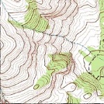
Moving on from Broadwater Lake, there is another mile and a half of trail to follow. Don’t worry about watching your GPS, or topo maps at this point- the trail actually moves past the lake, and then doubles back. After about a mile and a half, the trail comes to a point where a side trail sharply comes in from the left. Be sure to take this trail, or you’ll keep on hiking towards Keyser Brown Lake, and miss Lost Lake entirely. This side trail is hard to find at places, but it is especially hard to find coming back. Be sure to take note of where you exit the trail, once you do arrive at the lake. Otherwise, it is difficult to find the trail again, on the way back.
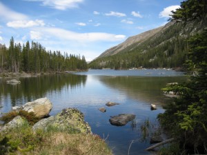
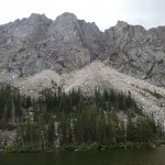
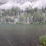
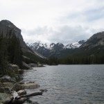
Once you have arrived at Lost Lake, you can take in it’s pristine beauty. Step lightly here though- the popularity of this area make it an easy lake for overuse. Indeed, you can easily see past campsites of other hikers, as well as sometimes trash. One year, I found an abandoned lean-to at this lake, which even had food in it! These are huge mistakes in a wilderness area, and a deadly mistake in Bear Country. If you do choose to camp at Lost Lake, make your camp a zero impact campsite.
The layout of Lost Lake is pretty simple. The shallowest parts of the lake are the east and north sides of the lake. If you’re looking for fish, concentrate on the west and south sides of the lake. Although the fish here are hard to catch, they are worth it. Cutthroat Trout and Grayling are in this lake, and they are here in abundance. In the late summer, all the fish will be located in the deeper water. Although early in the season you can plainly see fish in the shallower areas, these fish are pretty seasoned against fishermen. It takes skill and patience to catch one of these, but they are all exceptionally large for the popularity of this lake. Sixteen inch trout and Grayling are common, with the small ones being in the twelve inch range.
Another favorite activity of mine is boulder hopping, on the south side of the lake. To get to the south side, the easiest route is along the east shore. Although this trail can be muddy and brushy at times, it is nothing compared to the timber bashing that is required along the west end of the lake. Several years ago a large avalanche must have occurred here, because there are tons of dead fallen Lodgepole Pine, which make for an extremely slow and painful route. A favorite way of mine to reach the north end again is to swim across the lake. Be weary of shallow water though, if you choose this route. One year, I strayed towards the shallow end, and barely made it out of the thick mud that is along that side of the lake!
Regardless of your activities at Lost Lake, be sure and do everyone a favor before you leave. Pack out all of your garbage, and pick any remaining garbage from other hikers up, as well. This is an extremely popular lake in mid summer, and it is easy to see signs of past campers and hikers. Doing such a small thing as picking up a candy wrapper really does help out these environments, and it helps set a great example to other hikers, as well. Leaving the area in better condition than you found it really does help maintain the beauty of these high mountain lakes, and help preserve them for generations to come.
Pictures of Lost Lake, and the Trail
Directions to the Trailhead
From Red Lodge, head south of town on Highway 212. After 10 miles, turn right on Lake Fork Road. Follow this road for another 2 miles, and park at the trailhead. The road is in excellent condition, and paved all the way. The trailhead is easy to spot in the parking lot.
