Vernon Lake- Beartooth Mountains
Vernon Lake
Vernon Lake
Located just 2 ½ miles from the Clarks Fork trailhead, Vernon Lake is a perfect day hike for travelers on their way to Cooke City, or Yellowstone National Park. The trail gains very little elevation, and offers the opportunity to see wildlife such as deer, moose, and yes- bears. Finding the trailhead is incredibly easy, since it is both well signed, and next to Highway 212. Although you’ll pass many hikers on the first mile of this hike, once you turn onto the Vernon Lake trail, the traffic diminishes greatly. Another feature of this trail is a side trip to the Flume Trail at the beginning of the hike, which offers an educational opportunity about the now-defunct hydroelectric dam that was built in 1916. This “trail” is wheelchair accessible, while of course the hike to Vernon Lake is not.

Bridge over the Clarks Fork Yellowstone River.
Starting at the trailhead, follow the signs for Russel Creek Trail #3, and you’ll quickly bypass the Flume Trail, as well as the overlook for the Clarks Fork of the Yellowstone falls. The trail leads by a slow point in the river, which is as far as some anglers prefer to go. This section of the trail is almost always muddy, and full of mosquitoes. If Cooke City had an official mascot, it would be the mosquito- bring plenty of DEET for this trip. This part of the trail is straightforward- the trail runs through the forest, before arriving at the turn for the Vernon Lake trail.
Vernon Lake Trail #565
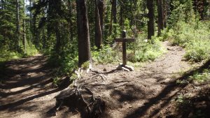
Turning right after approximately one mile, you turn onto Vernon Lake Trail #565. From here, the trail immediately climbs up the first of many hills. Although this trail is easy, it does contain a few hills here and there that add character to the hike. Let’s face it- no one enjoys a flat and boring trail. After about a quarter mile from the Vernon Lake turn, a small pond appears. The trail leads to the right along the pond, and continues its course.
Lillis Lake
After approximately 2 miles from the trailhead, Lillis Lake appears. This lake is a worthy enough destination for most people, but the fishing is tough due to the lilly pads along the shore, and there are far too many people that stop at Lillis Lake. If you’re looking for some space, continue down the trail to Vernon Lake.
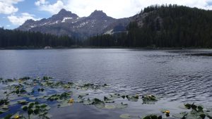
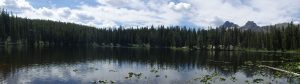
The trail immediately heads downhill, as it leads towards Vernon Lake. A quarter mile from Lillis Lake is the trail to Margaret Lake, which is an excellent side trip that offers good fishing. After a total of 2.5 miles, Vernon Lake appears. Surrounded by the forest, and framed by the nearby mountains, Vernon Lake reminds you that even though the elevation at the lake is 7,900 feet, the Beartooth Mountains have much more altitude to offer.
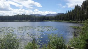
Lilly Pads at Vernon Lake
Fishing at Vernon Lake is good for brook trout, although casting is often difficult. Lilly pads line this lake, which makes the fishing frustrating at times. Although the pads are beautiful, they are a nightmare to retrieve your lure through. However, there are occasional breaks in the pads, which allow an angler easy access to the many trout in the lake. Anglers seeking a refuge from these lilly pads would do well to fish the western shore.
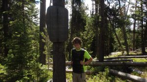
Future Conservationist at Wilderness Boundary
Vernon Lake offers only a couple campsites, since mostly day hikers visit this lake. The quick hike, combined with its short distance from Cooke City, make this lake a perfect day hike. Many other hikers will travel this trail for these reasons- although it didn’t take much effort to hike this trail, remember that this lake is within the Absaroka-Beartooth Wilderness, and it should be treated as such. Pick up any trash that you might see, and do everything you can to leave the lake as you found it. The wilderness is a delicate area, we must all do our part to ensure its beauty and trout filled lakes will be preserved for others.
Directions to the Trailhead
From Red Lodge, drive on Highway 212 for 58.1 miles, or from Cooke City drive 3.4 miles to the well signed Clarks Fork Trailhead.
