Passage Falls- Absaroka Range
Passage Falls

Passage Falls
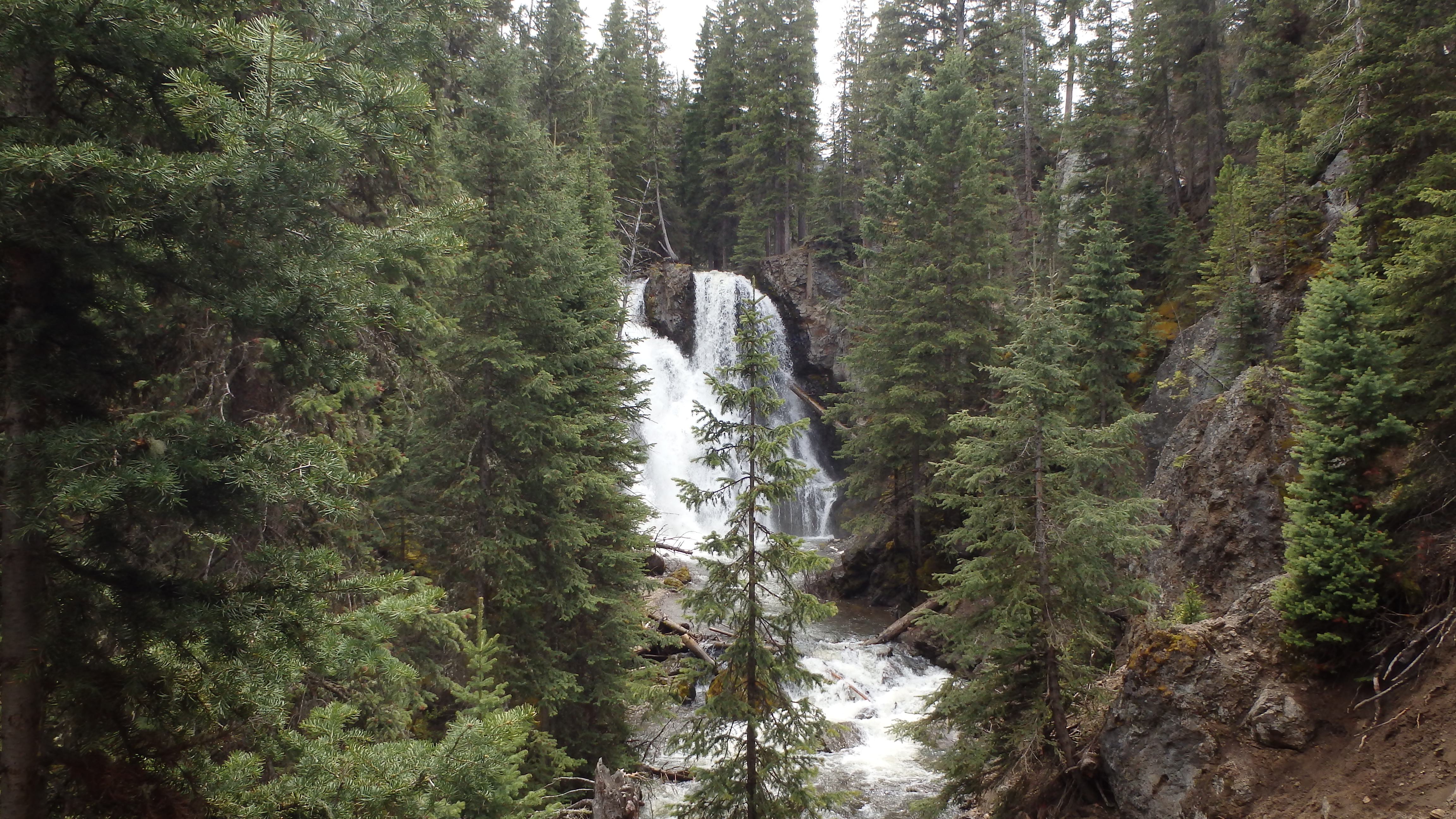
Standing beneath the falls, a whirlwind of mist covers you. The mist clings to anything that isn’t already wet, and the roar of the falls deafens you. Looking up, it’s hard to imagine how many hundreds of gallons of water are pouring over the falls, or how this waterfall managed to drastically change the volcanic outcrops that you cling to. Passage Creek beneath the falls becomes a torrent, as the water rushes out of the narrow valley. This place is Passage Falls, a popular hiking destination in the Absaroka Range, and a great place for a short day hike.
Located South of Livingston, Passage Falls is an easy to find hike that offers a spectacular waterfall. The short length (4.2 miles), easy to follow trail, and low gain in elevation (490 ft) makes Passage Falls an excellent hike for hikers of any level. Although this is an excellent trail most of the year, the best times to visit are between mid-May and mid-June, when the water levels are at their highest. In addition, the trail is quite busy later in the summer, so spring tends to be my preferred season for hiking this short trail.
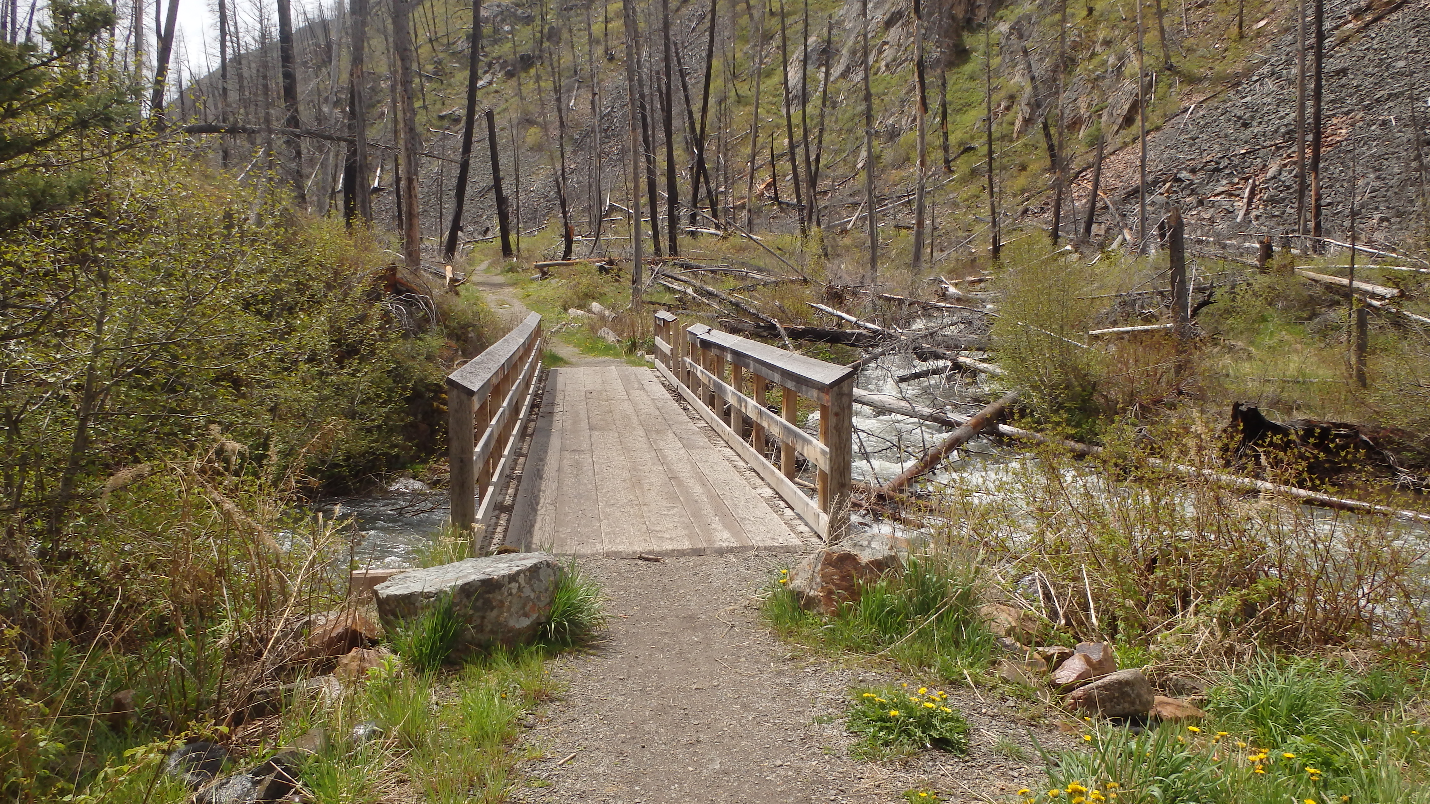
Bridge over Passage Creek
Leaving the large trailhead parking lot, you cross a sturdy bridge over Mill Creek. Cutthroat Trout can be found in the creek below, which tends to distract some hikers before the hike actually begins. Moving down the trail, you cross another sturdy bridge that crosses Passage Creek. The exposed creek beds here are a good source of petrified wood, and other interesting rocks. This trail follows Passage Creek for 1.6 miles, allowing many opportunities for rock hounds to search for their treasures.
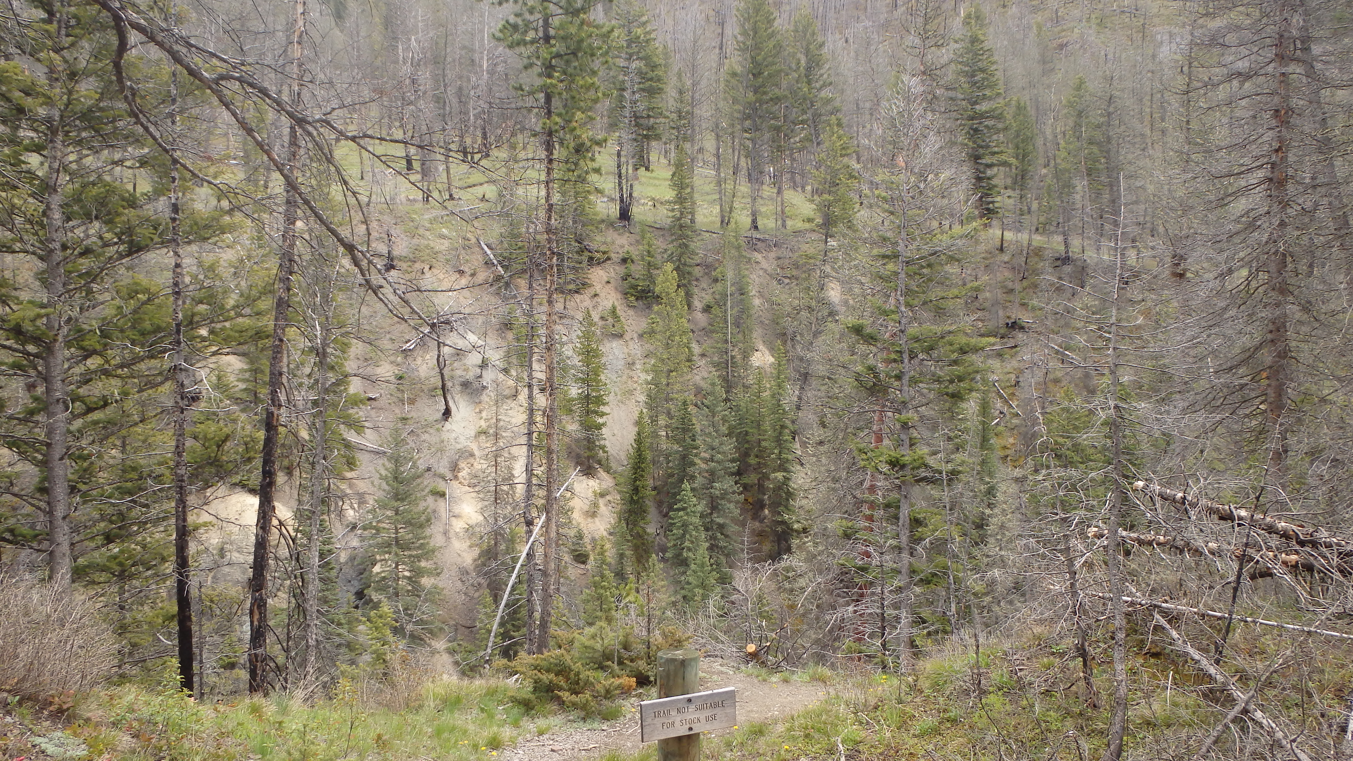
The forest surrounding this portion of the trail was burned in the 2007 Wicked Fire, leaving behind the dead standing lodgepole pine. The Gallatin Forest Service has done an excellent job of regularly clearing any trees that fall on the trail. Make sure to apply plenty of sunscreen- the lack of live trees means that there is no shade for the first 2 miles of the trail.
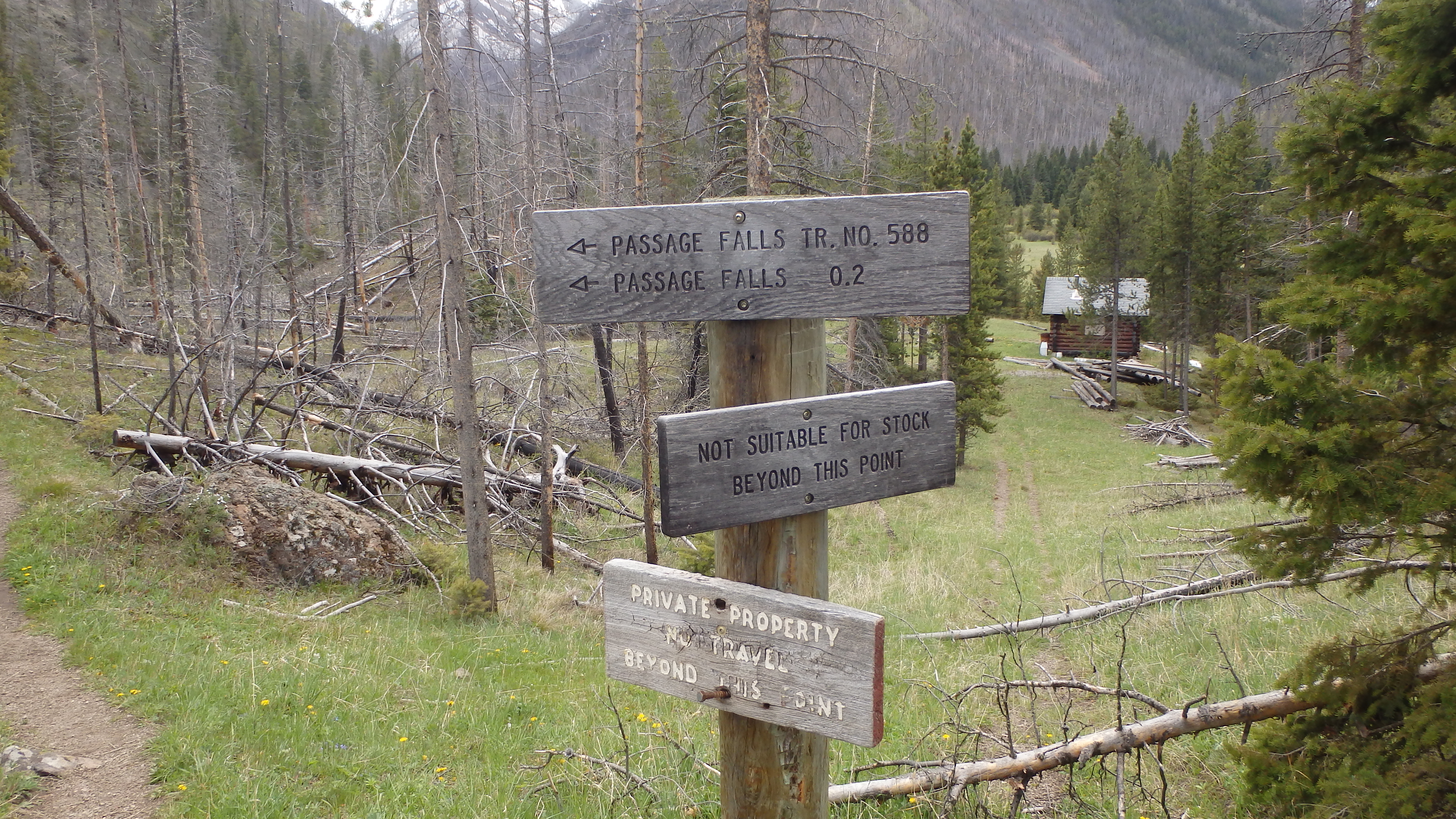
After hiking 1.6 miles on this easy to follow, well built trail, there is a fork in the trail. Turning left follows Wallace Creek all the way to Wallace Pass, and bearing right takes you to the falls. The intersection is well signed, and hard to miss. At this point, the grade in the trail becomes steeper, gaining 232 feet in .4 miles, a nice little hill. The trail climbs steadily, and before you know it (and before the kids complain), you’re at the highest point in the trail.
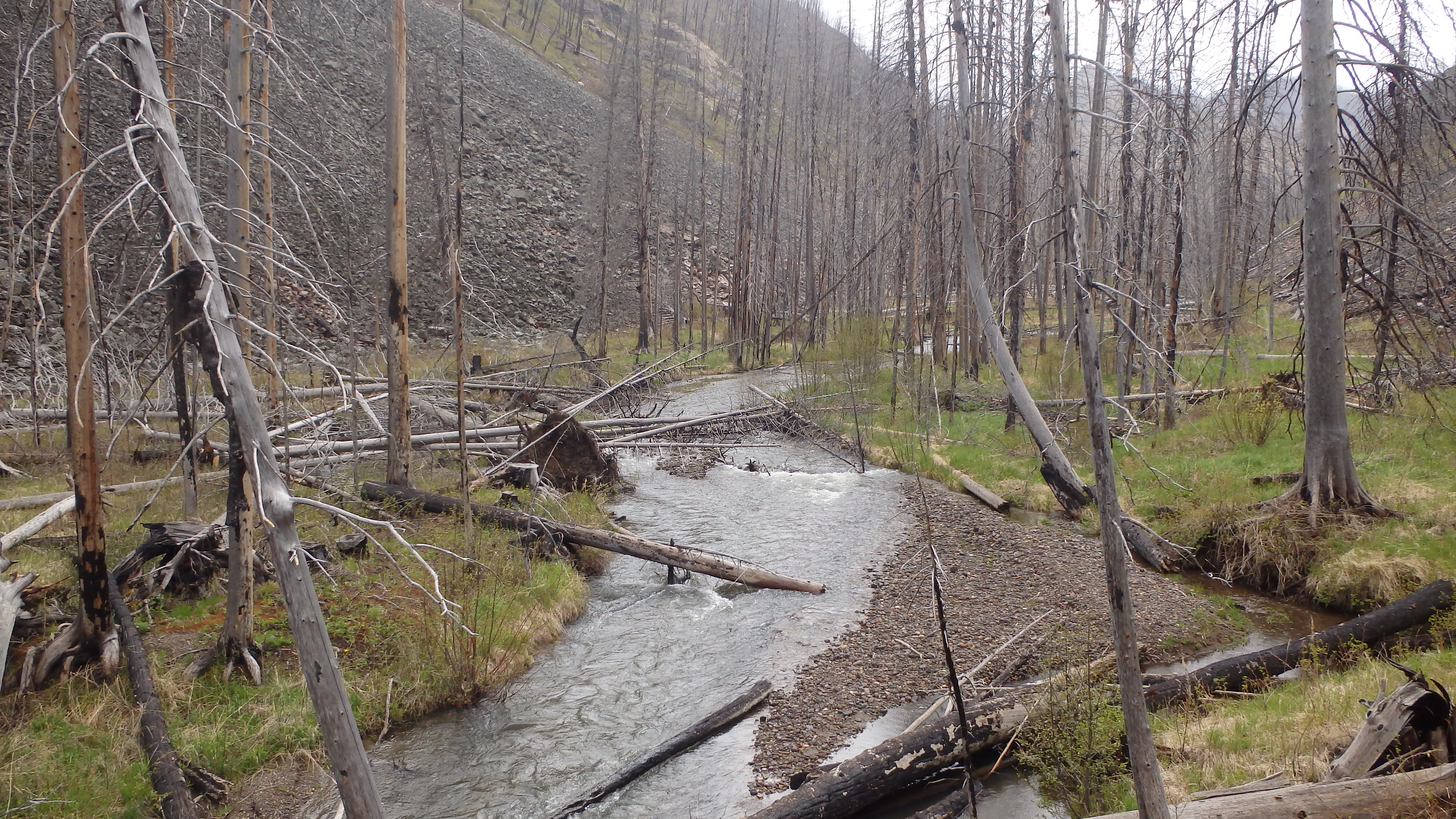
View of the valley beneath Passage Falls
At this point, there is a fork in the trail to a cabin. Be sure to respect the owner’s property rights, and stay on the Passage Creek Trail- this cabin is not part of the hike, and is instead part of a private inholding. Continuing straight along the trail, it is .2 miles to the falls, but it certainly doesn’t seem like it. Hiking down the 80 feet to the falls along the switchbacks, it’s now important to help the kids down. The bedrock is soft along this portion of the trail (allowing the creation of the falls), so the trail is constantly eroding away. The corners of the switchbacks are almost completely gone in some places, so be sure to help any little ones safely down this steep portion of the trail.
Once at the falls, the footing becomes worse. You can carefully leave the trail and walk down to where the falls are, but the footing is slippery and the rocks are loose. Adults and kids alike can climb down to where the creek meets the falls, but only adults should attempt to hike closer to the falls, if so desired. After spending some time enjoying the sights and sounds of the falls, turn back and hike the 2.1 miles to the trailhead.
Pictures of Passage Falls, and the Trail
 Passage Creek |
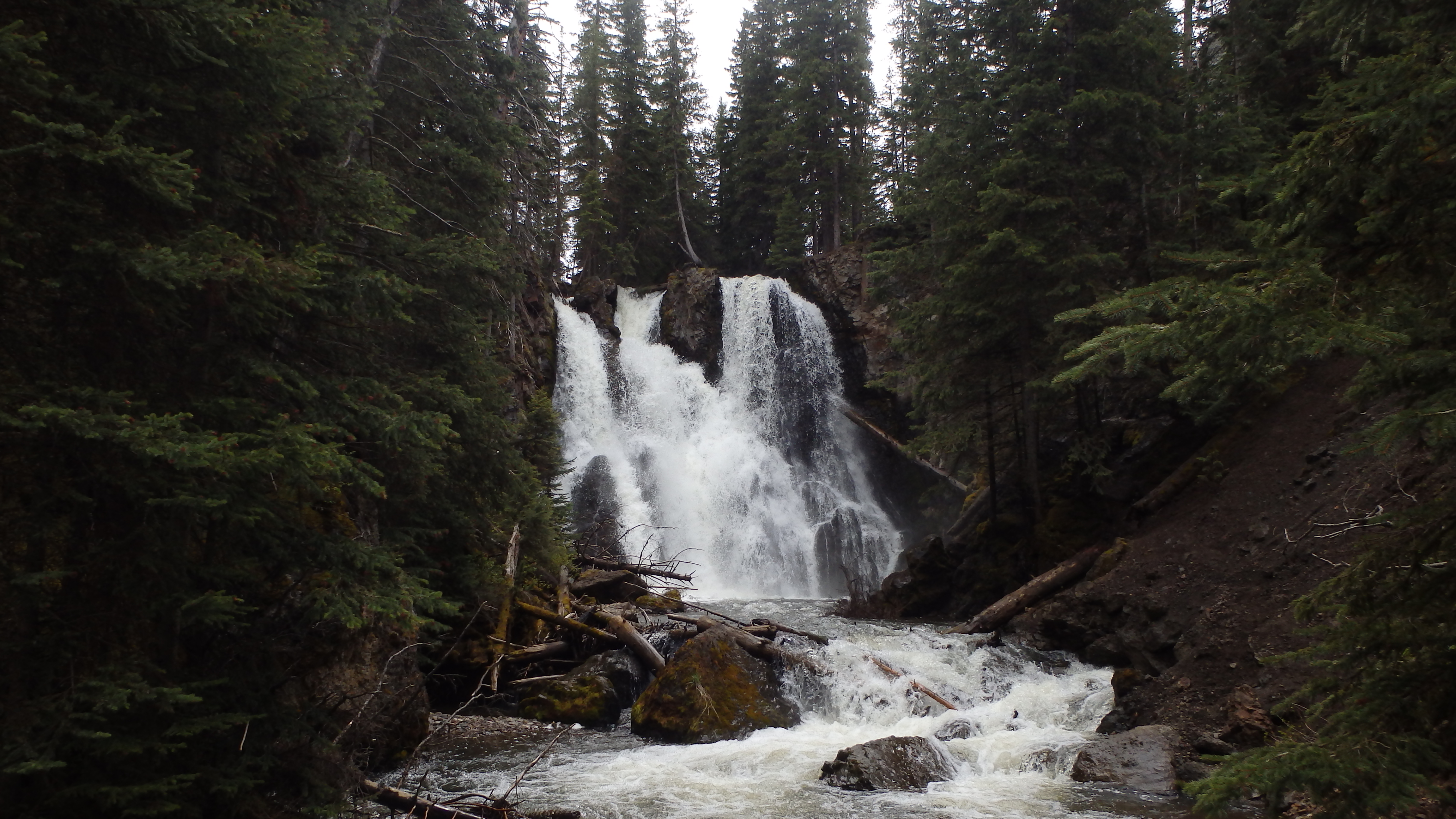 Passage Falls |
 Passage Falls |
 View from Trail |
 Well Signed Intersection |
 A Great Trail for Kids |
Directions to the Trailhead
From Livingston, drive 15.7 miles south on Highway 89, towards Gardiner. Take Mill Creek Road on the left, which is well marked. From here, drive 14 miles down Mill Creek Road, to the large trailhead on the right. The trailhead is 2.7 miles from the well signed Snowbank Campground, and appears to be a large pull out from the angle that you’ll be driving. Once you pull into the lot, it’s apparent that you’re at the correct trailhead.