Meyers Creek Trail- Beartooth Mountains
Meyers Creek Trail
Meyers Creek Trail
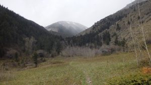
Meyers Creek Trail #27 offers a chance to enjoy the outdoors on a well established trail, without the crowds. This trail is great for any hiker’s skill level, or physical condition. Rockhounds will be satisfied with the fossils and metamorphic rocks that are easily found on the trail, and hunters will find no shortage of wild game. For some, the trailhead is scenic enough, but to fully appreciate the trail, you’ll want to stretch your legs.
Meyers Creek Trail
The Meyers Creek Trail starts with a gentle incline, slowly gaining elevation in the first three miles. This section is great for small kids, or for those who are just looking for an easy hike that only lasts a couple of hours. Meyers Creek is seasonal and usually dry, so you will want to bring enough water for this hike. On the bright side, the creek crossings won’t create much of an obstacle, even when the creek is flowing. Be sure to bring your camera- despite the dry creek, there will be plenty of scenery and wildlife to take pictures of.
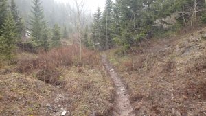
Leaving the trailhead, the first turn is only a few hundred yards away. Turn left to stay on the well signed Meyers Creek Trail, which crosses private land at this point; be sure to stay on the trail, and hurry through this section. After a half mile, the trail leads into the Custer National Forest, leaving behind any private land you’ll encounter on this hike. Continuing down the trail, Pass Creek Trail #88 appears on the left.
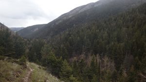
Scenery Along Meyers Creek Trail
Bear right to continue down the Meyers Creek Trail. After three miles of hiking, the grade becomes steeper, curves south, and offers fantastic views of the valley below, and of Meyer Mountain. The trail leads upward over the next three miles, climbing 1,700 feet- a good point to turn back for those who desire a relaxed hike. For those hikers that aren’t easily discouraged, continue hiking on this scenic trail- the scenery only gets better.
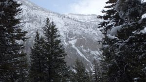
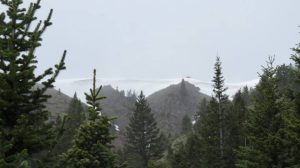
Fresh Snow on Trail
Hiking this section of the trail can be interesting in the early season- snow banks often cover the trail until early June, creating a formidable obstacle. Later on in the summer, the dry trail offers little refreshment- I personally prefer hiking this trail in late May, where snowfall is almost guaranteed, and the trail is devoid of fellow hikers. I’ll trade obstacles for solitude any day, although it’s easy to tolerate mixed company with the beautiful Squaw Pass at the end of the trail.
Squaw Pass (photo: Terry Cameron)
Squaw Pass first appears after hiking 5 miles in, and it marks the border between the Custer and Gallatin national forests. As this section climbs 600 feet in only half a mile, some hikers are perfectly content with viewing the pass from below. Snow covers this pass until late June, those wishing to hike the switchbacks up to Squaw Pass should bear this firmly in mind. If hiking to the top of the pass leaves you with a desire for more exercise, Moccasin Lake lies west of the pass, easily reached once you have hiked to the top of the pass.
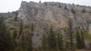
Metamorphic Cliffs
Heading back, the trail is a breeze- the steeper section of the trail passes quickly, leaving you with the remaining three miles of gentle downhill slope. One nice feature of this trail is that the scenery is just as beautiful on the way back to the trailhead. Green hills and towering metamorphic cliffs leave you with a constant awe and appreciation for the Meyers Creek drainage. As with any hike, the scenery is best protected by everyone- make sure to leave nothing behind on this trail.
Directions to the Trailhead
From Absarokee, take highway 419 towards Nye. Continue on this road just past Nye, turning right at mile marker 20, and then turning left onto Limestone Road. From there, continue down Limestone Road for 7 miles, turning left at the well signed Meyers Creek forest boundary. Drive by the rental cabin and Meyers Creek guard station (bearing left), to the trailhead.
Map to the Meyers Creek Trailhead