Glacier Lake- Beartooth Mountains
Glacier Lake
Glacier Lake
Glacier Lake offers an afternoon of fishing, hiking, and photography. Located close to Red Lodge, Glacier Lake is also an extremely popular lake- so expect some company on the trail. The trail is short (but steep), the scenery beautiful, and the trout willing. Thankfully, the road to the trailhead (forest service road 421) helps limit the traffic on the trail. To be sure, your car will take more abuse on the ride to the trailhead, than you will on the trail itself.
If your truck or SUV can handle the road, you’ll be rewarded with the opportunity to hike to four different lakes in the basin. Anglers will love the fishing opportunities in these lakes. Climbers will love the seemingly endless supply of boulders, spires, and peaks to climb. Photographers will enjoy the stunning scenery. All of these lakes are located near each other, so this makes for a great day of exploring an alpine paradise.
This trail, while only 2 miles long, is completely uphill. The trail climbs a little more than 1,000 feet in the 2.2 miles to the lake, making it a trail that may be tough for some children or beginners. After about a half mile, the trail crosses Moon Creek via a sturdy bridge, which is an excellent photo opportunity. There’s also the potential to head off to Moon and Shelf Lakes via a spur trail at this point.
After the bridge over Moon Creek, the switchbacks on the trail become a little steeper. As you hike higher and higher, the scenery gets better and better. When you stop to catch your breath, you will enjoy the view from the trail. The trail itself is well built, easy to follow, and leaves no questions. This is a popular trail, and you will probably run into at least a couple other hikers while on it.
Once you’re at the lake (2 miles passes quickly), there are many places you can go from here. You can either walk along the western shore via a short social trail that ends about halfway around the lake, or you can continue near the dam at Glacier Lake, and push on to nearby Little Glacier Lake, and Emerald Lake. Energetic individuals can hike off trail to nearby Mountain Sheep and Mountain Goat Lakes.
Anglers should pay special attention to where they are when they fish this area, as half of the basin is in Montana, and half is in Wyoming. It’s better to be prepared with a permit for both states, especially since I have had little luck fishing the Montana side of Glacier Lake. Tackle tends to perform better than flies at Glacier Lake, due to the wind.
Regardless of your activities or destination in this basin, be sure that you are prepared for the weather. This is alpine country, which is notorious for rapid weather changes. The winds common to this area (and commonly gusty around the afternoon) bring in storm clouds on an almost daily basis. Bring a warm jacket that will be comfortable in a rain storm, and you won’t regret it.
Pictures of Glacier Lake, and the Trail
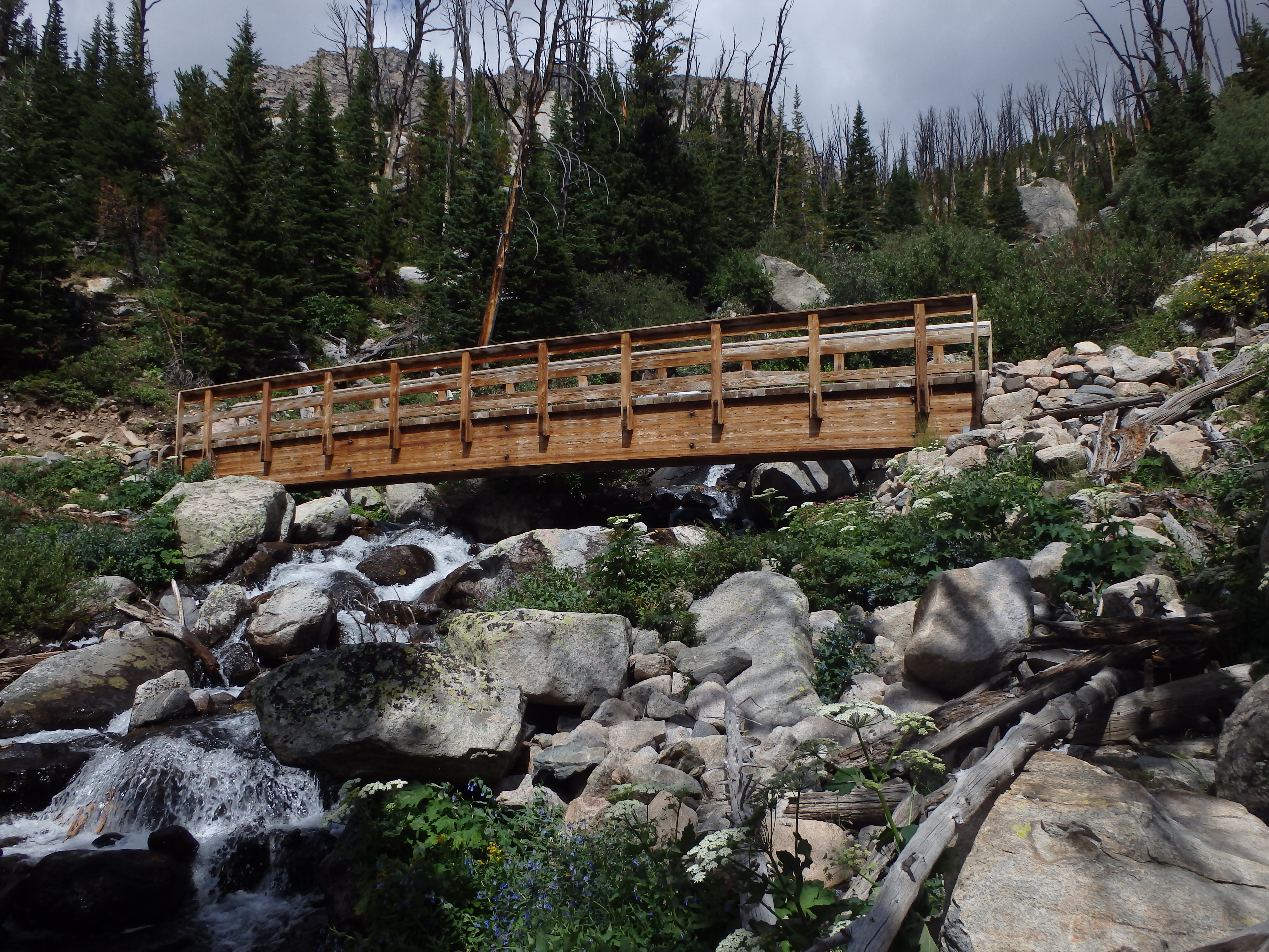 Bridge over Moon Creek |
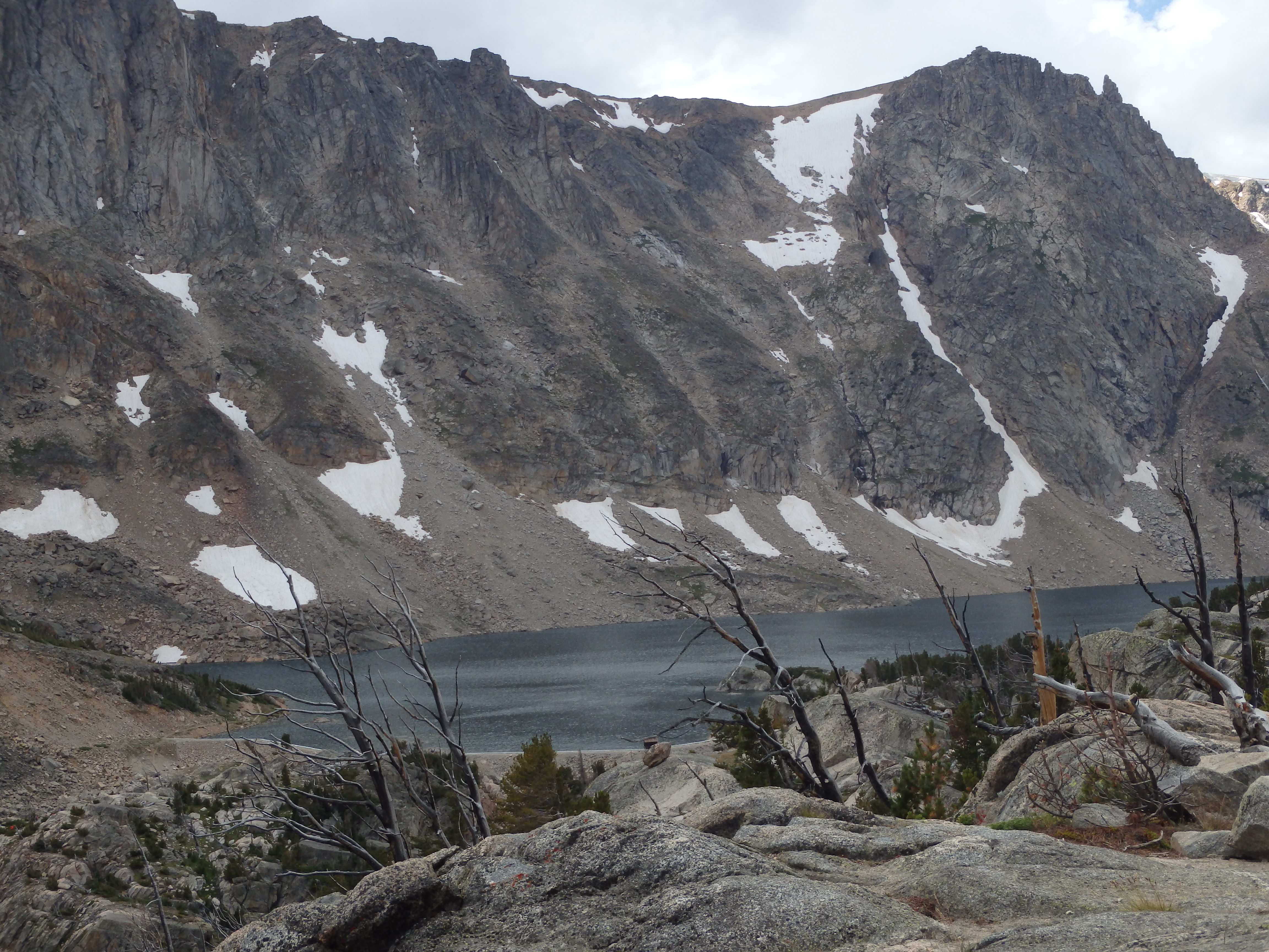 Glacier Lake from trail |
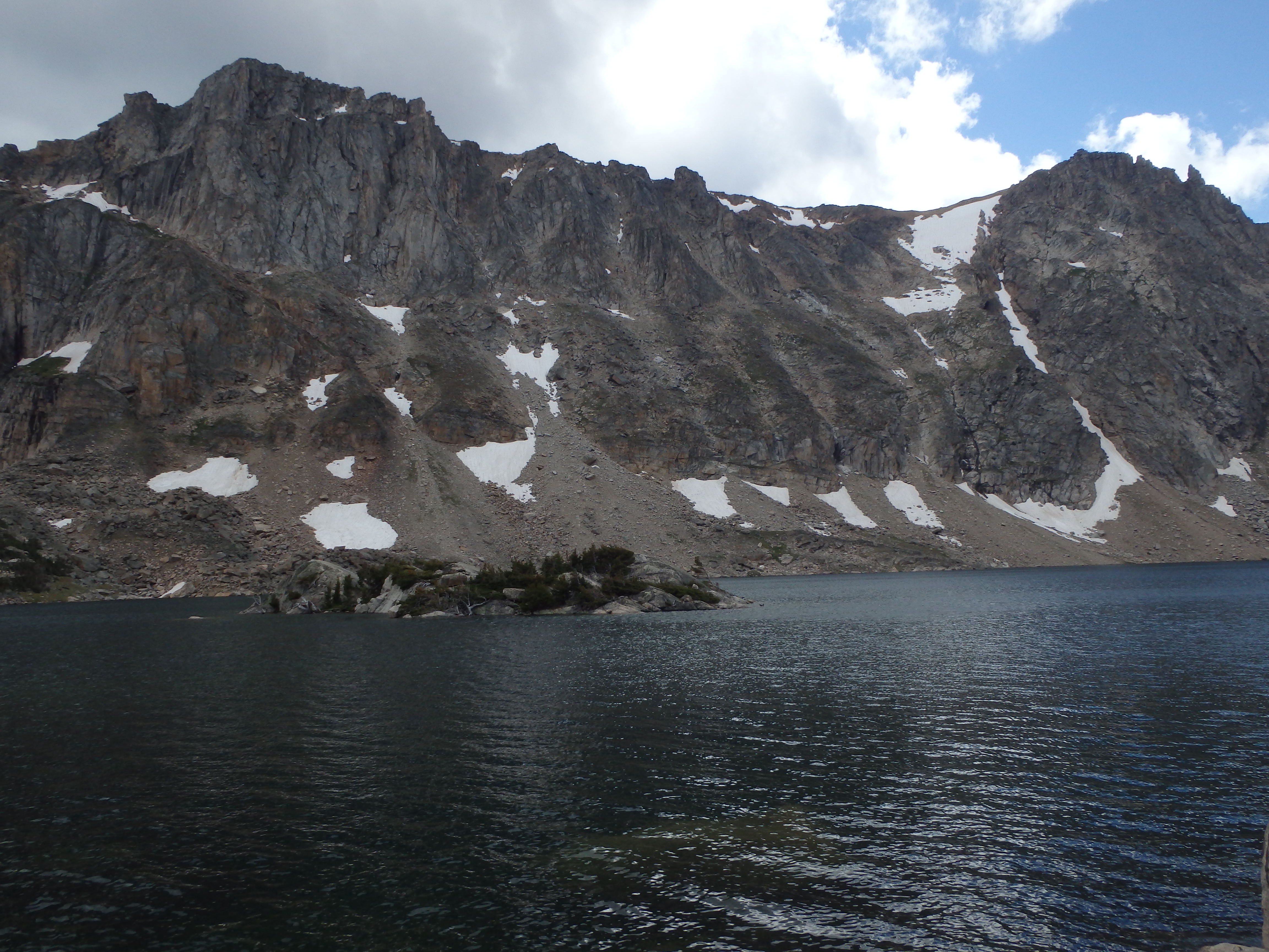
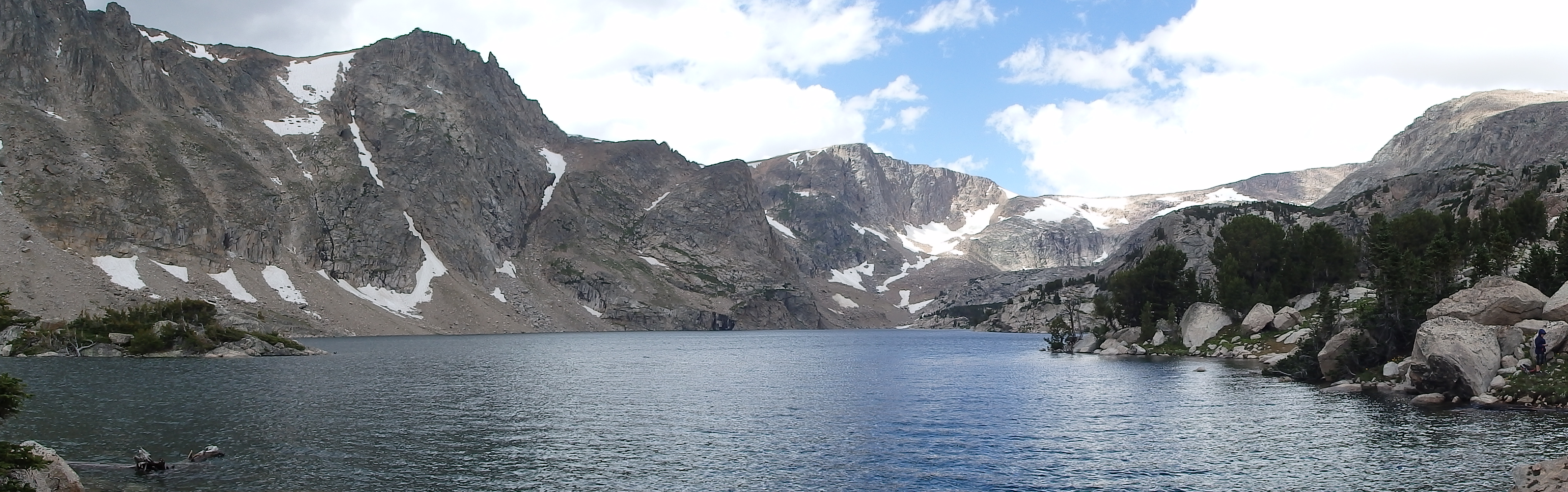 Glacier Lake |
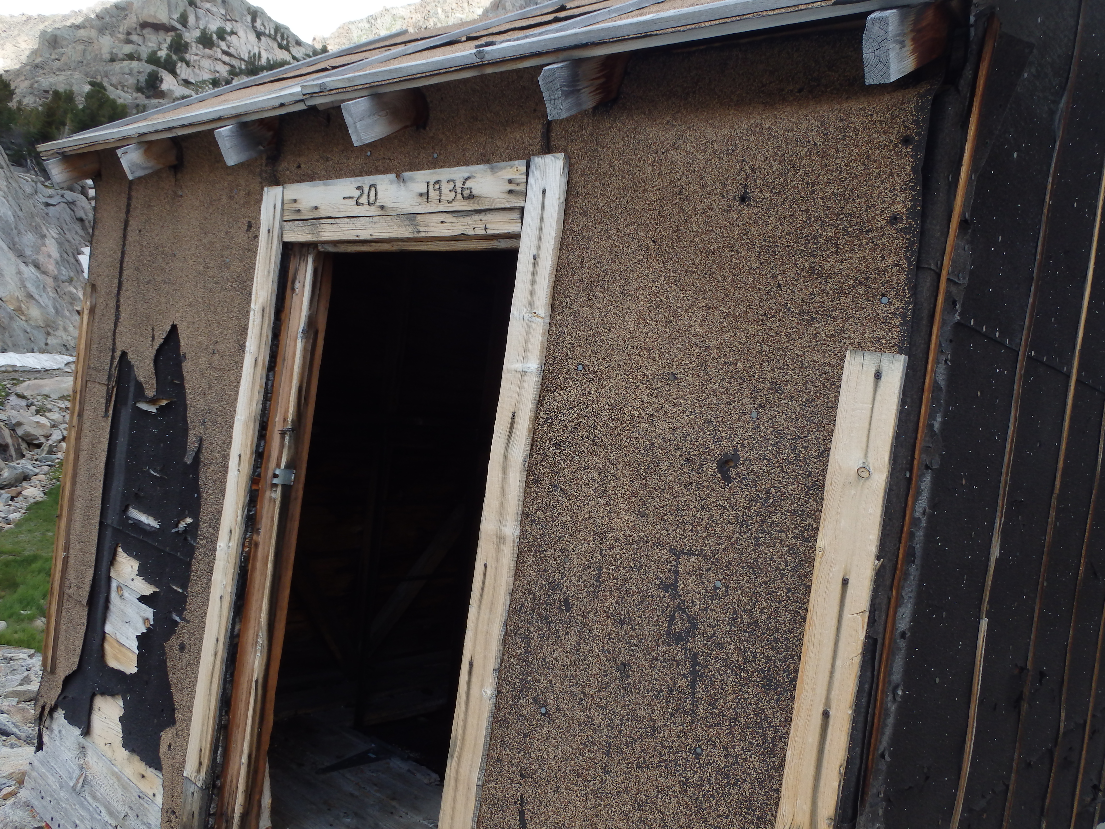 Shack at Glacier Lake |
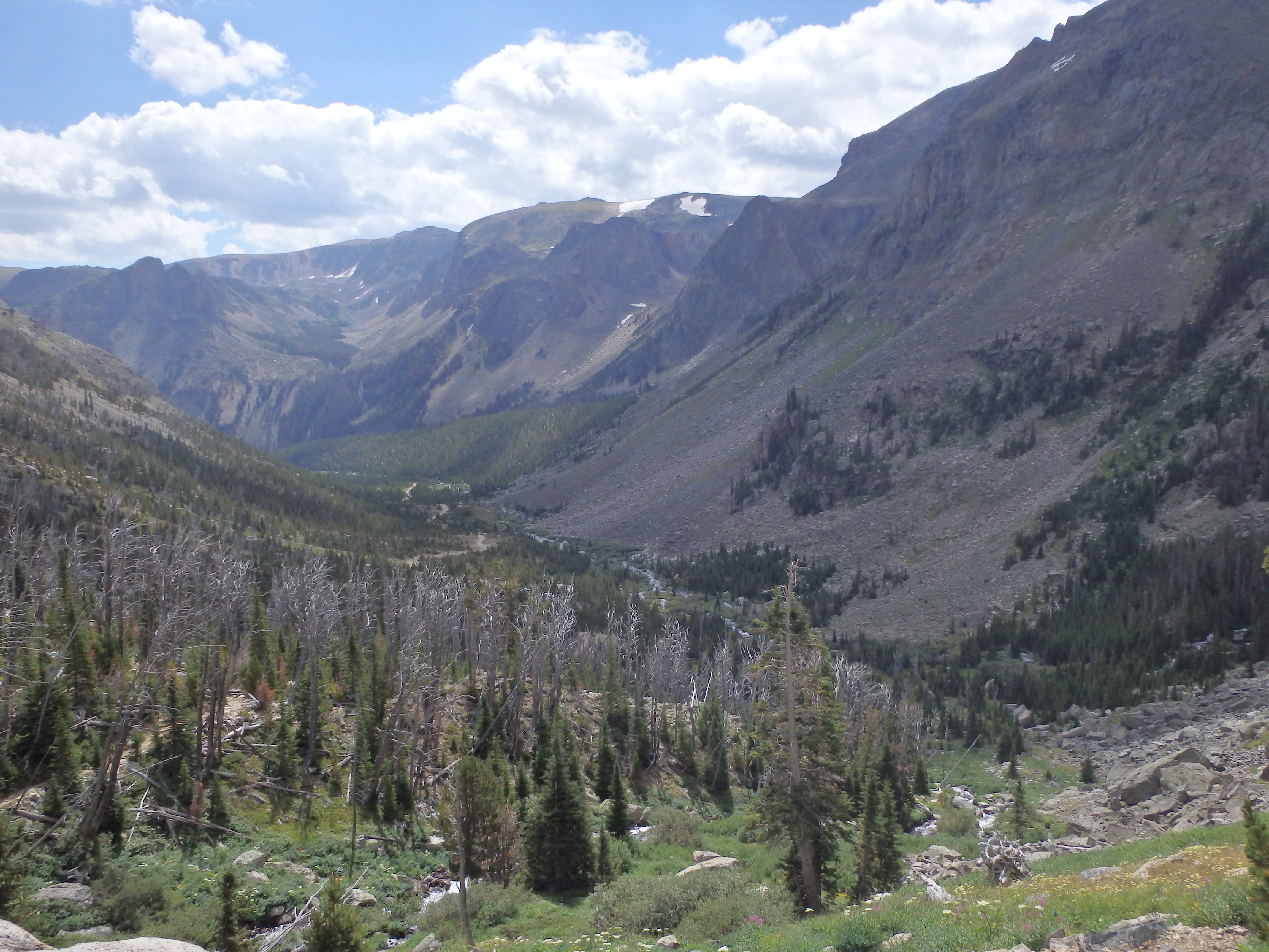 Canyon below trail |
Glacier Lake |
Directions to the Trailhead
From Red Lodge, drive on Highway 212 for 10.9 miles, turning right onto FS-421. From here, follow this road until the road passes the Limberpine campground, and the pavement ends. Once the pavement ends, take a left turn towards the Glacier Lake Trailhead. This is a rough road that really requires a high clearance vehicle- some pot holes are large enough to fit a car into! On the bright side, it’s impossible not to find the trailhead at this point, as there are no other turns to make. Continuing along this road for 7 miles, and enduring the bumps, you are rewarded with the trailhead at the end of the road.
Map to the Glacier Lake Trailhead
