The Beartooth Recreational Trail: Beartooth Mountains
The Beartooth Recreational Trail: Beartooth Mountains
The Beartooth Recreational Trail leads through some of the most scenic country in the Beartooth Mountains. Three different trailheads form an approximately 9 ¼ mile long loop, running by beautiful lakes and scenic alpine vistas– all of which are within a day hike of the Beartooth Highway. The Beartooth Recreational Trail gives a hiker many options; the three different trailheads allow you to choose your own adventure. You can make this trail a classic lollipop loop, a shuttle, or a true loop. Your options are numerous, which also makes this trail a good trail to get lost on.
While hiking along the Beartooth Recreational Trail, I lost the trail twice. Poor trail signage (most of the signs have been knocked down) along with a random trail that is broad in some areas and faint in others combine to create a trail that is easy to lose, but thankfully easy to find again. If you follow one of the branches on this trail system, the Dollar Lake Trail, the trail is easily lost. If you stay along the popular routes in this trail, however, the trail is well defined for the majority of the trail. Either way, don’t leave home without a map, a gps or compass, and a thorough understanding of the topology in the area. To make this loop, you have three popular options, all of which are moderately difficult.
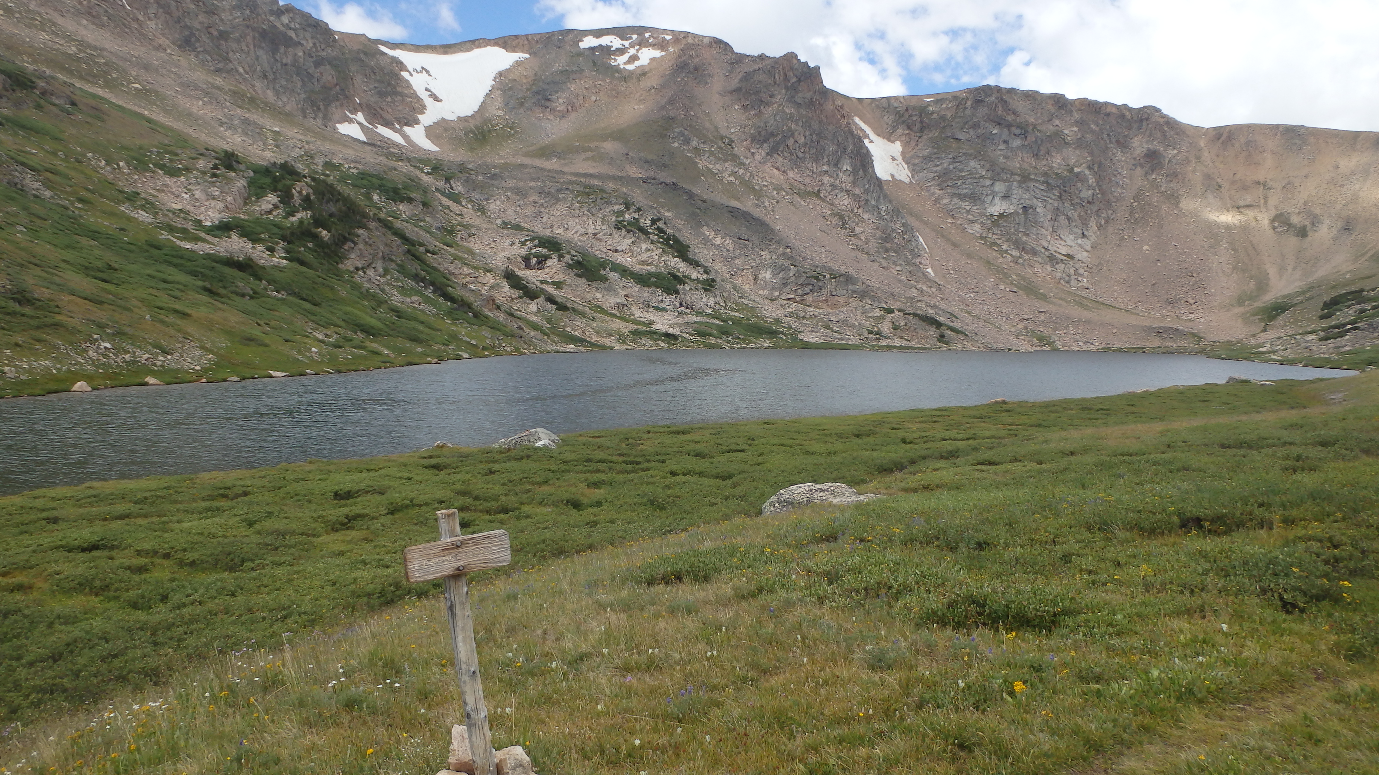
Gardner Lake
Gardner Lake to Dollar Lake Trailhead- Moderate Difficulty
This route is one of the most straightforward, running 10 miles without a real turn. You start at the Gardner Lake Trailhead, and hopefully have a vehicle waiting for you at the Dollar Lake Trailhead. Embarrassingly enough, when I hiked this path, I ended up at the Dollar Lake Trailhead without a shuttle to my truck. It’s a long walk this way at the end of your hike—don’t be like me. Once you’ve secured your transportation, start at the Gardner Lake Trailhead, and hike downhill for ¾ miles, to Gardner Lake. From here, cross the outlet stream of Gardner Lake.
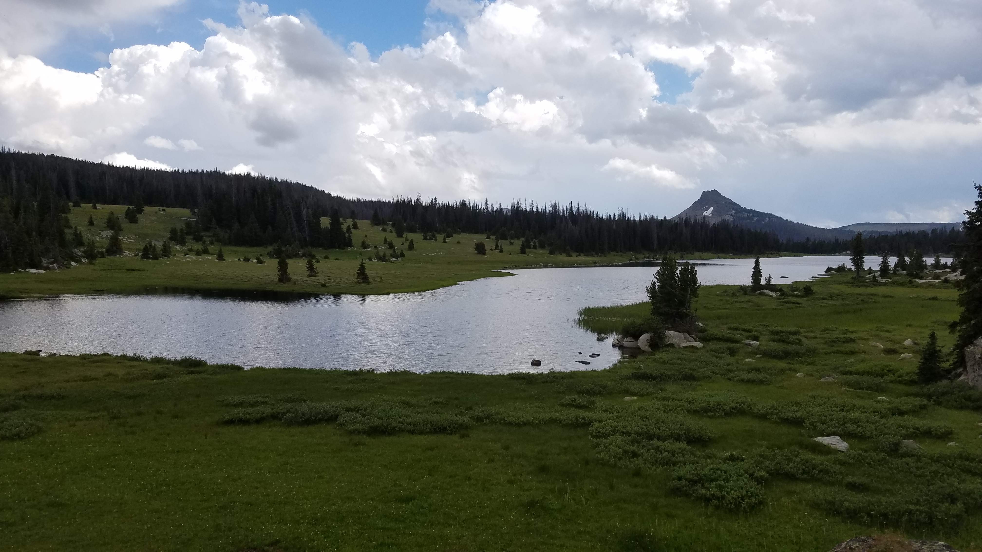
Once you’ve rock hopped (hopefully, upstream of the trail where the crossing is easier) across the outlet at Gardner Lake, the trail briefly departs from, and later rejoins Littlerock Creek. At 5 miles the trail becomes slushy in areas, which continues as you follow the trail around Tibbs Butte, towards the Sawtooth Meadows. Continuing along the trail (and ignoring the turn towards Stockade Lake), you cross another creek, and then the trail begins to climb.
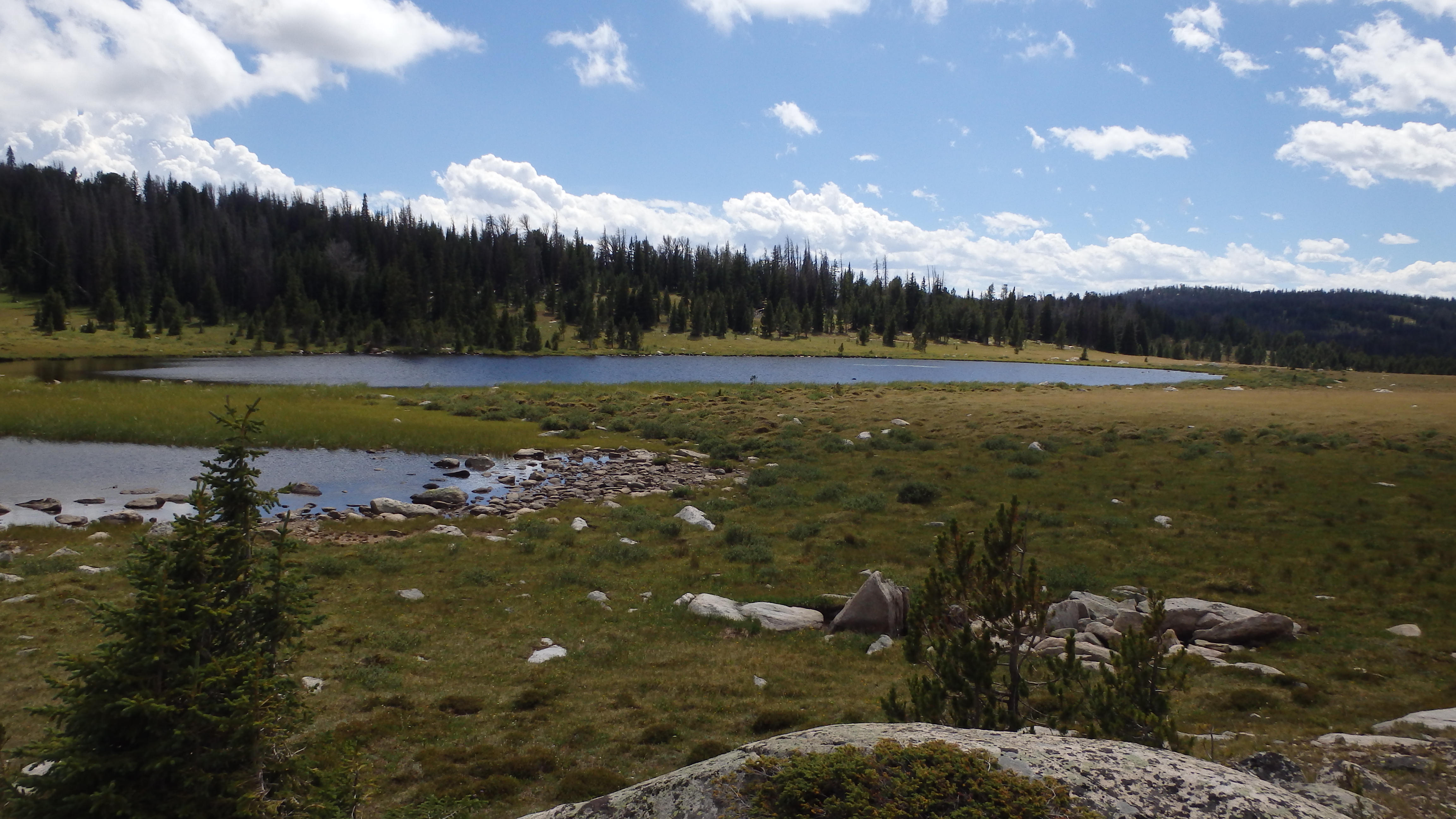
Top Lake
This section of the trail gains just 600 feet in 3 miles, a steady climb that rarely leaves you stopping to rest. The trail goes by quickly; alpine meadows and views of the southern edge of the Beartooth Mountains will leave you quickly passing by Top Lake and Dollar Lake. These two lakes are the last attraction along this path—soon, the trail ends at a wide dirt road. Turn right here, and follow it to the unsigned Dollar Lake Trailhead.
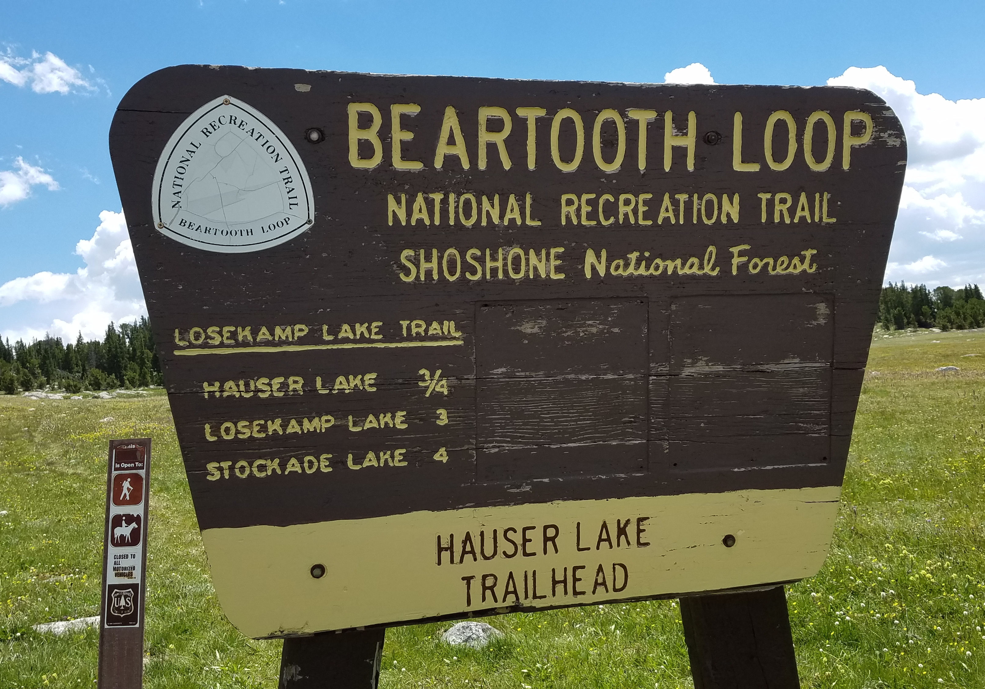
Hauser Lake Trailhead to Dollar Lake Trailhead- Moderate Difficulty
Hauser Lake
This route allows a true loop—it allows you to see most of the attractions along this loop, without retracing a single step. Leaving the Hauser Lake Trailhead, you hike a short ¾ mile to Hauser Lake. After Hauser Lake, the trail runs near Solar Lake, and then leads up and down a few hills for 2 miles. After a total of three miles down the Hauser Lake Trail, you arrive at Losekamp Lake. Since you’ll be creating a loop out of this hike via the Dollar Lake Trailhead, you will hike towards the lake, and then turn right (south) for a short mile, bringing you to Stockade Lake. From here, you have a couple of options on where to proceed.
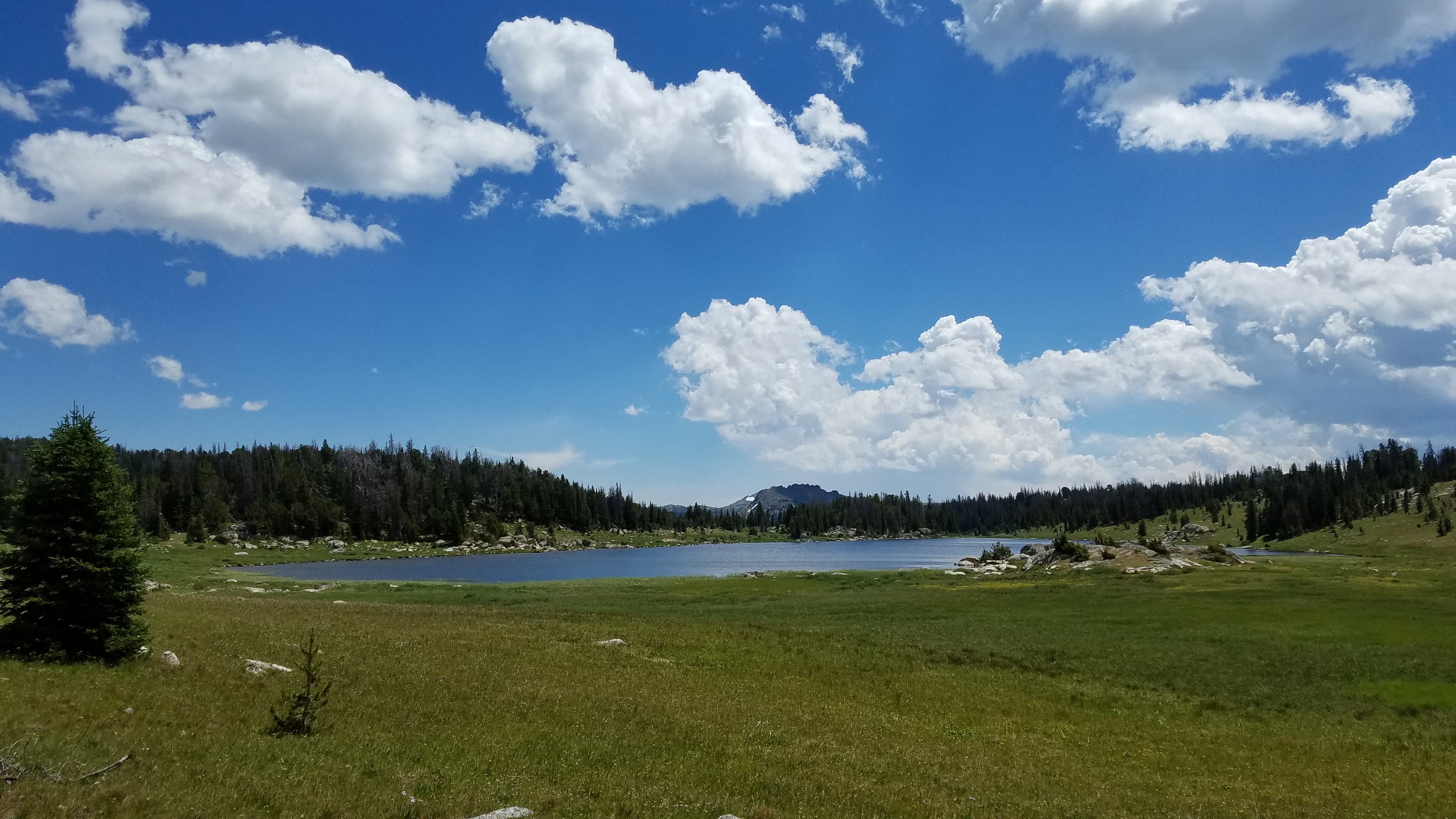
Stockade Lake
You can cross the inlet stream of Stockade Lake, but the more exciting route is to follow an extremely faint trail that leads around the western shore of Stockade Lake. This primitive trail climbs and drops over small 50 ft hills, before finally allowing you to rejoin the trail near the outlet of Stockade Lake. After you cross the outlet stream, you’ll be on the main trail again. Alternatively, you can hike the main trail which runs beside the eastern edge of the lake. Either way, after a short half mile stretch, you follow the trail downhill for almost a mile, before arriving at the trail junction for the Littlerock Creek Trail. Turn right here, and after a couple hundred yards, cross the shallow stream.
After you’ve accomplished your final stream crossing, the trail leads immediately uphill. The trail gains 600 feet in 3 miles, a nice uphill stretch. This section of the trail leads you by Top Lake and Dollar Lake, before disappearing in a whisper. The trail is hard to follow at this point, but if you head in the same direction the trail was leading before you lost it, you should be able to find it again. At this point you’re not far from the Beartooth Highway, so if you are truly lost you can always change your course slightly towards the highway.
After the maze by Dollar Lake, you emerge from the forest to meet a large dirt road. Turn right here, and hike the remaining 1 ¼ miles to the highway, and your vehicle at the Hauser Lake Trailhead. This loop option grants you the ability to take in as much scenery as possible, while still keeping the hike at a reasonable length (about 10 miles). What’s more, this route also takes you by the most lakes of any other route, 6 to be exact. If you’d rather hike the classic lollipop trail, there is still one final option, the Hauser Lake loop.
Hauser Lake Loop- Moderate Difficulty

Tibbs Butte Pass
This loop is the most logical of the other loops, yet you do miss Dollar Lake and Top Lake by choosing this route. The trail starts at the Hauser Lake Trailhead, and very quickly meets Hauser Lake after only ¾ miles. After Hauser Lake, the trail quickly passes by Solar Lake, before heading briefly uphill, and then downhill towards Losekamp Lake. From there, the easiest path is to hike left (north) to Tibbs Butte Pass. Hike the short and steep trail uphill, and then be amazed by the Littlerock Creek Valley scenery. As you drop down from Tibbs Butte Pass, bear right at the trail junction to head south along this scenic valley.
Although you might be tempted to hike along the Lower Highline Trail, stay along the well defined trail as it weaves though marsh and hills alike. As the trail begins to turn west, be on the lookout. After Sawtooth Meadows, the turn for Stockade Lake and Losekamp Lake appears. Turn right here, or you’ll end up crossing a creek and heading towards Top Lake.
As you turn right at the trail intersection, the trail leads through a small wet spot before quickly leading slightly uphill. As you head uphill, the outlet of Stockade Lake eventually appears. Stay along the east side of the lake, as the west side divides with a trail that heads over to Solar Lake. Hiking along the east side of Stockade Lake, you’ll quickly make it across the inlet stream, and continue your path along the Beartooth Recreational Trail.
As you cross the inlet stream at Stockade Lake, you’ll be greeted after about a mile with the familiar Losekamp Lake. Turn left (west) at the turn in the trail, and retrace your path back to Solar Lake and Hauser Lake. In the end, you’ll have hiked about thirteen miles, making this loop option the most longest for a day hike.
If you’re planning on a just a quick day hike along the Beartooth Recreational Trail, you’re missing out on a great opportunity for alpine camping. Whether at Camp Sawtooth, or somewhere else along the stretch of trail, the Beartooth Recreational Trail gives you many options to setup a basecamp. Between the three trailheads, and with side trips to Deep Lake and Black Stone Lake, the Beartooth Recreational Trail has many side trips that you can explore. Pick your destination, trailhead, and the amount of time that you have, and the Beartooth Recreational Trail won’t disappoint.
Directions to the Gardner Lake Trailhead
From Highway 212 outside of Red Lodge, drive 28 miles to the pullout on the left side of the road for Littlerock Creek Trailhead/Beartooth Loop.
Directions to the Gardner Lake Lake Trailhead
A few more miles down the road from the Gardner Lake Trailhead, the Hauser Lake trailhead appears as a small turnout next to Long Lake.
Directions to the Dollar Lake Trailhead
After the Hauser Lake Trailhead, drive a half mile along Long Lake, before a gravel road appears on the left. Turn here, and park at the trailhead. Walk a few hundred feet along the dirt road, before turning left onto the unsigned Dollar Lake Trail.