Author: chris | Category: Hiking Articles, Hiking Gear | Tags: aprs, backpacking, ham radio
In this remote alpine setting, ham radio communication is still possible.
One of the biggest challenges with amateur radio, or ham radio, is communicating over mountainous terrain in remote regions. Natural obstacles, lack of other nearby repeaters, and logistical limitations make backpacking or hiking while operating a ham radio difficult. For someone who is new to ham radio these technical challenges can be daunting. There is plenty of information on radio specifications, repeater frequencies, and ways to overcome natural barriers on the Internet. However, the majority of resources are spread out, requiring a new ham radio operator to spend dozens of hours on research before deciding if they should bring a ham radio on a backpacking trip. This article will discuss the different ways you can overcome the many challenges that hiking with a ham radio brings. First, I’m going to cover the most important step to operating a ham radio- licensing.
(more…)
07 Feb 2018
Author: chris | Category: Hiking Articles, Hiking Gear | Tags: ham radio
Narrow canyon walls can make operating a ham radio difficult.
Cross band repeat is a nice feature that many ham radios have– it gives the ability to transmit on one band to a more powerful radio and then, in turn, send that transmission from the more powerful radio on another band. Cross band repeat is typically used for a handheld radio to communicate with a more powerful radio, and to expand the communication range of that handheld radio. This is important when backpacking- if you can transmit using 5-8 watts to your vehicle at the trailhead, the radio in your vehicle can easily re-transmit the same message at 50-75 watts. You’ll need to do your homework with this solution, but it will easily enable you to communicate while backpacking.
(more…)
04 Feb 2018
Author: chris | Category: Hiking Articles, Hiking Gear | Tags: aprs, backpacking, ham radio
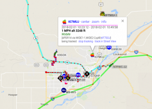
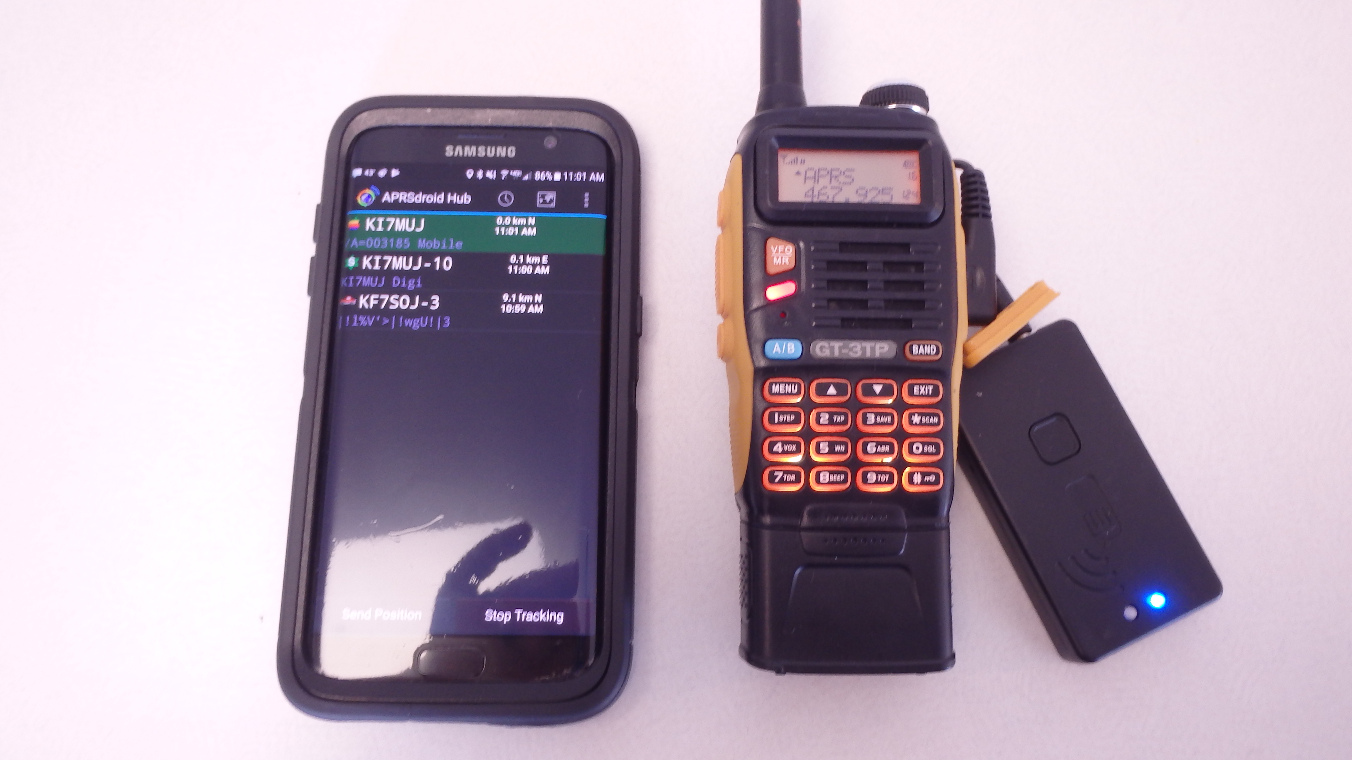
APRS Position and Course Data
Automatic Packet Reporting System (APRS) was developed in 1992 with the purpose of giving ham radio operators a way to transmit their location, allowing them to view the locations of other ham users, and send messages to each other. APRS is a mature technology, which is widely implemented in the ham community. Odds are good that there is a digipeater within range of your home. For backpackers, APRS presents an easy way to keep in touch with loved ones, while camping and hiking in the wilderness. Although APRS might sound like a hard system to operate, modern enhancements have made communicating via APRS an easy solution.
(more…)
04 Feb 2018
Author: chris | Category: Hiking Articles, Hiking Gear | Tags: aprs, direwolf, raspberry pi

My Raspberry Pi
A computer with a sound card interfaces to your radio via two 3.5 mm audio cables. An interface cable will be required for this, which you can either make yourself or order one from Clifford Wareham (https://www.ebay.com/usr/cliffordwareham?_trksid=p2047675.l2559). Once you have your interface, you will need to determine what hardware (computer) and what software (the APRS digipeating software) you will use. For my setup, I went with a Raspberry Pi 3– a well documented and reliable miniature computer that runs Linux. The Raspberry Pi 3 does need a USB sound card in order to work as a digipeater, since the Pi only natively supports audio out. The Pi 3 and a USB sound card should cost no more than $50.
(more…)
29 Jan 2018
Author: chris | Category: Hiking Articles, Hiking Gear | Tags: aprs, backpacking, ham radio
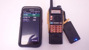
My handheld radio, running APRS thanks to the Mobilinkd Bluetooth adapter.
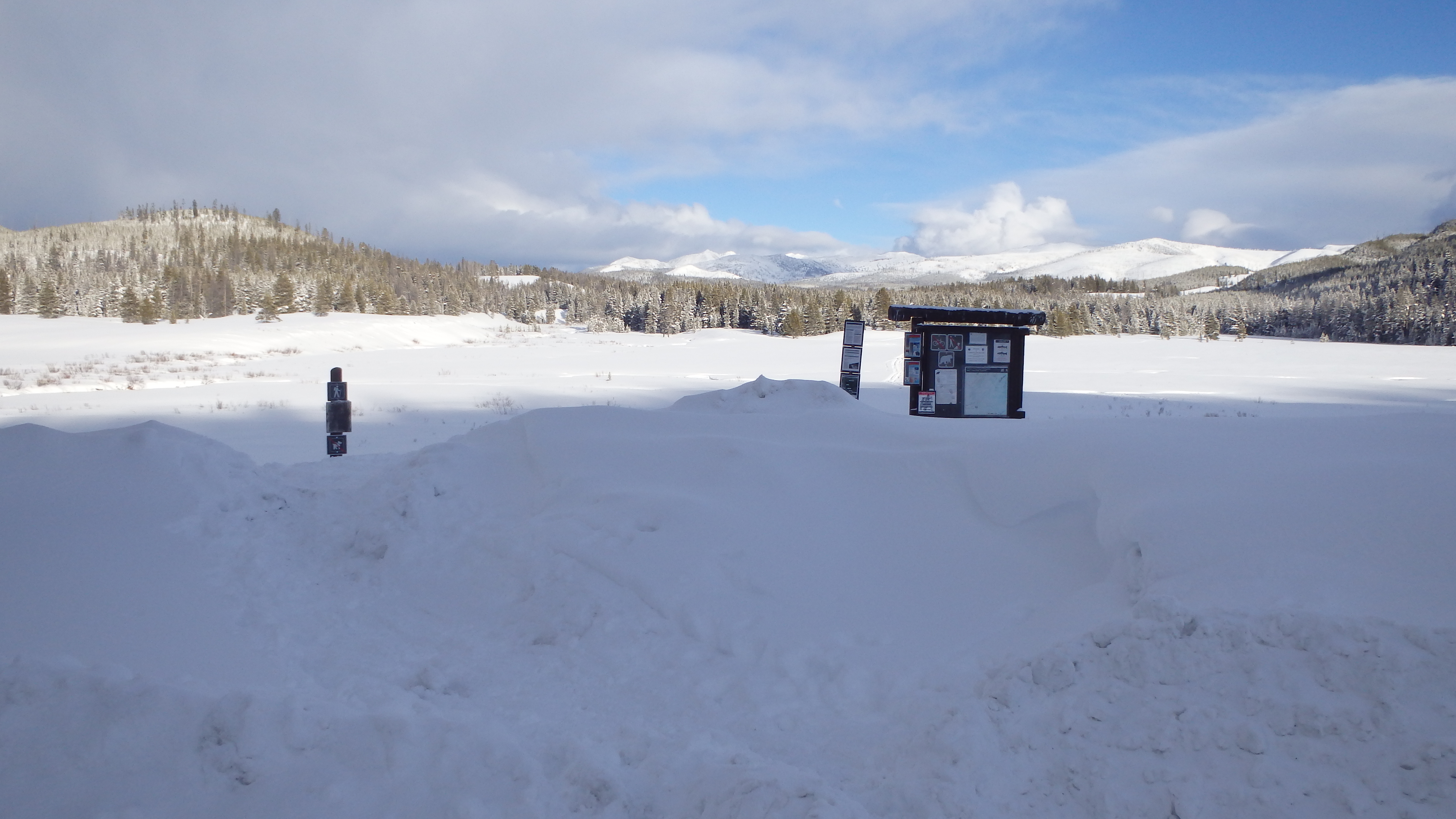
At times, you may find yourself unable to reliably use APRS while backpacking. Broken terrain and natural barriers can degrade your APRS transmission just enough to result in the total loss of packet information. Since APRS does not have a way to detect or recover dropped packets, some hikers get frustrated when they cannot use APRS on a backpacking trip. One way around this limitation is to setup a dedicated APRS digipeater that is located at the trailhead. This way, your weaker handheld radio can transmit an APRS message to a more powerful radio in your vehicle, which then transmits your original message at approximately ten times the power of your handheld. If you’re willing to invest a little money and time, this is not only an effective solution, but it’s also fairly easy to setup.
(more…)
29 Jan 2018
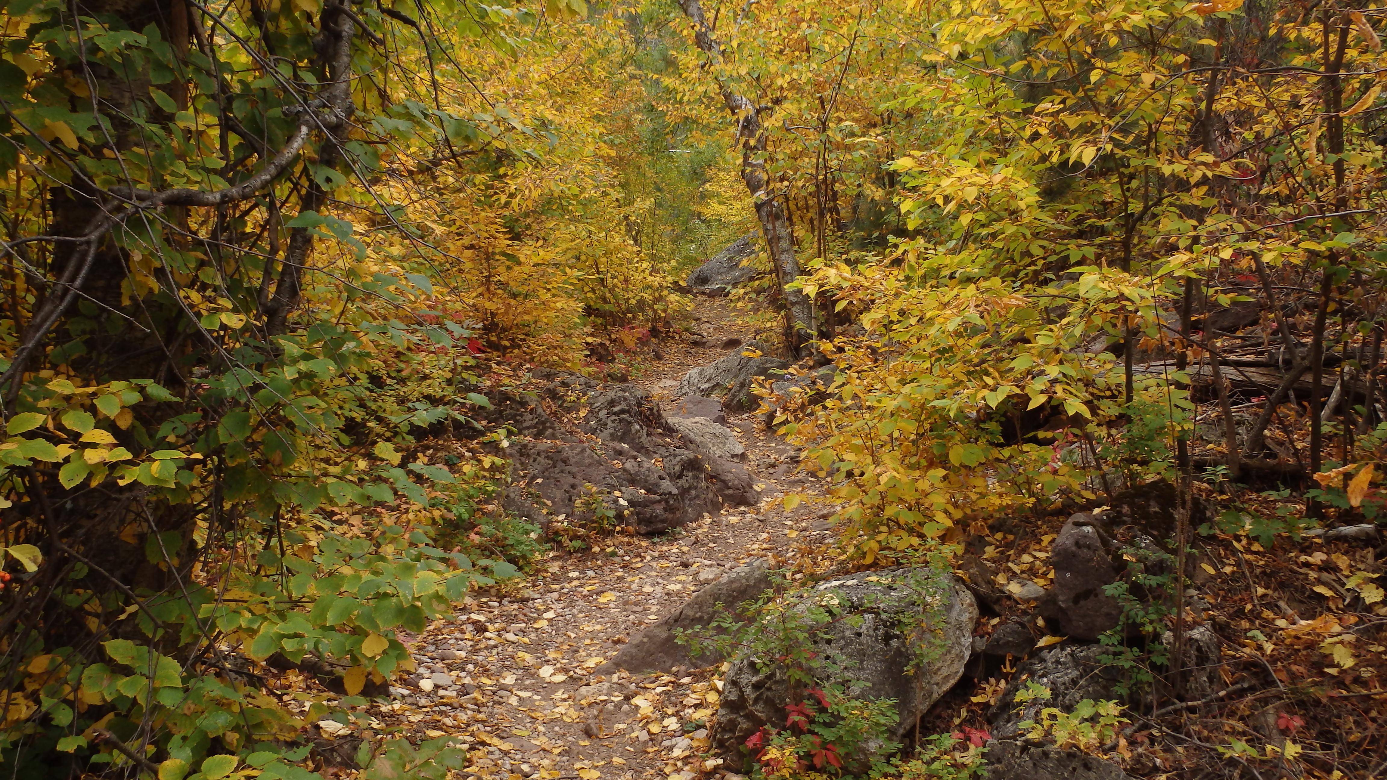
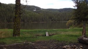
Author: chris | Category: Easy Day Hikes, Hiking Trails in the Beartooth Mountains, Montana Hiking Trails | Tags: Absaroka-Beartooth Wilderness, Beartooth Mountains, Red Lodge
Keyser Brown Lake
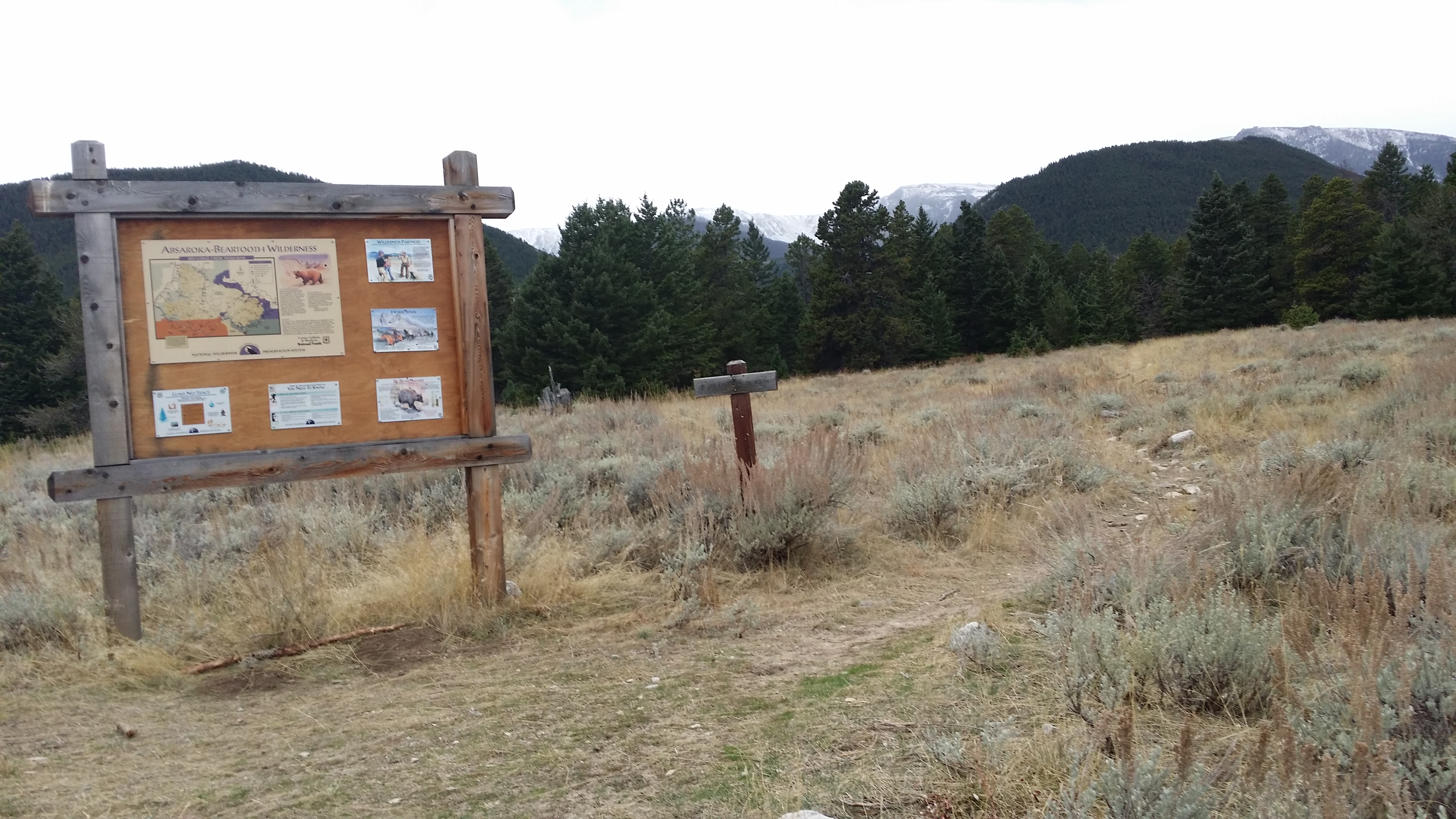
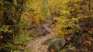
Keyser Brown Lake is a beautiful mountain lake that is easily accessible from Lake Fork Trail #1, in the Beartooth Mountains. This forested lake is at 8,700 feet, making it one of the easiest to access lakes along the Lake Fork Trail. The trail to Keyser Brown Lake only climbs 1,600 feet along the seven mile trail, which is what makes this lake so easy to reach. Keyser Brown Lake also excels as a base camp, supports a good brook trout fishery, and will help you escape the busy crowds on their way to Lost Lake. Leaving the paved parking lot, and crossing a sturdy bridge over the Lake Fork of Rock Creek, your trip to Keyser Brown Lake begins.
(more…)
27 Jul 2017
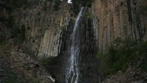
Author: chris | Category: Easy Day Hikes, Hiking Trails in the Gallatin Range, Montana Hiking Trails | Tags: Easy Day Hikes, Gallatin Range, Hyalite Canyon
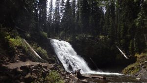
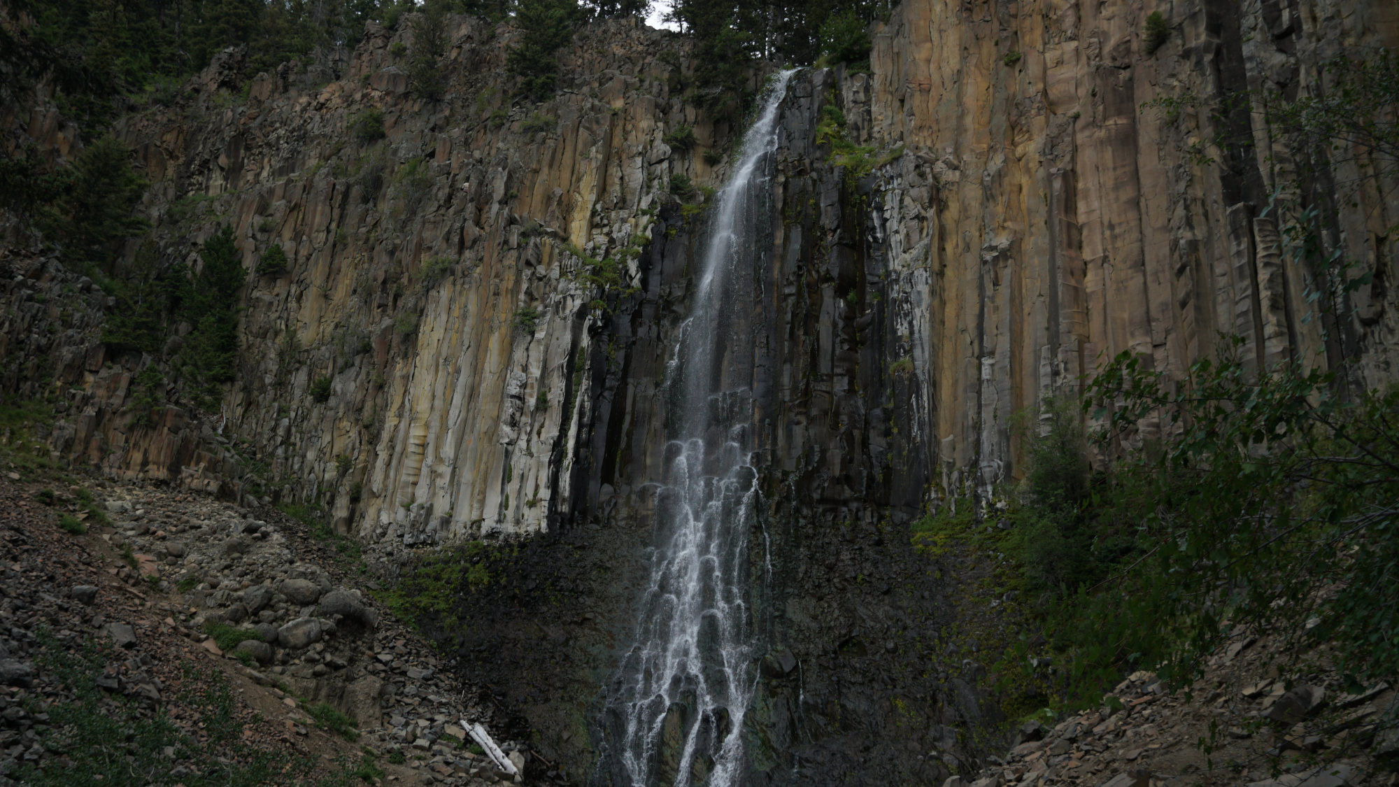
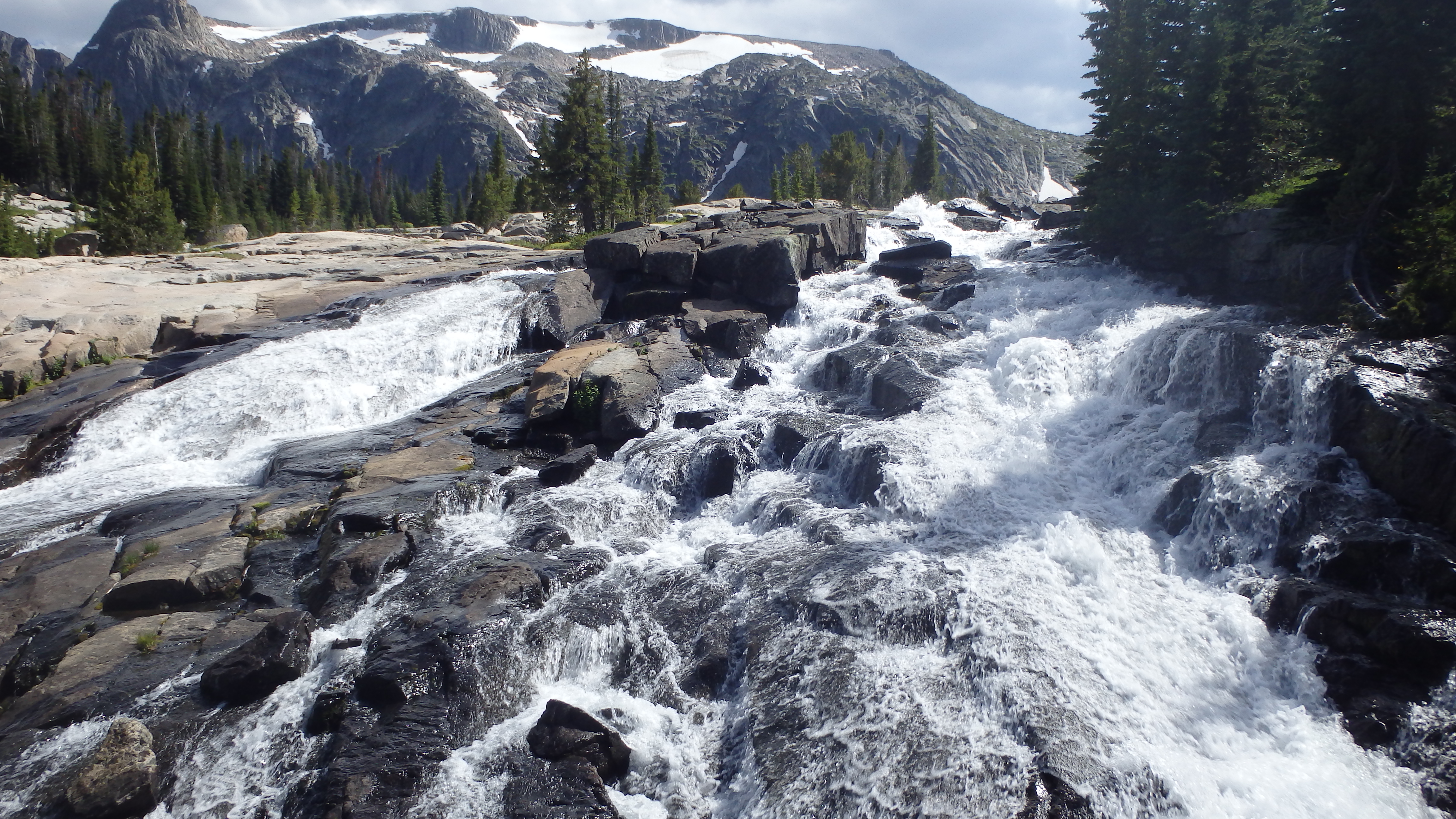
Grotto Falls
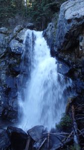
Grotto Falls, located in Bozeman’s scenic Hyalite Canyon, is a beautiful waterfall that can be reached within a half hour. Although the waterfall isn’t particularly tall, Grotto Falls makes up for that by its sheer volume. Hyalite Creek gushes over the falls into the pools below, creating perfect swimming holes to relax in after a hot day. Access to the falls is excellent, with the trail well groomed, and highly trafficked. Simply put, Grotto Falls should be on your must-see list if you are hiking towards Hyalite Lake, or even just in Hyalite Canyon for a day.
(more…)
02 Jul 2017
Author: chris | Category: Easy Day Hikes, Hiking Trails in the Gallatin Range, Montana Hiking Trails | Tags: Gallatin Range, Hyalite Canyon, waterfalls
There are many hikes on this site that can last for days, test your physical strength, and require navigational skills to reach your intended destination. Fortunately, Palisade Falls is not one of those hikes. The hike to Palisade Falls is quite possibly the easiest hike I’ve ever written about. You don’t need a water bottle or a backpack for this hike, and you don’t even need hiking boots for this hike. Instead, Palisade Falls offers something that few trails do- accessibility for everyone. This short 1-mile out-and-back hike can be explored by toddlers, the elderly, and even people who require wheelchairs or crutches. Simply put, this is the easiest hike you’ll ever take, but don’t let this dissuade you from hiking the Palisade Falls Trail. The natural beauty that Palisade Falls provides will still awe you, even if the hike won’t.
(more…)
01 Jul 2017
Author: chris | Category: Easy Day Hikes, Hiking Trails in the Gallatin Range, Hiking Trails in Yellowstone National Park, Montana Hiking Trails | Tags: Gallatin Petrified Forest, Gallatin Range, geology, Yellowstone National Park
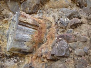
Petrified Wood on the Gallatin Petrified Forest Interpretive Trail
If you’re interested in the geological forces that shaped the mountains outside of Yellowstone National Park, or simply enjoy viewing petrified wood and semi-precious gems, the Gallatin Petrified Forest Interpretive Trail is an amazing trail. Although this trail is short, it gains 625 feet of elevation along the way (most of it during the last half mile). This gives a great calf stretch on the way to Yellowstone National Park, and is an excellent introduction to Yellowstone’s unique geology. Once you’re ready to hike this beautiful interpretive trail, drive down Tom Miner Rd for a dusty 11 miles, and begin your quick geologic adventure.
(more…)
28 Jun 2017
Author: chris | Category: Easy Day Hikes, Hiking Trails in the Gallatin Range, Montana Hiking Trails | Tags: bozeman, Easy Day Hikes, Gallatin Range
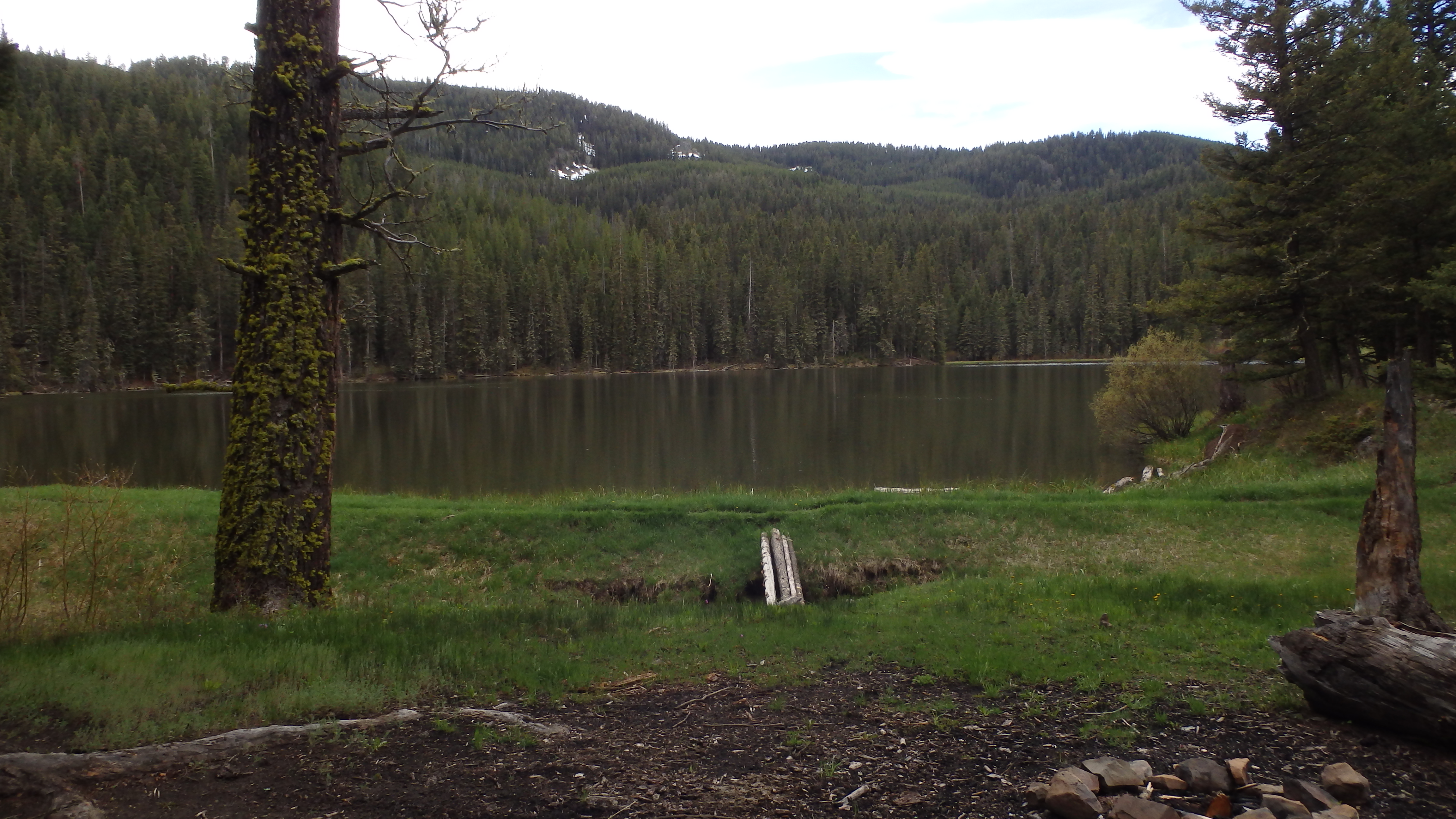
Rat Lake
Rat Lake, located just outside of Bozeman, MT, is a day hike that attracts many hikers, anglers, and tourists. The quick hike, combined with the close proximity to Yellowstone, Bozeman, and Big Sky, draw in many locals and tourists each year. The high traffic on this hike shouldn’t discourage you, though. Anglers will appreciate the trout fishing, hikers will be encouraged to hike further down the trail, and tourists will love the quick chance to stretch their legs. This trail even offers a chance to stay overnight in a US Forest cabin- Rat Lake Trail #416 offers everyone a quick trip into the Gallatin Range.
(more…)
12 Jun 2017
Author: chris | Category: Easy Day Hikes, Hiking Trails in Yellowstone National Park, Montana Hiking Trails

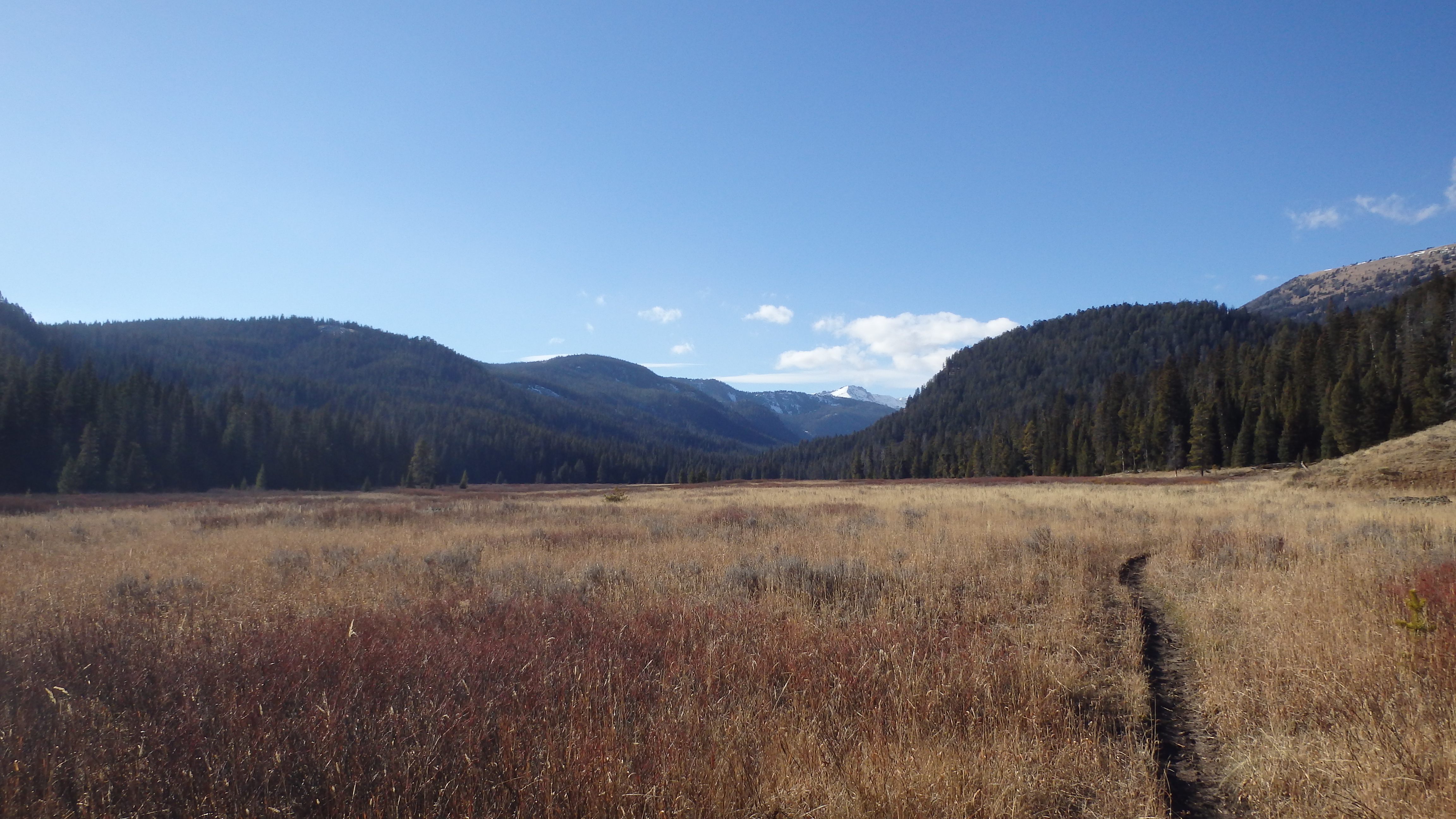
Bacon Rind Creek
If you’re looking for a quick day hike near West Yellowstone with beautiful scenery, look no further than Bacon Rind Creek. This short hike is great for small kids and adults alike, since the trail gains only a little over 300 feet in 2 ½ miles. Hikers looking for an adventure shouldn’t be worried about the trail’s easy grade– just because this is an easy hike it shouldn’t turn you away from Bacon Rind Creek, this grassy valley harbors some of Yellowstone’s famous wildlife; bears, moose, and rainbow trout all thrive in this valley. Once you’ve found the trailhead (refer to the directions below), you can begin this quick hike.
(more…)
20 Dec 2016
Author: chris | Category: Easy Day Hikes, Hiking Trails in the Gallatin Range, Hiking Trails in Yellowstone National Park, Montana Hiking Trails | Tags: Easy Day Hikes, Gallatin Range, Yellowstone National Park
Tepee Pass
Tepee Pass is a scenic day hike that is located just barely outside of Yellowstone National Park, and although the trail isn’t technically in the park, you can still see vistas of the park and the surrounding mountain ranges. Tepee Pass provides one of those rare moments when you can see two mountain ranges in all of their glory- the Gallatin Range to your left and right, and the Madison Range in front of you. While you’re on this hike, you also have the opportunity to see some of Yellowstone’s famous wildlife- bears, moose, and deer. If you’re not afraid of hiking up a large hill, the hike up to Tepee Pass is worth your time.
(more…)
29 Nov 2016
Author: chris | Category: Easy Day Hikes, Hiking Trails in the Madison Range, Montana Hiking Trails | Tags: Easy Day Hikes, Lee Metcalf Wilderness, Madison Range, Spanish Peaks
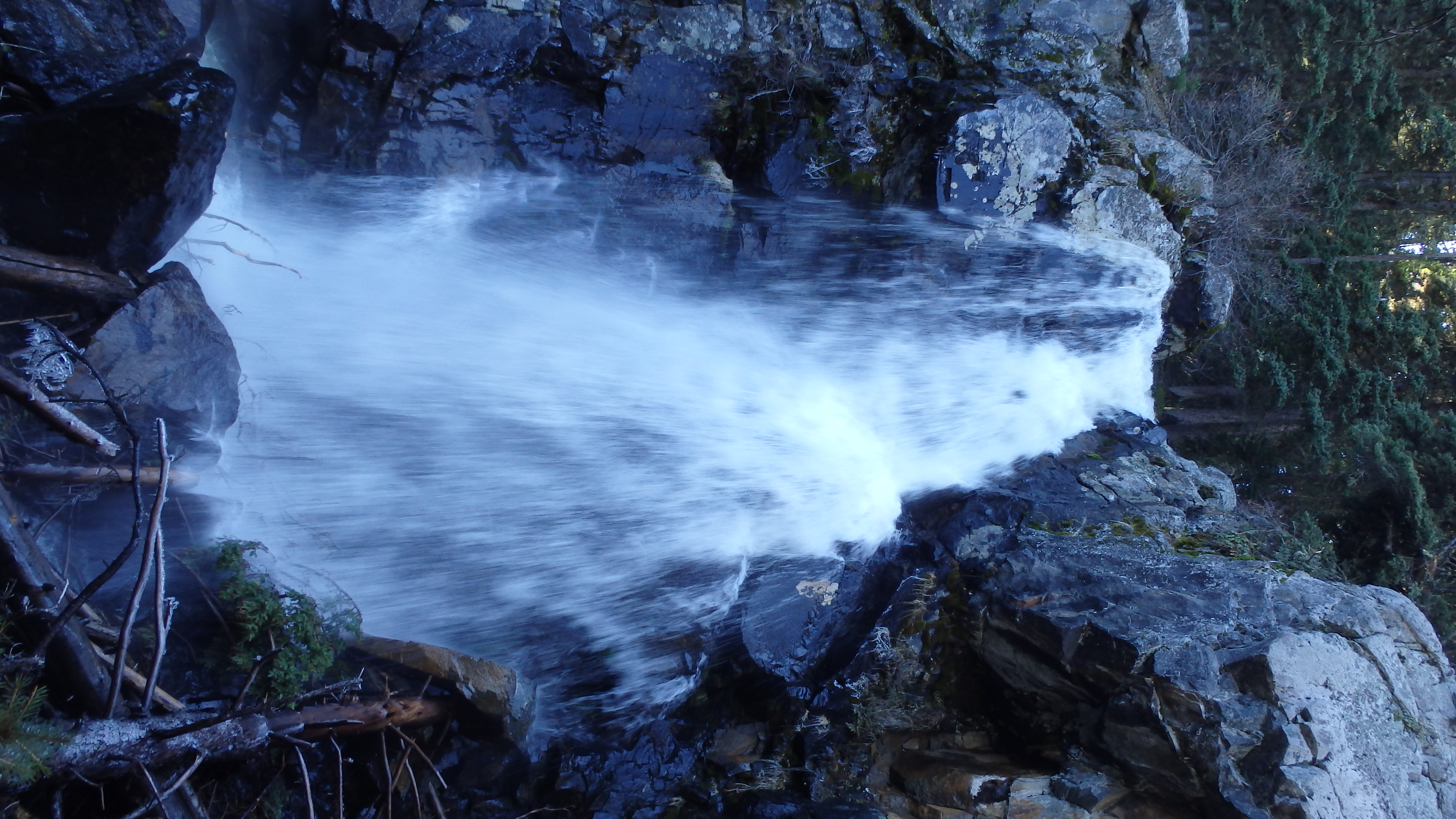
Pioneer Falls
Tumbling 40 feet into a narrow gorge, Falls Creek creates the dramatic display that is known as Pioneer Falls. Pioneer Falls is mesmerizing to watch, as gallon upon gallon of pristine water tumbles its way towards the southern fork of Spanish Creek. Standing here, you have to appreciate the Lee Metcalf Wilderness, and the need for wilderness areas in this country. To be humbled by nature’s creation, you only have to hike a few miles from civilization. Many trail guides list this hike as a 7.5 mile hike, but that is not correct- the hike to the falls is only 3 miles, making the total trip length 6 miles.
(more…)
07 Nov 2016
Author: chris | Category: Easy Day Hikes, Hiking Trails in the Black Hills | Tags: Black Hills
Little Elk Creek Trail
Conveniently located just 20 minutes from Rapid City, South Dakota, Little Elk Creek Trail offers the ability to quickly hop on a scenic trail, and start exploring the woods. This easy trail is a quick detour from I-90, and is close enough to Rapid City for a quick walk in the woods after work. Little Elk Creek Trail is 6 miles long, and gains only 500 feet in the first three miles, making it an easy trail for kids and older adults. Mountain bikers will enjoy the easy trail grade, and will especially appreciate the few boulders on the trail. If you’ve got a few hours to spare, head towards interstate exit 44, and the Black Hills.
(more…)
22 Oct 2016
Author: chris | Category: Easy Day Hikes, Hiking Trails in the Front Range | Tags: Denver, Eldorado Canyon, Front Range
Rattlesnake Gulch Trail
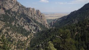
The Rattlesnake Gulch Trail is a quick 3 ½ mile hike through some of the most scenic views in Eldorado Canyon. This trail is full of natural beauty, with sheer quartzite and granite cliffs surrounding the hike, and vistas of distant mountain peaks. The trailhead is also close to Denver International Airport, making it a convenient detour for travelers in the area. Finding the trailhead is easy, although it does involve a fee; the Eldorado Canyon Park requires an $8 charge for those wishing to hike or climb in the canyon. That shouldn’t stop you from enjoying the Rattlesnake Gulch Trail, however.
(more…)
23 Sep 2016
Author: chris | Category: Easy Day Hikes, Hiking Trails in the Beartooth Mountains | Tags: Beartooth Mountains, Easy Day Hikes
Becker Lake
For a quick hike to a beautiful mountain lake that’s near Cooke City, there’s no better place than Becker Lake. The trail to Becker Lake is a bit lengthy at 9 miles, but the flat trail and numerous nearby lakes will work hard to help you overlook the distance. These 9 miles are also the flattest in the Beartooth Mountains, making the hike to Becker Lake a perfect hike for kids, and older adults. As such, you can expect to see other hikers on this trail. Thankfully, a few extra hikers won’t detract from the alpine beauty of this hike.
(more…)
27 Aug 2016
Author: chris | Category: Hiking Trails in the Beartooth Mountains, Moderate Day Hikes, Montana Hiking Trails | Tags: Absaroka-Beartooth Wilderness, Beartooth Mountains, Moderate Day Hikes
Echo Lake
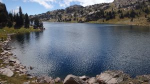
Echo Lake is a picturesque mountain lake that is just off The Beaten Path, a common hiking trail in the Beartooth Mountains. While Echo Lake is located only a mile from this popular trail, hundreds of hikers pass by it on the way to nearby Duggan Lake, or Big Park Lake. Echo Lake does offer something that these other two lakes don’t: the chance for solitude. The hike there is easy enough, the trail is well established, there are plenty of campsites, and the fishing is good. To put it simply, there are plenty of reasons why you should visit Echo Lake. You can reach Echo Lake via the Clarks Fork Trailhead or the East Rosebud Trailhead, both of which offer some of the best scenery in the Beartooth Mountains.
(more…)
07 Aug 2016